What is “nation size” that cannot be understood just by looking at the world map?

There are various
Countries That Are WAY Bigger Than You Think-YouTube
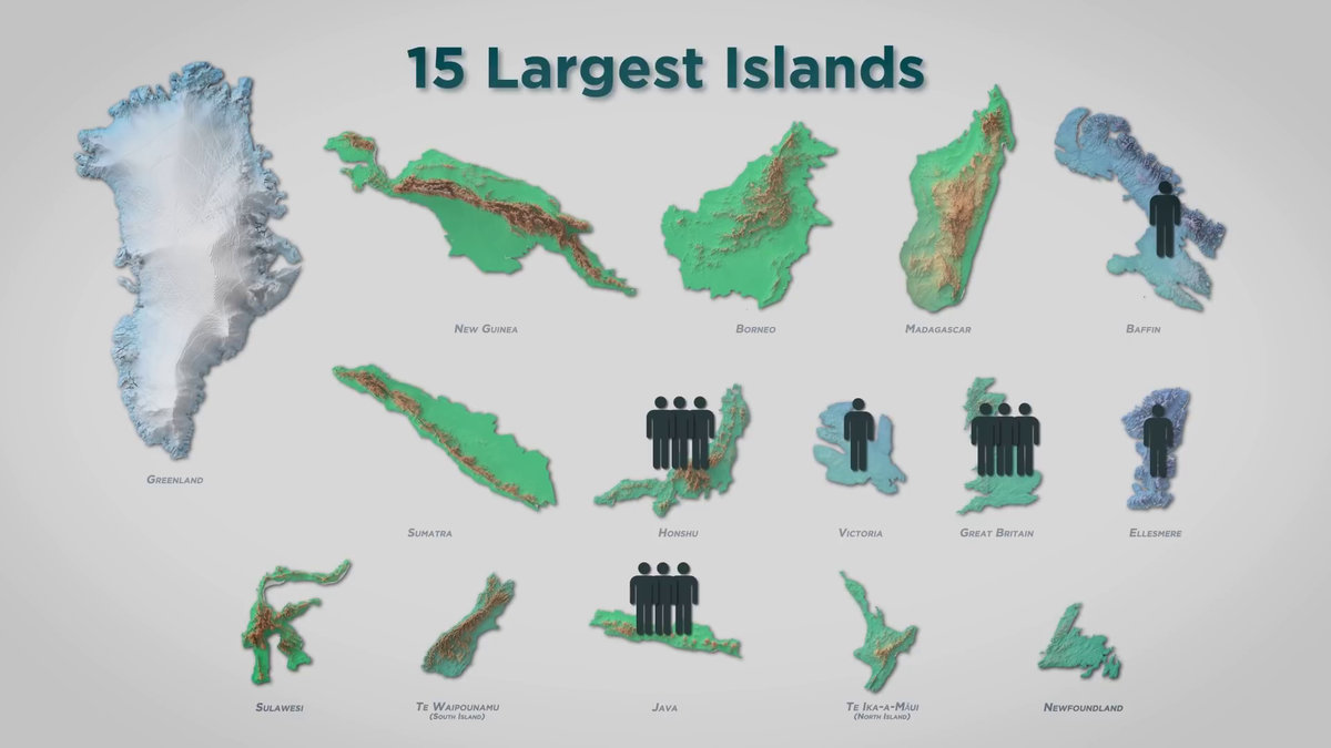
Below are the top 15 largest islands in the world. Greenland , New Guinea , Borneo , Madagascar , Baffin , Sumatra , Honshu , Victoria , Great Britain , Ellesmere , Sulawesi , South Island New Zealand , Java Island and North Island New Zealand .
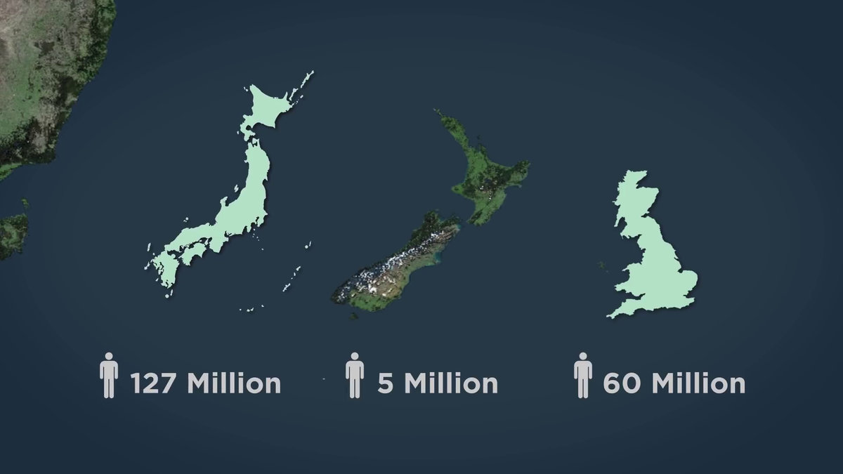
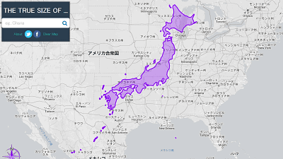
Comparing the Japanese archipelago, the New Zealand archipelago, and Great Britain, it looks like this. Hokkaido, Kyushu, Shikoku and Okinawa The addition of such as the Japanese archipelago about 380,000 km is 2, but in approximately 230,000 km 2 if only Honshu, about the same area as that of the New Zealand archipelago and Great Britain. And Japan has an overwhelming population of
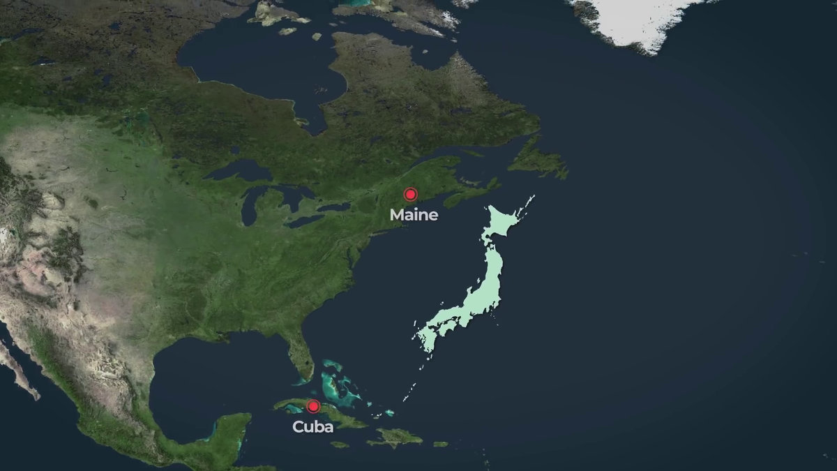
The length of the Japanese archipelago is about 2,800 km from Wakkanai in Hokkaido to Ishigaki Island in Okinawa, and is almost the same as the distance from Maine in the United States to Cuba in the Caribbean.
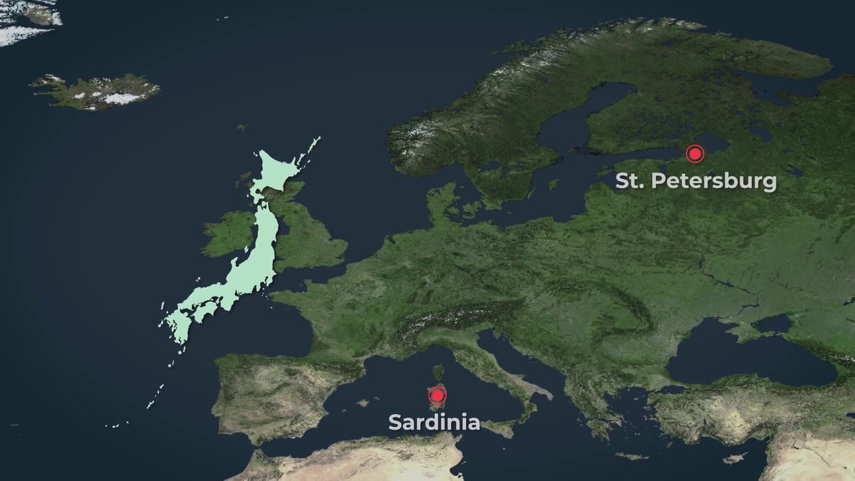
It is almost the same as St. Petersburg in Russia to Sardinia in Italy.
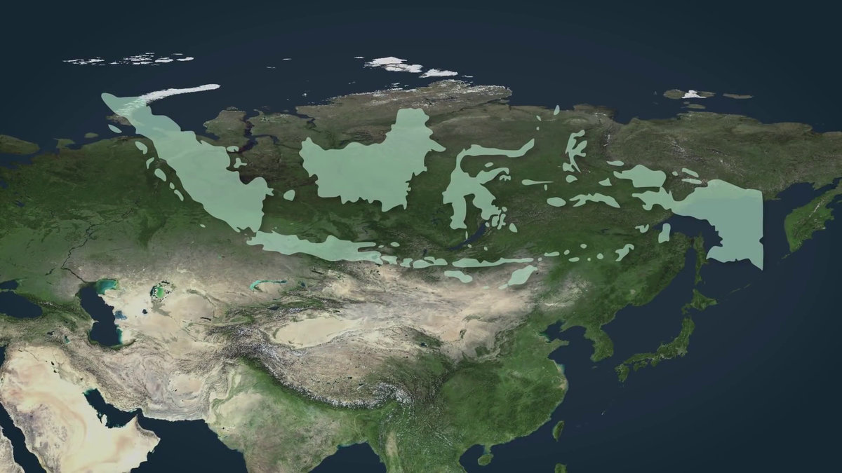
Indonesia, consisting of thousands of volcanic islands, is about 5000 km east and west, and looks like this over the North American continent.
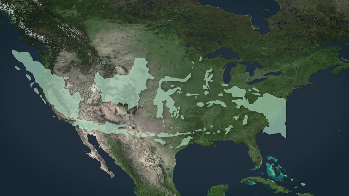
Overlapping with Europe, you can travel from Britain to Turkey and beyond to Uzbekistan.
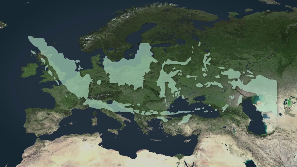
Also, you can see that it is almost the same width even if it overlaps with the vast Russia.
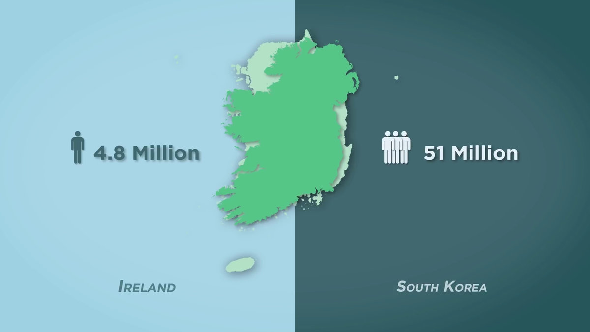
Ireland (about 84,000 km 2 ) and Korea (about 100,000 km 2 )
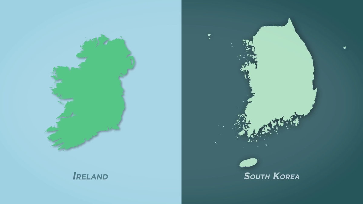
The Republic of Korea is slightly larger, but the population of the Republic of Korea is more than 10 times that of Ireland.
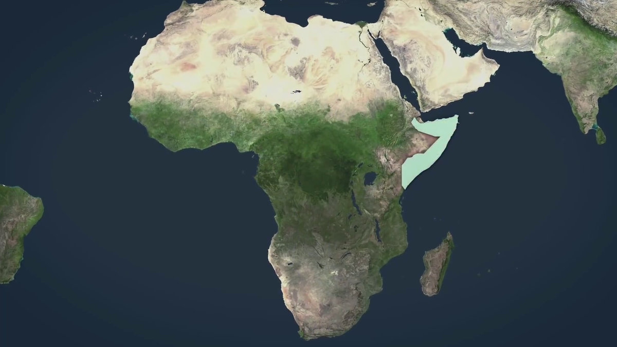
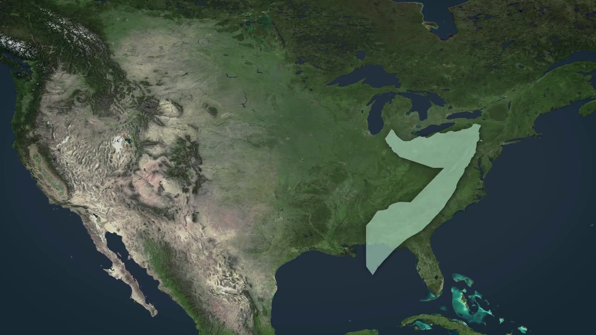
Somalia at the eastern end of Africa (about 637,000 km 2 )
This is what it looks like on the North American continent.
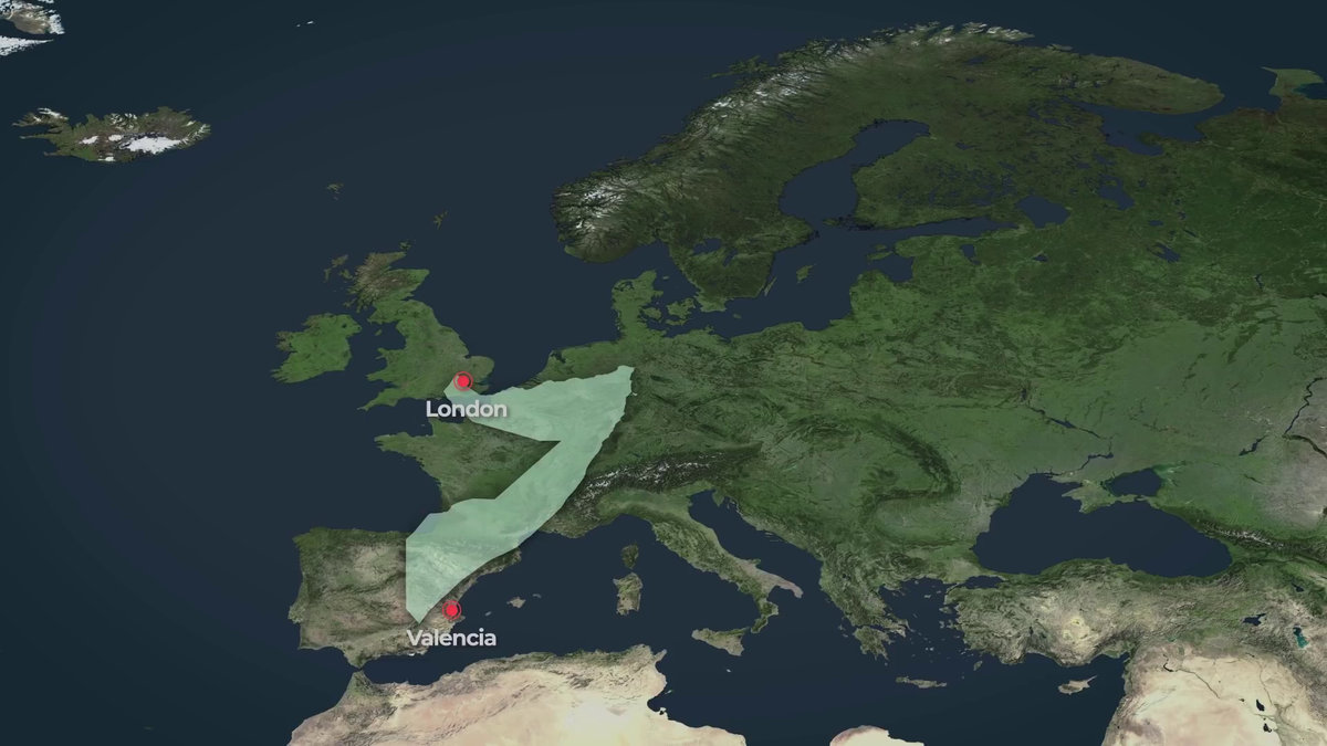
The north-south distance of Somalia is about the same in Europe as from London, England to Valencia, Spain.
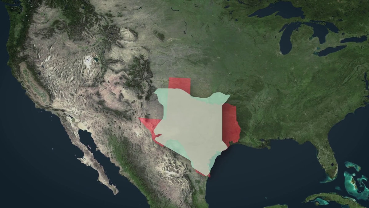
Kenya (about 580,000 km 2 ) next to Somalia is a bit smaller than Texas, USA (about 695,000 km 2 ).
You can see that the
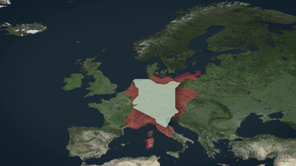
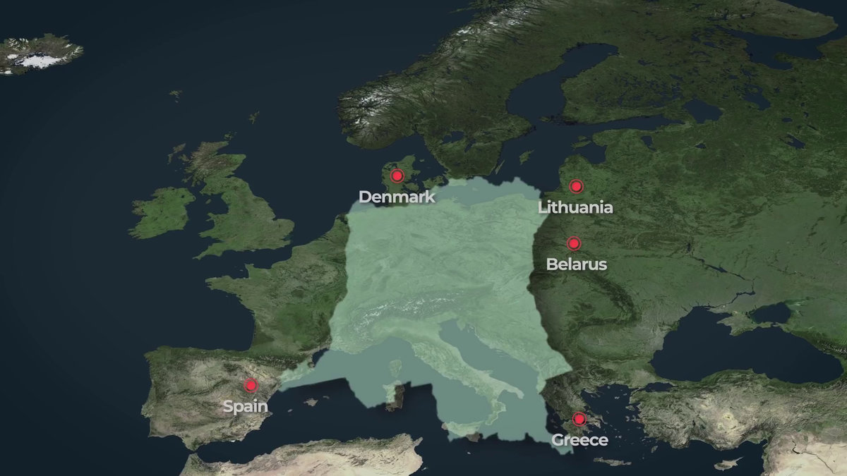
The Democratic Republic of the Congo (approximately 2.35 million km 2 ) in central Africa is ...
It is large enough to completely cover Eastern Europe.
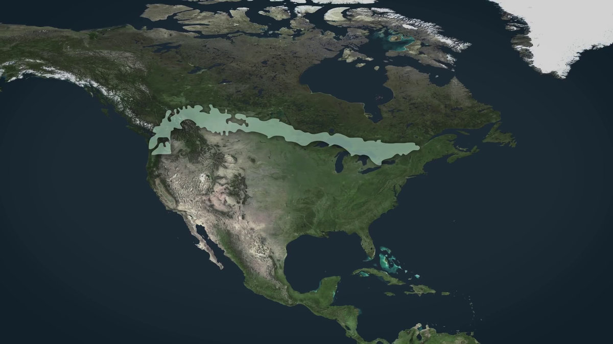
Chile (approximately 775,000 km 2 ) on the South American continent has a characteristic shape that stretches from north to south, with a length of about 4,300 km.
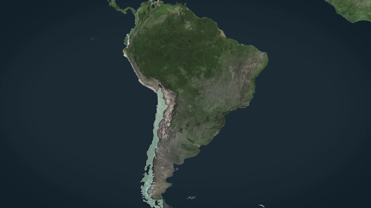
Just about the length of the border between the United States and Canada.
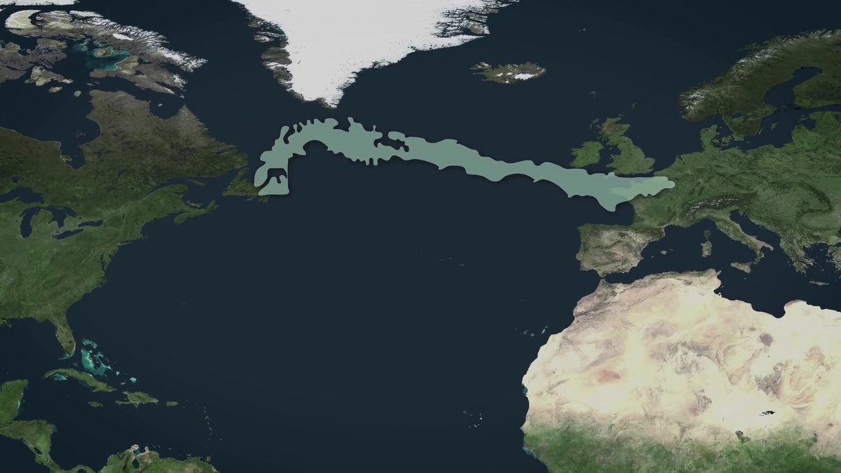
Chile extends from the North American continent to reach Europe. Chile's length is roughly equal to the width of the Atlantic Ocean.
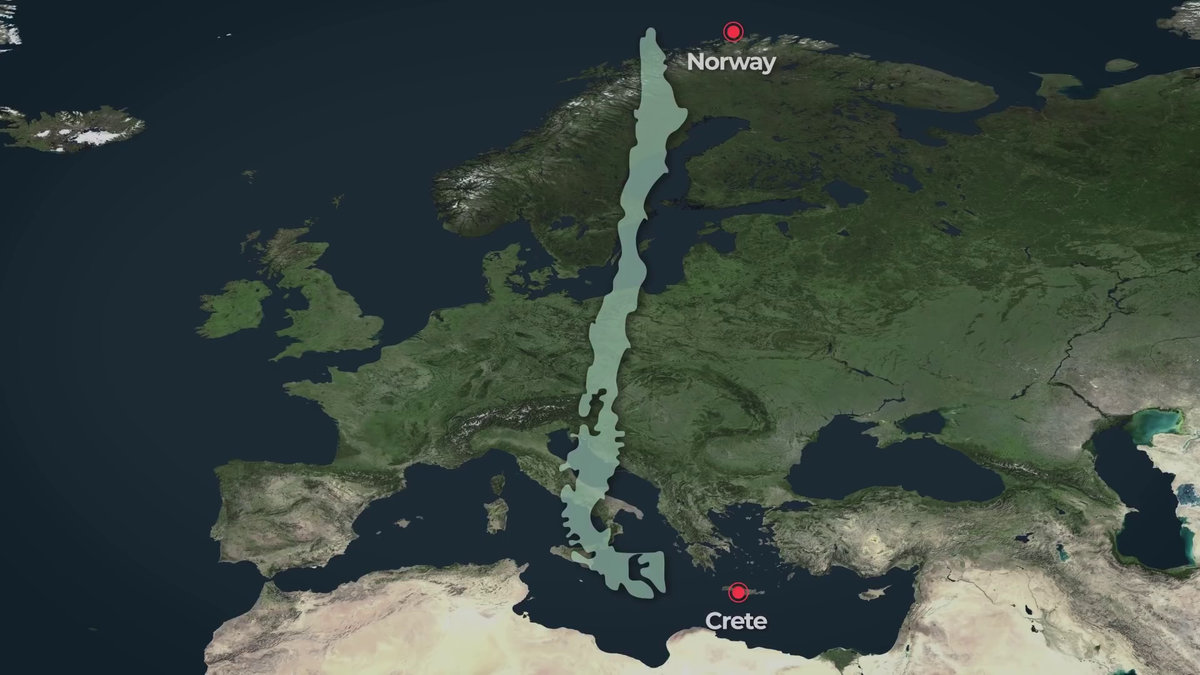
Also, placing Chile vertically over Europe is comparable to the distance from Norway to
The Indian subcontinent of Central Asia (approximately 4.4 million km 2 ) was originally a separate island, but it became a peninsula when it hit the Eurasian continent by continental migration.
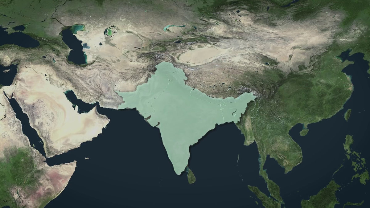
This is what it looks like in Europe. In fact, the Indian subcontinent is as large as the whole of Europe. In addition, EU be considered only in (the European Union) member countries, the breadth of Europe is approximately 4.5 million km 2.
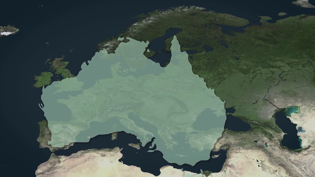
And over the continent of Australia (about 7.7 million km 2 ), Europe was almost completely swallowed.
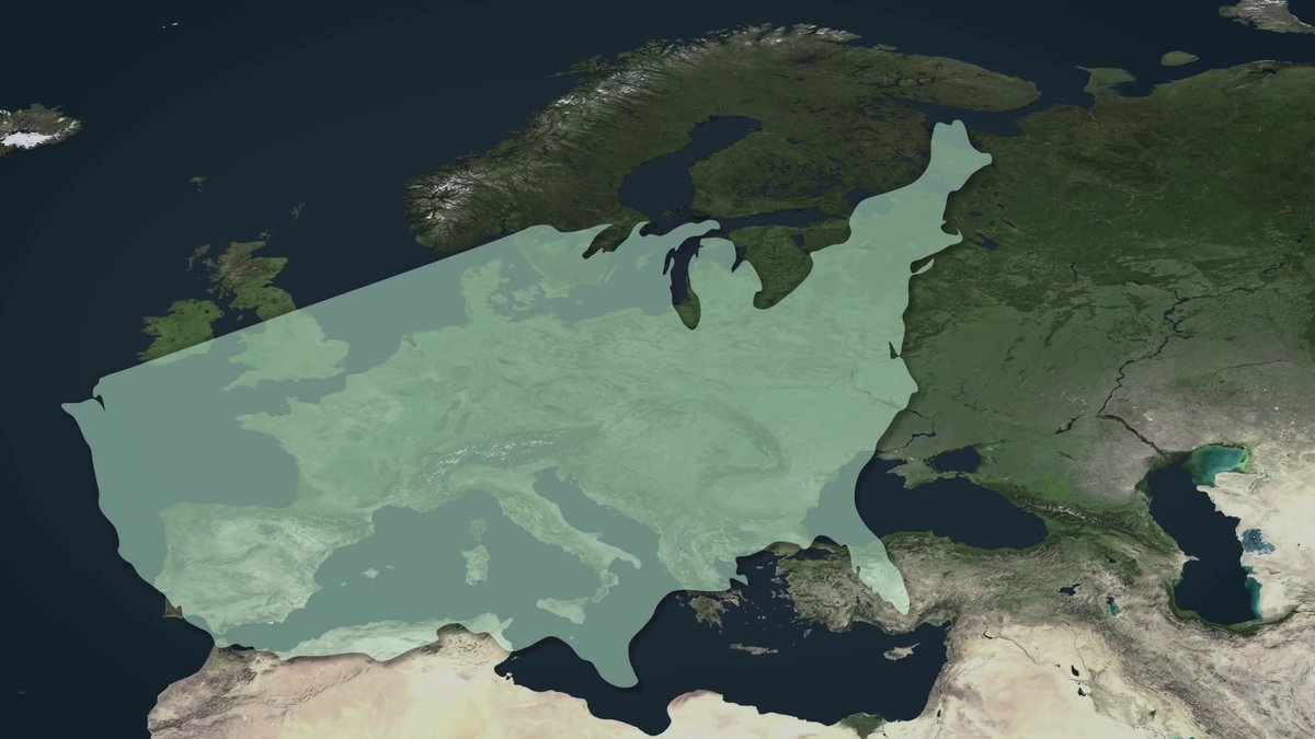
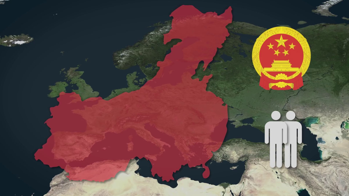
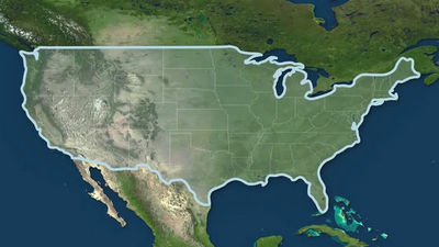
And the United States (about 9.8 million km 2 ) is more than twice as large as Europe.
And the approximately 14 million people, most of China's area with a population in the world was about 9.5 million km 2.
Related Posts:

in Video, Posted by log1i_yk