A map can be searched for "Are all roads leading to Rome?"

The word "all roads lead to Rome" which means that there are many ways and methods to the purpose is the reason that the way to the capital city Rome was well maintained in the Roman Empire It is a word. A map that can be ascertained by visually seeing "Do all tracts lead to Rome?"Roads to Rome"Has been published.
Roads to Rome
http://roadstorome.moovellab.com/maps/roads-to-rome/
An Interactive Map Shows Just How Many Roads Actually Lead to Rome | Open Culture
http://www.openculture.com/2018/05/an-interactive-map-shows-just-how-many-roads-actually-lead-to-rome.html
Designer'sBenedikt GroßWith Mr.Philipp SchmittMr. and a digital geographerRaphael ReimannRoads to Rome, which was made in cooperation with Mr. and others, shows a narrow line on the white world map on the way to Europe from various points to Rome.
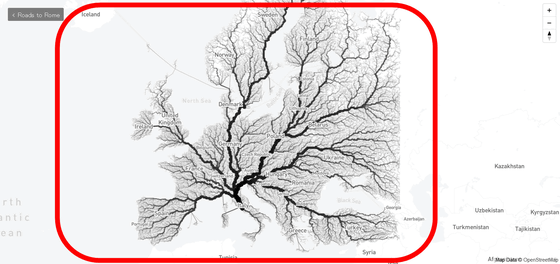
Manufacturers set up more than 480,000 start points in various parts of Europe that are over 26 million square kilometers in size. We developed an algorithm to calculate the shortest route from each start point to Rome, and showed Roads to Rome by displaying the route selected by the algorithm on the map. You can see that the route leading to Rome is crowded as it is in the form of the Continent of Europe, following the phrase "All roads lead to Rome".
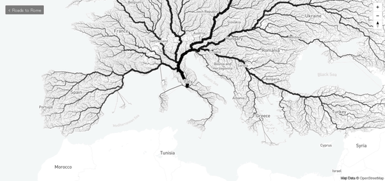
The road displayed is represented by thicker lines as the number of times selected by the algorithm is larger, from northern ItalyFlorenceIt is understood that the route that passes through from Europe to Rome. It is also an autonomous state of ItalySardiniaIsland and French territoryCorsicaThe straight route extending from the continent to the continent seems to be the route on which the ferry is in service.
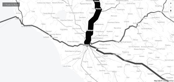
The situation around Rome is like this. When you expand it you can see the fine city name firmly, you can see that the main road around Rome, a thick main road, narrow road extending from the nearby place is stretched.
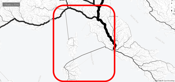
Also on the isolated island of Sardinia, the road from corner to corner was extended to Rome.
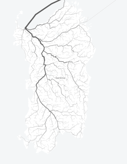
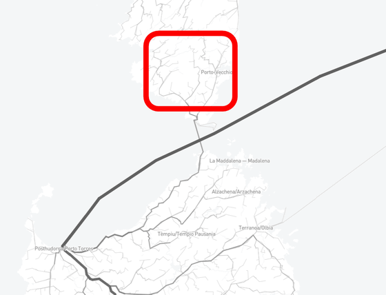
Also, the line extending from Corsica to the adjacent Sardinia is a route passing through the ferry which is in service between the two islands. Apparently there seems to be a region near French territory of Corsica that is closer to the mainland via France and closer to the Italian territory via Sardinia. The southern part of Corsica enclosed with a red frame seems to cross the Sardinian island first and cross the mainland of Italy to Rome quickly.
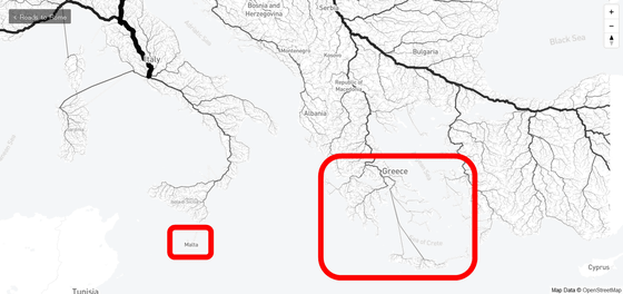
When I move the map along the Mediterranean Sea from Rome to the east, it floats in the Mediterranean SeaRepublic of MaltaAnd the islands of Greece that the way to Rome is properly passed ......
From the continent of EuropeBosphorus StraitsFrom Turkey where I crossed, the path was stretched like a capillary.
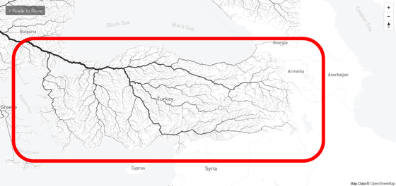
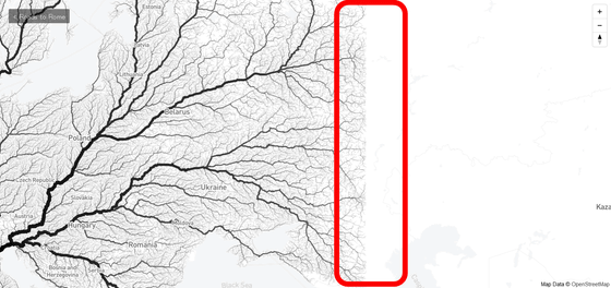
It seems that the south end of the start point of Roads to Rome is domestic in Turkey, and the eastern end is near east longitude 44 degrees in Russia. The road is stopped all the time around the east longitude of 44 degrees.
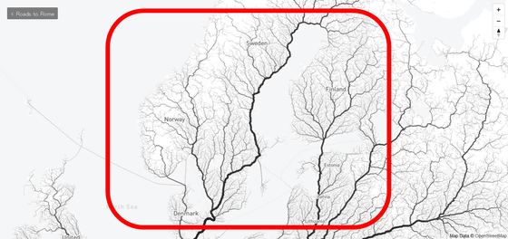
Scandinavia PeninsulaFrom the Nordic countries located in, the road to Rome was steadily extending.
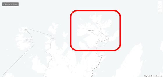
Located on the northern tip of the Scandinavian Peninsula in NorwayMagelloi IslandEven from Rome, it seems to arrive.
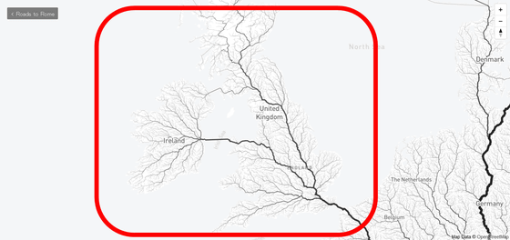
From the UK and Ireland, connect the Strait of DoverEnglish Channel TunnelIt is possible to go to Rome through ......
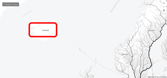
From Iceland, far from the continent of Europe, you can reach Rome via a remote island.
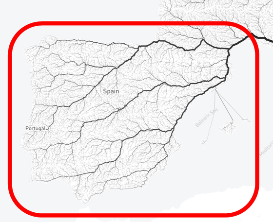
Spain and Portugal, the westernmost part of the continent of Europe, are located only between the African continent and the continentStrait of GibraltarThe road to Rome had been stretched to the end of Rome.
Roads to Rome made me feel like I could reach Rome from anywhere in Europe, and it was a map that makes me feel excited just by watching it.
Related Posts:
in Review, Web Service, Posted by log1h_ik


