``GPSJam'' is a website that uses a globe to see at a glance ``where on the earth GPS is being interfered with''
In recent years, location information services using GPS have been widely used, such as ``checking maps using GPS'' and ``searching for nearby information using GPS.'' However, there are some areas around the world where GPS is jammed due to conflicts or other factors. ' GPSJam ' is a website that allows you to check at a glance the areas where GPS is being obstructed using a globe.
GPSJAM GPS/GNSS Interference Map
GPSJAM FAQ
https://gpsjam.org/faq/
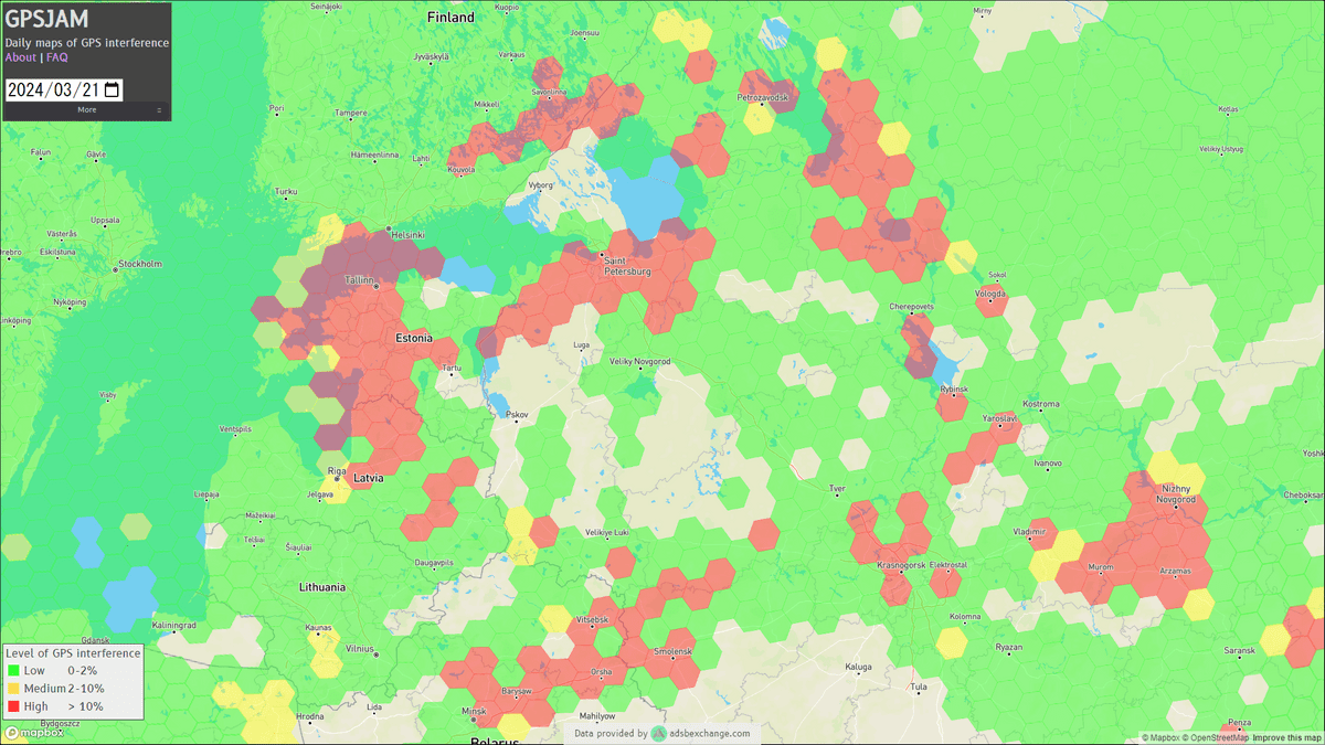
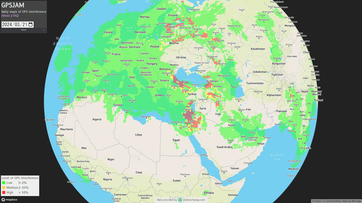
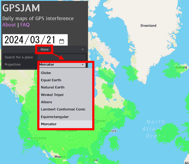
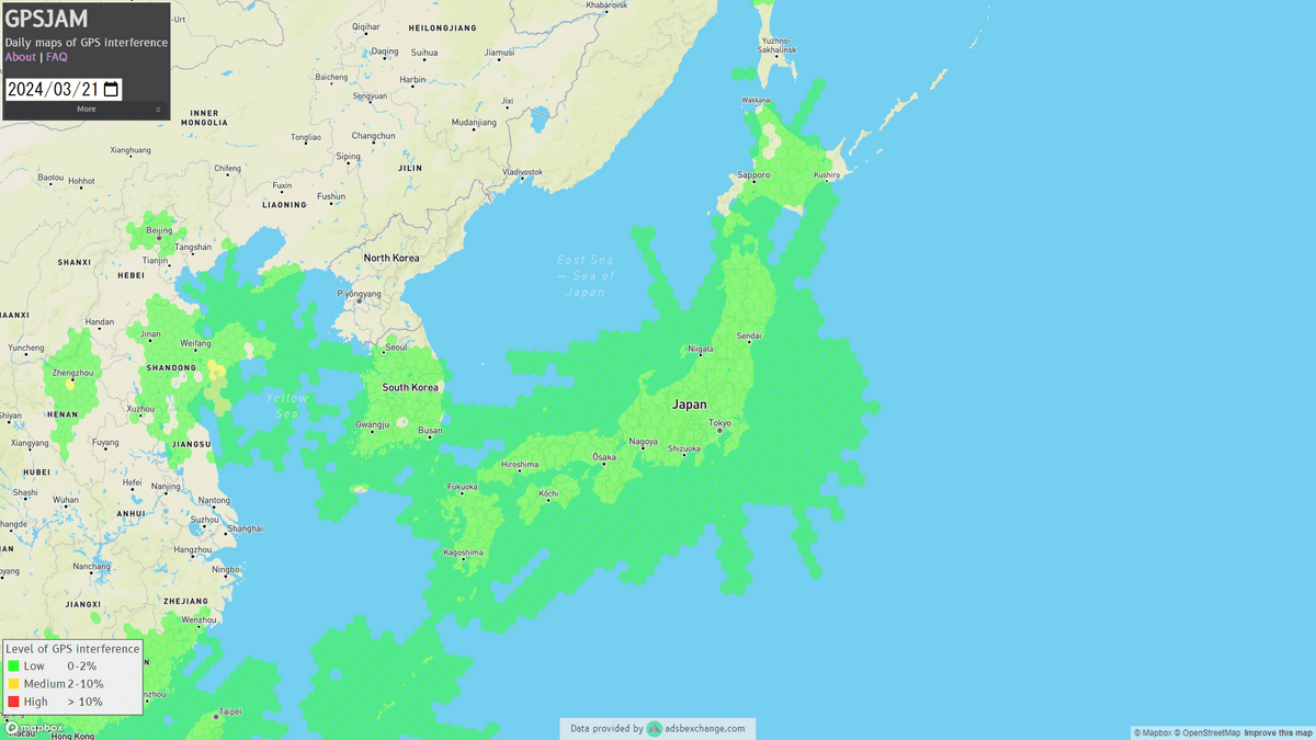
When you access the GPSJam site, it looks like this. Green hexagons on the globe indicate areas where 98% or more of all aircraft flying in that area reported 'good navigation accuracy using GPS,' and yellow indicates areas where 2-10% of aircraft reported 'good navigation accuracy.' Areas that reported a low level of Red hexagons indicate areas where 10% or more of aircraft reported 'poor navigation accuracy.'
You can enlarge or reduce the map by scrolling and move it by dragging.
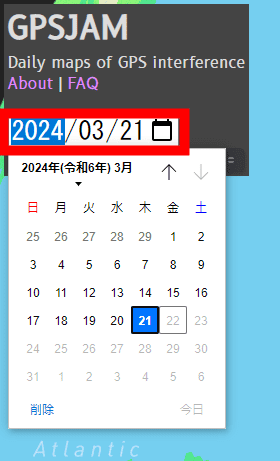
You can also check past data by clicking on the date in the upper left.
Click 'More' to search for a specific place name or select a map projection method such as Mercator projection.
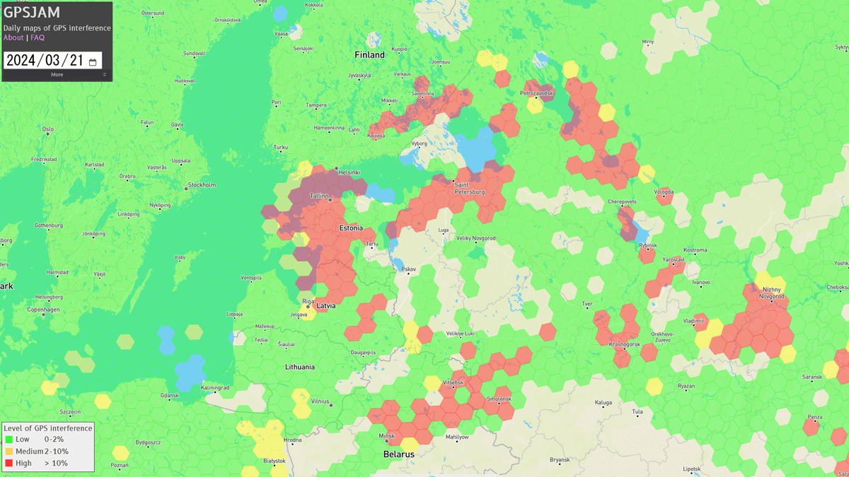
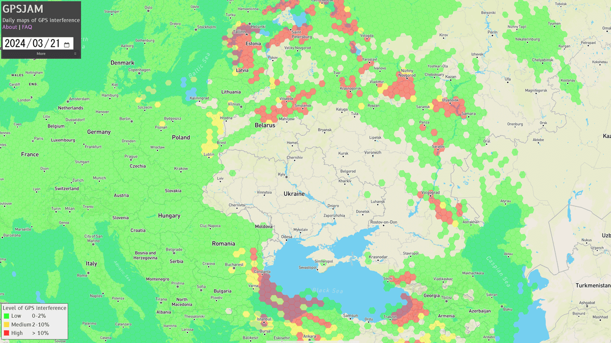
If you check the map, you will see that GPS is widely blocked in areas close to Russia, such as Belarus, Estonia, and Latvia.
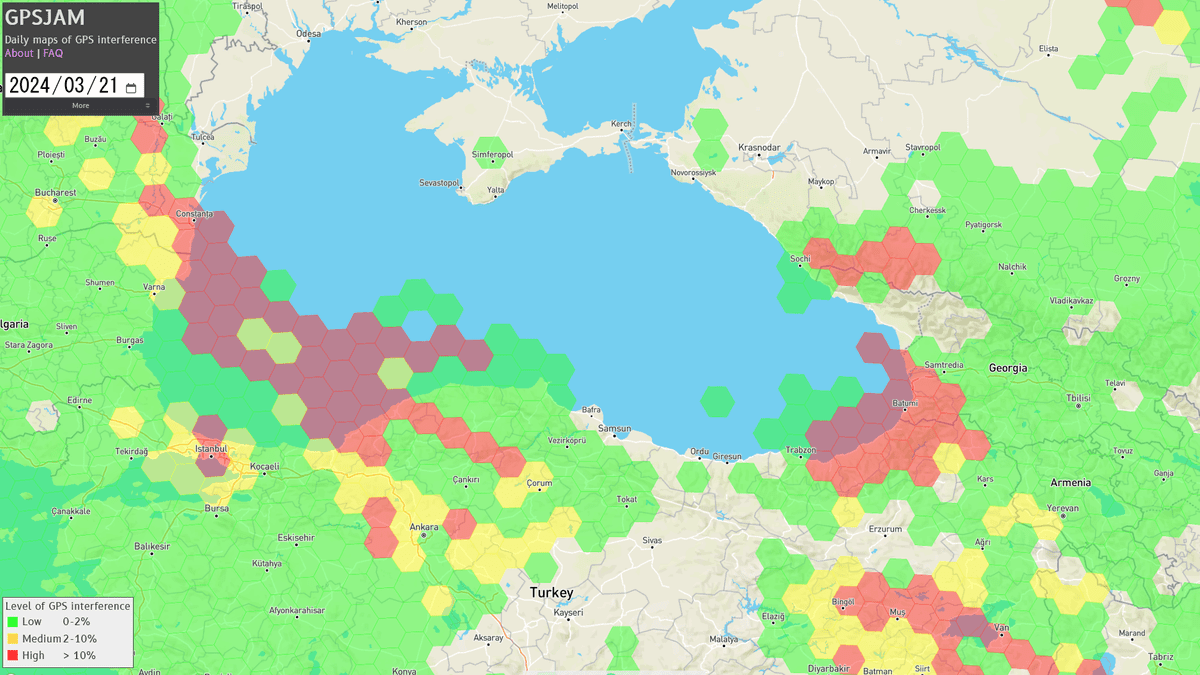
The red range also extends to areas around the Black Sea, such as Turkey and Georgia.
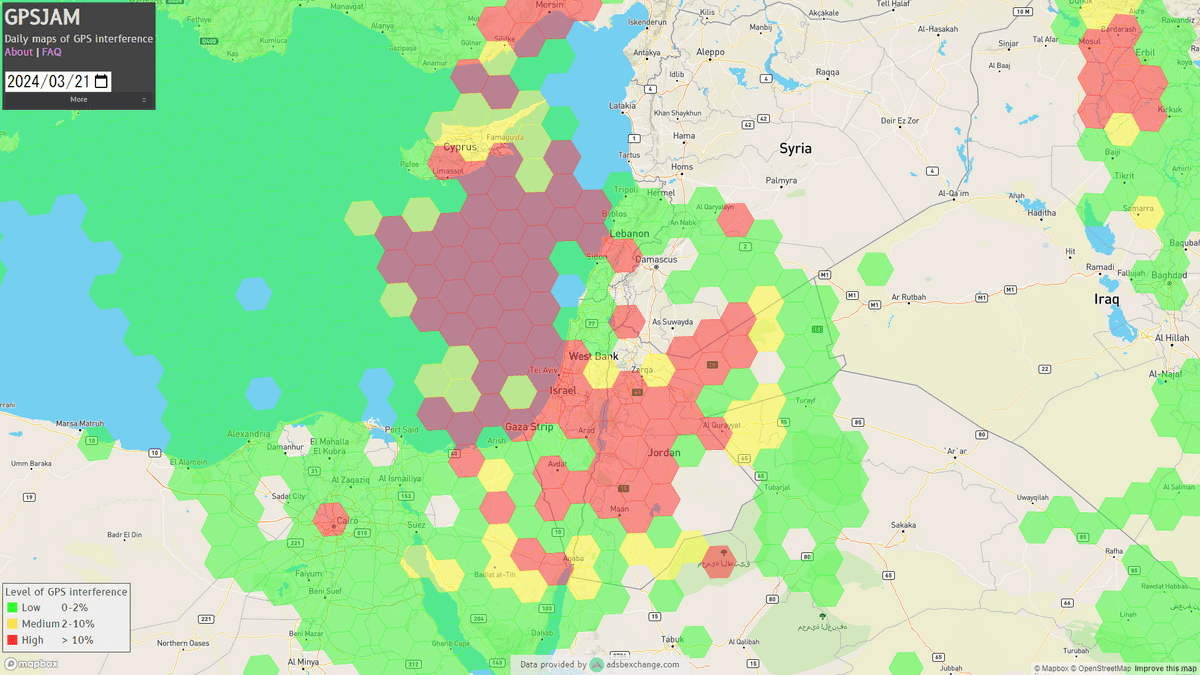
GPS interference has also been confirmed in Syria, a region in the Middle East where conflict continues, including in the Gaza Strip.
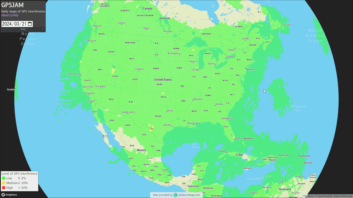
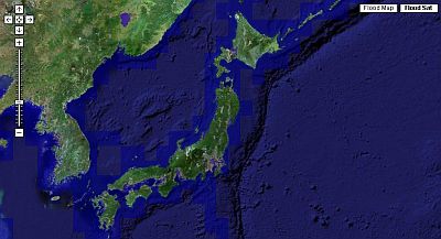
Please note that at the time of writing this article, no GPS interference has been confirmed around Japan.
According to
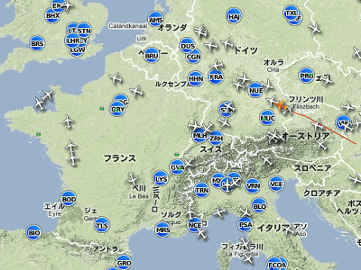
Furthermore, ADS-B includes an item called 'integrity,' which indicates the reliability and accuracy of positioning results, and GPSJam uses this as an indicator to estimate GPS interference. Most aircraft equipped with ADS-B use GPS, but in conflict zones GPS accuracy tends to decrease due to GPS interference by military systems. In addition, there is a possibility that navigation accuracy will decline due to factors such as testing of military jamming systems in the southwestern United States and activation of defense systems to protect wealthy Russian oligarchs from drone attacks. there is.
Wiseman added, ``Due to the areas where fighting is intense and the lack of aircraft capable of transmitting data to ADS-B Exchange , the data provider, In some areas, there are no green, yellow or red markings.'
Related Posts:


in Review, Web Service, Posted by log1r_ut