Flightradar24 releases a map showing areas where GPS is jammed

Satellite positioning systems such as GPS used in navigation apps are sometimes subject to interference. The radar app ``Flightradar24'' has created and published a map that visualizes where in the world interference/jamming is occurring based on aircraft passing data.
GPS jamming & interference map | Flightradar24
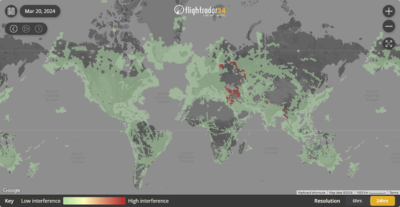
When you access it, a map like this will be displayed. Of the colored areas on the map, the closer to green there is less interference waves, and the closer to red there is more interference waves, indicating areas where interference due to jamming etc. is occurring. Although the name is ``GPS Jamming Map'', in addition to the ``GPS'' operated by the United States, it also includes data from Russia's ``GLONASS'', Europe's ``Galileo'', China's ``BeiDou'', etc. That's what he said.

The area with a high percentage of red on the map is from the southern coast of the Black Sea to the Middle East.

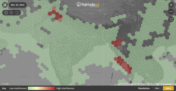
Red is dotted here and there in the mountainous regions of the India-Pakistan border and around Myanmar.

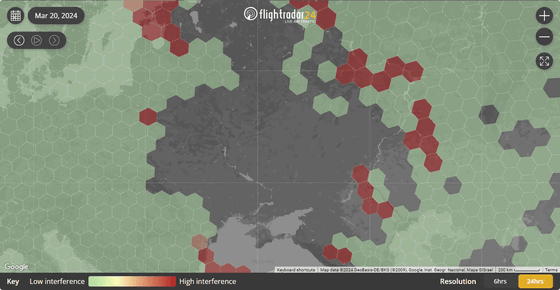
On the other hand, there was no coloring around Ukraine on the northern coast of the Black Sea. This is because we only use data from locations where there is a sufficient number of flights.

Flightradar24 says they hope to enhance the map by adding another data source in the near future.
Flightradar24's new GPS jamming map | Flightradar24 Blog
https://www.flightradar24.com/blog/gps-jamming-map/
Related Posts:
in Review, Web Service, Posted by logc_nt


