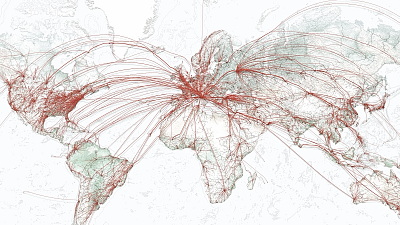
"RadarVirtuel.com" where aircraft operation information is displayed on the map in real time
"RadarVirtuel.com" is a site that displays the current position of aircraft in the world in real time on the map. It is not only to display but also to be able to see various information. At the moment, the area where the aircraft is displayed is only Europe, the Middle East, the West Coast of the United States, the East Coast of Australia, etc. However you can see that over 100 aircraft are operating.
Details are as below.
RadarVirtuel.com
Some aircraft oscillate signals including information such as identifier and current position, which is called broadcast-type automatic dependent monitoring (ADS-B)ADS-B signal receiverYou can check the information of the aircraft individually as long as you have it. "RadarVirtuel.com" cooperates with many individuals and businesses having this ADS-B signal receiver to cover the whole area, so that it can see information of aircraft in various parts of the world I will.
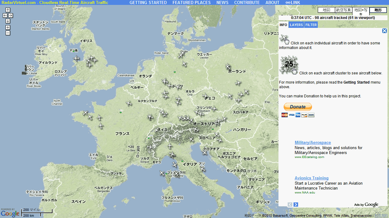
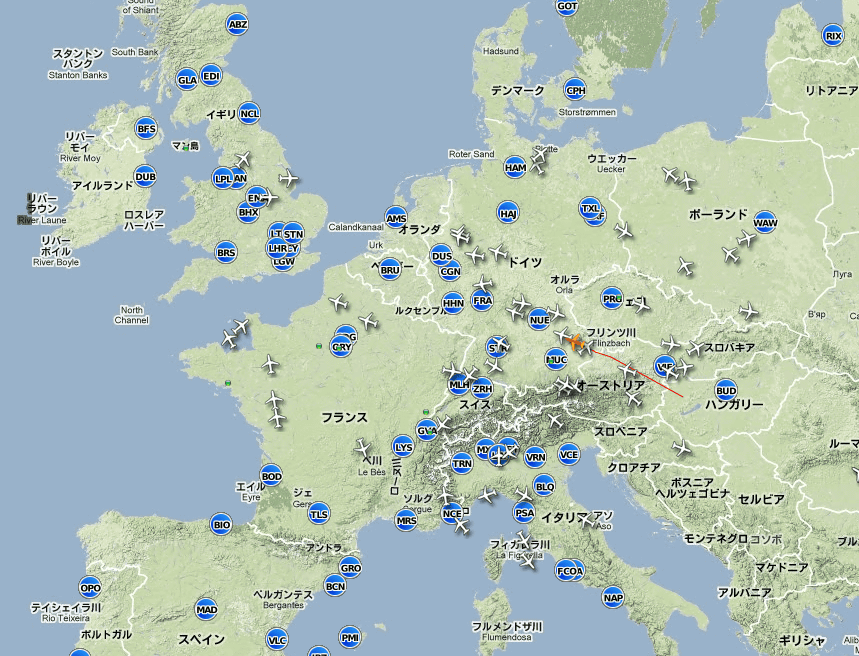
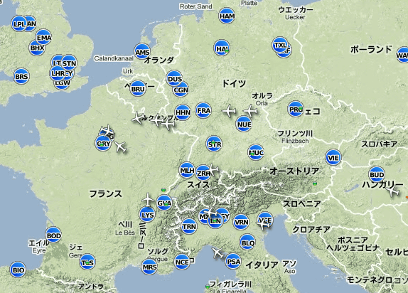
It is the screen right after jumping to the site. The aircraft is displayed on the map of Europe. All information is updated every 4 minutes, but since only the aircraft in the covered area is displayed, the number of aircraft may fluctuate greatly.
Clicking on the aircraft will look like this. This red line is the flight route and shows the things in the past 30 minutes.
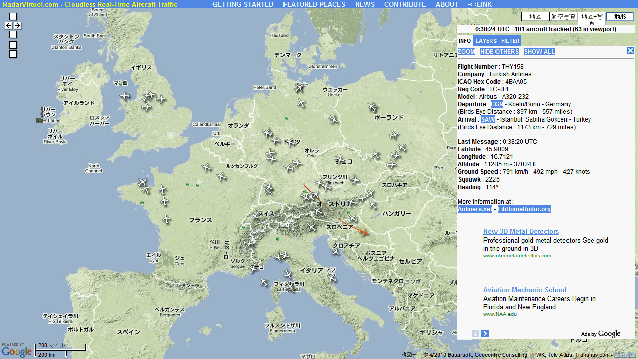
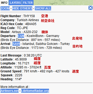
The detailed information on the right side is like this. By 158 flights of Turkish Airlines (THK), the airframeAirbus A 320, In Bonn, GermanyCologne / Bonn airport(CGN) from Istanbul in TurkeySabiha Gokcen International AirportYou can see that it is flying at a speed of 791 kilometers per hour above the altitude of 11285 meters towards the SAW (SAW).
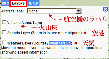
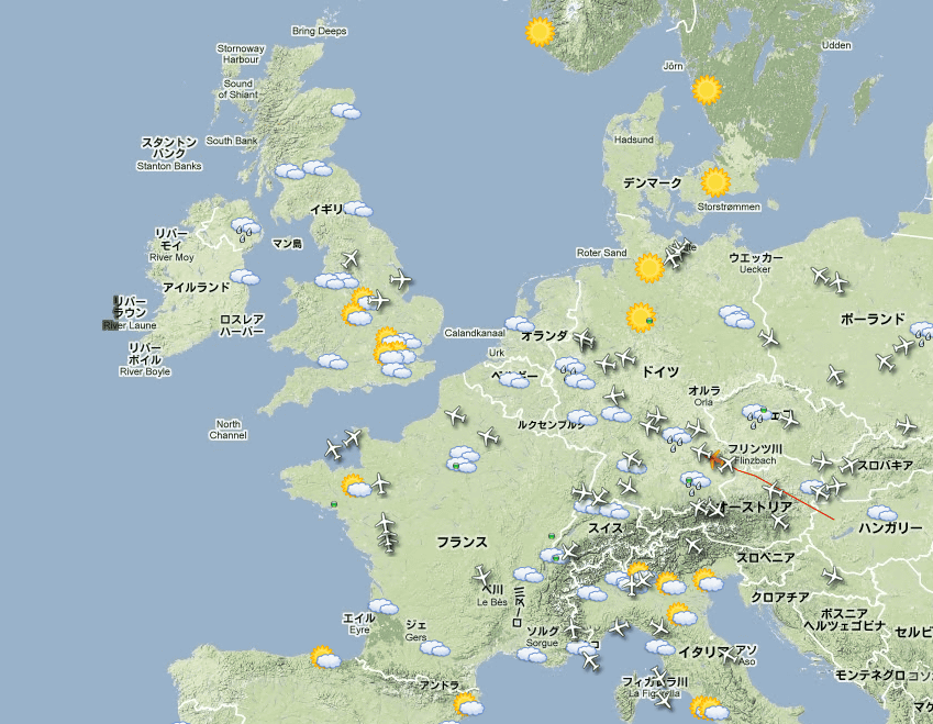
On the "LAYERS" tab in the upper right control panel you can display aircraft labels, influence of volcanic ash, airfield, weather etc on the map.
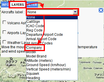
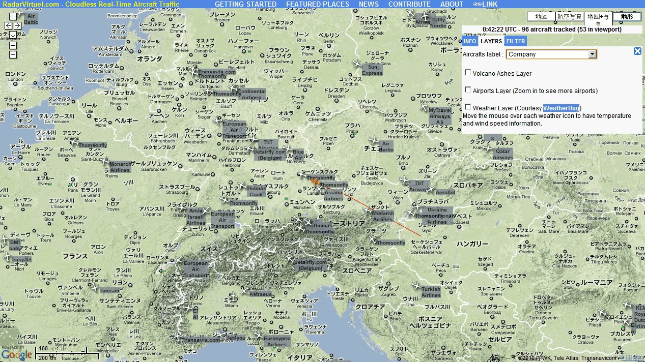
Aircraft labels will display additional information beside the plane. For example, if you want to display the aircraft company name, click the "LAYERS" tab and then "Company" from "Aircrafts Label".
The result is as follows.
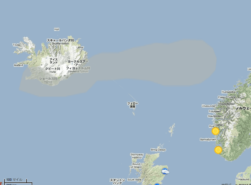
The influence of volcanic ash is displayed when checking "Volcano Ashes Layer".
Iceland'sEyelashes of Eyjafjatra yokeolYou can see that there is volcanic ash by.
For airport display, check "Airports Layer". Three letters of alphabetAirport CodeIs displayed.
Weather Layer "for weather indication.
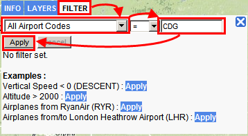
There is also a filter function to display only the specified aircraft. For example,Charles de Gaulle International AirportTo display only the aircraft departing or arriving from CDG (CDG), click the "FILTER" tab, select "All Airports Codes", enter "CDG", and finally click "Apply" I will.
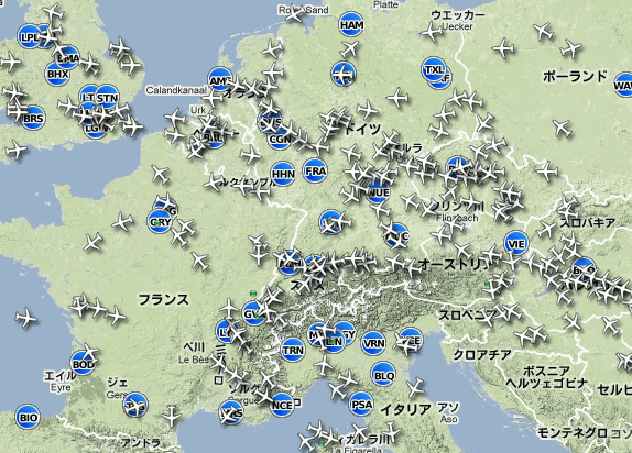
It is before you click "Apply". A lot of aircraft are displayed.
It is after clicking "Apply". Only the aircraft departing or arriving from Charles de Gaulle International Airport was displayed.
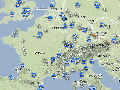
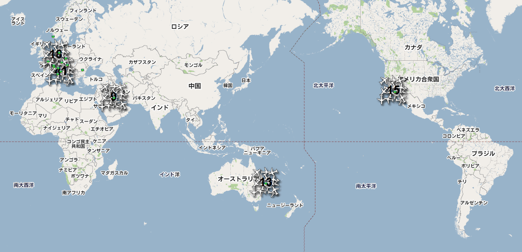
If you shrink the map and display the whole world, it will be like this. Places where aircraft are concentrated will become chunks and numbers will be displayed.
In the past, Internet Explorer has confirmed performance problems, and Firefox, Chrome, Safari are recommended.
Related Posts:

in Web Service, Review, Vehicle, Posted by darkhorse_log