"Flight Stream" to visualize flight lines and flights connecting airports all over the world
Every day in the world many planes connect each other and continue to support the flow of people and things. It's easy to see how such an airplane connects airports in various places "Flight Stream"is.
Flight Stream
http://callumprentice.github.io/apps/flight_stream/index.html#
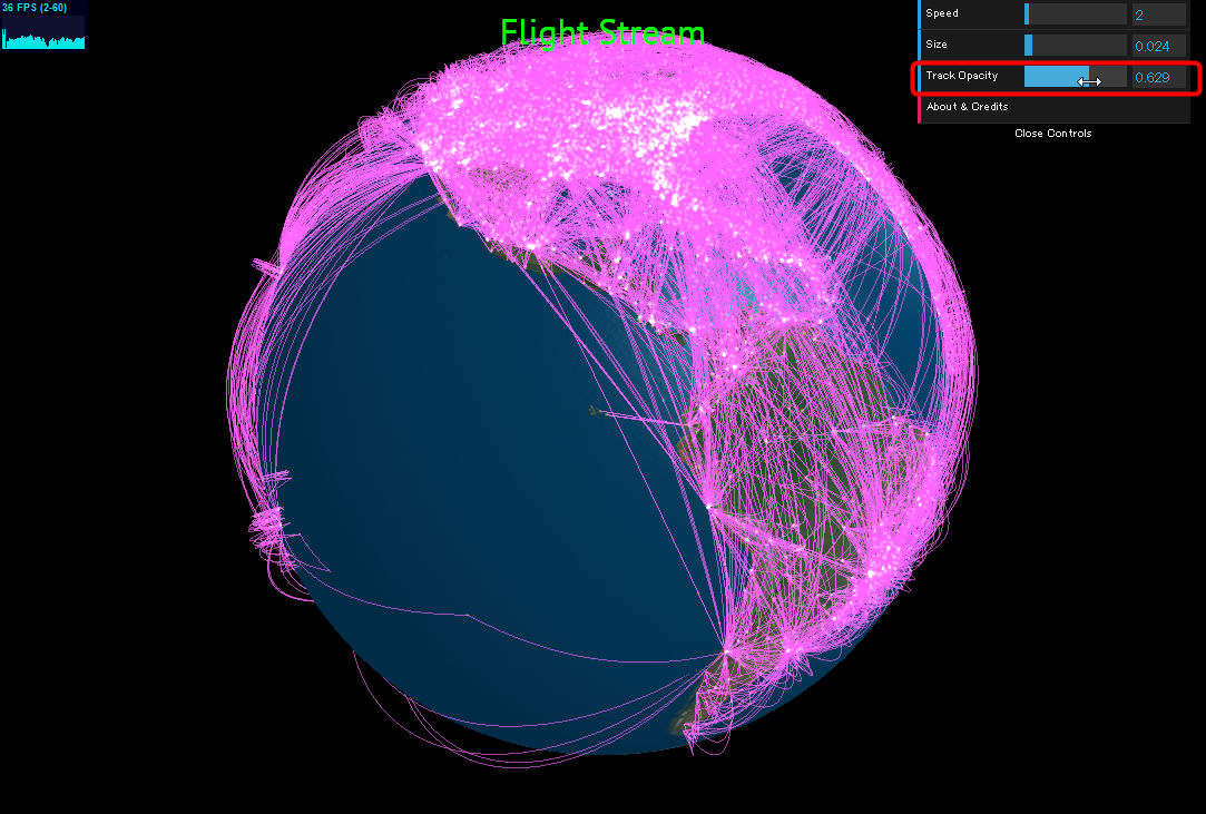
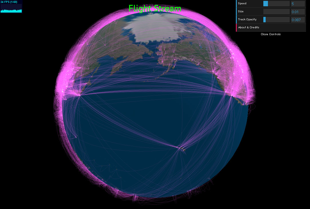
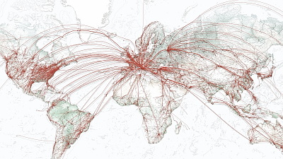
When you open the page, a round earth is displayed, things like pink round orbs (light bulbs) start to fly around the continent. All of this is an airplane flying around the world.
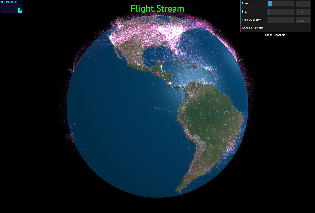
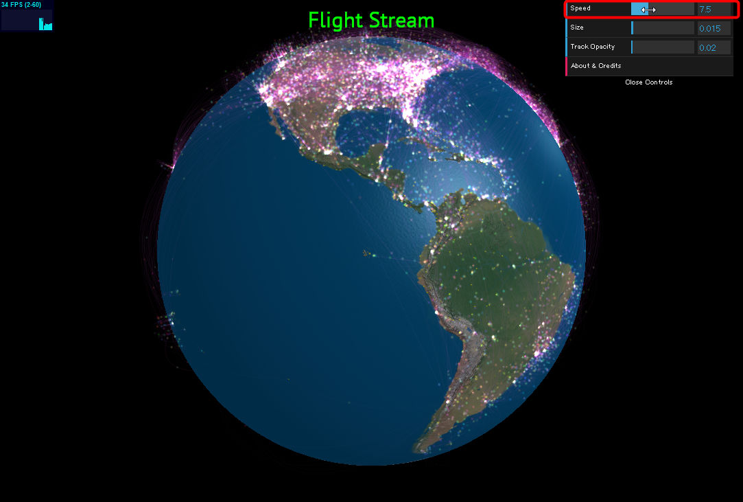
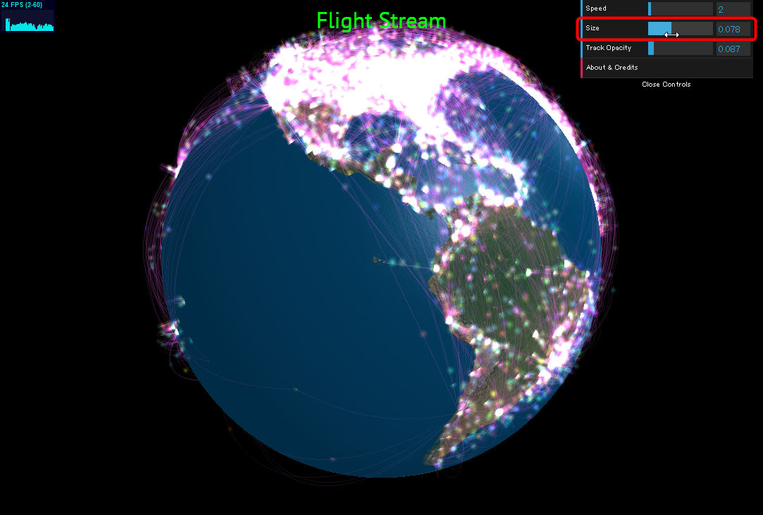
There are various control panels in the upper right, it is possible to adjust the display condition.

Speed: Adjust the speed with which the time advances. The faster it goes to the right, the faster it gets.
Size: Change the size of the Orb indicating the plane. Be careful as it will not be possible to distinguish each too much if it is too large.
Track Opacity: Adjust the transparency of the pink color line connecting the airport.
In addition, it is possible to enlarge or reduce the map by rotating the mouse wheel etc. Although it can not expand to a detailed level like Google Maps, it does not seem to be a problem to see rough routes.
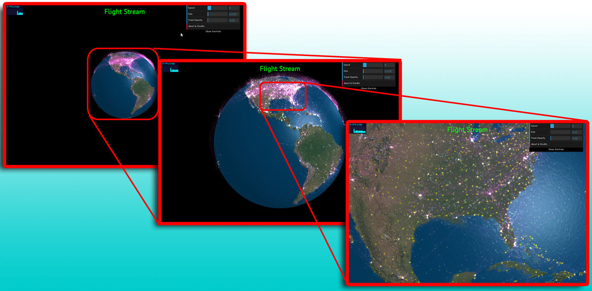
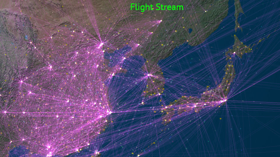
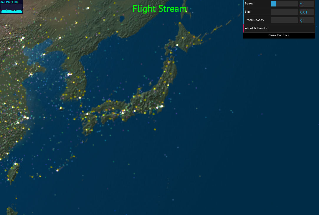
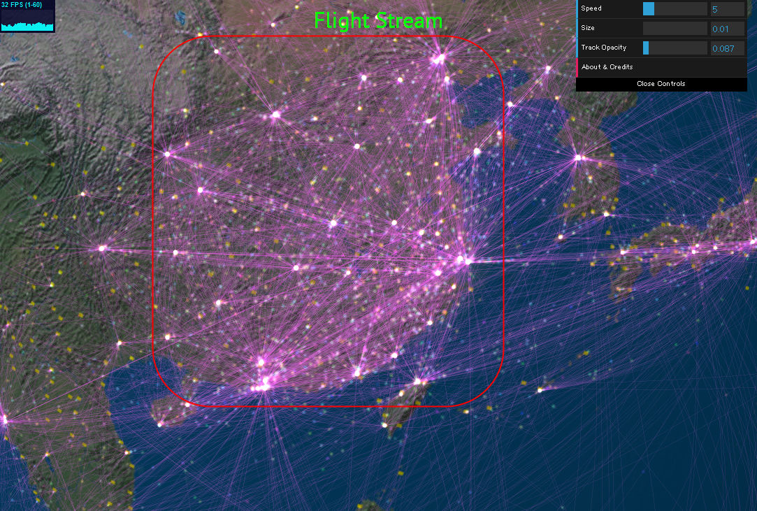
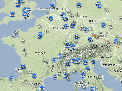
So, first I tried to display the Japanese archipelago. Each orb that shines brightly on the land or ocean indicates an aircraft in flight.
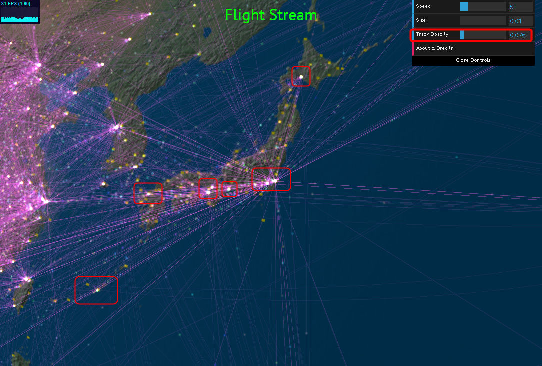
Raising Track Opacity makes it possible to better understand the aircraft's routes. You can see how many lines are gathered at major airports such as New Chitose, Narita · Haneda, Centrair, Kansai / Itami, Fukuoka, Naha etc.
If you look at China beyond the ocean, you can see that big airports are scattered here and there.
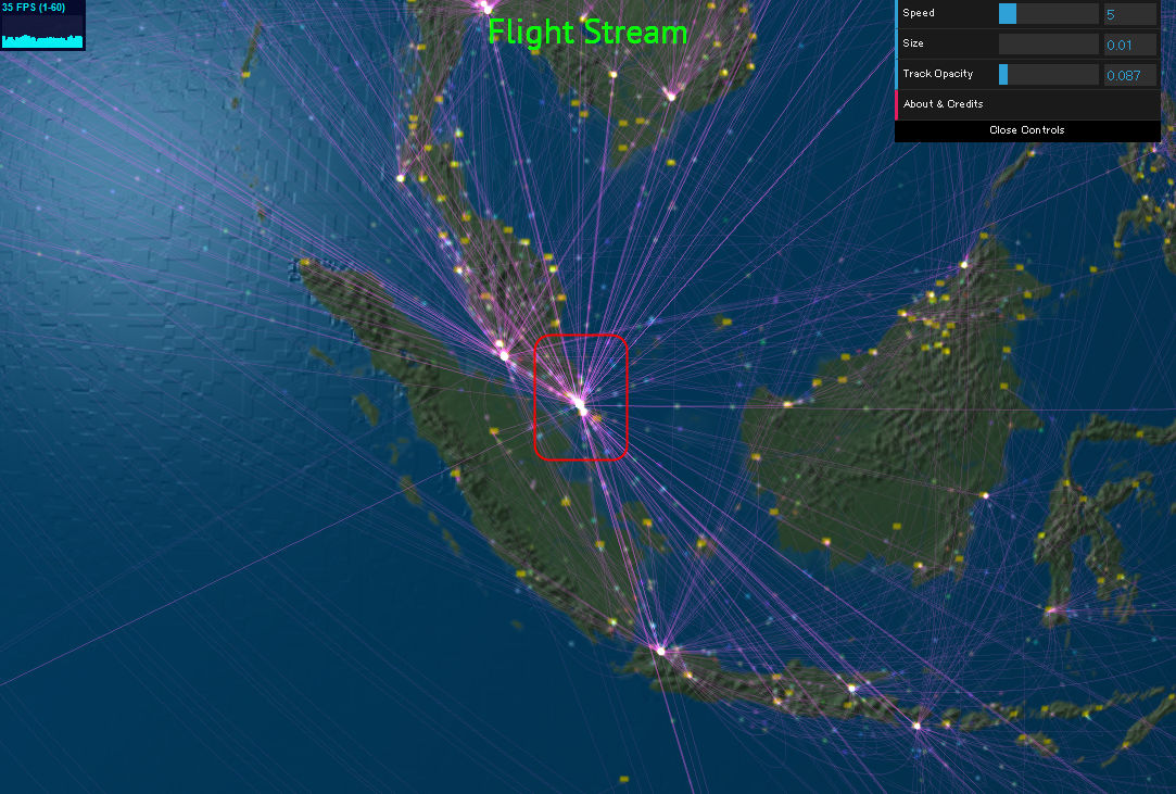
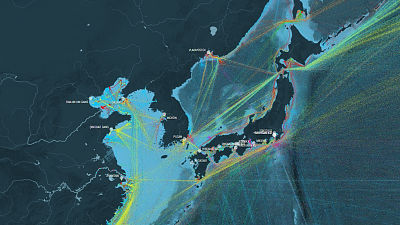
There were also many lines concentrated in Southeast Asia's leading hub airport and Singapore's Changi international airport.
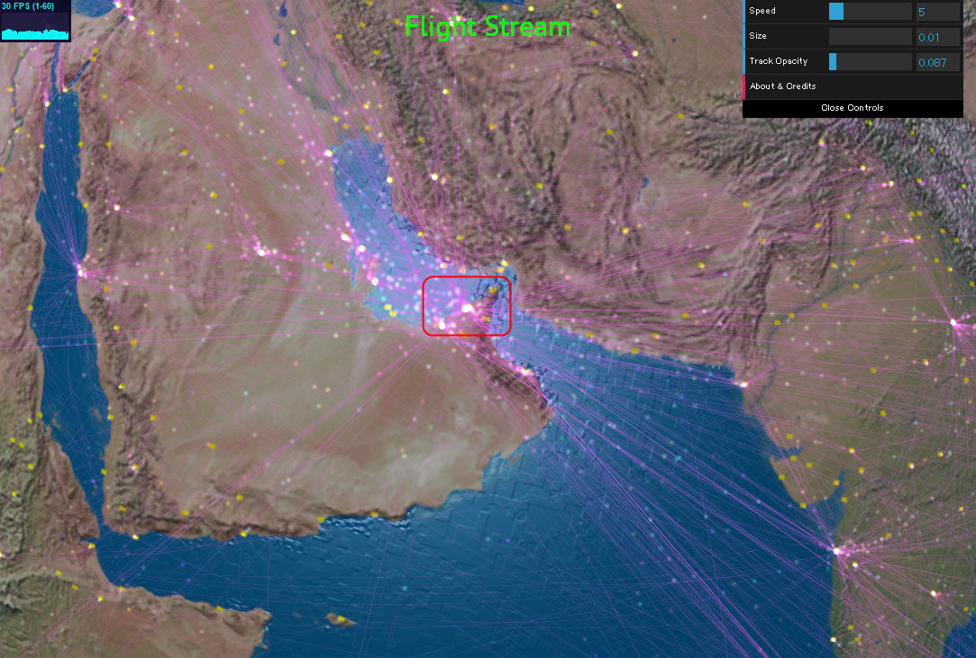
And you can see how Dubai companion airport in Dubai, a rapidly growing desert, functions as a new hub base.
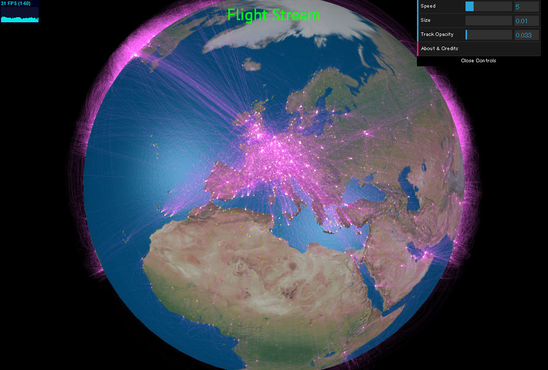
In Europe where many countries are crowded, the level where the whole area is dyed pink.
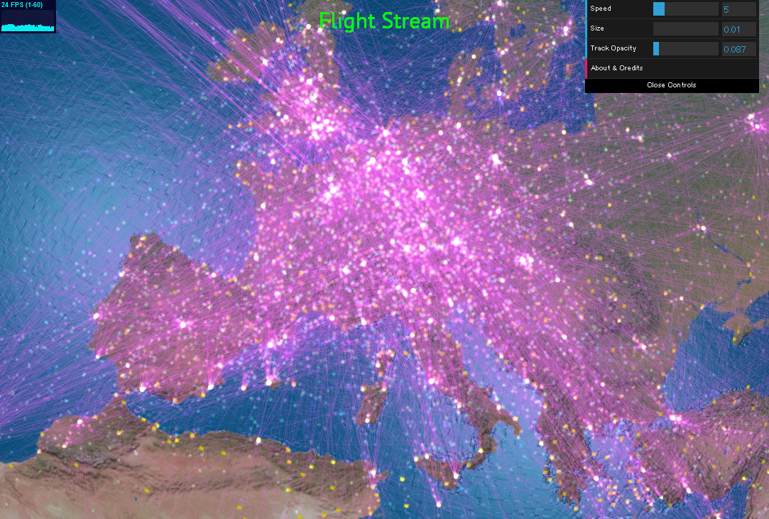
From a distance perspective, you can see that a lot of lines concentrate in Europe.
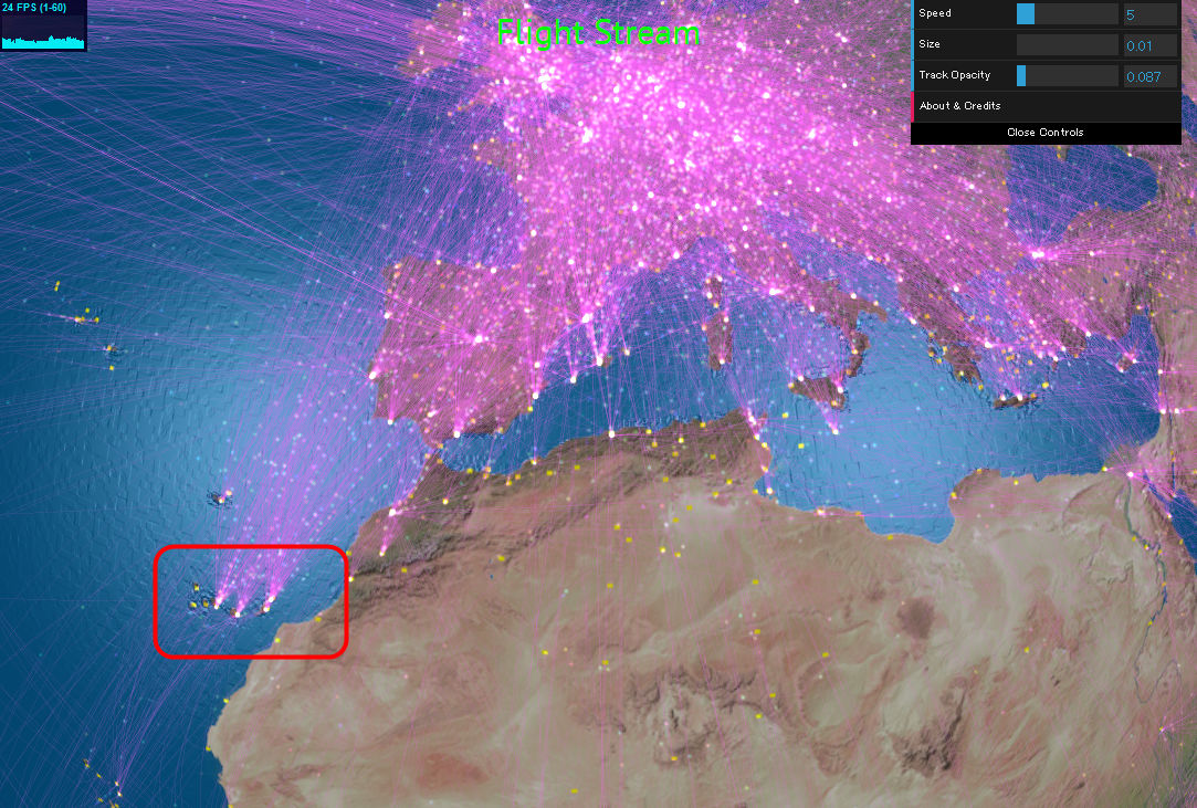
Three major airports dotted off the coast of Africa are popular resort areas with a temperate climate,Canary Islandswas. It seems that the number of routes is a popular barometer.
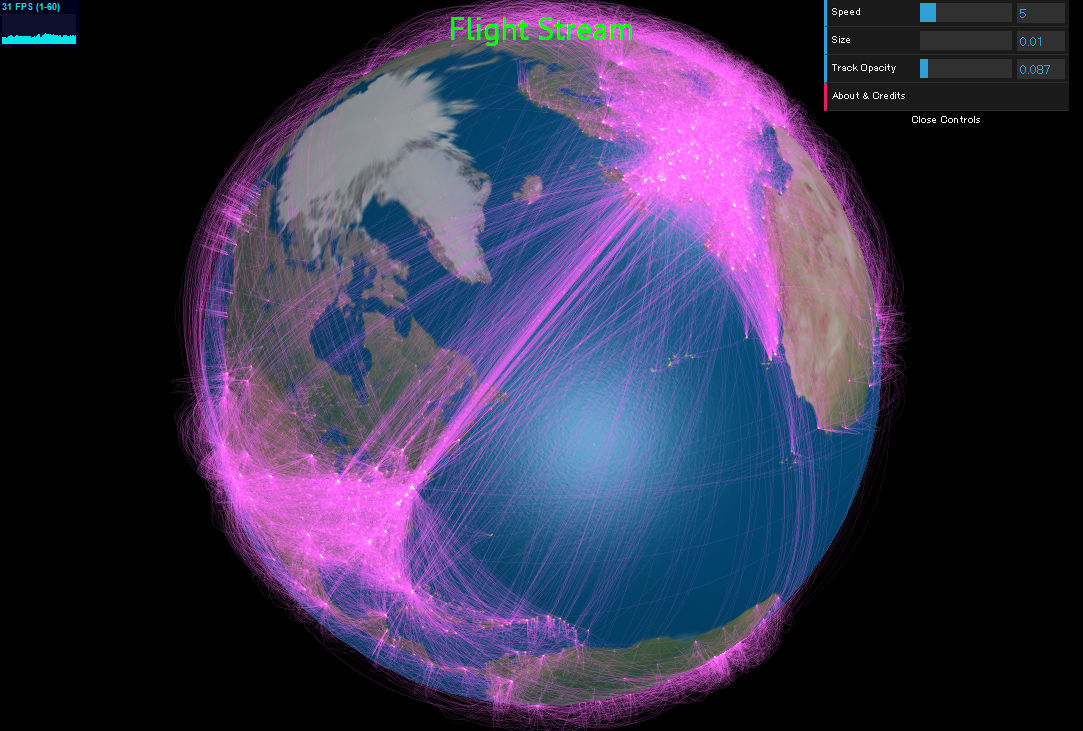
North American continent is like this. Connect big airports as bases with thick routes and access small airports from various basesHub and SpokeA scene like a model of.

Atlantic routes connecting America and Europe are obvious at a glance.
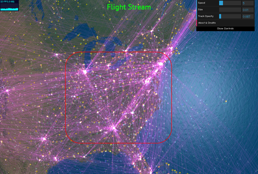
On the east coast of the United States, the three major airports in New York (JFK International Airport), Chicago (O'Hare International Airport) and Atlanta (Hartsfield-Jackson-Atlanta International Airport) were particularly conspicuous.
The Pacific routes connecting Asia and North America including Japan are like this. Many routes are connected from various places to the route which leads to Hawaii as a matter of course.
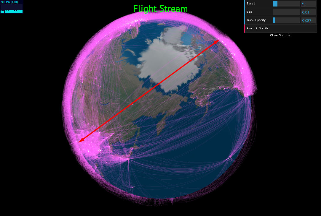
Looking around the North Pole, the route of "North Pole Route" connecting Asia and the East Coast of the United States can be seen.

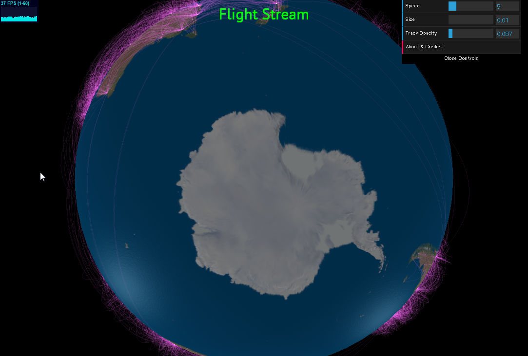
Conversely, the route around Antarctica did not seem to be set at all.
Unfortunately, the information on the displayed flight is not in real time,OpenFlights.orgIt is said that it utilizes data by. However, because there is convenience to be able to adjust the time axis, it seems to be said that its advantages are great.
By the way, the route connecting Westray Island and Papa Westley Island in the northern part of Scotland, which is said to be "the shortest route in the world", fits within the red square.
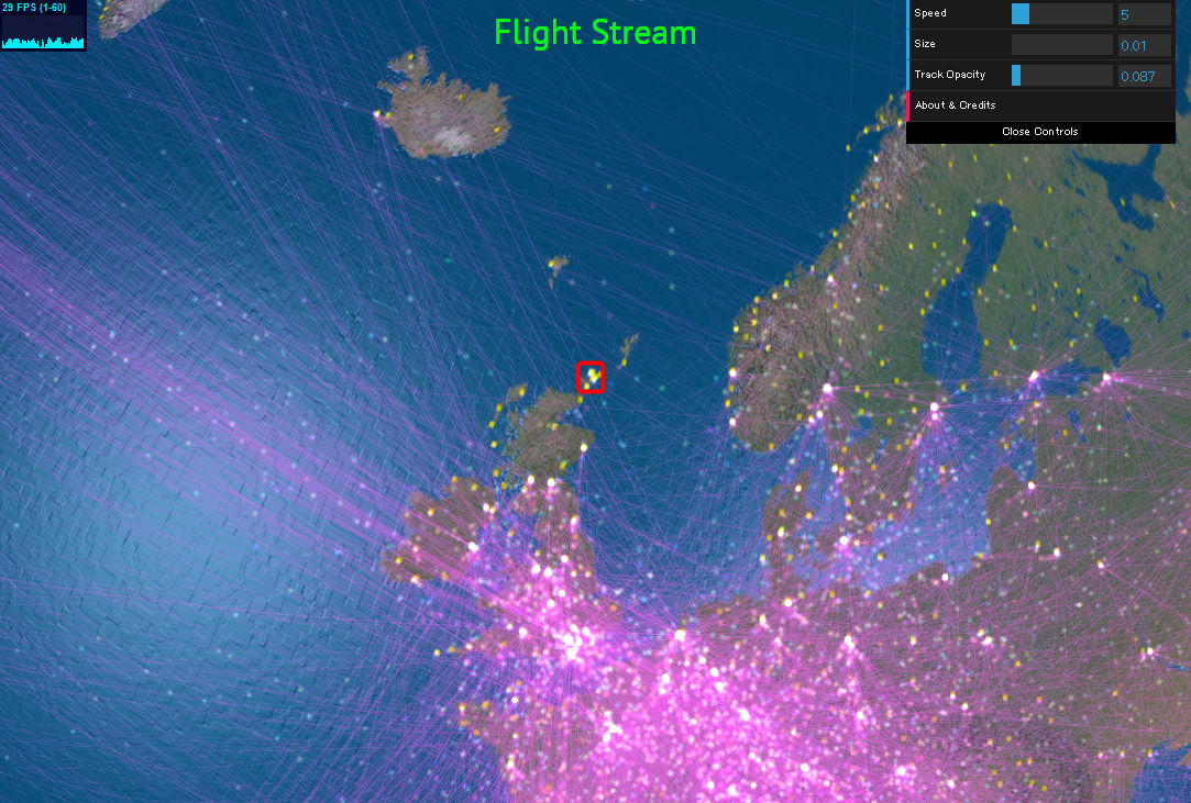
The distance is only 2.8 km, which is a very short route. A movie with a startling flight of only 90 seconds of flight time is like this.
Westray to Papa Westray flight - YouTube
Conversely, the longest route in the world was Singapore Airlines' Singapore - Newark flight. Although it is now the abolished route, it is 9535 miles (15,345 kilometers) away and the required time is about 18 hours, so it turned out well that both airports are at a glance level at first sight .
Related Posts:
in Video, Note, Web Service, Vehicle, Design, Posted by darkhorse_log