What is the difference between the satellite positioning systems 'GPS', 'GLONASS' and 'Galileo' that are indispensable for map applications and car navigation systems?

When measuring position information on the earth, various
GPSrChive - GPS vs GLONASS vs Galileo
https://www.gpsrchive.com/Shared/Satellites/GPS vs GLONASS vs Galileo.html
GNSS calculates position using a measurement method called ' trilateration '.
An easy-to-understand explanation of how GPS measures location information looks like this - GIGAZINE

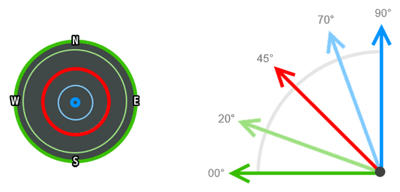
GNSS also uses the best positioned satellites to calculate the current position, with satellites positioned between 70 and 90 degrees being the best for calculating vertical position. Satellites between 20 and 70 degrees are considered to be the most accurate when calculating latitude and longitude, while satellites between 0 and 20 degrees are less reliable because they are more sensitive to obstacles such as buildings.
GPS is the GNSS operated by the United States Air Force and has been available worldwide since April 1995. There are 32 artificial satellites used in GPS, orbiting the earth at an
The following image is the orbital path of the GPS satellite.
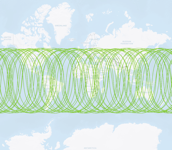
Satellites do not pass 35 degrees of latitude on the side far from the equator.

GLONASS is operated by the Russian Aerospace Forces and has been available worldwide since November 2011. There are 24 artificial satellites used, the orbital inclination angle is 64.8 degrees, and the altitude is about 19,100 km. Each satellite orbits the earth in 11 hours and 15 minutes, with a positioning error of 5-10m.
The following image is the orbital path of the GLONASS satellite.
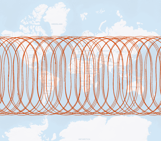
Satellites do not pass through 25.2 degrees of latitude on the side far from the equator.

Galileo is a GNSS operated by the
The following image is the orbital path of the Galileo satellite.
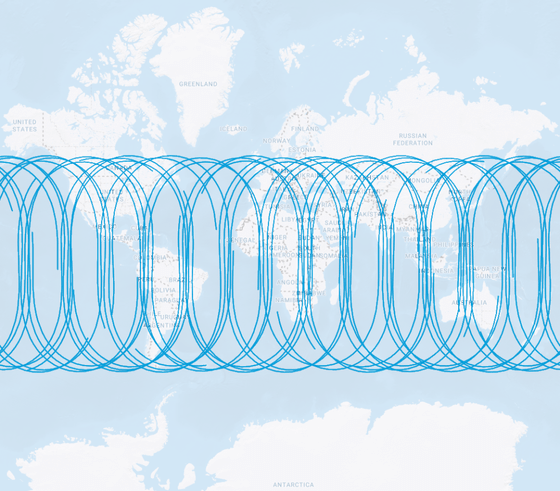
Satellites do not pass 34 degrees of latitude on the side far from the equator.

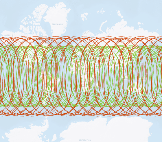
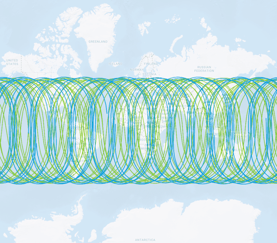
Also, GPSrChive compares the orbital paths of each satellite, and the image below compares GPS and GLONASS. It shows that GLONASS shown in red has a wider orbit than GPS shown in green.
An image comparing GPS and Galileo shows that there is almost no difference in the latitudes passed by the green GPS and the blue Galileo.
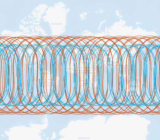
Similar to the comparison between GPS and GLONASS, the images comparing Galileo and GLONASS show a wide area of red GLONASS.
Services such as
GPSrChive confirms the visibility of each satellite at latitude 5°N, latitude 25°N, latitude 45°N, and latitude 85°N at 25°E. The image below shows satellites visible at 25 degrees east longitude and 45 degrees north latitude. Green is GPS, red is GLONASS, and light blue is Galileo. Blue is the Quasi-Zenith Satellite System (QZSS) operated by Japan.
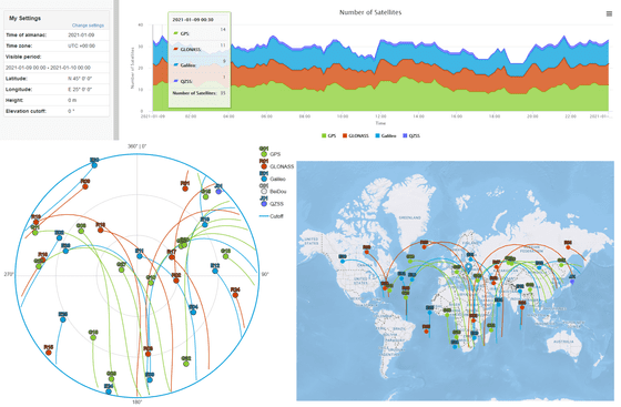
Although the number of visible satellites varied slightly with changes in latitude, the total number of available satellites did not change significantly. Also, the number of available satellites was the largest for GPS.
GPSrChive recommends using multiple GNSS for reliable navigation as the number of available satellites is the same when combining GPS with GLONASS and GPS with Galileo.
Related Posts:
in Science, Posted by log1r_ut

