More than 3,000 valuable military maps from the 16th to 19th centuries are released online
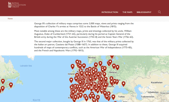
George IIIs Collection of Military Maps
https://militarymaps.rct.uk/
Huge archive of old military maps published – ianVisits – London news and events
George III is known for collecting many maps, and said that he had more than 55,000 maps and charts, including topographic maps and marine charts. After George III's death, his son, George IV , donated much of the collection to the British Museum. It was left without being donated.
Dr. Yolande Hodson, a British history researcher, has published such a military map of George III on the website 'George IIIs Collection of Military Maps'. Anyone can see valuable military maps from the 16th and 19th centuries online.
When you access the official page and scroll down a bit, you will see a button called 'OPEN THE MAP'. Click here ...
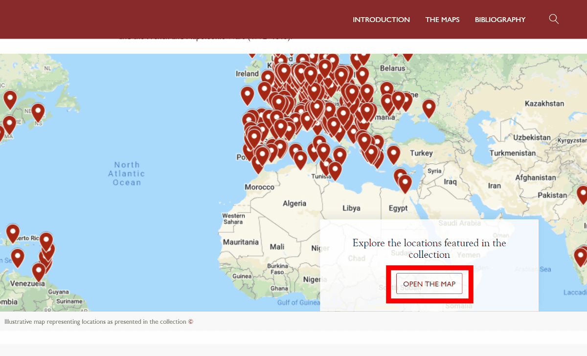
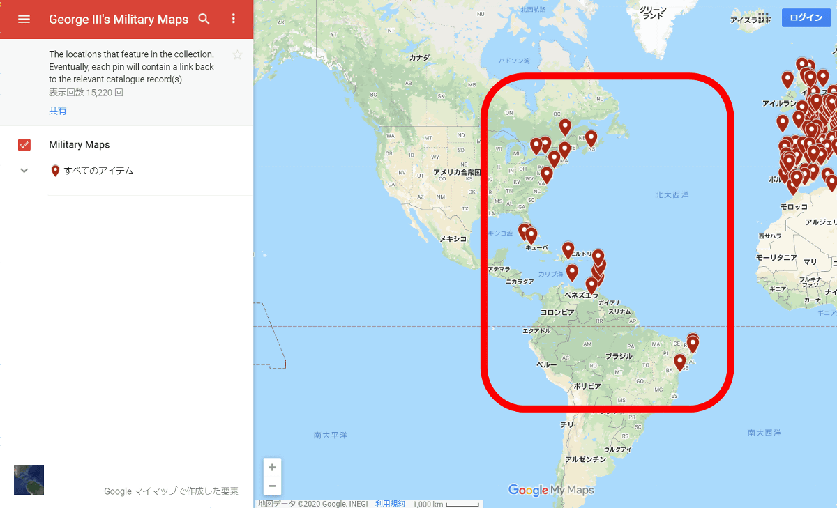
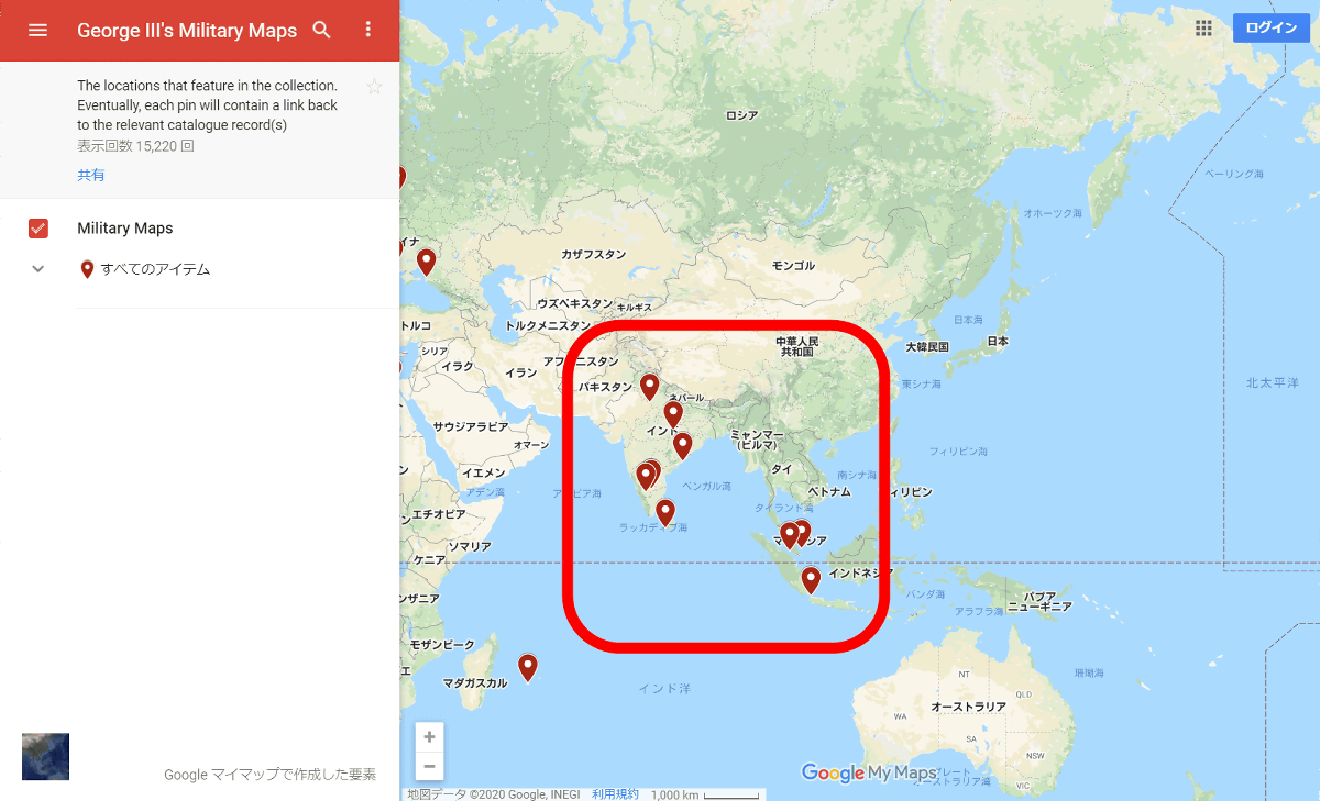
Displays each point on the world map corresponding to the military map of George III. Most collections are concentrated in Europe, but there are also military maps for South Africa and India.
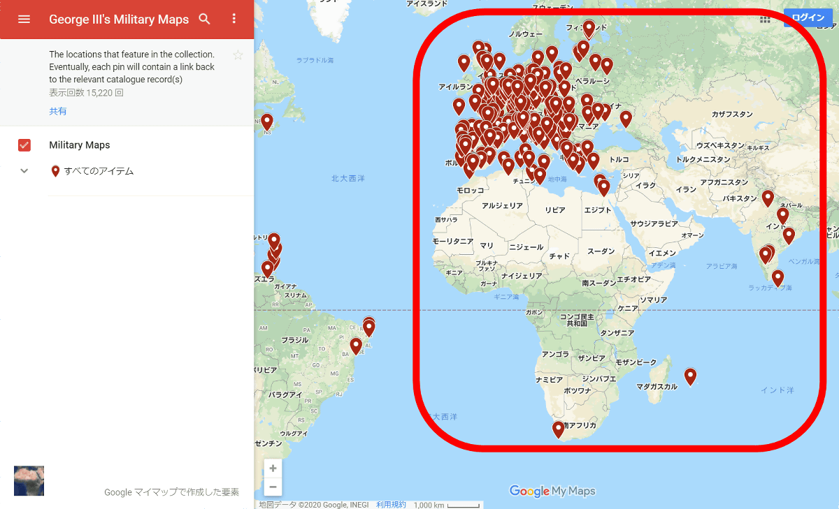
Plus, military maps of the Americas and ...
There was also a Southeast Asia military map.
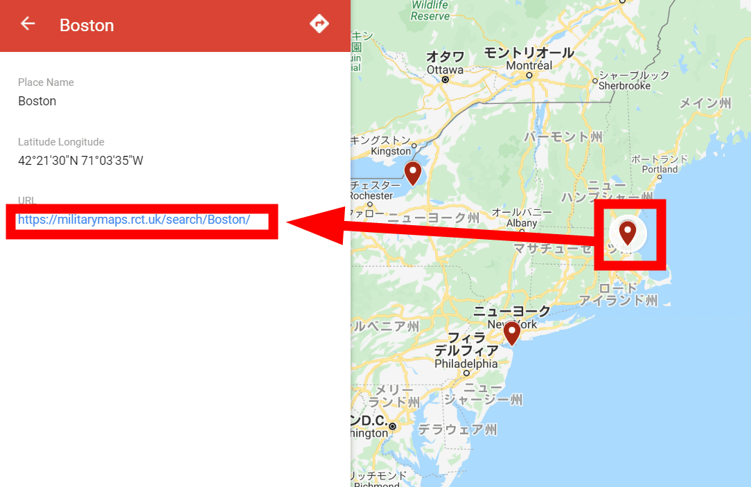
Clicking on a point on the map will display the URL of the military map on the left side of the screen. Click on the URL ...
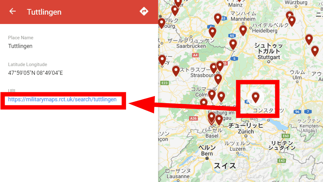
The military map at that point is listed. Click on the displayed military map.

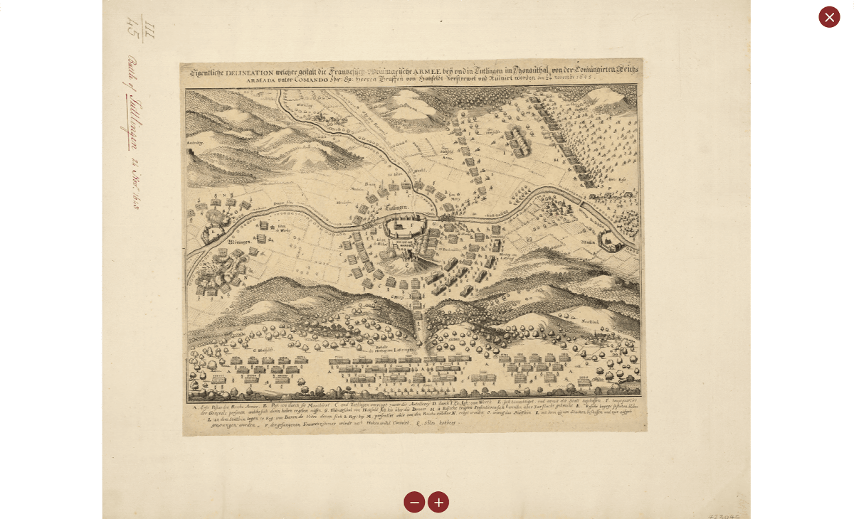
Then you can see the selected military map.
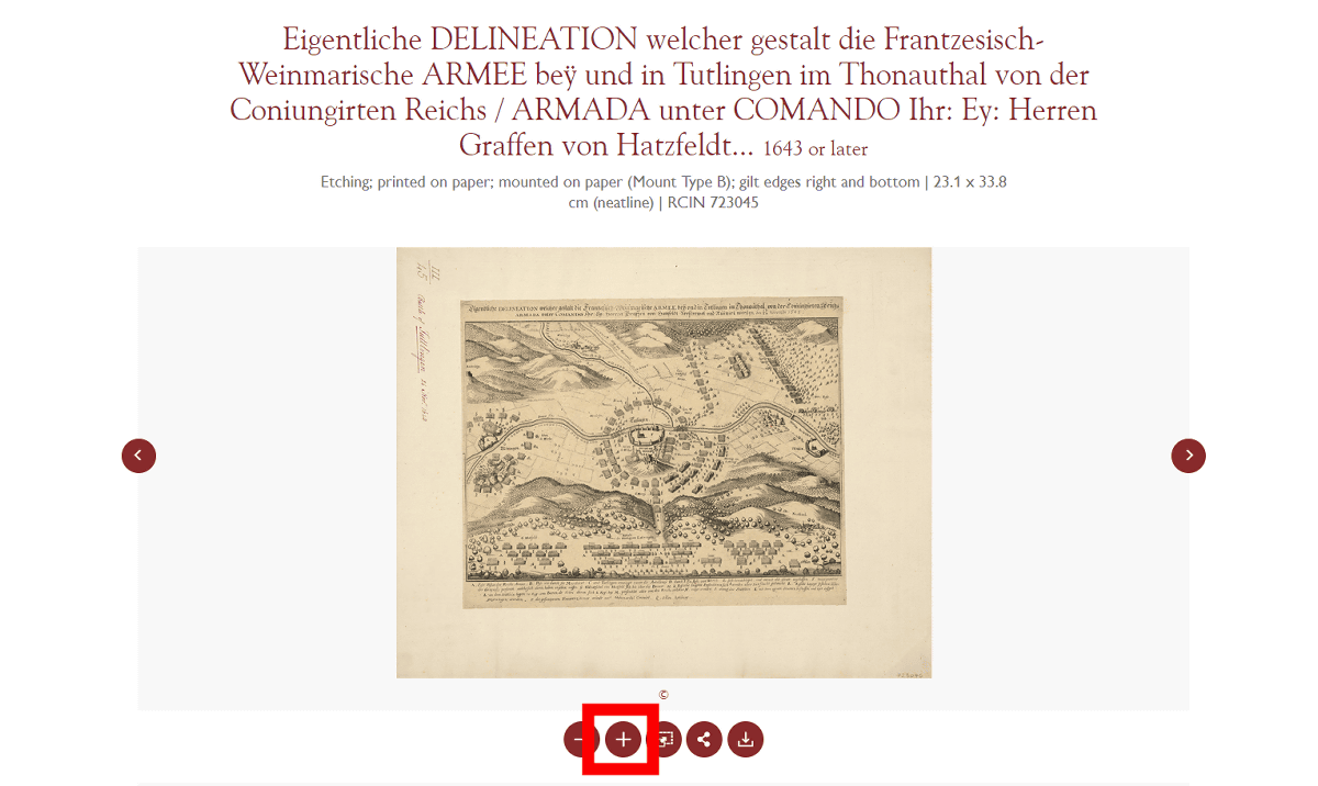
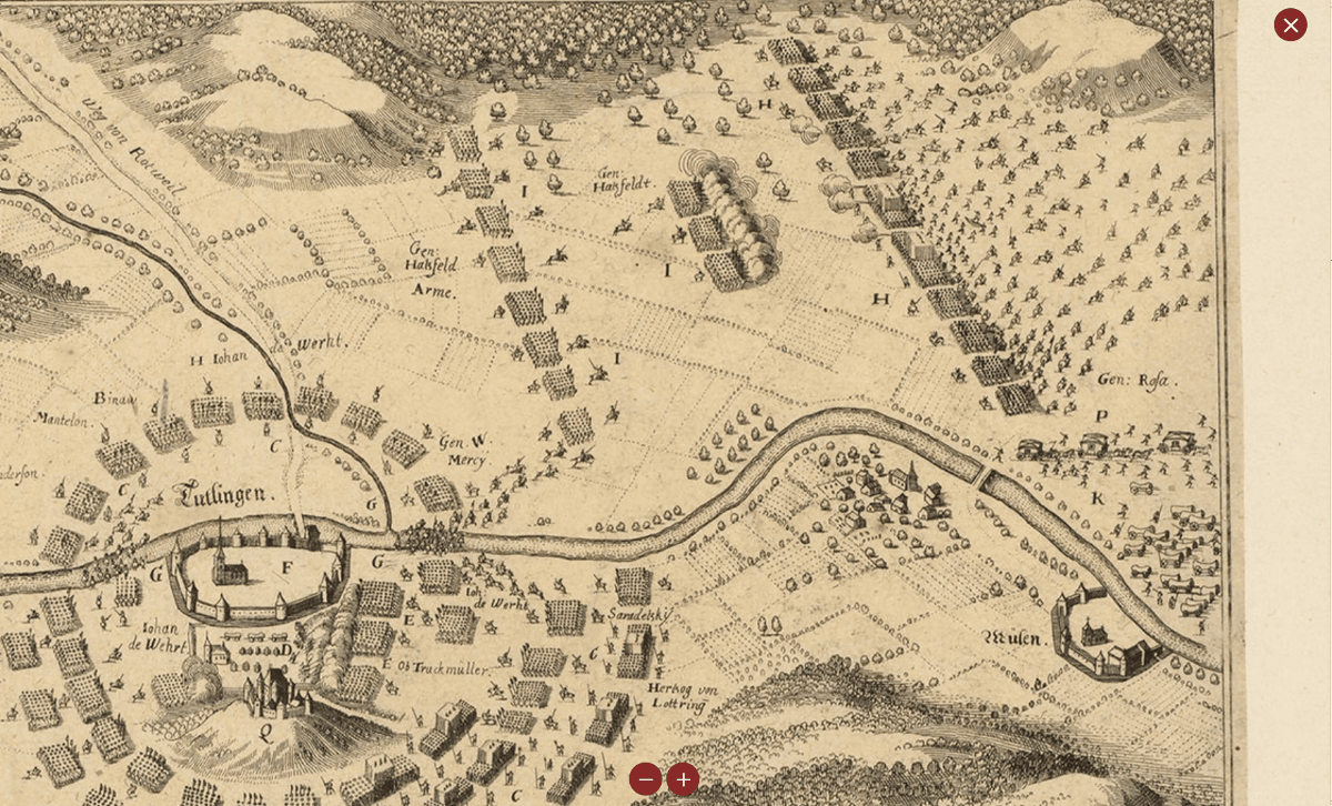
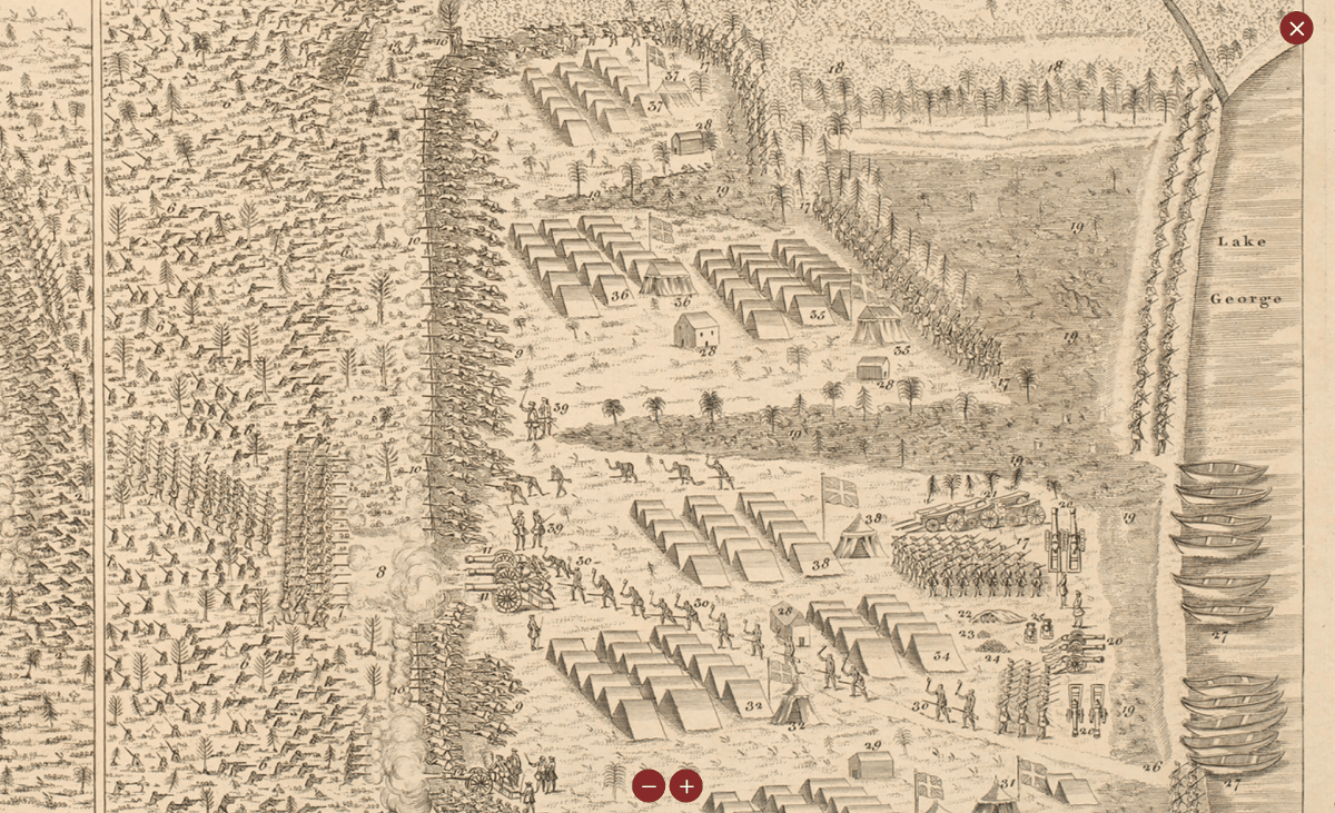
The military map can be enlarged and displayed.
If you zoom further, you can also see the French army in winter and the formation of the Holy Roman Empire trying to surprise the French army.
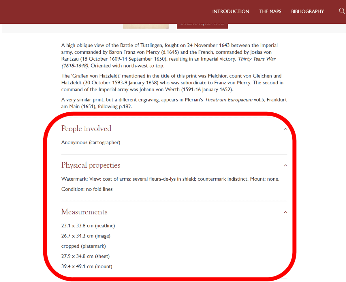
At the bottom of the screen was a description of the military map, the creator of the map, the physical characteristics of the map, and information such as the size.
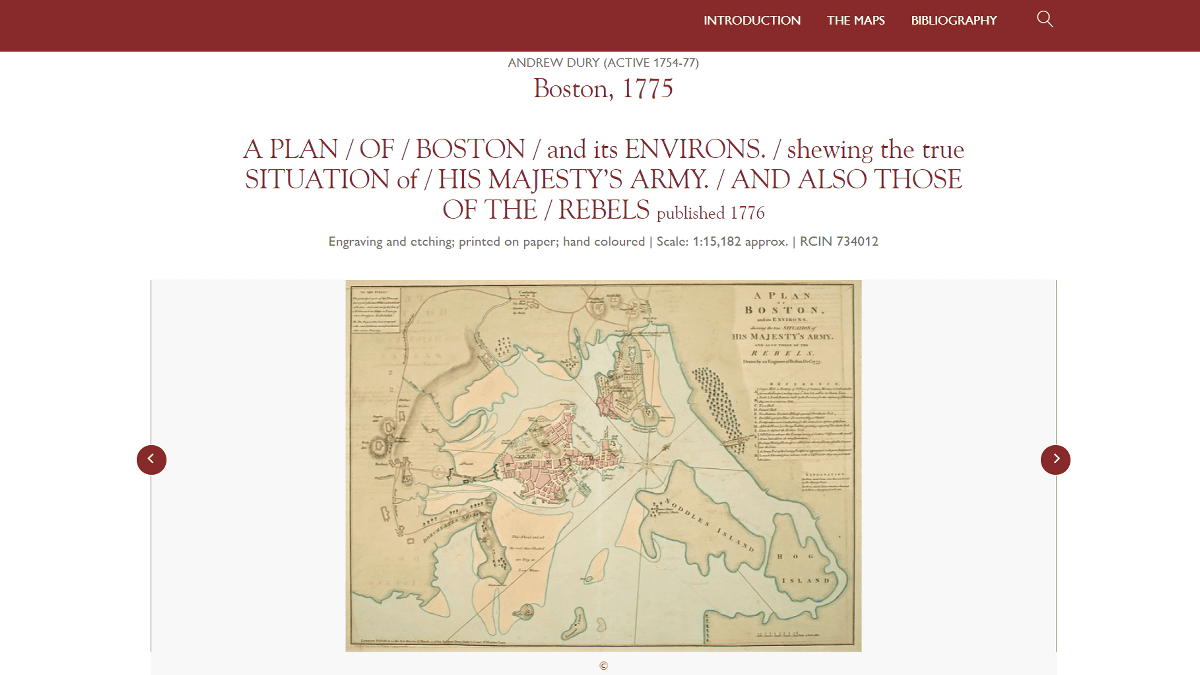
Also, it seems that there is a military map of the battle that occurred in Boston, USA, so if you look at the details ...
British colonial forces led by
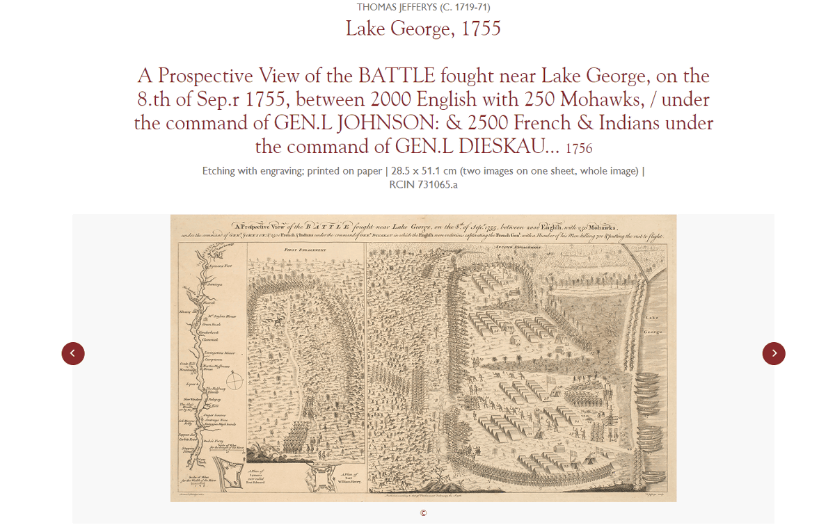
You can find various information such as the aspect of the position behind Lake George, weapons, formation and so on.
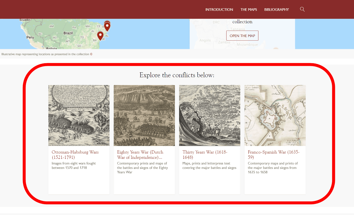
In addition, has been a military map is categorized by prominent war officially the bottom of the page, 'the war over the 1521 - 1791 years of the Ottoman Empire and the Habsburg Monarchy,' '
Related Posts:


in Review, Web Service, Posted by log1h_ik