`` Special administrative agency NERV disaster prevention application '' that distributes earthquake, earth and sand, heavy rain risk and disaster prevention information at the fastest level in the country has been released, so I actually tried using it

Twitter account that
Gehiln launches “Special Agency NERV Disaster Prevention App” on September 1st (Disaster Prevention Day) ~ Cooperation with Japan Meteorological Agency to deliver optimal disaster prevention information to users at the fastest level in Japan ~
https://www.gehirn.co.jp/news/2019-09-01/01-press-nervapp/
Special agency NERV disaster prevention application
https://nerv.app/
At the time of writing the article, only the iOS version of the NERV disaster prevention app is available. To use the app, first install the app from the following.
“Special Agency NERV Disaster Prevention” on the App Store
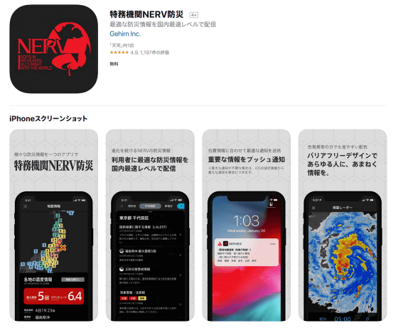
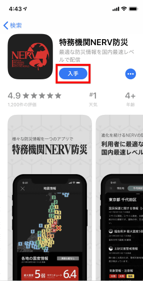
Access the above link and tap “Get”.
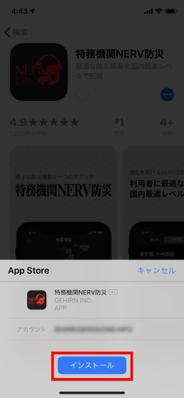
Tap 'Install' ...
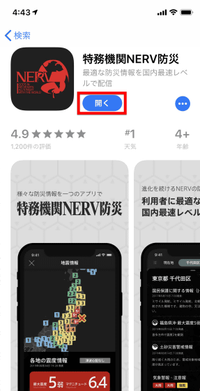
When the installation is complete, open the app.
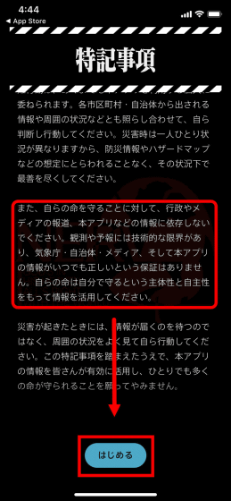
Immediately after the application was launched, “special notes” were displayed.
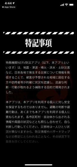
As you read the special notes, there is a rare word written as a disaster prevention app that says, “Do not rely on information from the government, media reports, this application, etc. to protect your own life”. It was. This is
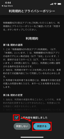
Read the terms of service and privacy policy, check 'I confirmed the above' and tap 'I agree'.
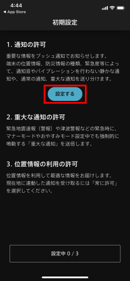
We will make initial settings. First, tap “Set” for “Allow notification”.
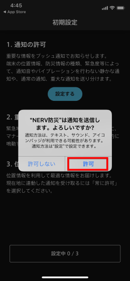
Tap “Allow” when asked “Do you want to send a notification for“ NERV Disaster Prevention ”?”
Each time one setting is completed, the next setting becomes possible. Tap “Set” for the second “Allow critical notifications”.
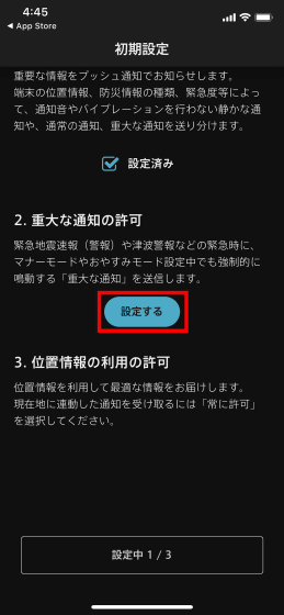
Tap “Allow” because “NERV Disaster Prevention is asking you to send you an important notice”. As a result, during an emergency such as an earthquake early warning (alarm) or tsunami warning, it will be forced to sound even when the manner mode or sleep mode is set.
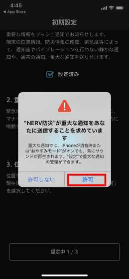
Finally, “Allow location information” is set.
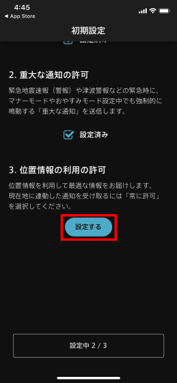
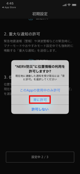
Press “Always allow” to receive notifications linked to your current location.
Finally, press “Start”.
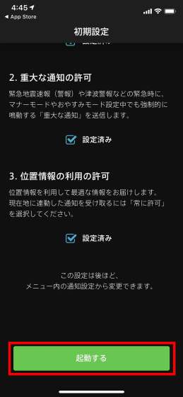
This is the home screen. The weather information is displayed on the home screen, and the switching tabs “Nationwide” and “Current location” are displayed at the top of the screen, and “Home”, “Timeline”, “Radar”, “Weather forecast”, and “Menu” are lined up at the bottom.
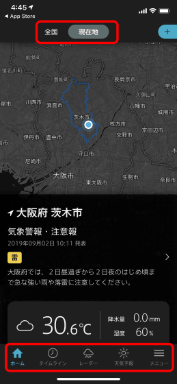
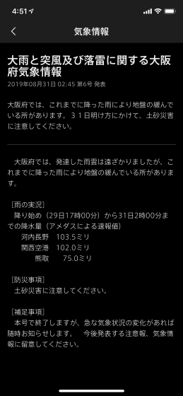
When I tried to display the 'Timeline', weather information was displayed going back to the past three days. When a flood or landslide disaster occurs due to heavy rain, a lot of relevant information comes out in advance, so you can confirm that the situation is imminent by going back the timeline. There was a “lightning warning”, so when I tap it…
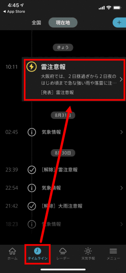
Details are displayed like this.
Going back to the timeline and going back further, there was a call for attention to landslide disasters.
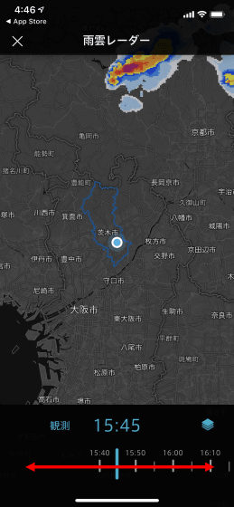
“Radar” looks like this. By default, rain cloud radar is displayed, and by swiping the bottom of the screen, you can see the movement of rain clouds from one hour ago. The movement was very smooth and non-stressed.
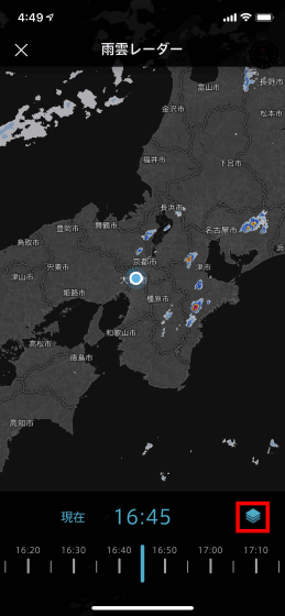
Tap the icon on the bottom right ...
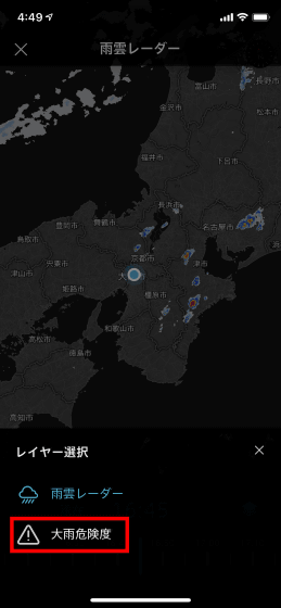
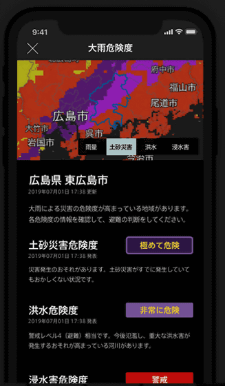
Switching from rain cloud radar to “heavy rain risk” was possible. From the bottom of the screen, you can check the risk of “earth and sand disaster”, “flood” and “flood damage” as well as “rain (analytical rainfall)”. There was no particular indication when using the app, but ...
It seems that the map will be colored with the color shown at the top of the screen when the risk increases. Gehiln has been designated by the Meteorological Agency as a partner of the push notification service related to the “risk distribution of heavy rain and flood warnings”, and in cooperation with the Japan Meteorological Agency has also developed a “heavy rain risk notification function” . Development is centered on designers who are qualified as disaster prevention specialists and developers who are skilled in the visualization of geospatial information.
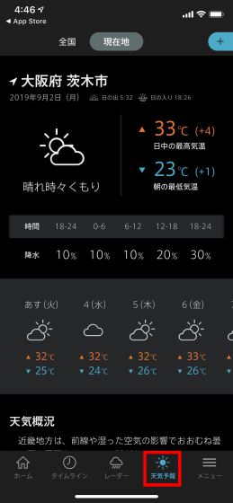
When the weather forecast tab was opened, the daily maximum / minimum temperature, the probability of precipitation by hour, and the weather forecast for the next week were displayed.
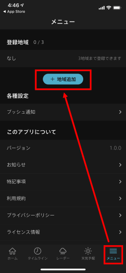
Furthermore, “Region addition” can be performed from “Menu”.
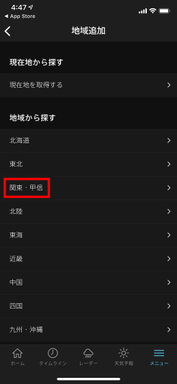
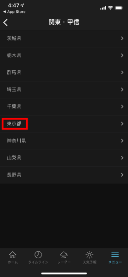
The region will be designated from the seven regions. First press 'Kanto Koshin' ...
Tap “Tokyo”.
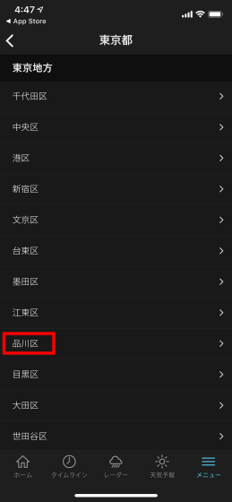
Tap “Shinagawa Ward”.
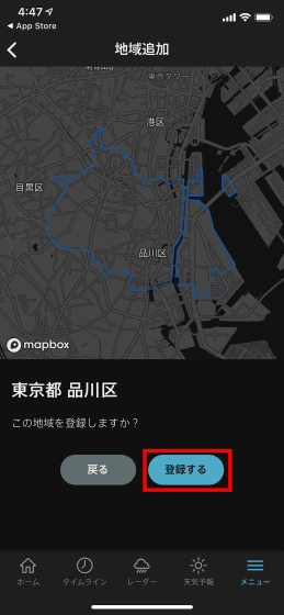
Tap 'Register' at the end to complete. You can specify the area at the municipal level.
Up to 3 cities can be registered.
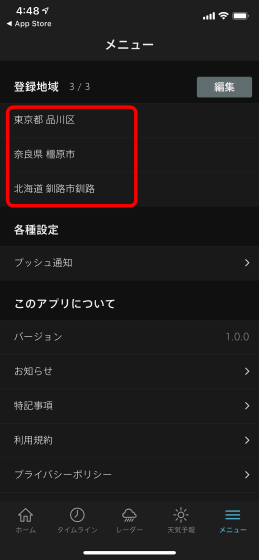
When completed, a tab was created at the top of the home screen. You can quickly switch the area you want to see just by sliding the screen.
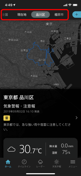
You can check the status of Japan as a whole from the “Nationwide” tab, but the map can also be scaled by pinching in and out.
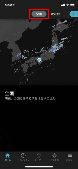
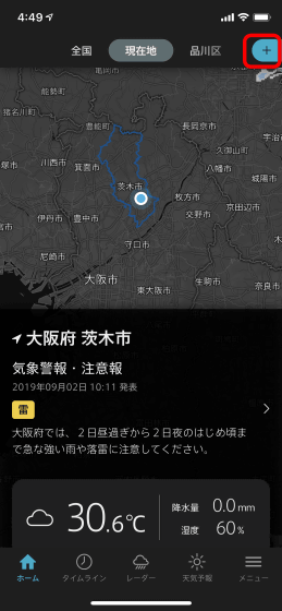
You can also add or change regions from the blue button next to the tab.
When I checked the app, there was no particularly severe weather / earthquake information, but the following screen should be displayed in the event of an earthquake. The app is a barrier-free design, and red and purple colors that often appear in Evangelion's work are warning colors, so we try to avoid using them unless necessary.
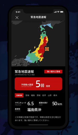
The font uses simple and highly visible
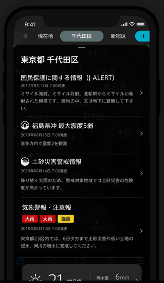
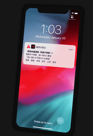
Push notification is like this. According to the location information of the terminal, the type of disaster prevention information, the urgency level, etc., notifications that do not notify or vibrate, normal notifications, and critical notifications are used properly.
At the time of article creation, only the iOS application is released, but the Android version will be released later. In addition, a speech-to-speech function that is generated and distributed only 2 seconds after receiving JMA data will be added in an upcoming update.
Related Posts:

