"Three prefectural border" of Tochigi, Gunma, Saitama was newly developed and it seemed to be a tourist resort
A beak of a crane called "Gunma prefecture in the form of a horse". An elongated place in Gunma prefecture that stretches to stab. Why such a prefectural border was born. Are you going to attack Tokyo? Gunma Corridor. I doubted on the long-standing doubts as a result of examining for this article.
Hello,Takuya SAITO who did a round around the world by bicycle @ Charridermanis. Bye bye to the land so far, Hello hello to the new land. If you are just traveling you will love the border like the border and prefectural border. So, I found this on the netThree prefectural boundaries of Tochigi, Gunma, SaitamaI thought I had to go someday. It is ahead of the Gumma prefecture listed at the beginning.
Three prefectural border
For the three prefectural boundaries, information is also posted on the official site of the municipality that contacts.
About Tochigi city prefectural border
http://www.city.tochigi.lg.jp/hp/menu000016000/hpg000015880.htm
Go walking! "Three prefectural boundaries" - Itakura cho
http://www.town.itakura.gunma.jp/cont/s021000/d021010/20160609113735.html
About Tochigi prefecture Tochigi prefecture · Itakura cho in Gunma prefecture · Saitama prefecture Kaosu city boundary / About Kasumi city
https://www.city.kazo.lg.jp/soshiki/kitakawabenishi_shinkou/sankenkyou/6371.html
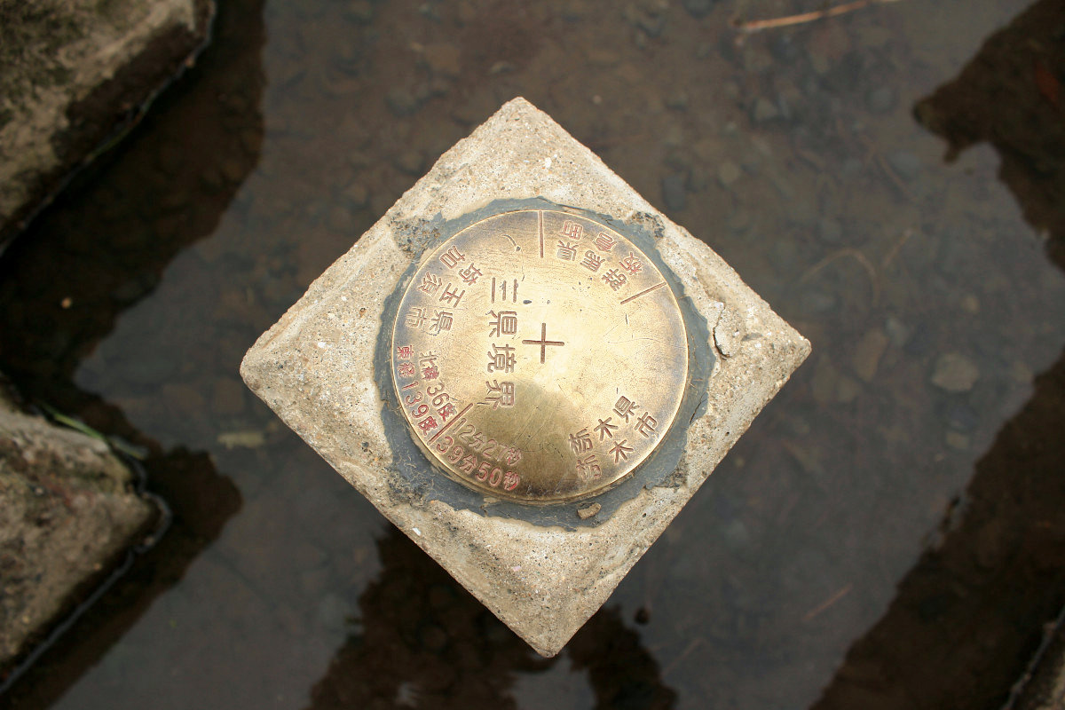
The place here is GPS coordinates "36 degrees 12 minutes 27 seconds north latitude, 139 degrees 39 minutes 50 seconds east longitude".
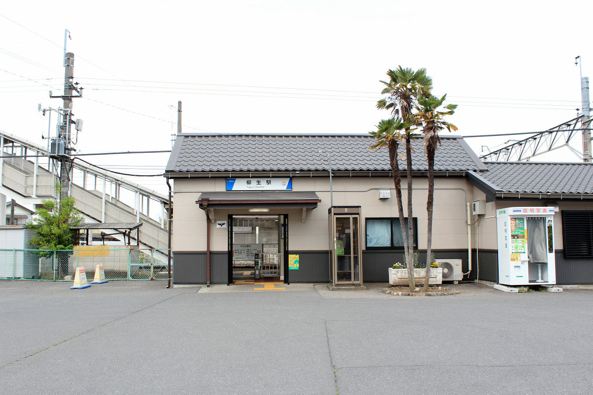
The nearest station is Tobu Nikko Line · Yagyu Station. The station is located in Saitama Prefecture Kazo (Ka) City.
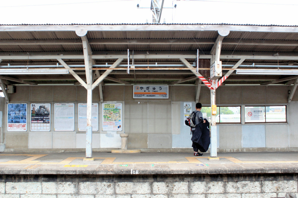
The day and night trainTwo in one hourIt was a relaxed station.
It is a quiet quiet station in front of the station. There is nothing.
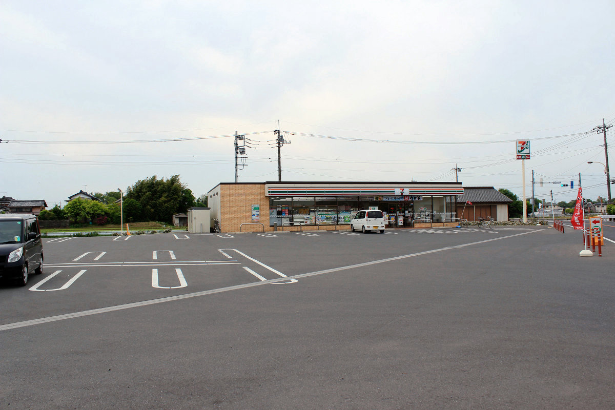
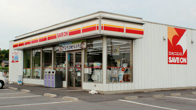
Before that, we stopped by a belly and Seven - Eleven Kitagawa Prefecture Yagyu store. Three prefectural boundaries are opposite to each other across the railroad track, and we will walk a bit. It was a store with a large parking lot because it was along Route 354. I did not drink this morning from the morning, moving without eating, and after the prefectural border there was a schedule so I needed to replenish.
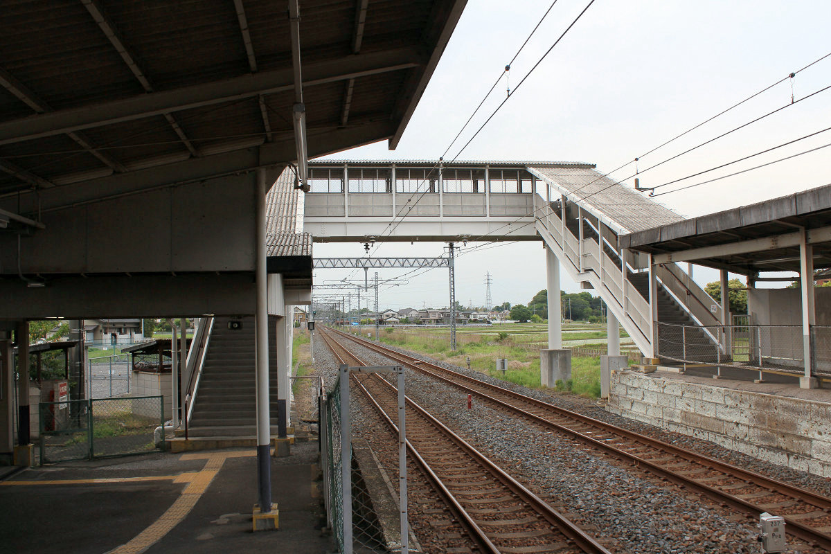
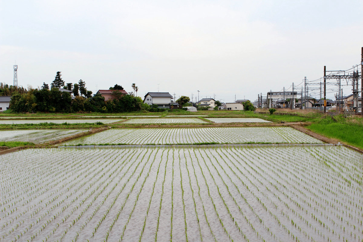
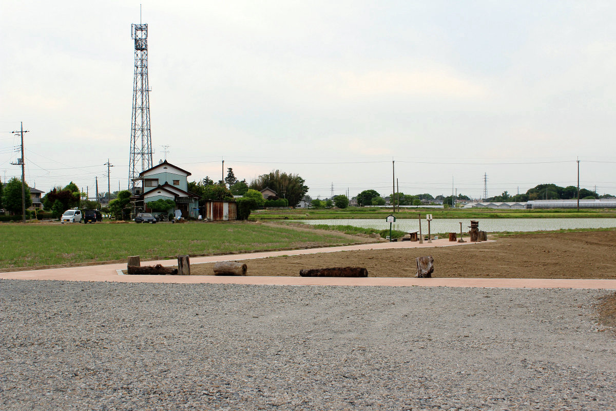
In the area around the station there is a view of the countryside where the rice field spreads.
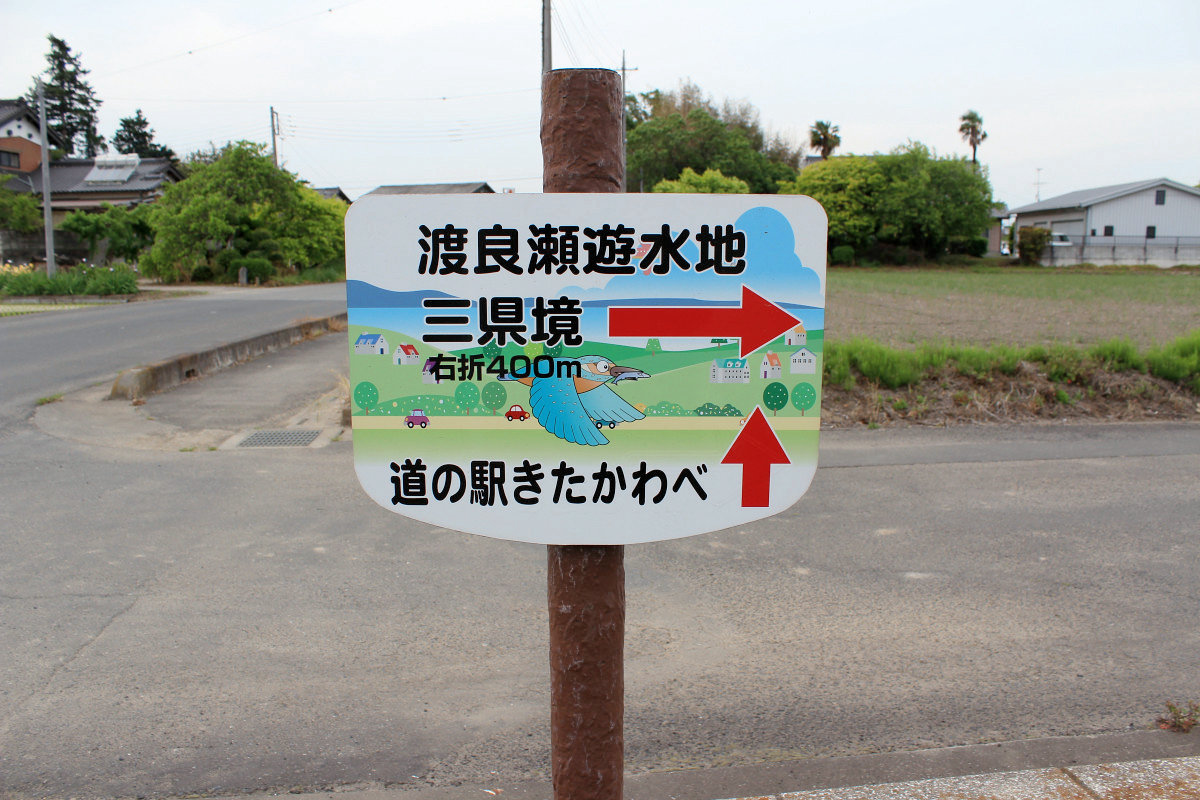
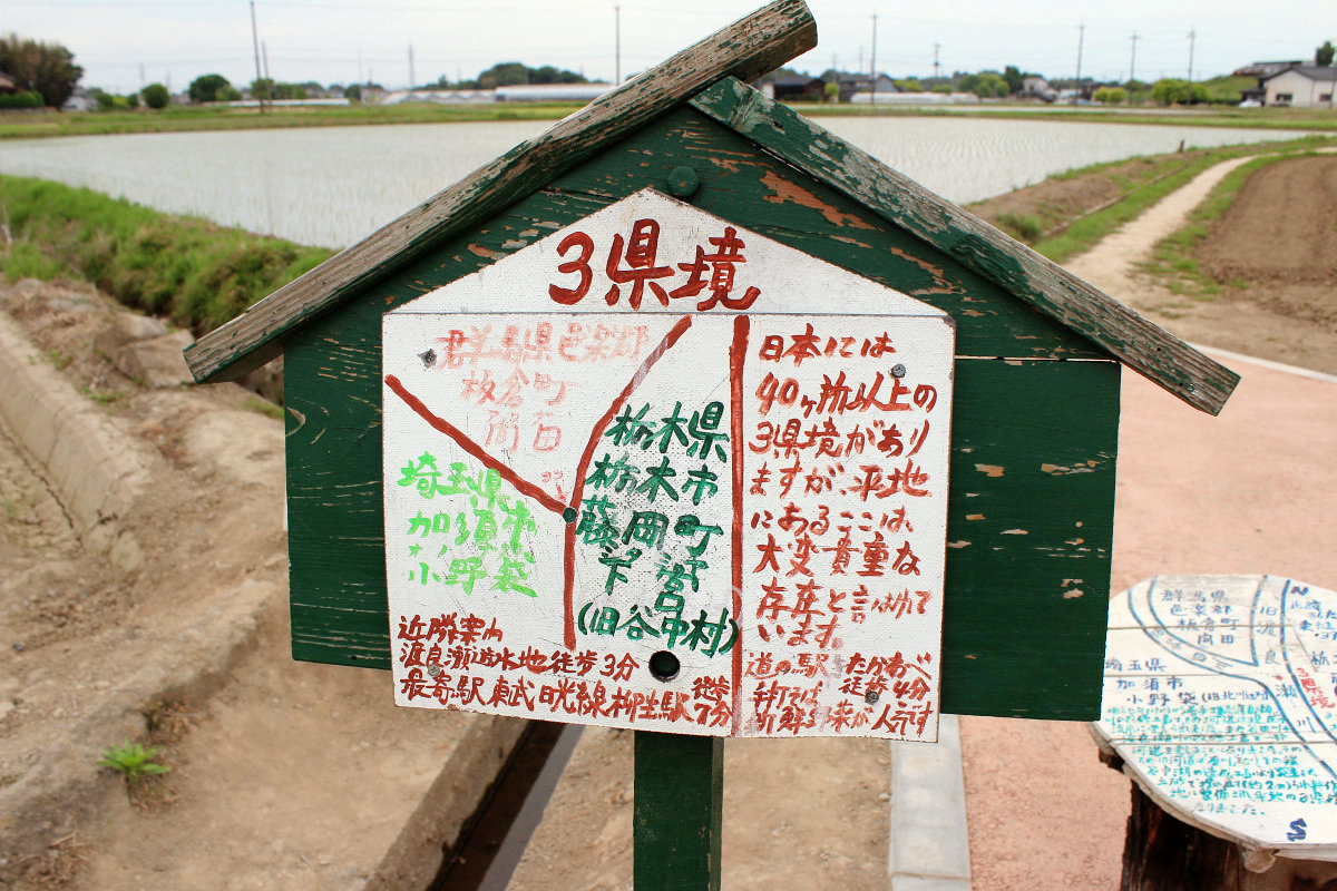
The three prefectural boundaries are the eastern side of Yagyu station. Depending on Google Maps on the smartphone, walking around the hall will bring you an information board.
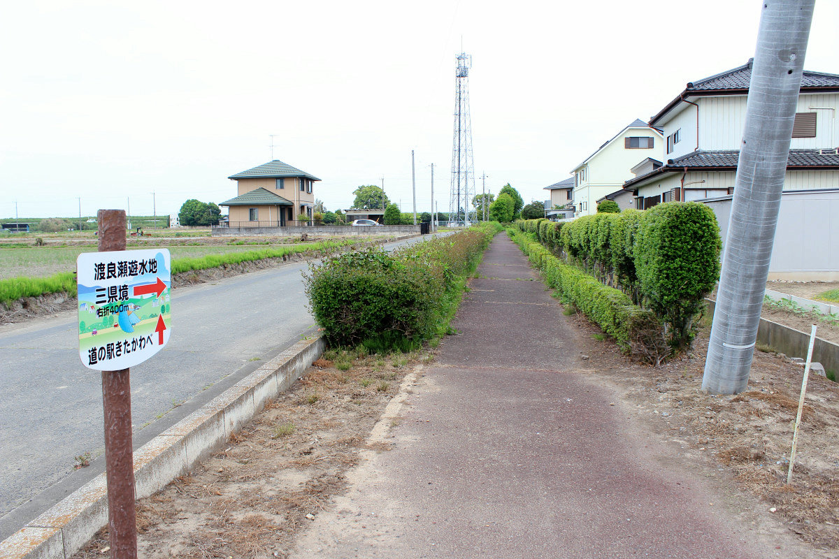
Guide board showing the direction of "three prefectural border" and "road station".
As I followed the arrows, a crowd of people spread in a wider field.
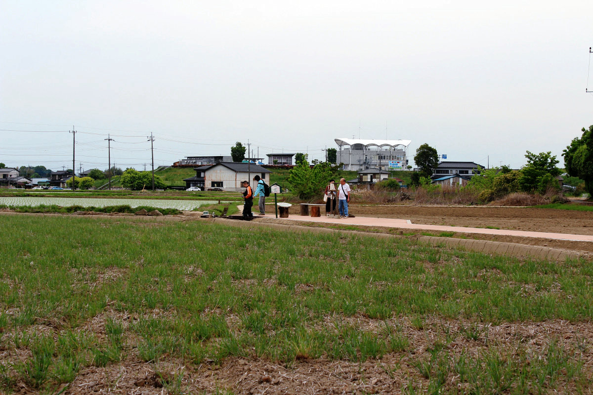
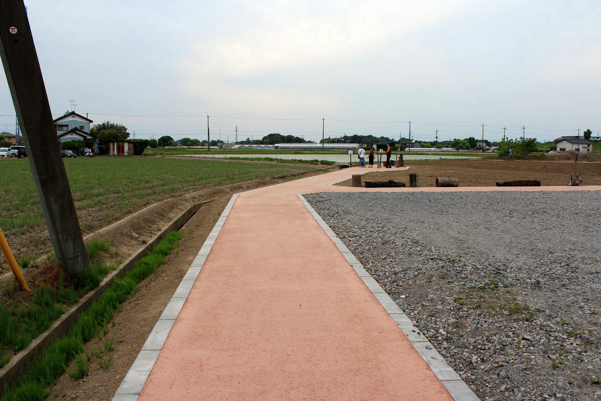
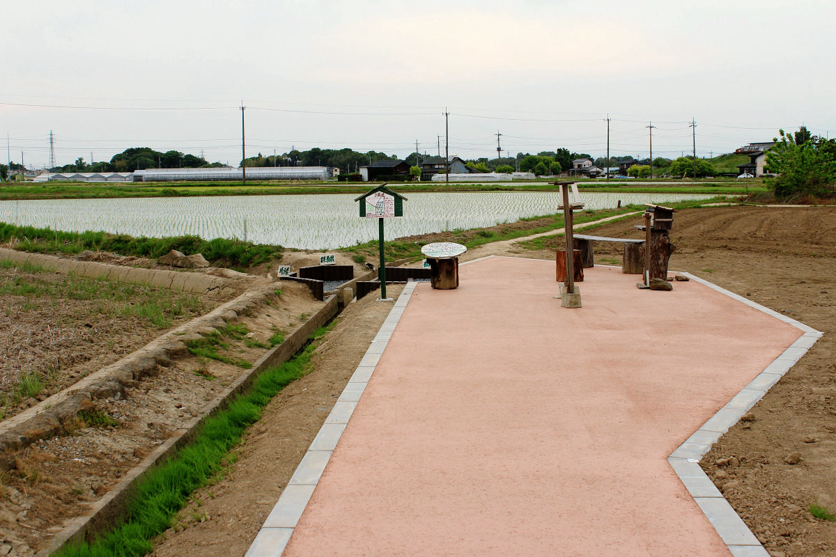
A well-organized boardwalk.
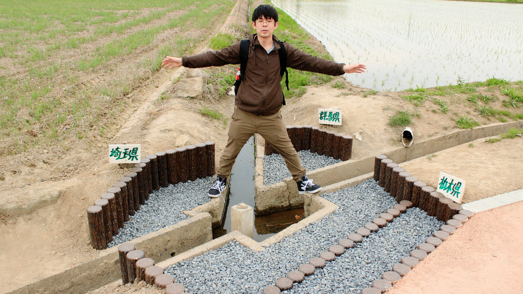
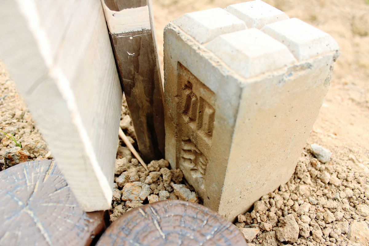
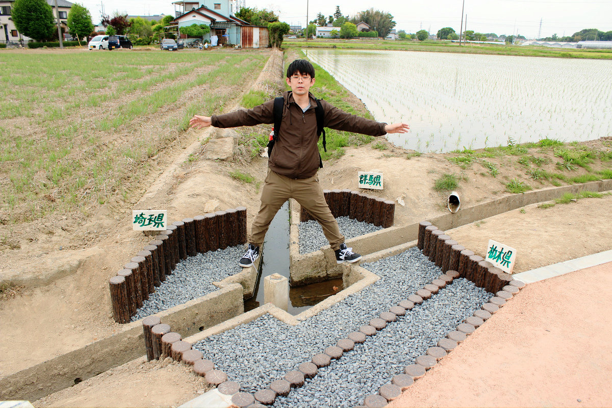
And here are the three prefectural boundaries of Tochigi / Gunma / Saitama which are the destinations of this time.
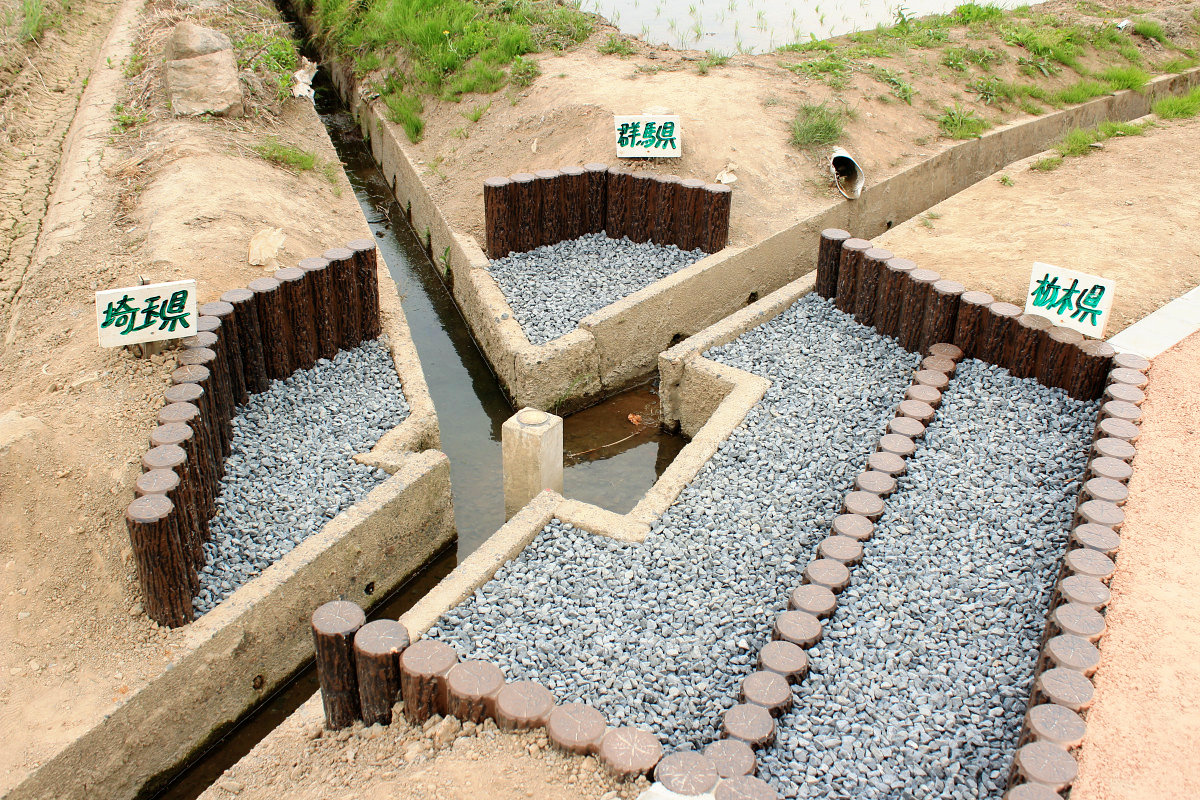
A prefectural border is established in the center of the irrigation canal. It is "three prefectural partitions".
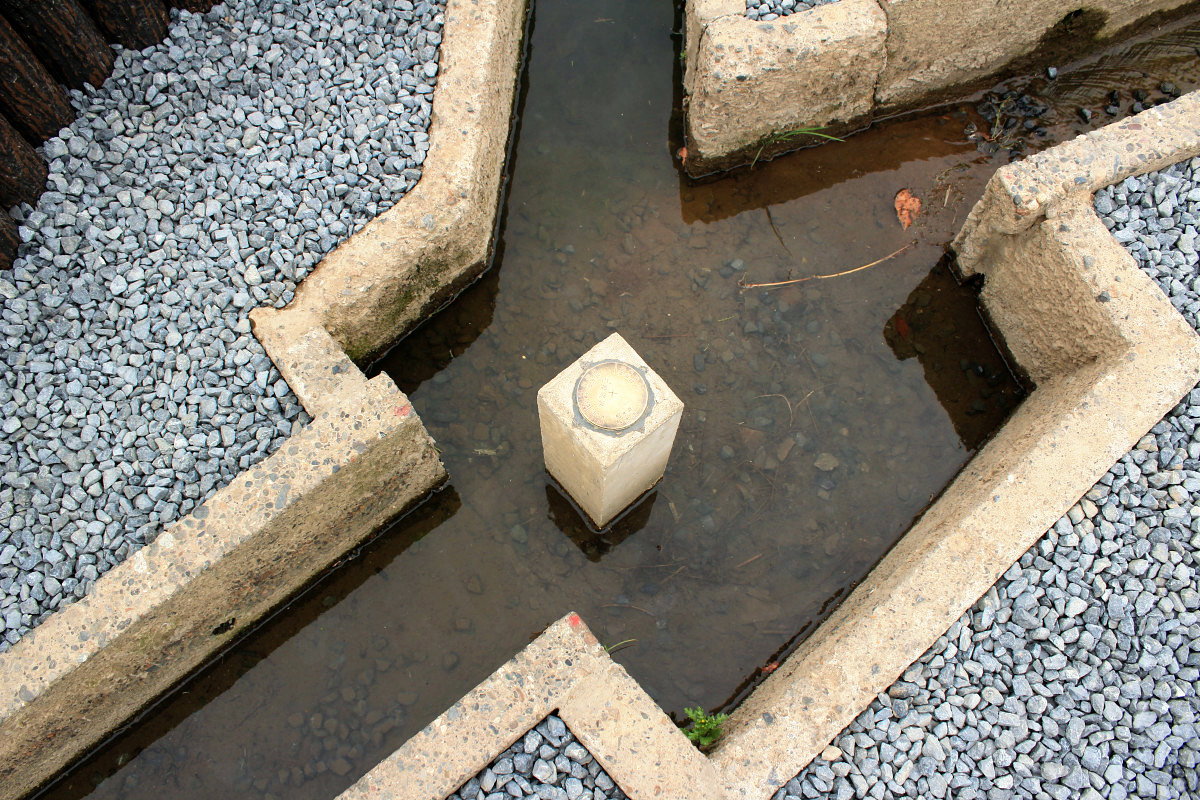
The plate with the municipal name and latitude and longitude of the three prefectures was shining.
There is also a stand card. There seem to be three prefectural boundaries in over 40 places in Japan, but here is easy accessible on flat ground. Others are at the top of the mountain and in the river, so they are not likely to arrive so easily.
Here is the composition of these three prefectural boundaries.
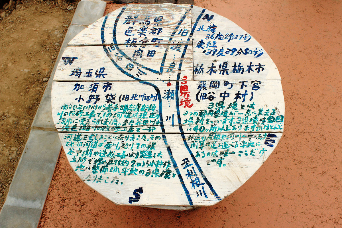
In short description, it seems that the original three prefectural boundaries were on the Watarase River.Watarase RiverIs a first-class river in the Tone River system, and is based on Imperial Mountain (Sukan) which runs through Tochigi prefecture and Gunma prefecture. However, from the end of the Meiji era to the beginning of the Taisho era, artificially changed the flow of the Watarase River in order to make a water fountain. The flow of the Yadagawa river that joins the Watarase River in the same way has changed. The place where it was a prefectural boundary became abolished as it stopped flowing and it was landfilled by the earth and sand which was produced later by the construction of the water fountain (Yanaka lake), so it became a flat land.
· Ahead of Gunma prefecture
The tip of the elongated part of Gumma prefecture is complicated because the old river is the prefectural border. In the same way north sideYaba RiverThe river is becoming a prefectural boundary and it is complicated. Although I can not imagine from now, the Yaba River was the mainstream of the Watarase River. The prefectural border on the south side generally agrees with the current Tone River. Looking at this way, you can see that the narrow part of Gumma Prefecture was a land sandwiched between two large rivers, Tone River and Watarase River.
【56】 Renewing the river Picture of the Watarase shore along the border: Region: Yomiuri Shimbun (YOMIURI ONLINE)
http://www.yomiuri.co.jp/local/gunma/feature/CO004071/20130630-OYT8T00037.html
·fields
Here is a rice field in Gunma prefecture.

Field in Tochigi prefecture.
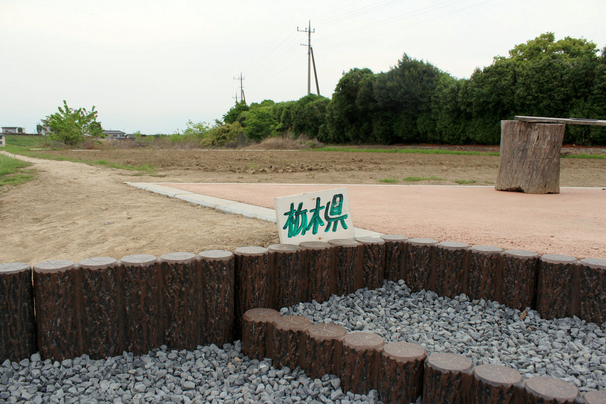
Field in Saitama Prefecture.

I do not know whether it will be shipped to the market, but it is also wonderful that the crops of different prefectures are growing up next to each other like this.
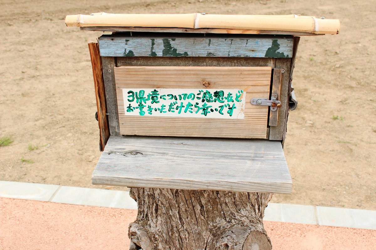
A boundary mark indicating the classification of the land that was on the back of the signboard.
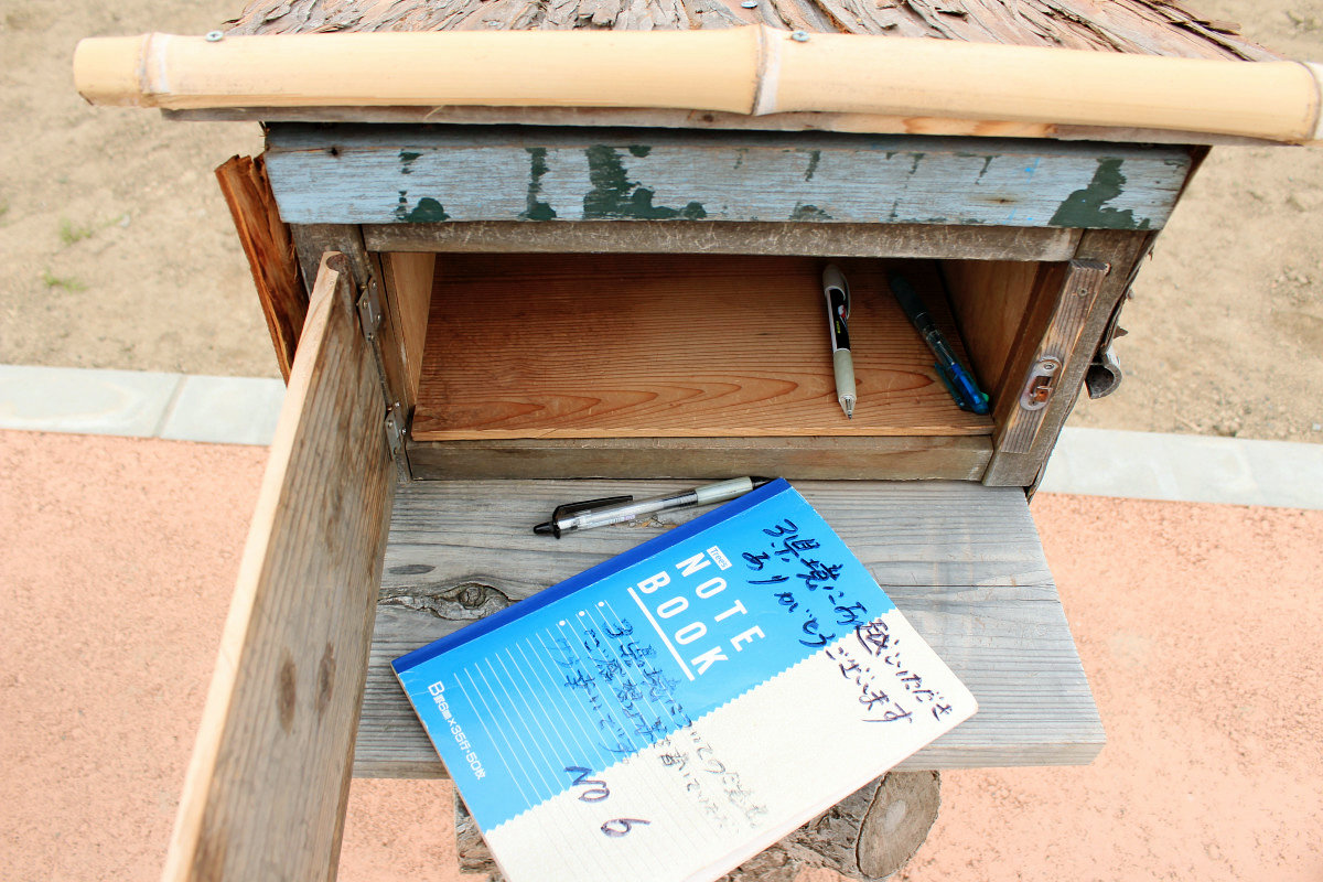
Such a wooden box is also put.
Inside was an impression note. And the sixth book. It is good to have a taste of traveling both writing and peering.
In addition, I found the prefecture name board of three prefectures. "Saitamachi & amp; Kobaton (Saitama)" "Gunma (Gunma)" "Tachibana (Tochigi Prefecture)" with the character here. Hospitality that "Please take a picture with this place".

I also asked other tourists to take a commemorative photo.
If you do not have anyone else, it's okay, the camera stand is prepared properly here.
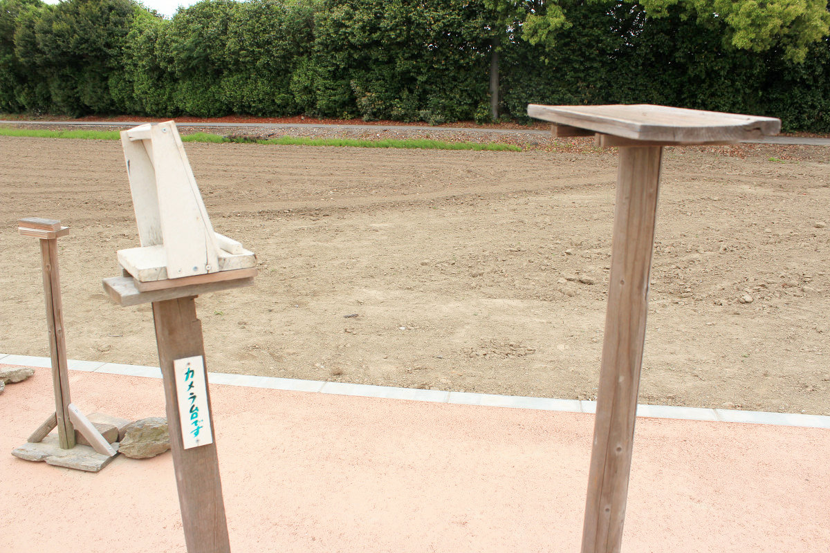
For these three prefectural borders, a proper walking path was developed for the local municipalities to boost as tourism resources. It seems that it was taken up in the newspaper, and tourists came everywhere. Long ago, when I looked it up, the promenade was an irrigation canal that could not be decorated, the color of the soil was a color of the soil, and it was an image that was more than a scourge, but it seemed pretty much a sightseeing place.
Three prefectural boundaries seen from a slightly separated position.
◆ Four prefectural boundaries
It is easy to visit three prefectural borders, so it will be fun to step by step like "rhythm game" with "Gunma, Gunma, Tochigi, Saitama" "Tochigi, Saitama, Gunma, Saitama" "Saitama, Saitama, Saitama, Saitama" . However, I will let the fourth prefecture appear abruptly, "Tochigi, Gunma, Saitama ... Ibaraki!" So as to break such a refreshing mood.
Actually, there are Ibaraki prefecture just beside these three prefectural boundaries. I tried walking to Ibaraki prefecture, wanting to "cross the three prefectural boundaries" to "four story boundaries crossing". So, I dropped in at a convenience store.
Letting three prefectural boundaries ......
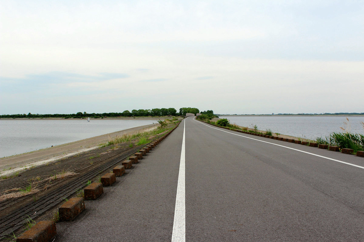
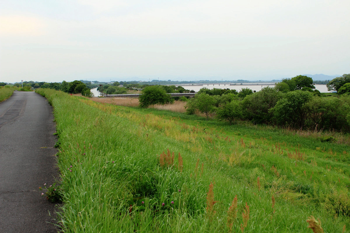
When crossing the super embankment which could be seen from three prefectural boundaries, there is a huge pool basin called Watarase Settlement. Here is the history of repeated flood damage, and measures taken to counter the Ashio copper mine pollution incident.
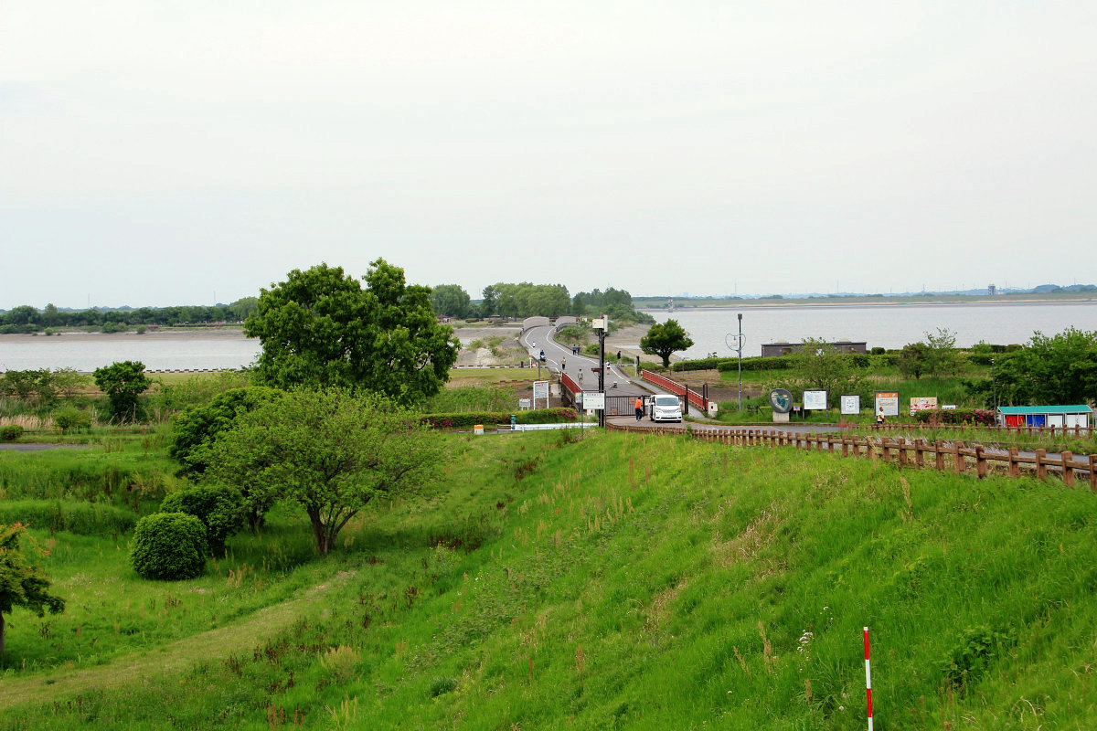
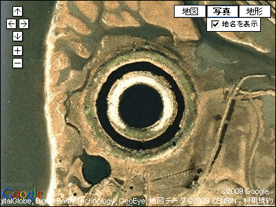
Yanaka lake which shaped quite unusual heart.
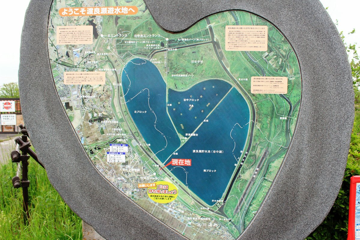
I was planning to cross Yanaka lake across the bridge, but before 17 o'clock the gate announced "It will be closed soon" will be the time over. I am sorry but I went back to Ibaraki prefecture in a circle around the idyllic area.
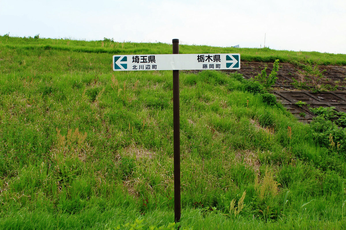
Suddenly, the prefecture border between Saitama and Tochigi prefectures.
It was surprising that there are so many nature in Watarase Seto, Kanto Plain.
A bridge over the Watarase River.
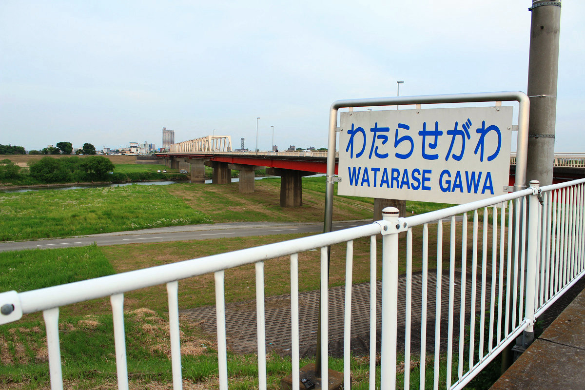
There was a prefecture boundary between Saitama and Ibaraki prefectures on the bridge. This is four boundary crossing over.

I will enter Furukawa (city) city. The same sound as Koga city in Fukuoka prefecture.

I finished walking to JR Furukawa station.

Although I did not do this time, in the south of Furukawa-shi, Ibaraki Prefecture, there is a prefectural boundary with Noda-shi, Chiba prefecture. When the dog is compared with the motif mascot "Chiba-kun" in Chiba prefecture, the part of the nose which is dark, black. As far as you see the map, you will not not be able to walk because you are not far away. That way, it seems that you can overcome the five prefectural boundaries with Tochigi, Gunma, Saitama, Ibaraki and Chiba in one day. If it says "So what?" It is until then, but I like the people I like.
Even three prefectural borders, four prefectural boundaries and five prefectural boundaries as much as you like. People who like to travel Geographical lovers have had an unbearable place in Gunma prefecture ahead of time.
◆ Notice from Chariderman
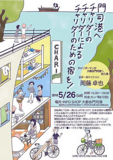
On Saturday, May 26, 2018, it is located in Kita Kyushu City Moon WardINFO SHOP big city Moji portA talk live will be held on Charriderman, entitled "Mojiko Port Charida's Charlider's Accommodation for a Child!" Rates are by campaign and 1 drink, it is from 16 o'clock to 18 o'clock. If you have time, please visit.
https://www.facebook.com/events/2529786227247079/
(Sentences / Photos: Takuya S. Narou Charriderman
Cycling around the world for a bicyclehttp://shuutak.com
Twitter@ shuutak
Facebook Pagehttps://www.facebook.com/chariderman/
DMM lecture requesthttps://kouenirai.dmm.com/speaker/takuya-shuto/)
Related Posts:

in Coverage, Posted by logc_nt