Added the shortest route search function of door to door to newly show parking lot congestion on Google Maps, can be used like this
In Google Maps for Android, the function to display the congestion status of the parking lot in the city is targeted to major cities in the United StatesProvisioned from January 2017However, in the update on August 29, the area was expanded to cities other than the United States and it became possible to use the function of displaying the route from door to door from the parking lot to the actual destination It is.
Put it in park with new features in Google Maps
https://www.blog.google/products/maps/put-it-park-new-features-google-maps/
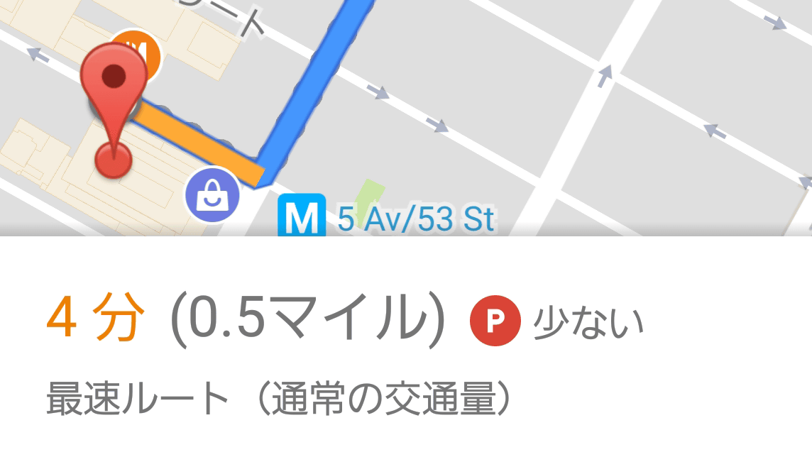
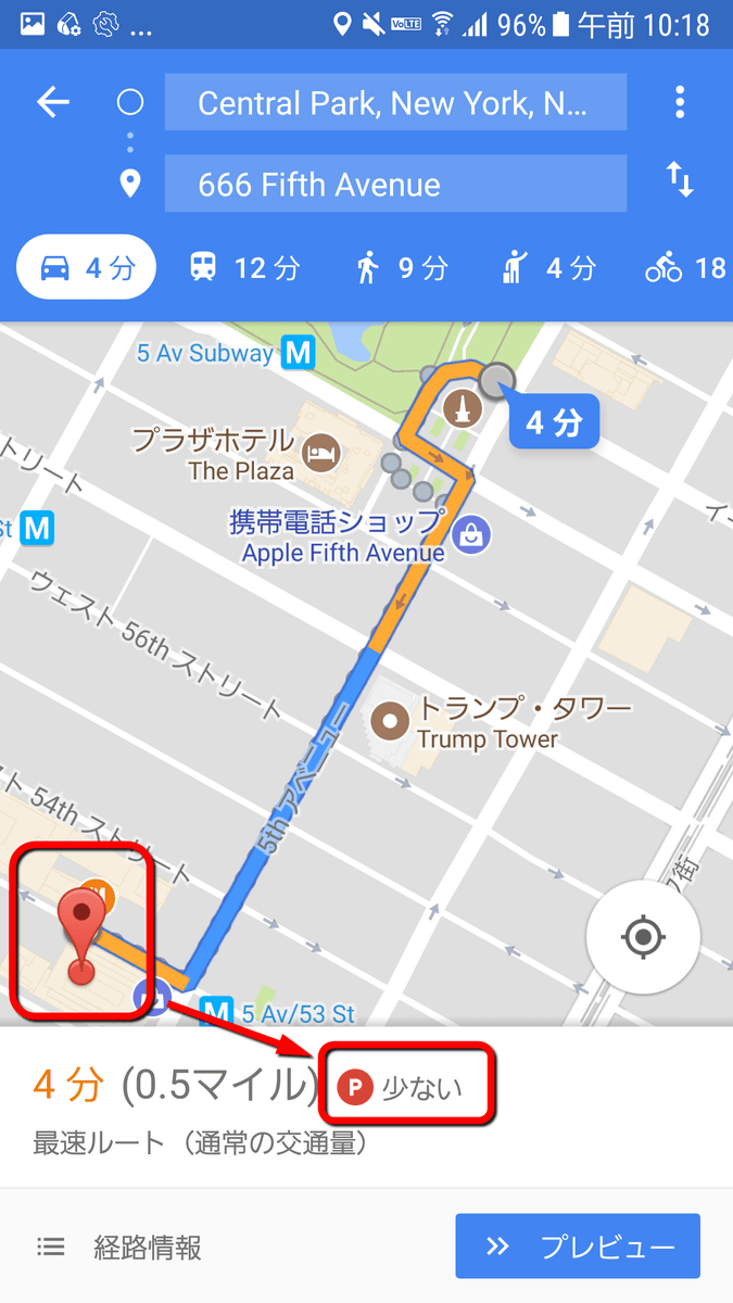
On January 29, 2017, Google released the function to display an icon called "parking difficulty icon" on the map with the Google Maps application for Android. When you tap the parking lot displayed in the application and set it as the destination, the word "small" or "ordinary" indicating congestion status is displayed on the icon of "P" as shown below .
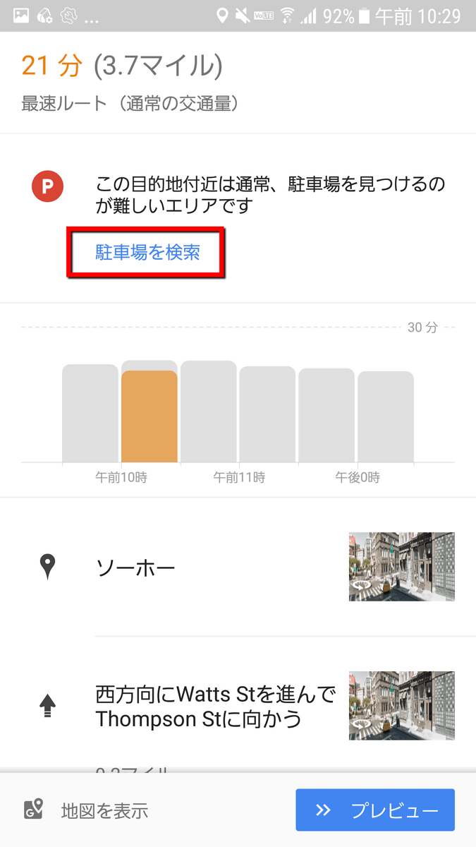
Changing to the detailed display shows the contents such as "Area near this destination is usually difficult to find parking lot".
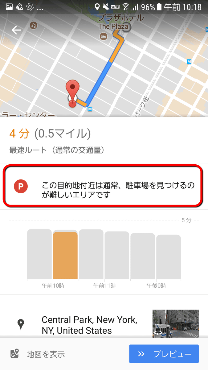
This display does not indicate the real congestion situation in real time, it is to predict the time zone and situation where the parking lot is likely to be crowded with high precision by utilizing Google machine learning. It is a mechanism to judge the difficulty of finding a parking lot based on big data such as actual parking lot usage data and position information data provided anonymously.
Research Blog: Using Machine Learning to predict parking difficulty
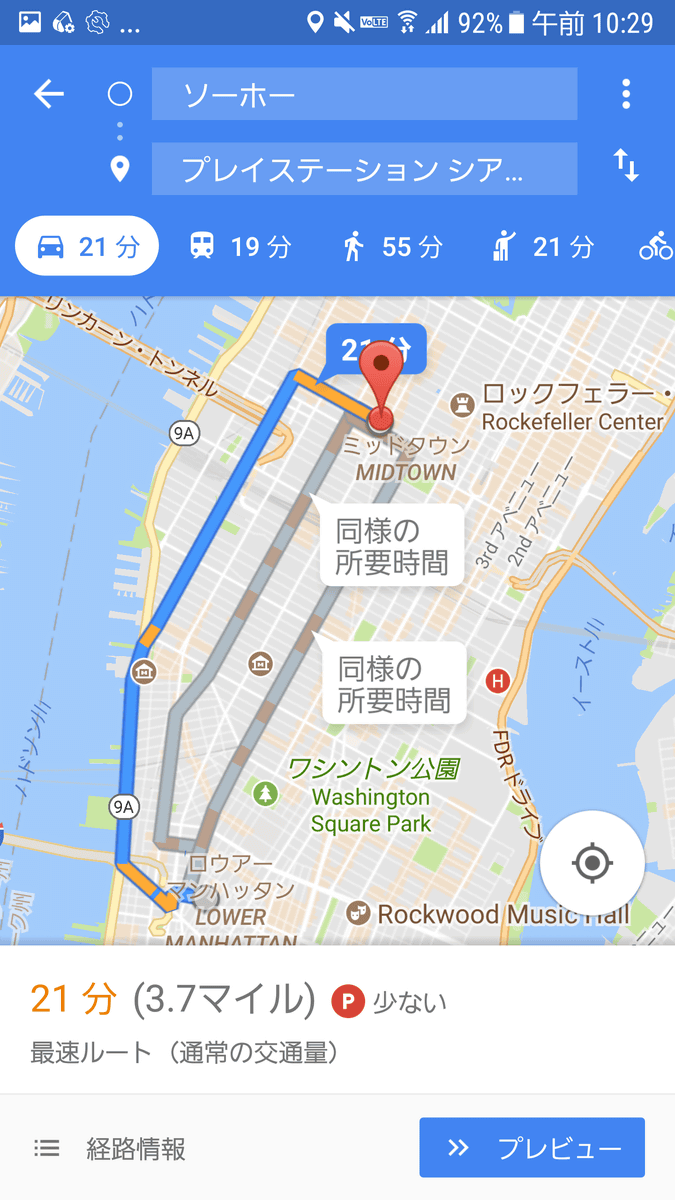
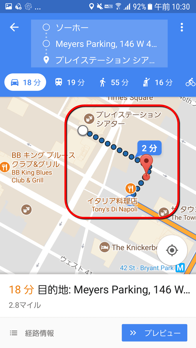
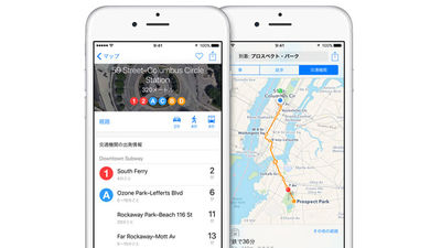
Also, after searching for the actual destination rather than the parking lot, you can select the nearest parking lot together with the congestion situation and display the walking route from the parking lot to the destination. For example, it is close to Times Square from the Soho area in New YorkPlaystation TheaterSearch the way to ... ....
Switch to the detailed display and tap "Search parking lot".
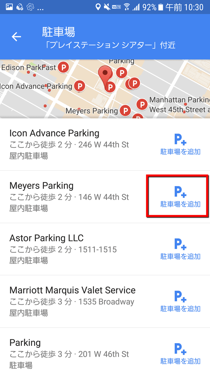
The list of parking lots in the vicinity is displayed. Select one of them and tap "Add parking lot" to set the parking lot as a way point.
Routes including waypoints were displayed. If you set up near the destination ... ...
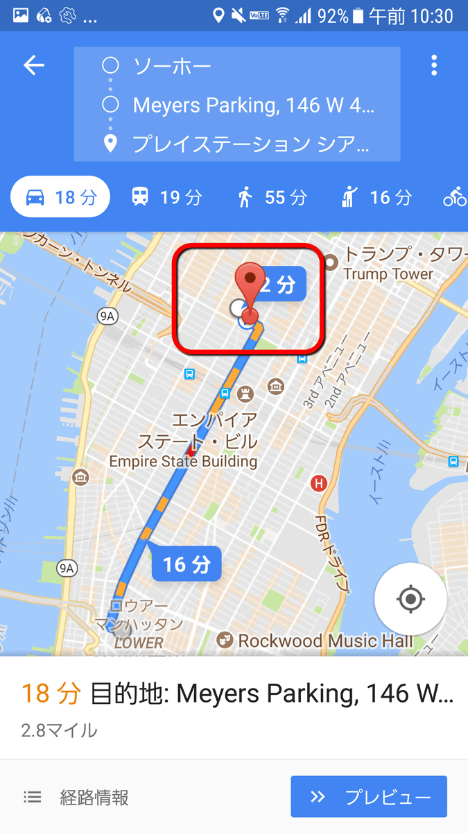
In this way, the way from the parking lot to the final destination was displayed.
At the time of article creation, this function can be used in 25 cities in the United States, plus 24 cities in 12 countries. Unfortunately, Japanese cities are not included, but I would like to expect further additions.
【USA domestic】
San Francisco, Seattle, Miami, Atlanta, Boston, Charlotte, Chicago, Detroit, Los Angeles, Minneapolis / St. Paul, New York City, Orlando, Philadelphia, Pittsburgh, San Diego, St. Louis, Tampa, Washington DC, Cleveland, Dallas / Fort Worth, Denver, Houston, Phoenix, Portland, Sacramento
【Other than USA】
Canada: Montreal, Toronto, Vancouver
Germany: Cologne, Düsseldorf, Stuttgart, Munich
United Kingdom: London, Manchester
Italy: Milan, Rome
France: Paris
Russia: Moscow
Spain: Alicante, Barcelona, Madrid, Valencia, Malaga
Netherlands: Amsterdam
Denmark: Copenhagen
Sweden: Stockholm
Czech Republic: Prague
Brazil: Rio de Janeiro, Sao Paulo
Related Posts:

in Software, Smartphone, Posted by darkhorse_log