Mermaids, giants, and Poseidon are drawn on the map of 1562
There are many things that you do not understand even in the days when you can see things in every corner of the whole world while staying at the desk by using Google map and Bing map like present. Especially if it is in the midst of a great voyage, the Americas called "New World" and "New World" are often unknown from people in Europe, and maps at that time included mermaids and giants, Poseidon etc. are drawn.
In 1562 Map-Makers Thought America Was Full of Mermaids, Giants, and Dragons | Atlas Obscura
http://www.atlasobscura.com/articles/in-1562-mapmakers-thought-america-was-full-of-mermaids-giants-and-dragons
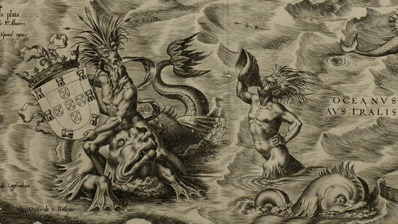
The map shows this, the Spanish cartographerDiego GutierrezAlso known as a painter and publisherHieronymus cockThis work is named "Americae Sive Quartae Orbis Partis Nova Et Exactissima Descriptio".
File: Gutiérrez, the Americas, 1562.jpg - Wikimedia Commons
https://commons.wikimedia.org/wiki/File:Guti%C3%A9rrez,_the_Americas,_1562.jpg

This map is the oldest one as a wall hanging map depicting the new world. In 1492 when Christophar · Columbus' arrival of the Bahamas arrived in Brazil by Vicente · Yañes · Pinson in January 1500, it was 1522 that the fleet of Ferdinand · Magellan played the world around the world, so there are already many known places Because of it being, the coastline is accurately drawn.
On the other hand, it is distinctive that it is portrayed as "publicity content" or "folklore tradition".
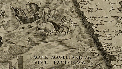
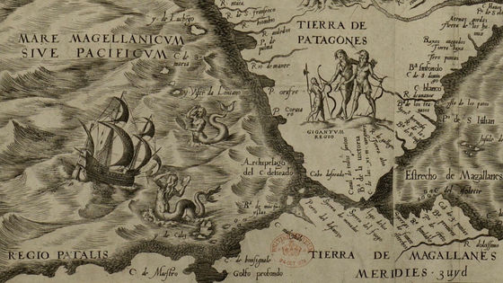
For example, a mermaid is drawn on the southernmost tip of South American continent, west of Cape Horn, and a giant is drawn on the land.
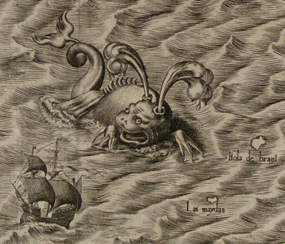
A huge monster that is going to attack the ship. Apparently, the appearance that a whale is blowing the tide has become a motif.
A creature that can be seen like a dragon.HippocamposIt is said that Hippocampos lives between Norway and the United Kingdom.

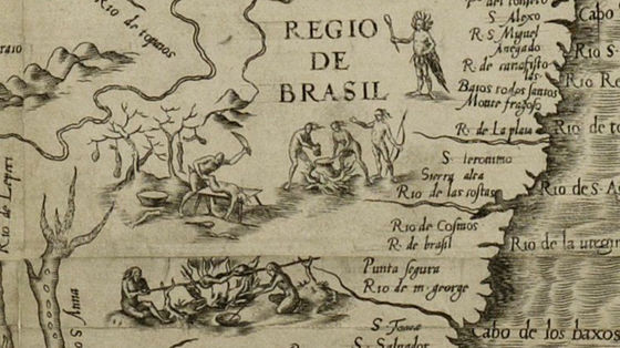
In the vicinity of Brazil is the figure of a person who kills people and seems to be grilled and eating. Around this time, explorers from Europe should already have encountered the local civilization, but it seems that it is drawn with the image that "barbaric and dangerous people live".
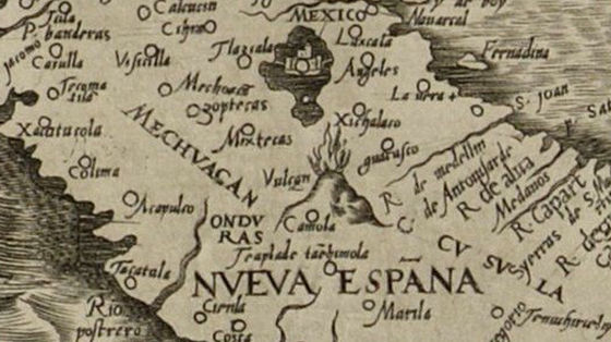
A huge volcano drawn in Mexico
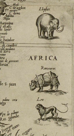
Africa is also drawn on the right end of the map, and elephants, rhinoceroses and lions are in the shape. However, if it is originally drawn it will be an indian society that should not be in Africa.
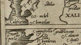
And "California" which is drawn with fairly small letters at the left end of the map. It seems that this map was the first time the name was used.
By the way, it is Poseidon who has the trigraminal spear drawn on the central upper part of the Atlantic Ocean. Behind that behind the car is King King of SpainFelipe II. Spain is the king at the height when it was called "the country where the sun does not set".
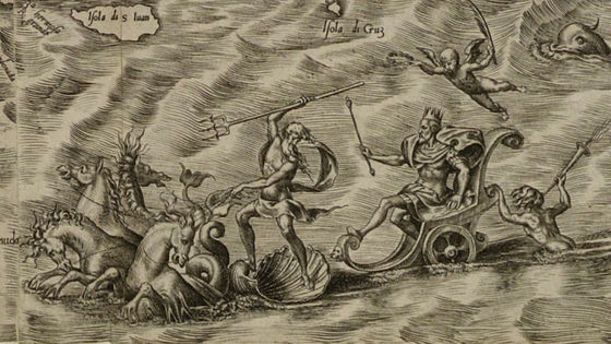
In the lower part of the Atlantic Ocean there is a man holding a shield with a huge creature. It is a shield of Portugal that went into the open sea to compete against Spain.
Aquiles Alencar Brayner of the British Library said that the literacy rate in Europe was not high, maps are a few navigation tools, and also a popular medium to convey things about distant lands.
Related Posts:
in Note, Posted by logc_nt