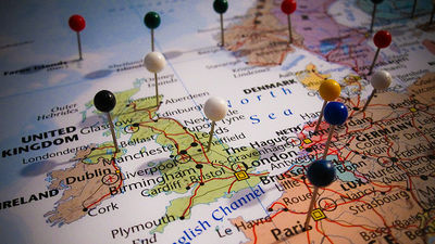
Tragedy caused by pins displayed in wrong position with location information based on IP address
ByKit
Since the IP address is allocated to some extent based on geographical information, it is possible to determine the location information "from where to access". However, this precision varies, sometimes pins are displayed at an absolutely misplaced position. If the pin points only to places where there is nothing, there is little effect, but a tragedy is occurring by unfortunately pointing to a specific place.
Internet mapping turned a remote farm into a digital hell | Fusion
http://fusion.net/story/287592/internet-mapping-glitch-kansas-farm/
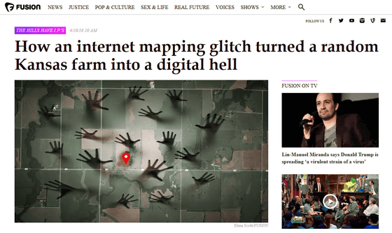
The problem is occurring in 360 acres of farms owned by Joyce · Taylor · N · vogelman. The location is a small town called Potwin, 1 hour drive from Wichita, the largest city in Kansas.
On the farm there are two storied houses and farms, pasture grounds, old orchards, two barns and several pigstuffs, Taylor has been lending us here for a long time, but for the borrower Somehow, it seems that various people, such as FBI agents, federal court enforcement officers, collectors of the Revenue Department, ambulances looking for suicide desires, police officers looking for missing children, and so on.
This mystery phenomenon continues for ten years, but Fusion's Kashmir Hill and security researcher Dave Maynor explored the cause, not because the borrower was really a cheat or a cheat, but the IP addressGeolocation(Position information).
From the IP address, in some cases it is possible to specify up to the house unit, but sometimes it is not possible to obtain accurate information, and information can only be determined to the country level. MixMind, a digital mapping company based in Massachusetts state, displays defaults when the address can not be accurately grasped by IP address in units of state, city, county, etc. to fill up even a bit of error.
In the case of the United States, the "middle of the country" of the country is "North latitude 39 degrees 50 minutes west longitude 98 degrees 35 minutes" near the border with the state of Nebraska in the northern Kansas State, and in the case of the digital map "39.8333333, -98.585522" It is written. However, in 2002, MixMind decided to "round" this number and set the default position when it was only known that the IP address is "somewhere in the United States" as "North latitude 38 degrees, 97 degrees west longitude (38.0000, -97.0000) "We changed it.
With this change, more than 5,000 companies using MixMind's IP mapping information, the place that is about two hours away from the original position is now displayed as "the center of America". And it seems that this new "center of America" happens to be the entrance of Taylor 's farm by chance.
Prior to Kshmir Hill,A case where the results of the "find" function at the time of losing a smartphone gather at a specific houseHe also told Mr. Taylor that he thought that "There are other houses that are suffering from similar cases," he also took up at Fusion.

According to Mr. Hill, there are other similar cases, Tony living in Ashburn, Virginia, because it has a data center nearby, it has been treated as a "location" of 17 million IP addresses , It seems that the police have come from four years ago.
Incidentally, MixMind takes this problem seriously, and a company named Mapzen has created a "place name dictionary" and is promoting MixMind's database improvement.
Missing the Point - GeoIP's, Points, Polygons, and a Precarious Farm in Kansas · Mapzen
https://mapzen.com/blog/missing-the-point/
Related Posts:


in Web Service, Posted by logc_nt