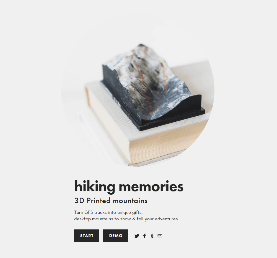
"Nicetrails" which can make memories by three-dimensionally shaping the GPS log of mountain climbing and cycling with terrain
I think that there are many people who logs activities such as mountain climbing, cycling, and driving using smartphones, GPS terminals, etc. In most cases, after returning home, they display on the map on the screen of the smartphone or the PC and look back on the memories There should be many cases only. Born in Spain "Nicetrails"It is a service that can record the 3D map of the record based on the GPS log data and display it on the browser and also can order real models outputted by the 3D printer.
Nicetrails | Turn GPS tracks into tiny mountains, 3D Printed
http://www.nicetrails.com/
Nicetrails was created from log data such as GPS applications.gpx dataYou can browse the 3D map by simply uploading it to the site and can also order the real thing. If you only have to display the 3D map, you can enjoy it for free, so if you have a GPS log on hand, try it for the time being.
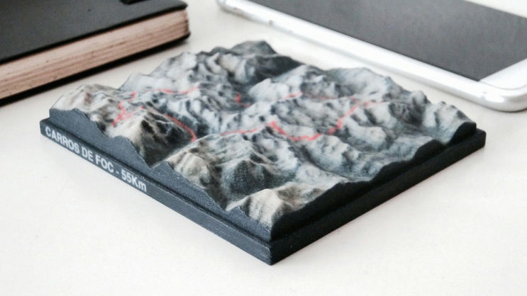
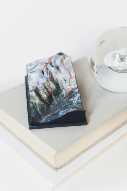
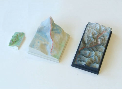
The actual 3D model looks something like this. You can see it as if you pick up your own trajectory.
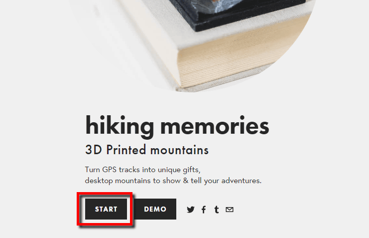
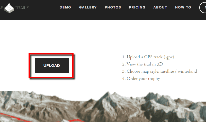
To create a 3D map, visit the site and click "Start".
Click "UPLOAD" and select the .gpx data. Please note that .gpx data can be created with GPS logging application or GPS terminal, so it is good to create it with a smartphone application etc. during mountain climbing or cycling.
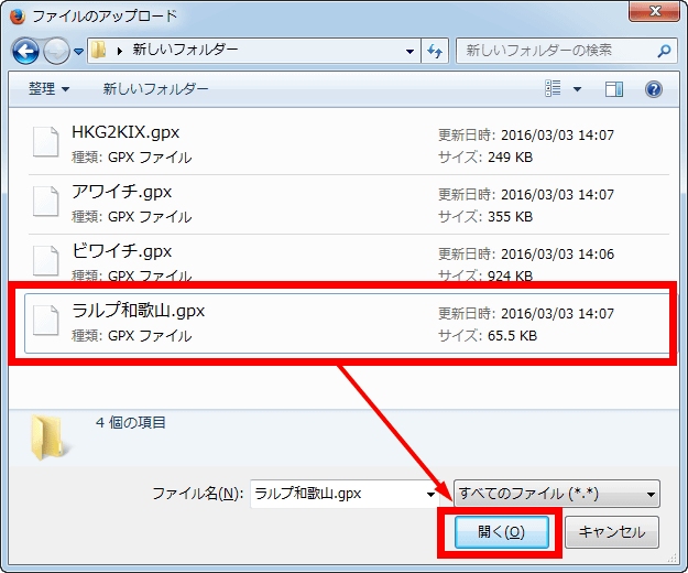
Select the. Gpx file in the opened window and click "Open" to upload the GPX data to the nicetrails server.
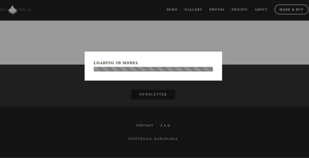
Upon completion of downloading a few seconds and 3D map data ......
A 3Dized map was displayed in the center of the screen. The section of the terrain is drawn in black, and it rotates slowly counterclockwise slowly to make it clear that it is 3D data.
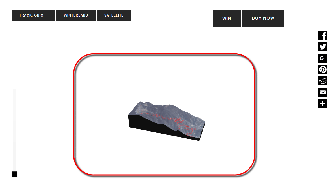
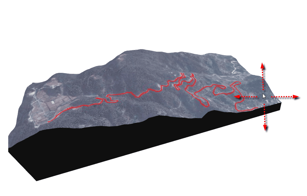
You can enlarge or reduce the 3D map by dragging up and down while right-clicking the mouse. The map surface seems to be using Google map data.
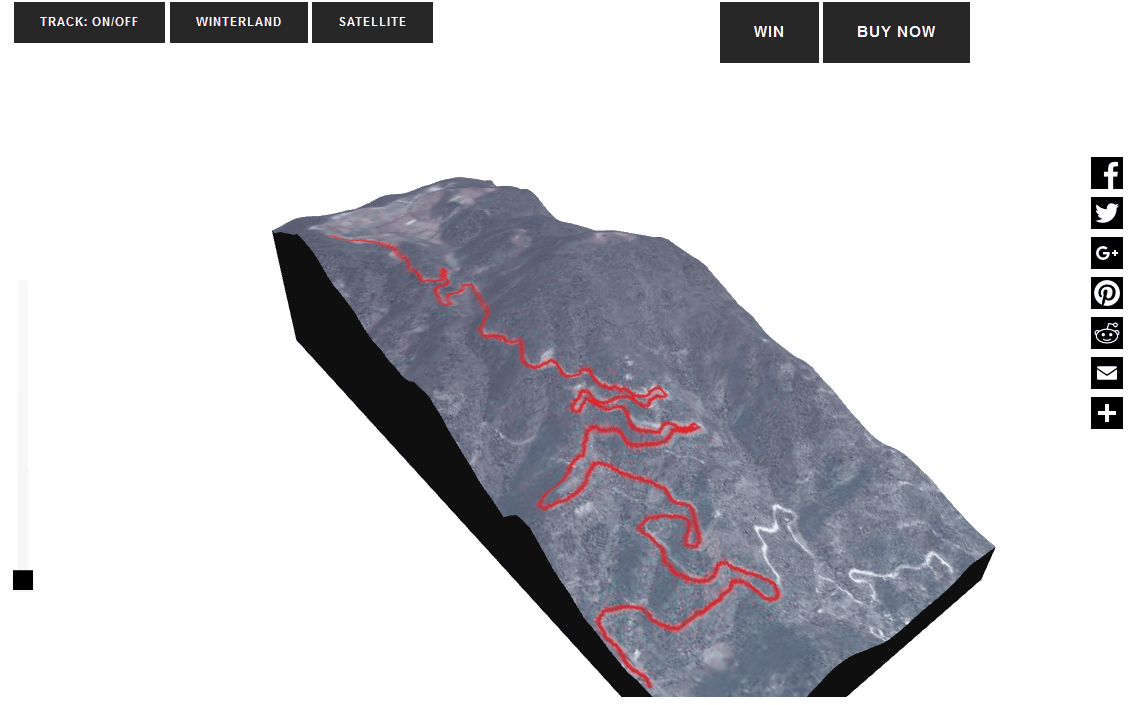
By right-clicking and dragging on the screen, you can move the 3D map freely 360 degrees. Although some familiarity is necessary for operation, it is also possible to look up with the place you want to see. However, as the map is rotating slowly, it may be a bit difficult to keep watching the same place.
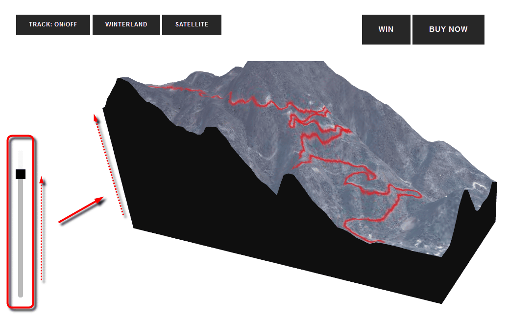
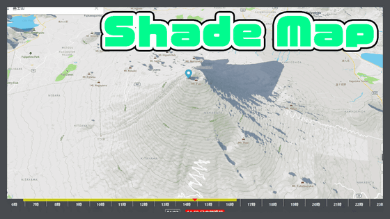
Raising the slider on the left side of the screen highlighted the surface undulations. Since it often feels somewhat unsatisfactory if it is displayed on a scale, it seems to be said that it is a nice function to view.
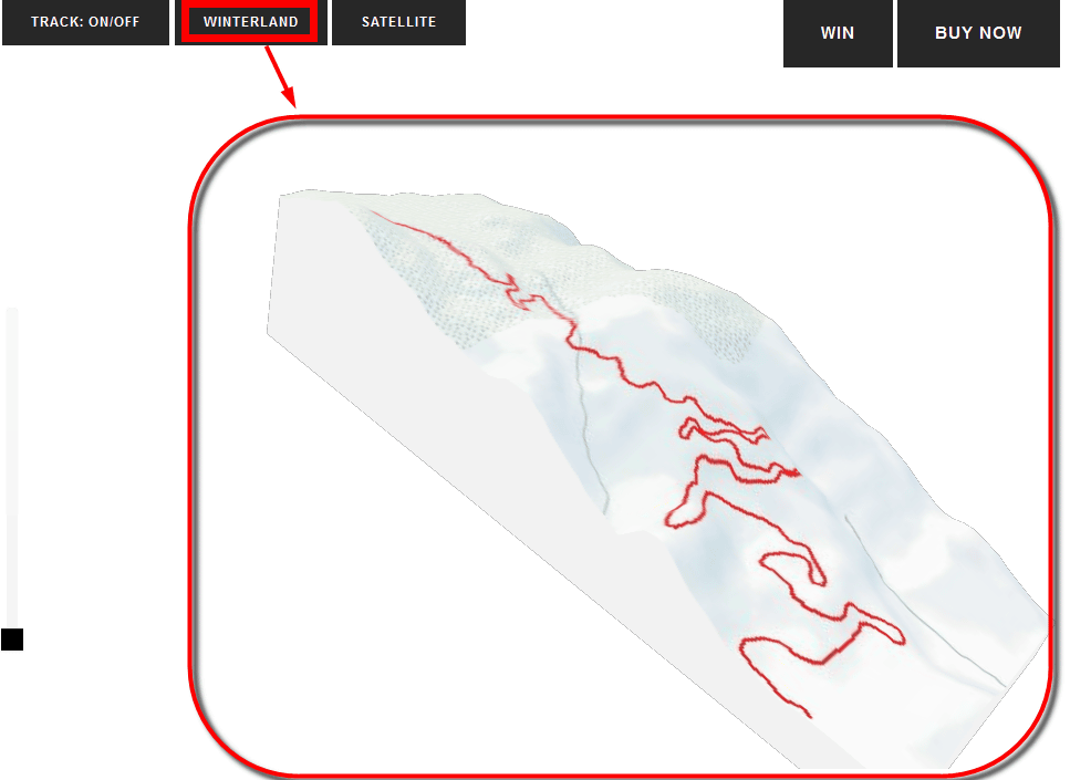
When you click "WINTERLAND" at the top of the screen, the ground turns pure white and it looks like a snowy mountain. It is the best display when reproducing the data of skiing and trekking went in winter.
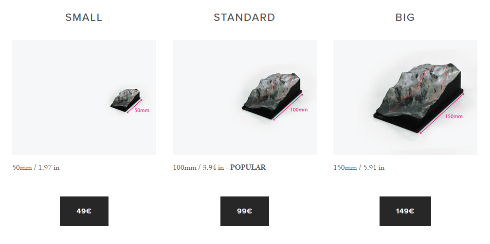
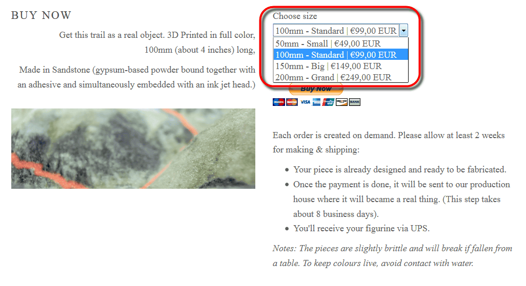
Even though it is easy to view and view it, it's a nice piece of nicetrails, but you can also order real 3D models online. Three kinds of sizes are available: SMALL with a long side of 50 mm, STANDARD with 100 mm, BIG with 150 mm, each with a price of 49 euros, 99 euros, 149 euros (about 6100 yen, about 12 2300 yen, about 10 000 8500 yen), and it seems that shipping fee is included in the price at the time of article creation.
To order a 3D map, click "BUY NOW" at the top right of the screen.
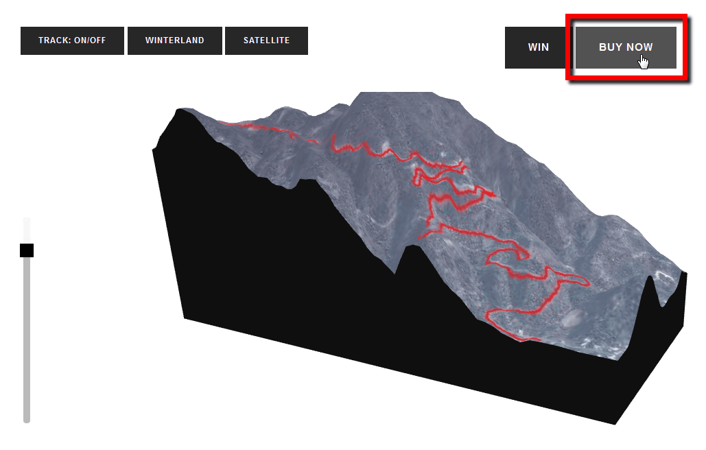
It is OK if you select the size on the screen and proceed with the purchase procedure. For payment you can use credit card or PayPal.
As you can see, nicetrails was a fun entertaining service that lets you keep your hobby activities in shape.
Related Posts:


in Web Service, Review, Posted by darkhorse_log