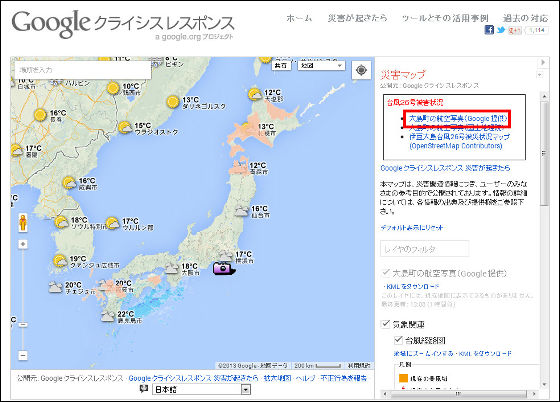
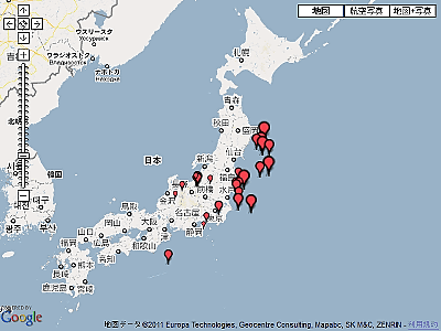
Disaster Map of the Izu Oshima where a sediment-related disaster occurred on typhoon 26 was released

Mudslide caused by Typhoon No. 26 occurred, Google Disaster Map released the latest aerial photograph of Tokyo and Izu Oshima which suffered a large scale damage.
If a disaster occurs - Google Crisis response
http://www.google.org/intl/ja/crisisresponse/howwerespond.html
Go to the above URL and click 'Satellite imagery of Oshima Town (provided by Google)' at the upper right of the screen.
By clicking the icon of the camera displayed on the map of Izu Oshima, you can check the local aerial photograph.
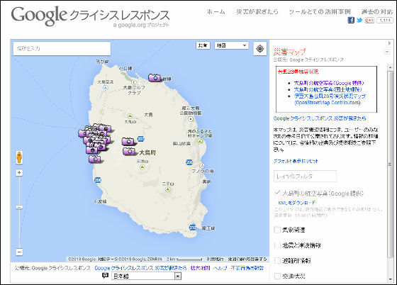
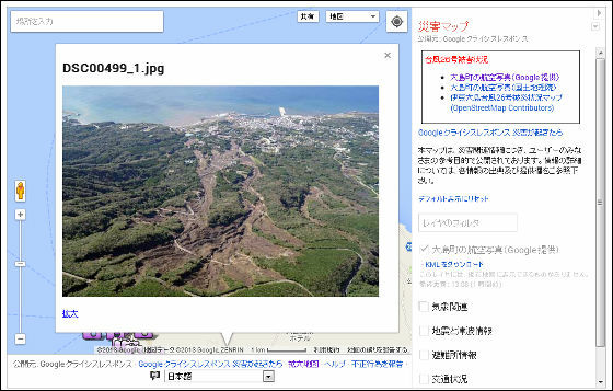
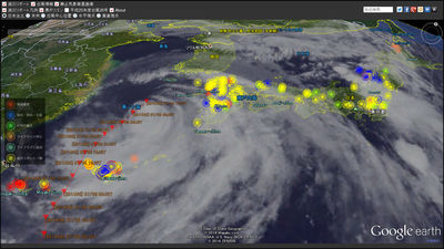
In the aerial photographs around Oshima Town, you can see that a large landslide occurred and the house collapsed.
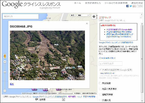
Debris flow occurs in quite a deep position of the mountain.
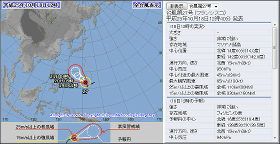
According to the announcement by the Meteorological Agency, typhoon No. 27 is northward at 15 kilometers per hour on October 18, 2013, and there is a possibility of approaching Okinawa and western Japan around October 23, 2013, so strict precautions Is required.
Japan Meteorological Agency | Typhoon Information
http://www.jma.go.jp/jp/typh/
Related Posts:

in Web Service, Posted by darkhorse_log