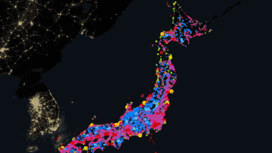
'Japanese Surname Atlas' shows on a map what surnames are distributed in Japan
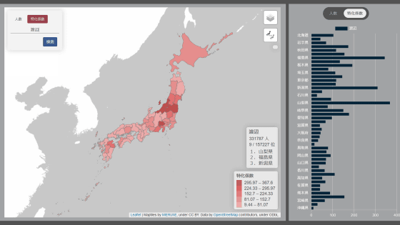
' Japanese Surname Atlas ' is a service that displays on a map the distribution of surnames at three levels: prefecture, former city, town, and village (2000), and oaza, town, and district.
Japanese Surname Atlas
When you access the site, you will first see a pull-out map of Japan and the most common surnames by prefecture.
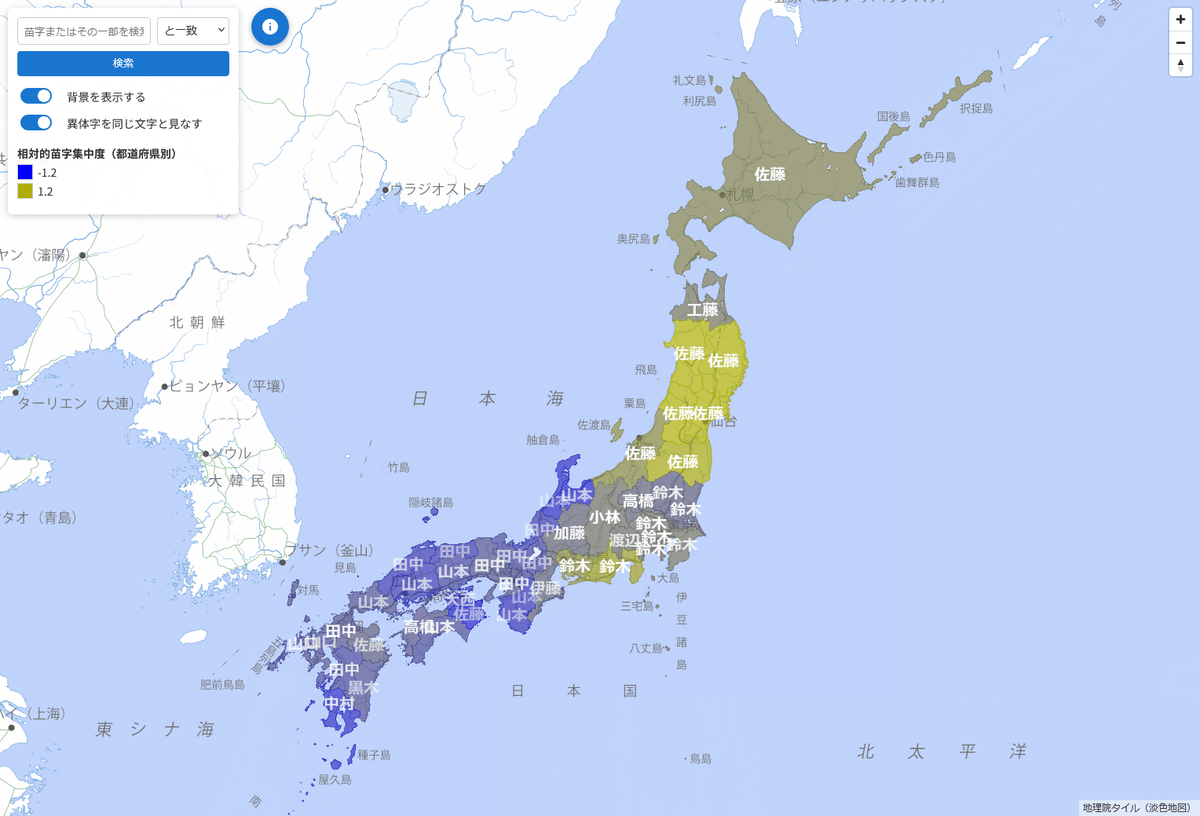
The darker the label, the fewer types of surnames there are, and the closer the background color is to blue or yellow, the more concentrated the surnames are.
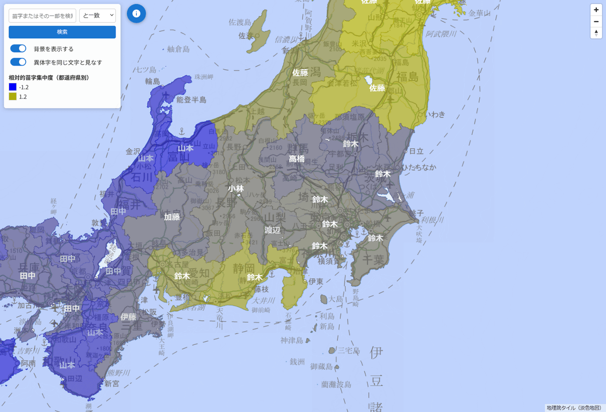
As you zoom in on the map, at a certain point the divisions change to 'Former Cities, Wards, Towns and Villages (2000).'
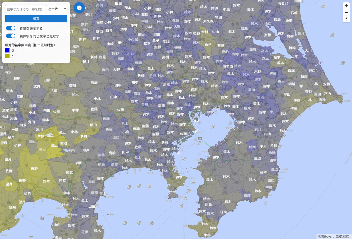
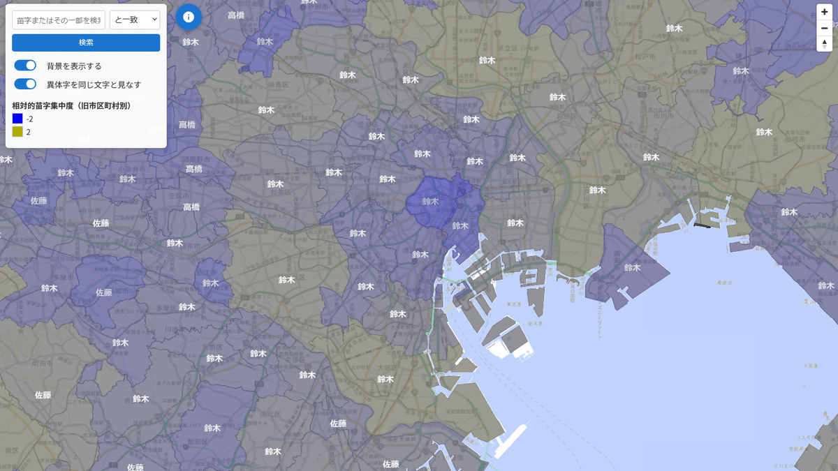
Zooming in further, we can see the distribution of towns and villages.
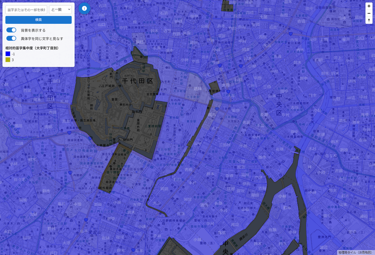
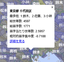
Clicking on the map will display the top three most common surnames in the location you clicked on, the total number of households, the total number of surnames, the number of households per surname, and the relative surname concentration, with a 'View details' link at the bottom.
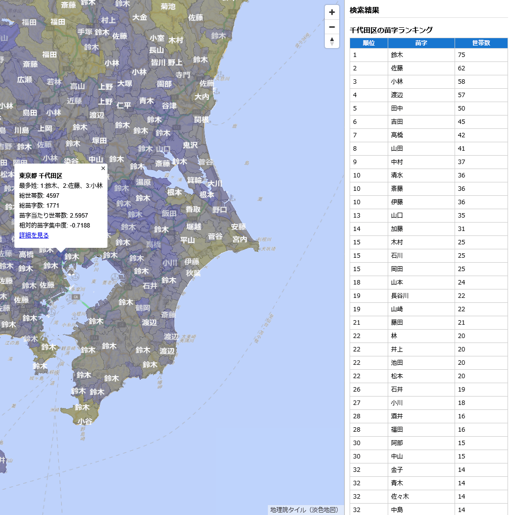
Clicking on the link will display a ranking of surnames for that area in the column on the right.
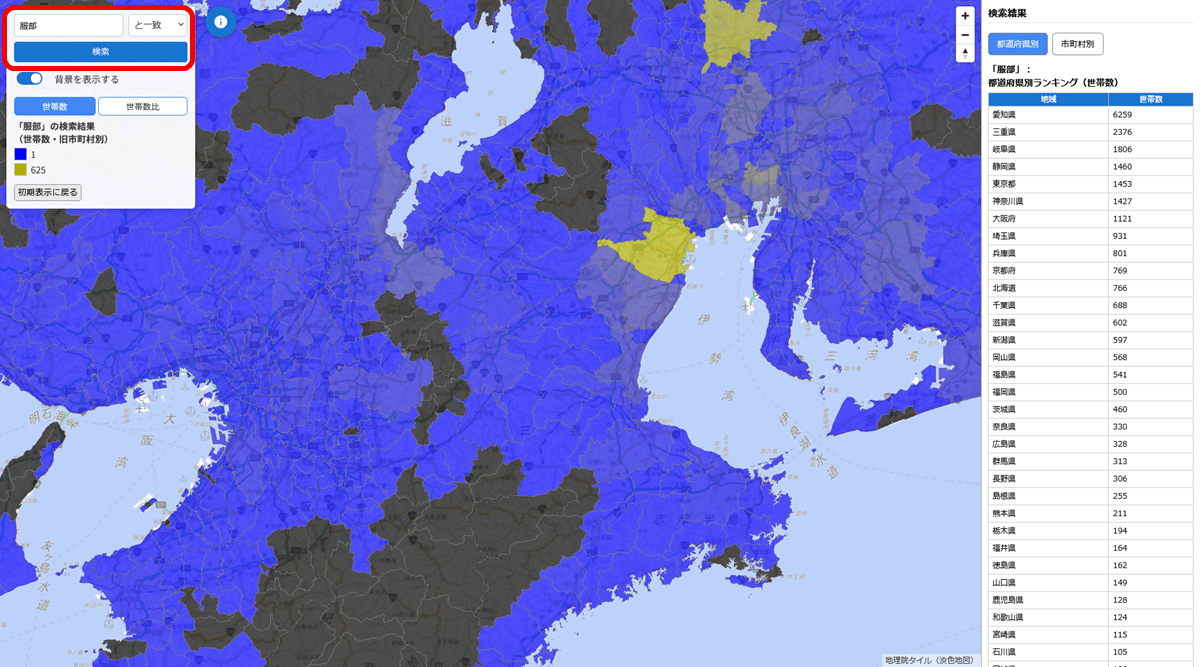
You can also use the search box in the upper left to find out where a particular surname is distributed.
According to creator Sugawara , the surname data is based on electronic telephone directory data from 2007 .
Related Posts:
in Web Service, Review, Posted by logc_nt