'STARLINKMAP.ORG' displays where Starlink satellites are currently flying in real time
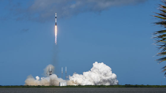
``Starlink'', developed by entrepreneur Elon Musk's space company ``SpaceX,'' is a communications infrastructure service that uses a network built with thousands of artificial satellites to provide high-speed internet access anywhere in the world. You can access it at A map ' STARLINKMAP.ORG ' has been released that allows you to understand in real time where such Starlink satellites are currently flying.
STARLINKMAP.ORG - Real-Time Starlink Satellite Tracker
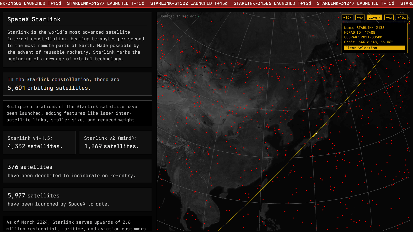
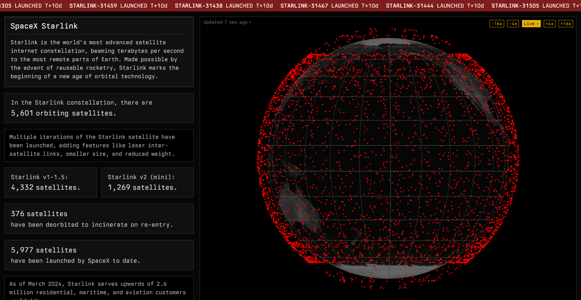
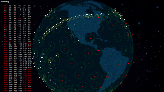
When you access STARLINKMAP.ORG, it looks like this. A globe is displayed on the right side of the screen with numerous red dots, all of which represent Starlink satellites. The movement of the satellite is displayed as an animation, but the default speed is 16 times, so click 'Live' in the upper right.
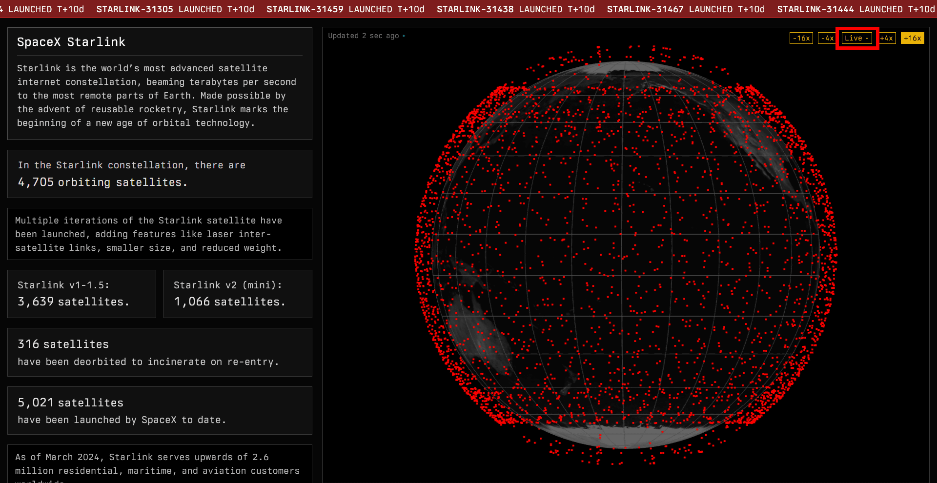
Then, the position information of Starlink satellites will be displayed in real time.
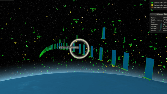
You can move the globe by dragging it, and you can zoom in and out by operating the mouse wheel. When I clicked on the satellite that was in the sky above Japan at the time of article creation, the name of the satellite 'STARLINK-5081' was displayed. Further, in the upper right corner, NORAD ID (satellite catalog number), COSPAR (International Satellite Identification Code), and Orbit (orbital altitude and
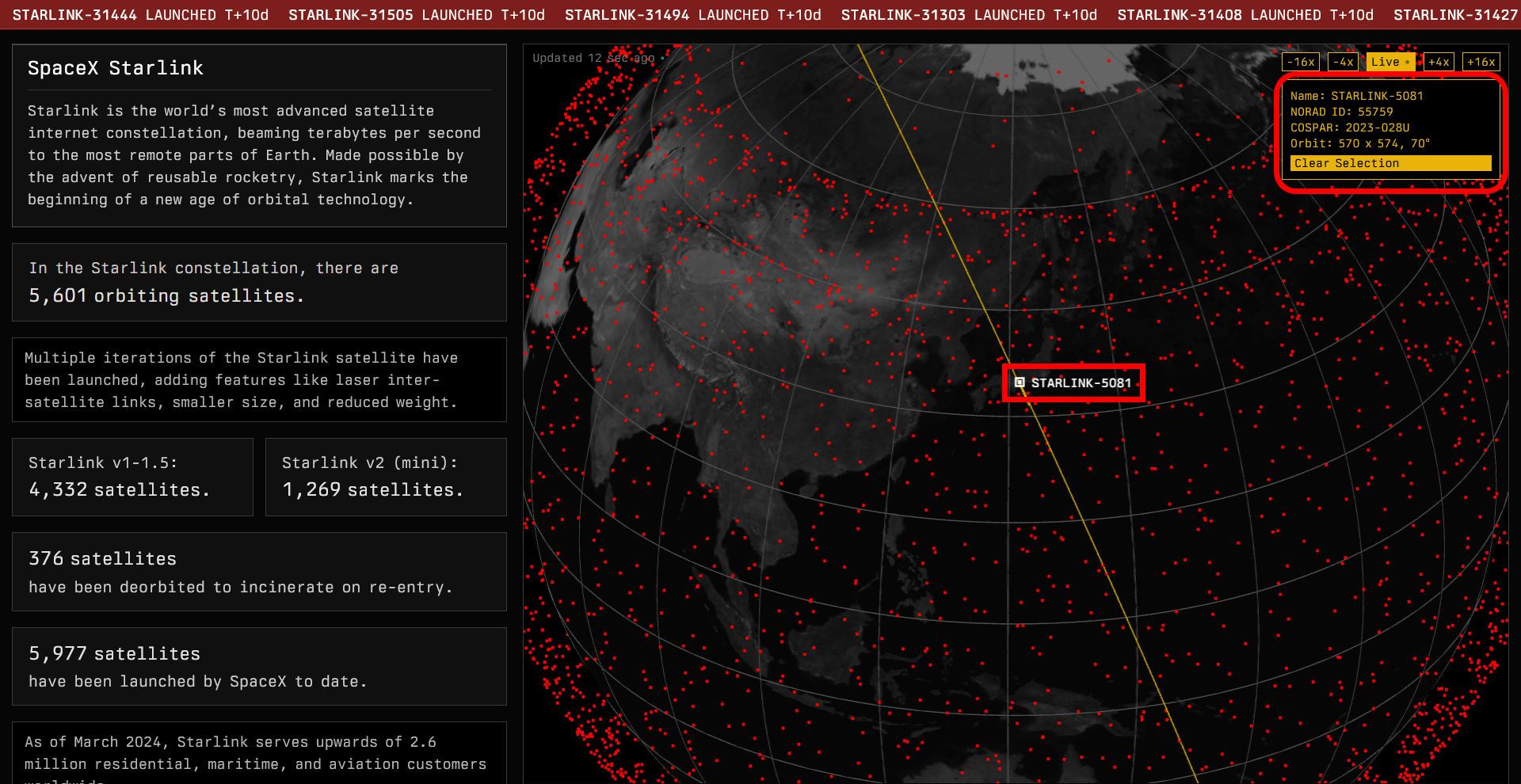
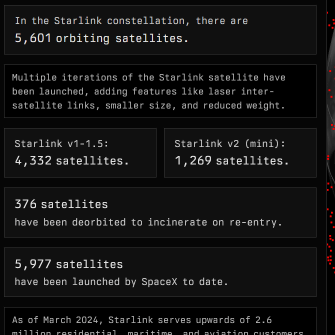
The number of Starlink satellites is displayed on the left side of the STARLINKMAP.ORG screen. At the time of article creation, there were a total of 5601 artificial satellites, of which 4332 were first generation and 1269 were second generation. In addition, there are 376 satellites that have left orbit and been incinerated, and 5,977 satellites have been launched by SpaceX so far.
According to comments posted on the social news site Hacker News, most of the orbital inclinations of Starlink satellites are set at 53 degrees.
Related Posts:


in Web Service, Review, Posted by log1i_yk