A map that understands where the artificial satellite used in SpaceX's 'Starlink' that builds the Internet network from space is

SpaceX, a private space development company founded by Elon Musk,
starlink satellite map
https://satellitemap.space/indexA.html
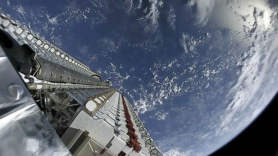
SpaceX's Starlink project is to construct an Internet connection environment using more than 10,000 artificial satellites placed in orbit around the earth. The satellites used in the Starlink project were first launched in May 2019, when 60 were launched. The rocket used for the launch is the SpaceX reusable rocket ' Falcon 9 '.
SpaceX launches 60 first satellites for Starlink project to build Internet environment using artificial satellites-GIGAZINE

by Official SpaceX Photos
On June 4, 2020, the eighth satellite for Starlink was launched, and 60 new satellites were put into orbit. The total number of artificial satellites for Starlink that have been put into orbit at this launch has reached 480.
SpaceX launches 60 new satellites for ``Starlink'' to build the Internet in space and is ready to connect to the Internet already-GIGAZINE

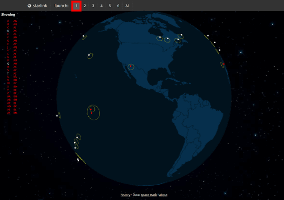
The 'starlink satellite map' allows you to check such Starlink satellites on a map. The starlink satellite map acquires the satellite position data from Space-Track.Org, and at the time of article creation, the total 360 satellite positions that were put into orbit by the sixth launch are shown on the map. It has been.
starlink satellite map

If you click '1' next to 'launch' at the top of the screen, you can display only 60 artificial satellites that were launched into the orbit at the first launch on the map.

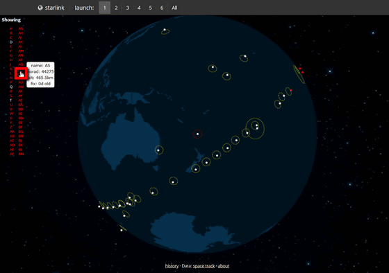
The names of the artificial satellites displayed on the map are lined up in the upper left of the screen, and when the mouse cursor is placed here, the corresponding artificial satellite is displayed in the center of the map. The artificial satellites written in red are the ones that were thrown in at a position deviating from the target altitude (550 km).

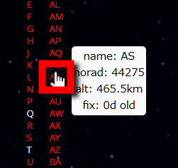
In addition, when you move the mouse cursor, the window that is displayed also contains four pieces of information: 'name (name of artificial satellite)' 'norad ( satellite catalog number )' 'alt (horizontal altitude)' 'fix (navigation position)'. It will be displayed in.

The total number of artificial satellites launched by the Starlink project is 12,000, so it is expected that more than 10,000 points will be collected on the 'starlink satellite map' in the future.
Related Posts:
in Web Service, Posted by logu_ii


