A trip on local buses from the northernmost to southernmost bus stops in Osaka Prefecture [Settsu Edition]
The TV Tokyo affiliated travel variety show '
·table of contents
◆ Introduction (rules, starting point setting, arrival point setting, etc.)
◆ Move to the starting point
◆ Departing from the northernmost bus stop in Osaka Prefecture, 'Toyonaka Center-mae'
◆Lunch at 'Beccaraiteo' at Yamashita Station
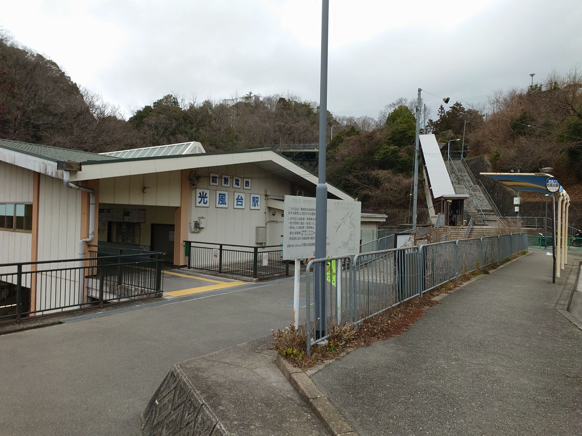
From Yamashita Station to Kofudai Station
◆We took a detour to 'Myokenguchi' because we had to wait for an hour
From Kofudai Station to Senri Chuo
From Senri Chuo to Toyonaka, enter Osaka city
◆From Osaka City to Sakai City
◆ I want to somehow get through Sakai City and head to Izumi City.
◆ Introduction (rules, starting point setting, arrival point setting, etc.)
The 'Local Route Bus Journey' has three rules: 'As a general rule, only use local route buses (express buses and other means of transport are prohibited),' 'The use of the Internet when gathering information is prohibited, but gathering information from paper maps and information centres is OK,' and 'Reach the designated destination within three nights and four days.'
However, this time I will be researching everything myself, such as where the start and finish are, and whether there are any checkmate situations, so I will only apply the first principle of 'only use local buses.'
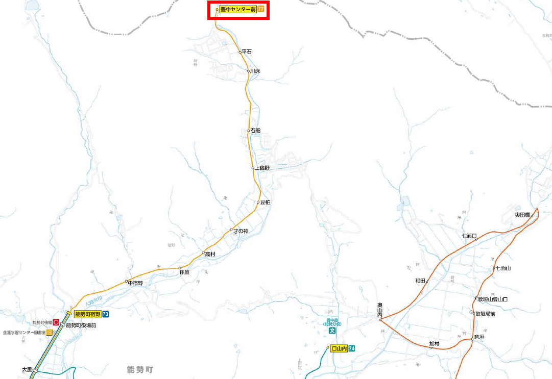
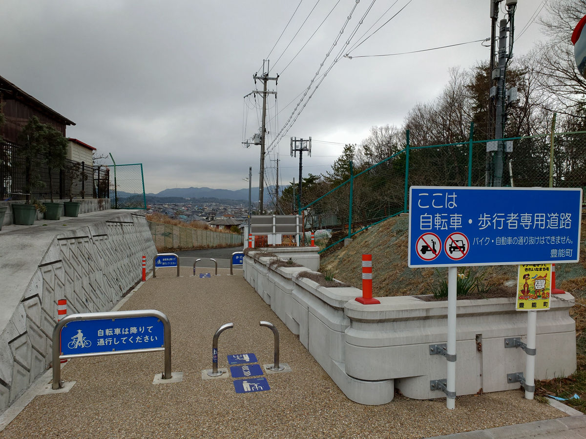
The starting point is Nose Town, Toyono District, the northernmost municipality in Osaka Prefecture. The only bus route that runs through Nose Town is the Hankyu Bus route, and its northern terminus is 'Toyonaka Center-mae,' 'Kuchiyamauchi,' and 'Okudabashi.' Based on the Hankyu Bus (PDF file) Osaka area route map , we set 'Toyonaka Center-mae,' the northernmost of these, as the starting point.
On the other hand, the southernmost bus stop is Sasegawa, the last stop on the Tanagawa Nishihata route of the Misaki-cho Community Bus, which runs through Misaki-cho, Sennan-gun, the southernmost municipality in Osaka Prefecture. This is where we headed.
The plan was to carry out the plan on a weekday in February 2024.
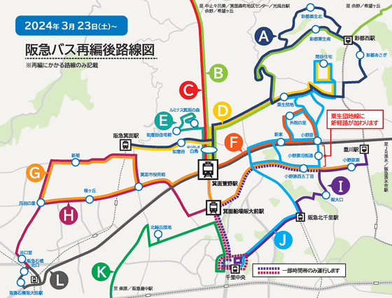
Incidentally, on March 23rd, about one month after this report was written, the Kita-Osaka Kyuko Line was extended from Senri Chuo Station to Minoh Kayano Station, and many of the bus routes that connected the northern part of Toyonaka City and the area towards Minoh City were changed to only stop at Minoh Kayano Station.
◆ Move to the starting point
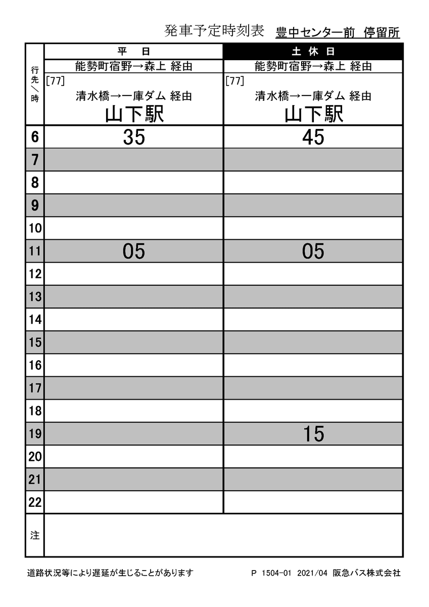
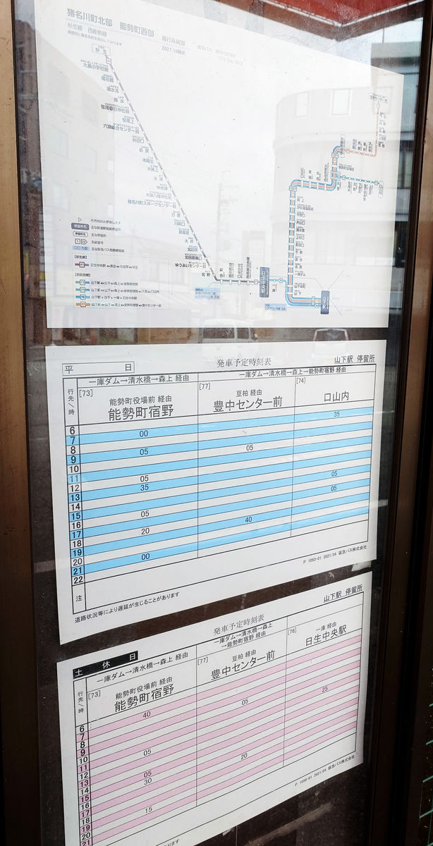
The timetable for the starting point, Toyonaka Center-mae, is as follows: two trains depart at 6:35 and 11:05 on weekdays, and three trains depart at 6:45, 11:05, and 19:15 on holidays.
Even the shortest route to the finish line is a little over 100km away, so I want to leave as early as possible, but Toyonaka Center-mae is located here. If I stay at the nearby
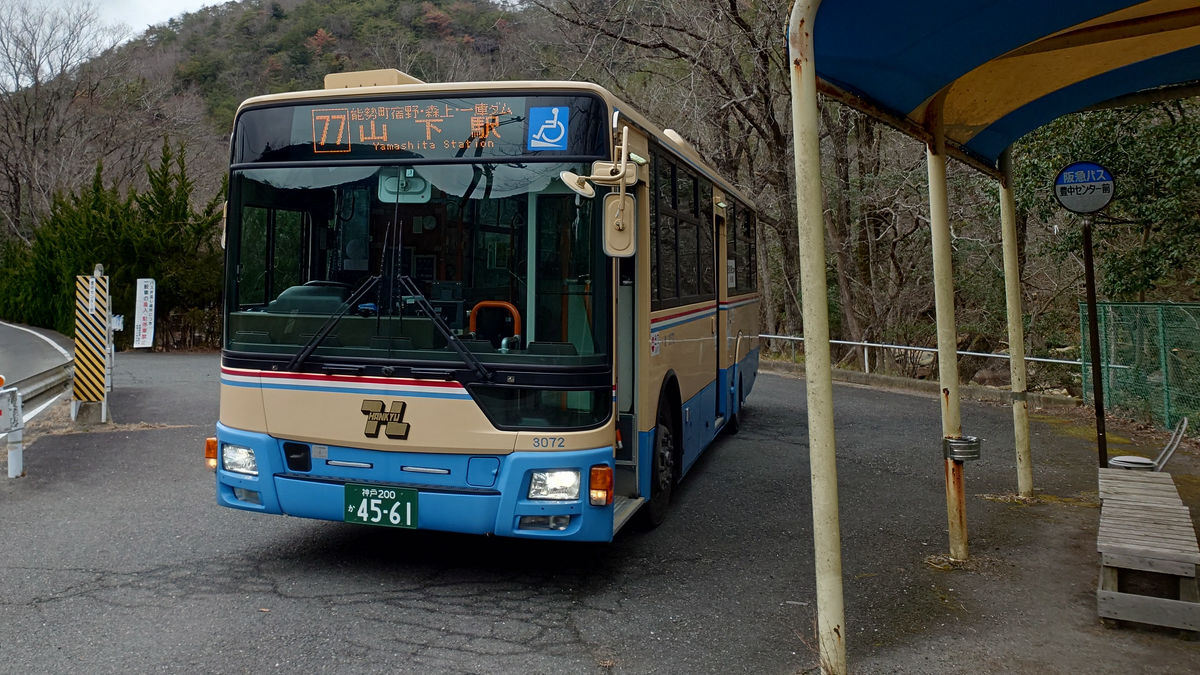
First, I went to Yamashita Station on the Nose Electric Railway to get to Toyonaka Center-mae.
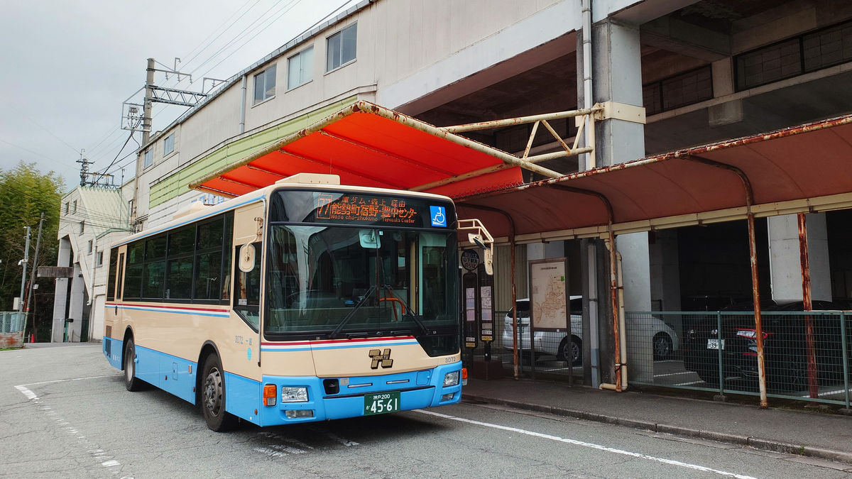
As you exit the station, you will find the Hankyu Bus 'Yamashita Station' bus stop.
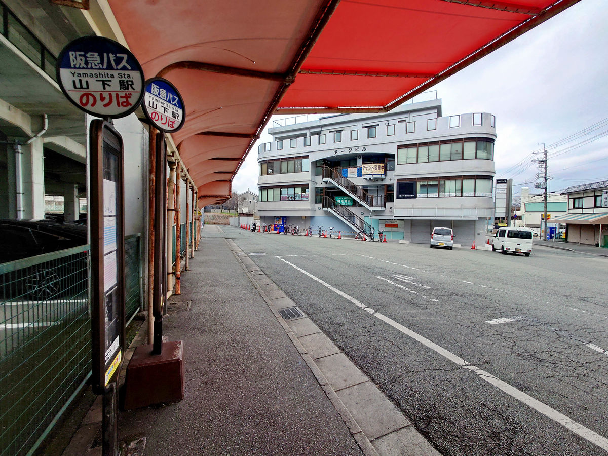
Route 77 to Toyonaka Center-mae departs at 10:05.
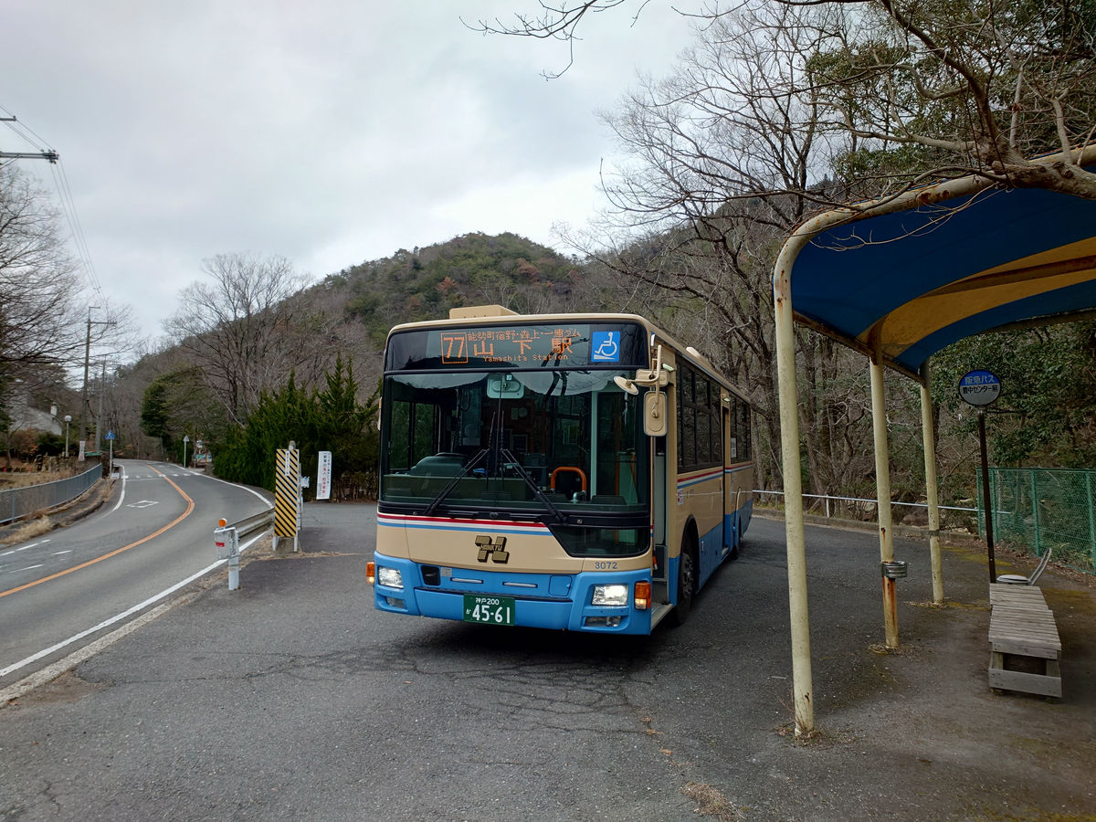
Eventually, the bus we were supposed to catch arrived.
We set off for 'Toyonaka Center-mae.' There were about 10 passengers in total.
On the way, the bus picked up more passengers at the 'Yamashita' bus stop and headed north on National Route 173. About six passengers got off at 'Katayamaguchi'.
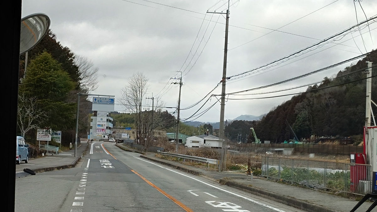
The bus entered Prefectural Route 54, and one by one more people got off, and when the bus arrived at 'Toyonaka Center-mae' at around 10:42, there was only one other person on board. After getting off, the person walked in the direction of Kameoka City.
The bus stop is located north of the village, so there are almost no pedestrians around, but there is a fair amount of vehicular traffic as it is a route through to Kameoka.
Located near the bus stop is Toyonaka City Youth Nature House Wappuru.
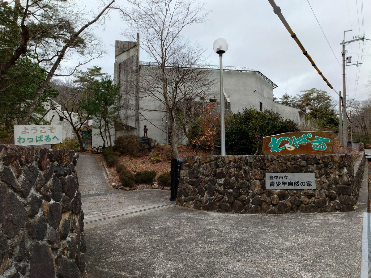
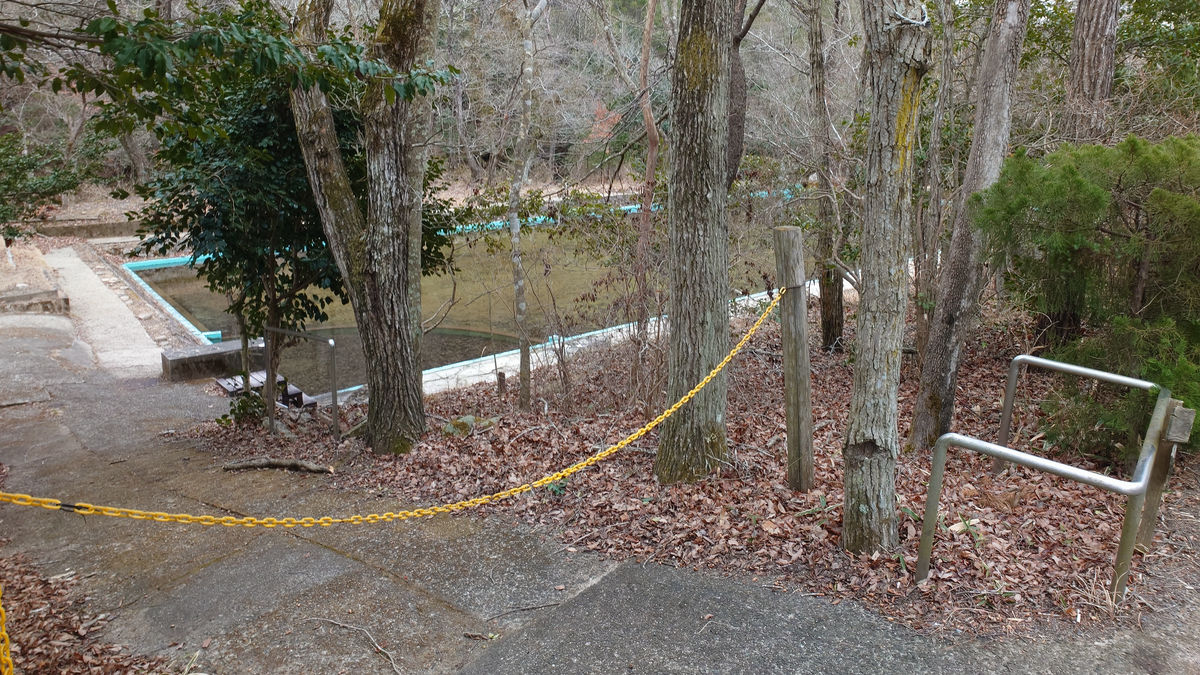
It was closed because it was winter, but there seemed to be a water play area.
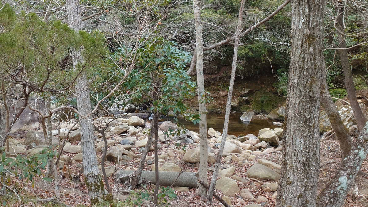
The Ojitsugi River flows on the east side of Prefectural Route 54.
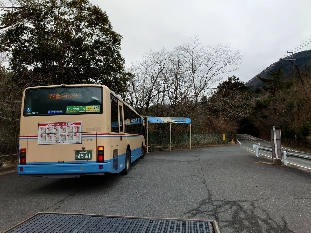
◆ Departing from the northernmost bus stop in Osaka Prefecture, 'Toyonaka Center-mae'
I boarded the '77 Line Yamashita Station bound' bus bound for the southernmost bus stop in Osaka Prefecture. Naturally, there was only one other passenger on the first bus.
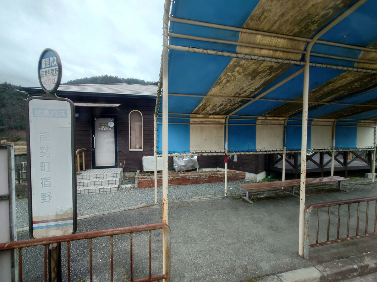
However, at the first bus stop, 'Hiraishi,' the bus immediately picked up a passenger, and the number of passengers gradually increased as the bus headed south along Prefectural Route 54. On the way, the bus made a slightly longer stop at the 'Nosemachi Shukuno' bus stop, where one more person got on.
In aerial photographs you can see that it looks like a roundabout.
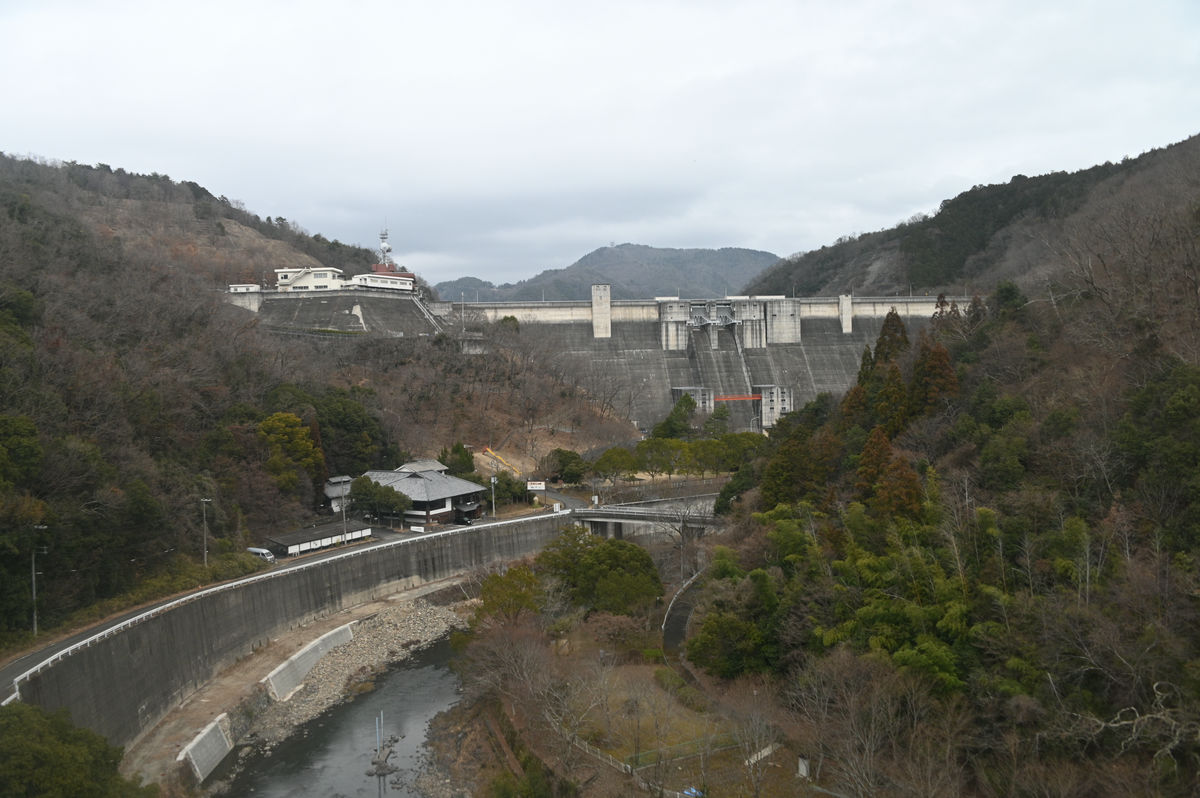
As you head south, you will soon see a large lake called
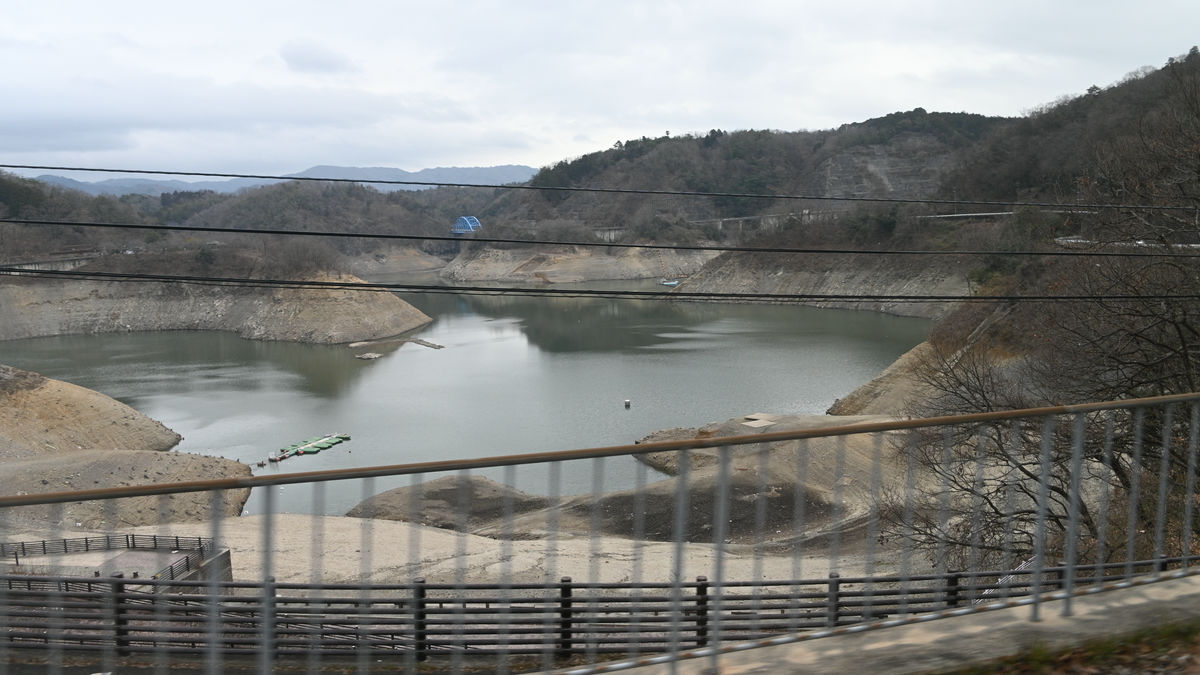
This is the reservoir lake of
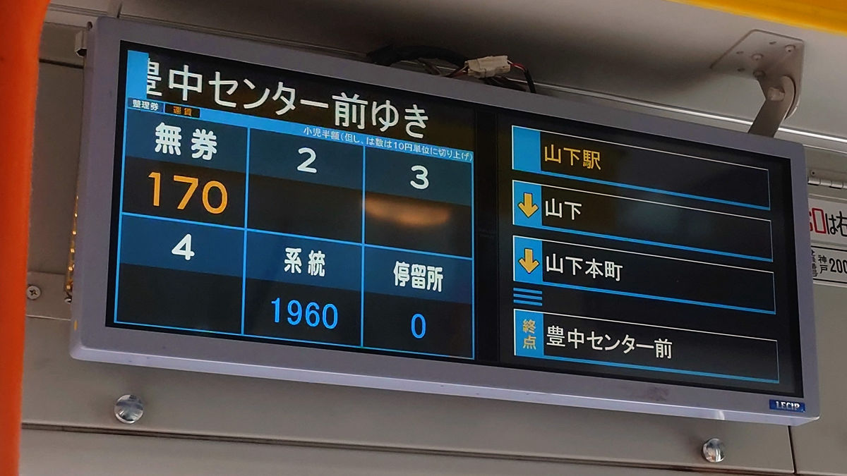
It took about 40 minutes from the starting point to arrive at Yamashita Station, where about six people got off. The fare was 700 yen.
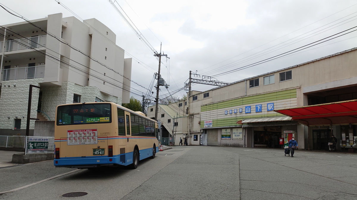
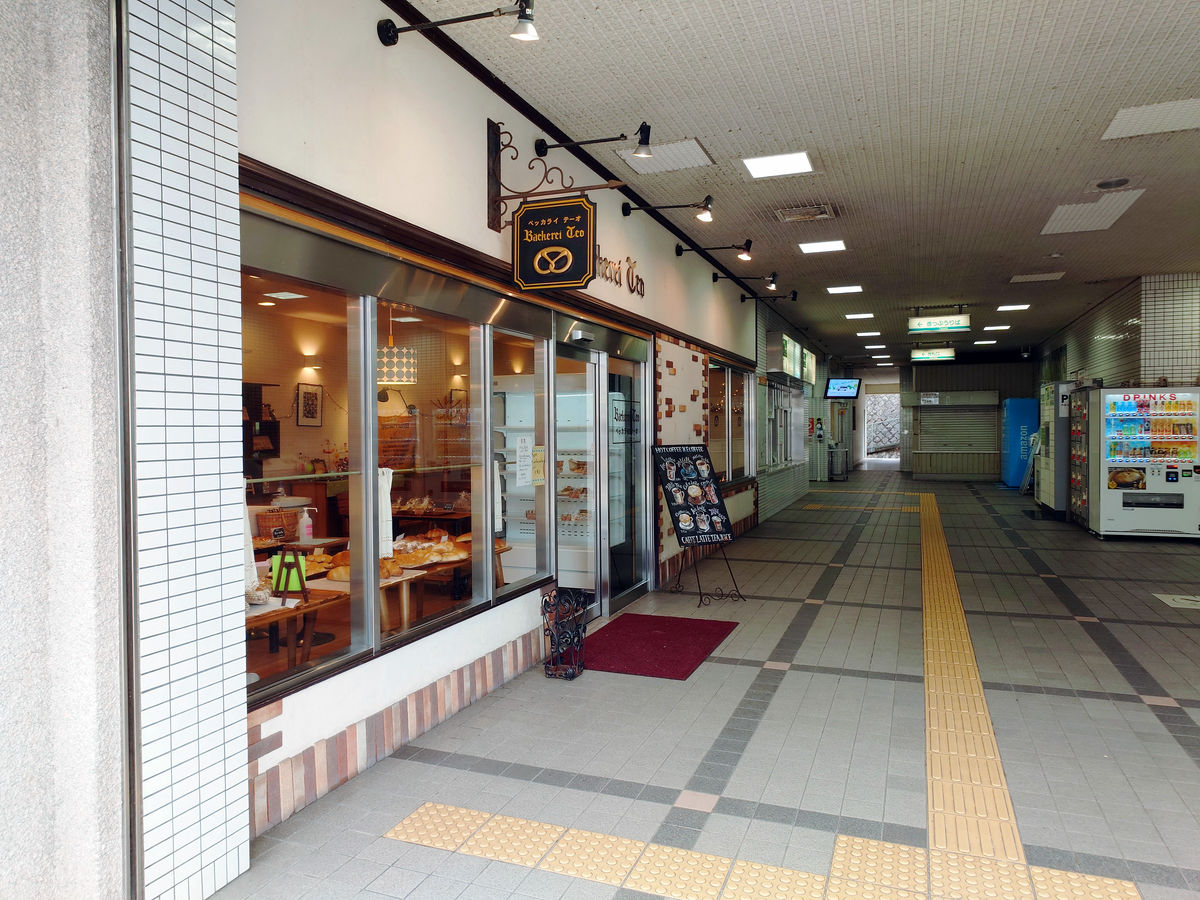
◆Lunch at 'Beccaraiteo' at Yamashita Station
The travel from Yamashita Station will continue to be by Hankyu bus, but there are two possible routes. One is to head south, via Nose Electric Railway Hirano Station, towards Hankyu Kawanishi Noseguchi Station. The other is to head east, take the Yamato Danchi Line that runs through the residential area east of Yamashita Station, and head from Nose Electric Railway Kofudai Station towards Kita-Osaka Kyuko Senri Chuo Station.
After some consideration, I could have continued on the bus if I headed towards Kawanishi Noseguchi, but the connections were not very good and it would have taken a long time, so I decided to walk from Kofudai to Senri Chuo. Also, since this was a trip from the northernmost to the southernmost point of Osaka Prefecture, I wanted to travel within Osaka Prefecture as much as possible. ...Yamashita Station is already in Kawanishi City, Hyogo Prefecture, but I can't avoid it when going to and from 'Toyonaka Center-mae', so I'll just ignore it.
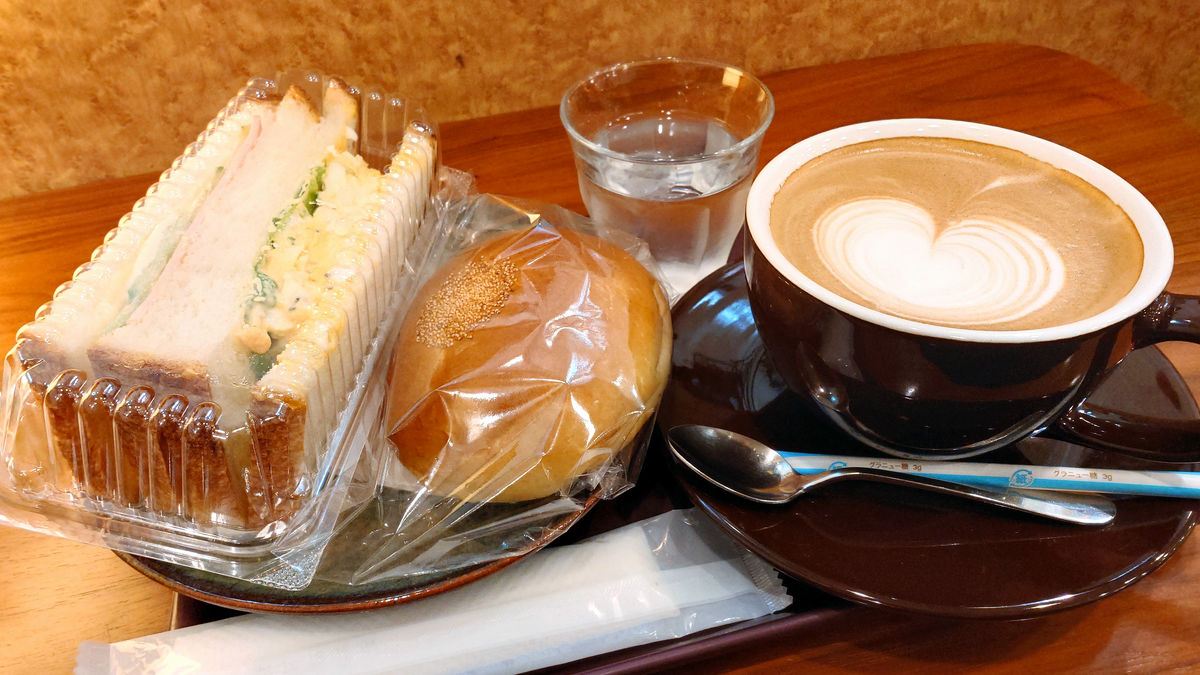
Since I had some time to spare before the Yamato Danchi Line bus arrived, I decided to have lunch at
You can eat the bread sold in the store as it is.
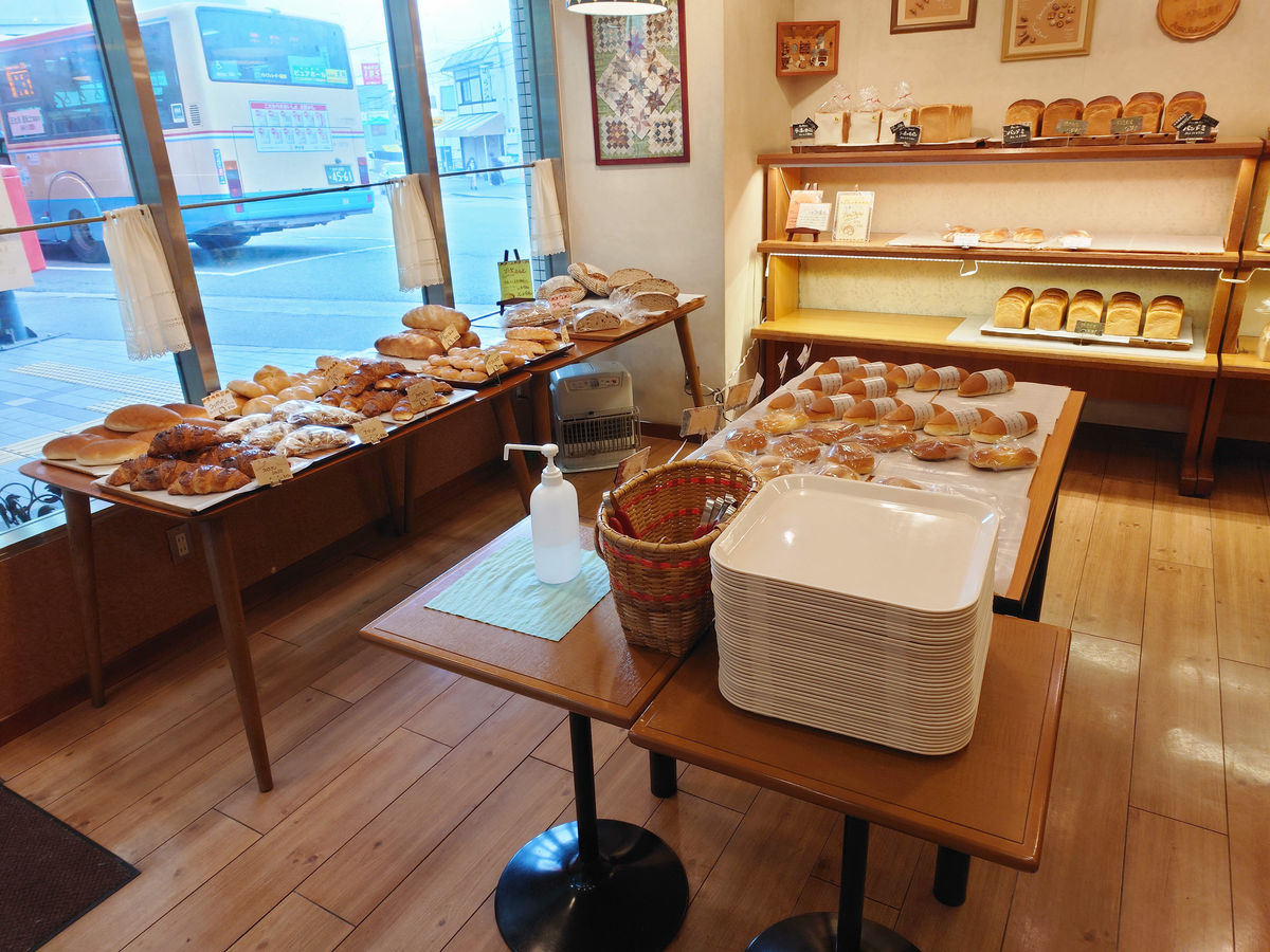
Now that we're comfortable, we prepare for the long journey ahead.
From Yamashita Station to Kofudai Station
After lunch, I head to the bus stop called 'Yamato Nishi 5-chome' from Yamashita Station to catch the next bus. To get to the bus stop by the closest route, I head east from the north side of Yamashita Station. First, I go under the train tracks heading towards Nissho Chuo.
Furthermore, you will also pass under the railway tracks heading towards Myokenguchi.
If you go left along the road, you'll reach a dead end in a residential area. The correct answer is to go through the gap-like passage on the right.
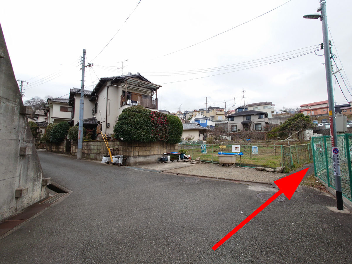
There were some points along the way where I was a little worried about whether it was really a safe road to go on, but I passed some local people so it didn't seem like a problem.
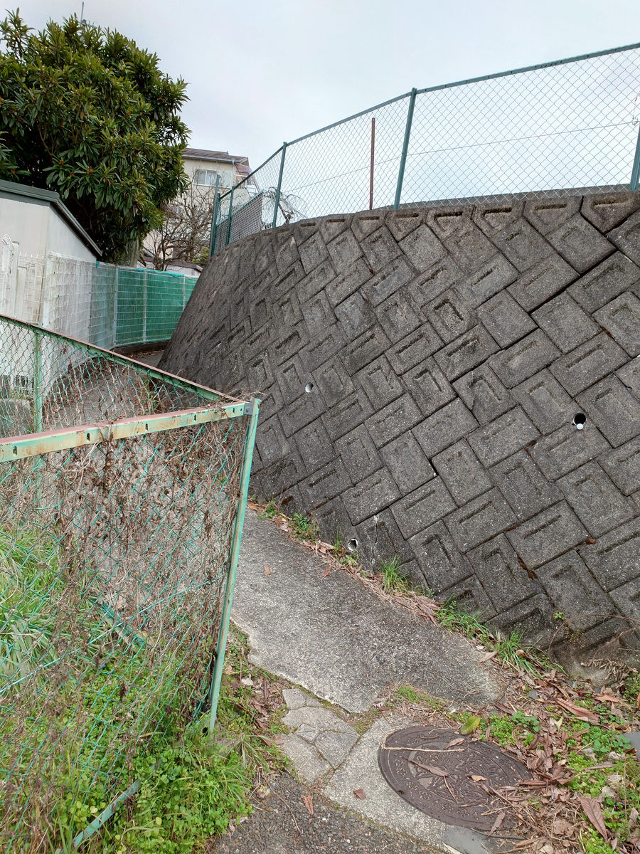
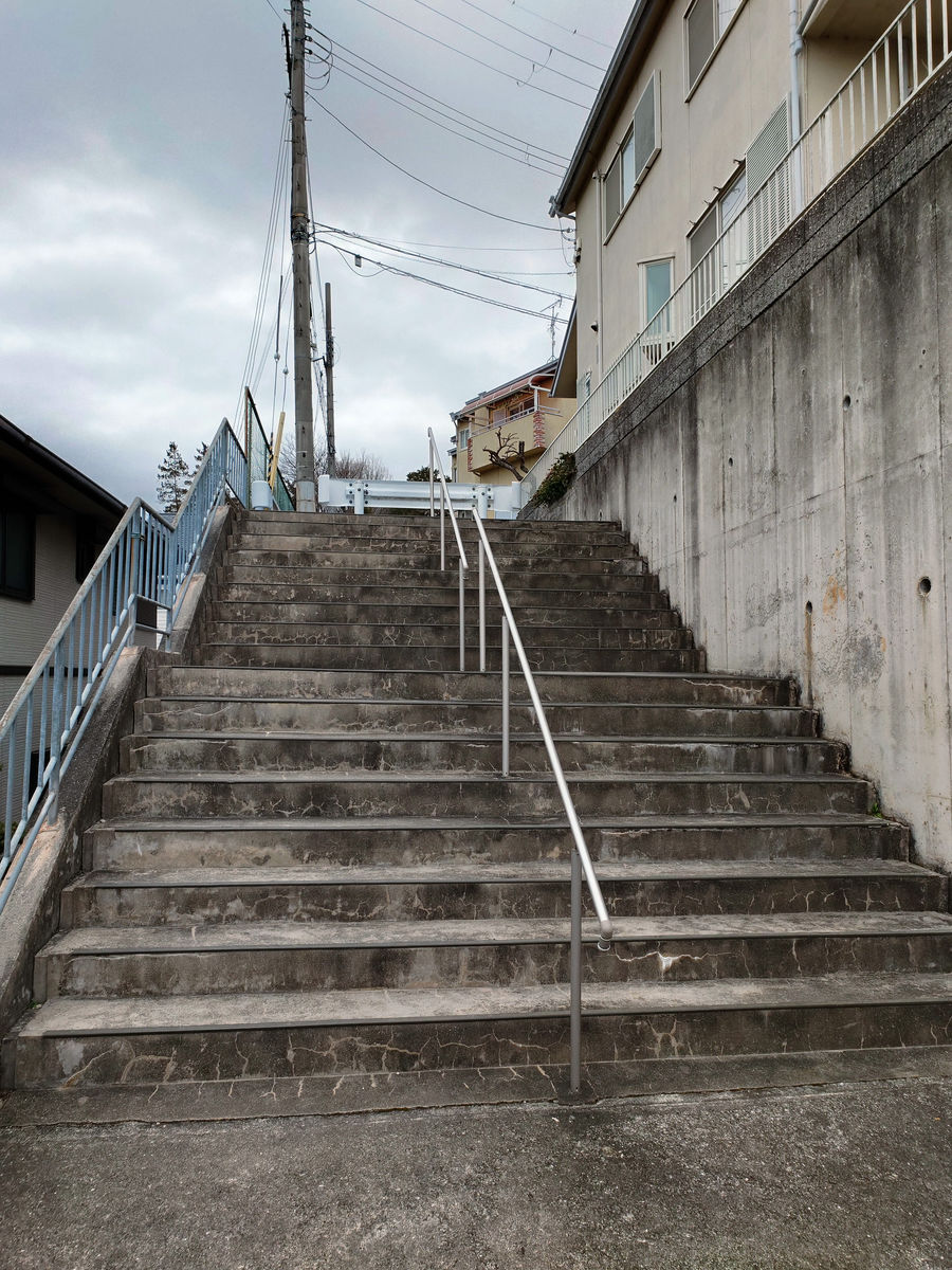
Finally, a proper staircase appears.
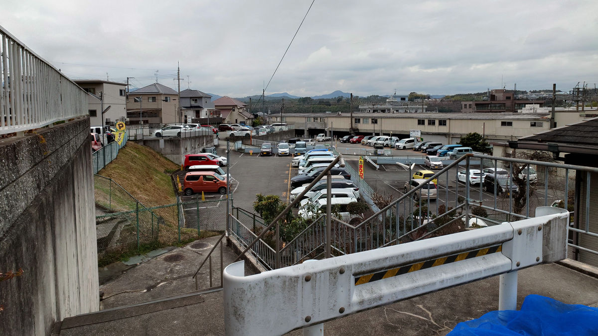
Looking back from the top of the stairs, you can see this. You can see that you have passed through a gap in the parking lot on the east side of Yamashita Station.
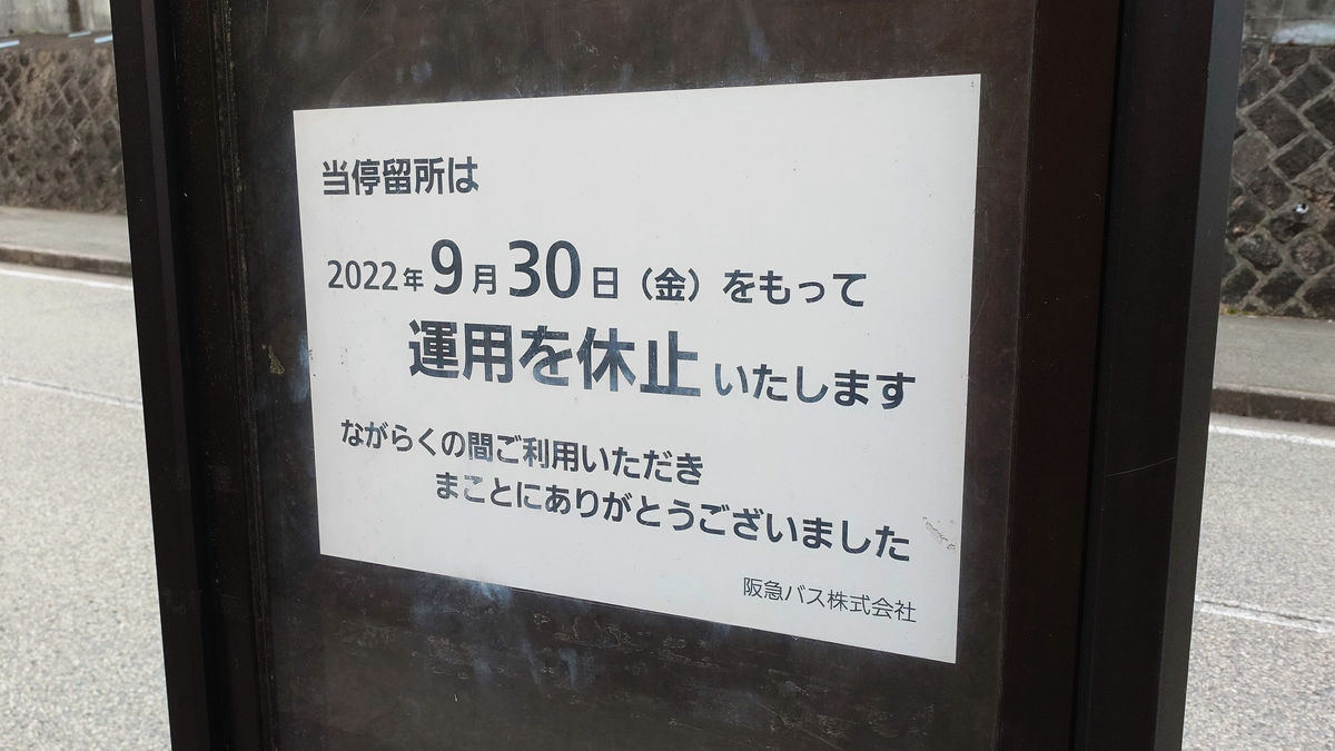
As I emerged from the residential alley onto a slightly wider street, I found a bus stop called 'Yamato Nishi 3-chome' along the back approach to
However, it was suspended from operation as of Friday, September 30, 2022.
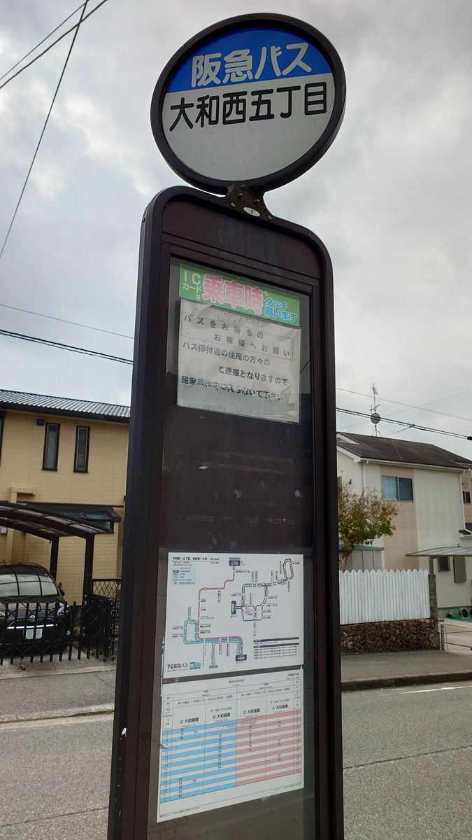
From there, it's a two-minute walk to the Yamato Nishi 5-chome bus stop.
If you search for a route on Google Maps, the route you have just walked will be displayed.
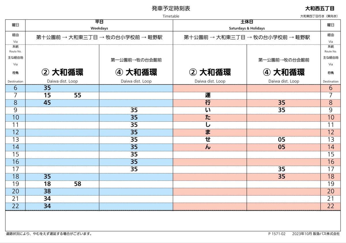
The timetable looks like this, with one train per hour during the day.
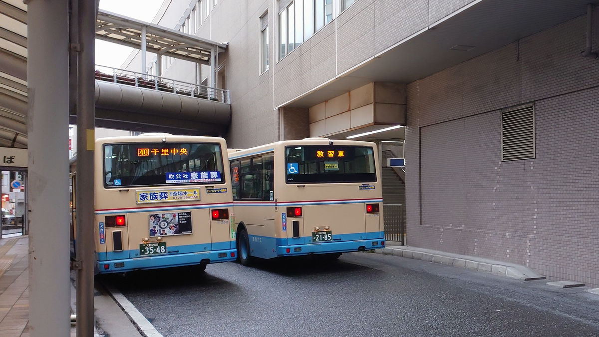
The bus arrived about three minutes late. The vehicle was
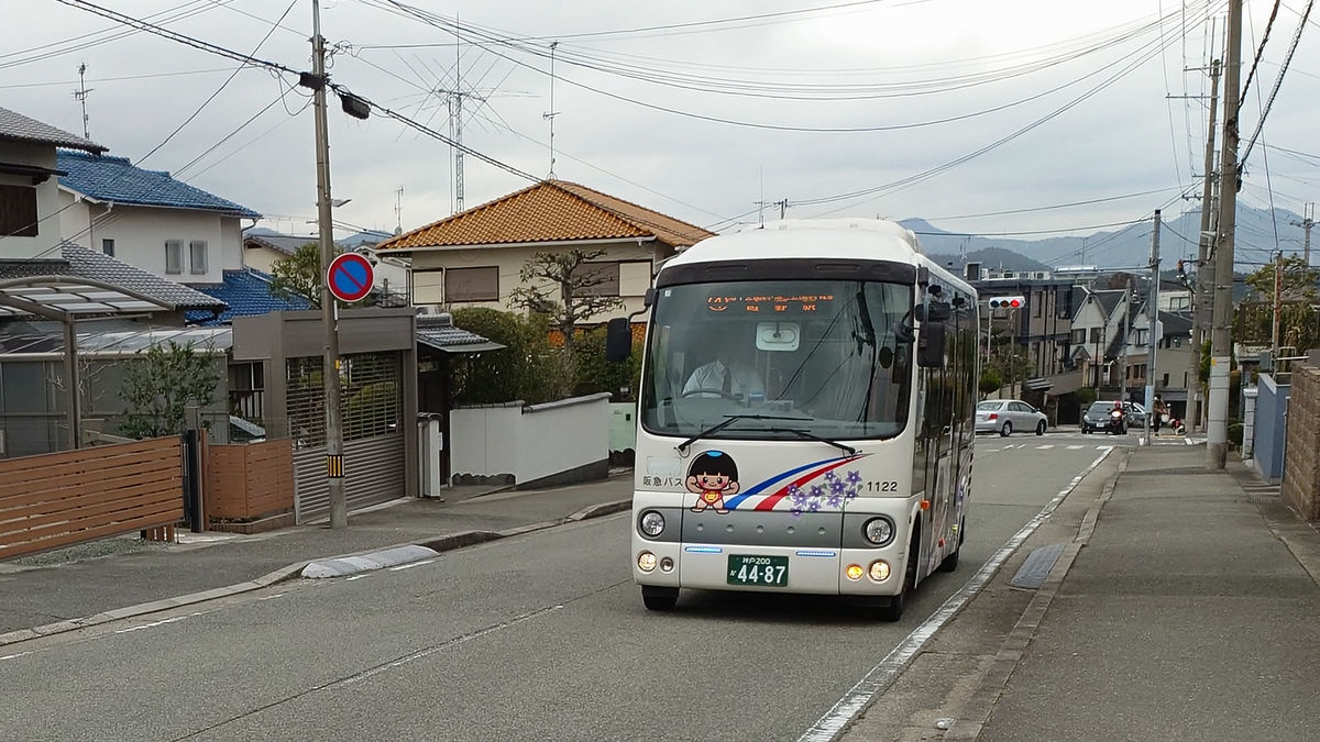
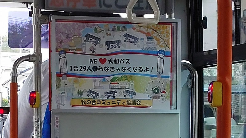
The Yamato Danchi Line will be reviewing and changing its service once a year from 2021 onwards. Inside the bus, there was a message from the Makinodai Community Council that read, 'WE♥Yamato Bus, if we don't have 29 people on each bus, it will disappear!'
After just under 10 minutes on the bus, I arrived at the 'Daijuu Koenmae' bus stop and got off. The fare was 230 yen.
From here, walk through the residential area and head towards Kofudai Station.
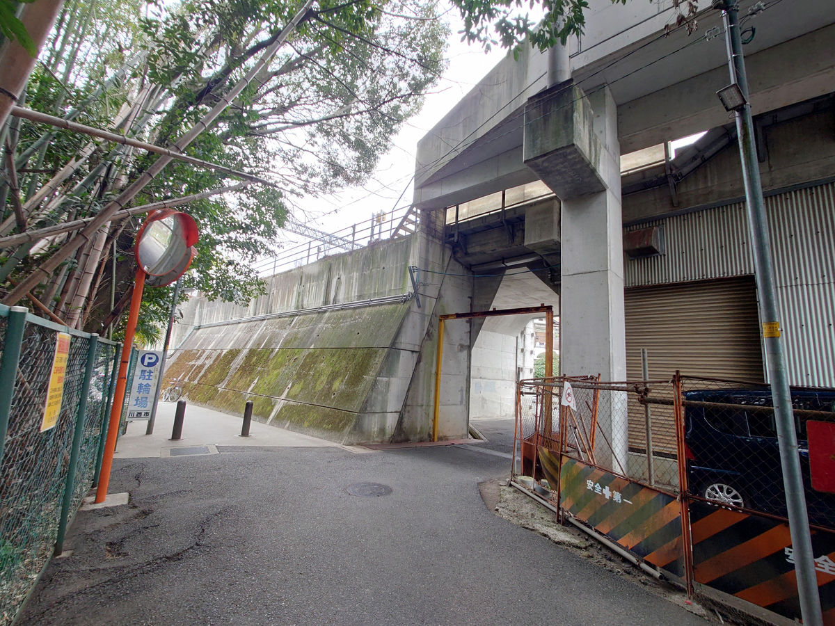
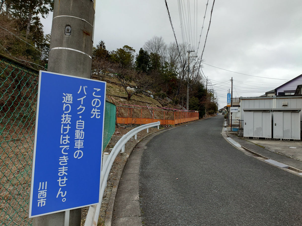
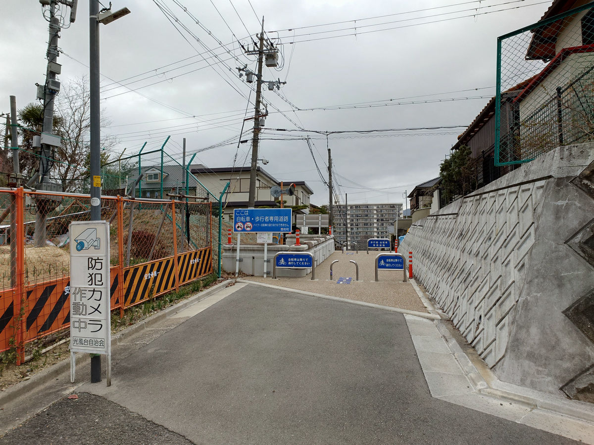
Continue along the road at the northern end of the residential area, where there is a Kawanishi City sign that reads 'No motorbikes or cars allowed beyond this point.'
The top of the sloping road is the border between Kawanishi City, Hyogo Prefecture and Toyono Town, Osaka Prefecture.
According to Google Street View, at
This is what it looks like from the Toyonocho side.
It's mostly just a straight road to Kofudai Station, but the station is down the valley on your left.
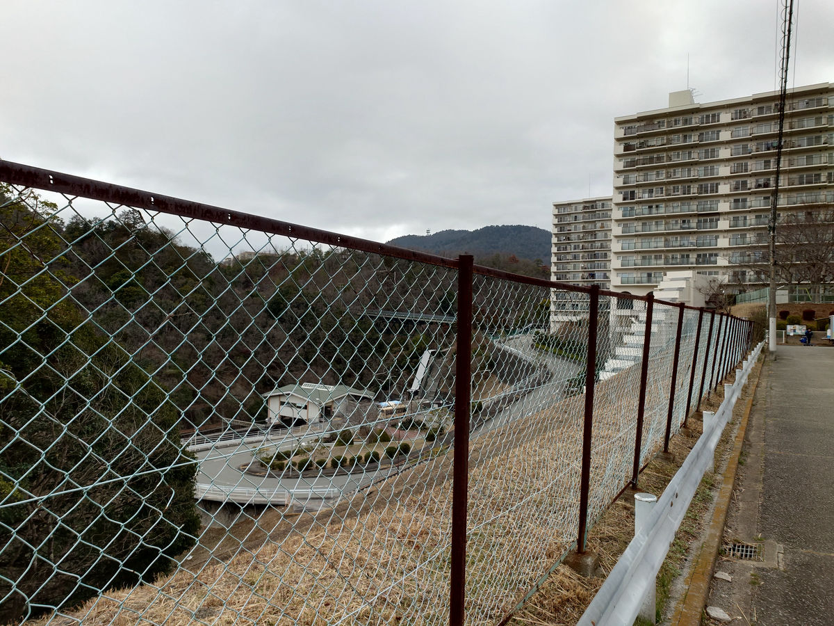
Far down the road you will come to the rotary in front of the station.
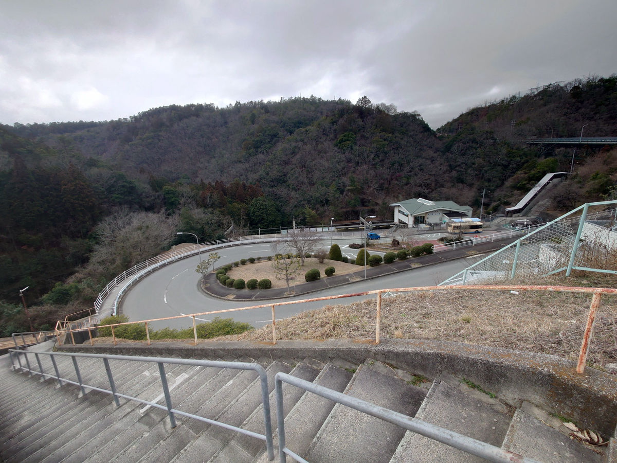
While I was going down, a bus came up the hill. This was the 12:53 bus, and the sign said it was route 4 bound for Minoh Morimachi District Center, but it first circled around the west side of the station towards Shinkofudai, then returned to the Kofudai Station bus stop and continued on to Minoh Morimachi District Center. Since I wasn't planning on getting on the bus anyway, there was no problem if I let it go.
It was an eight-minute walk from the 'Daijuu Koenmae' bus stop and I arrived at Kofudai Station on the Nose Electric Railway.
The walking distance shown on Google Maps looks like this.
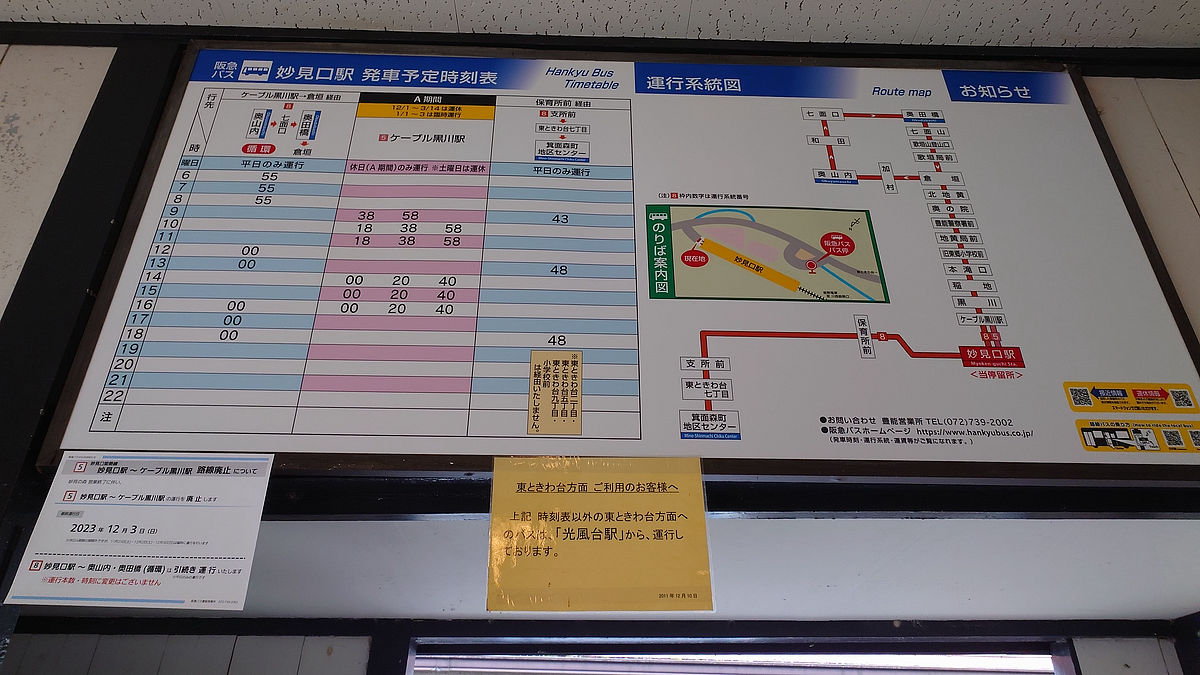
◆We took a detour to 'Myokenguchi' because we had to wait for an hour
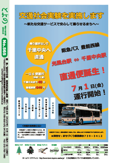
In addition to the route from Kofudai Station to Senri Chuo with a transfer at Minoo Morimachi District Center, a direct service to Senri Chuo has been set up as a transportation social experiment from July 1, 2022. This time, we will be taking this direct service.
Toyono Public Relations June 2022 issue (No. 565) back cover
(PDF file)
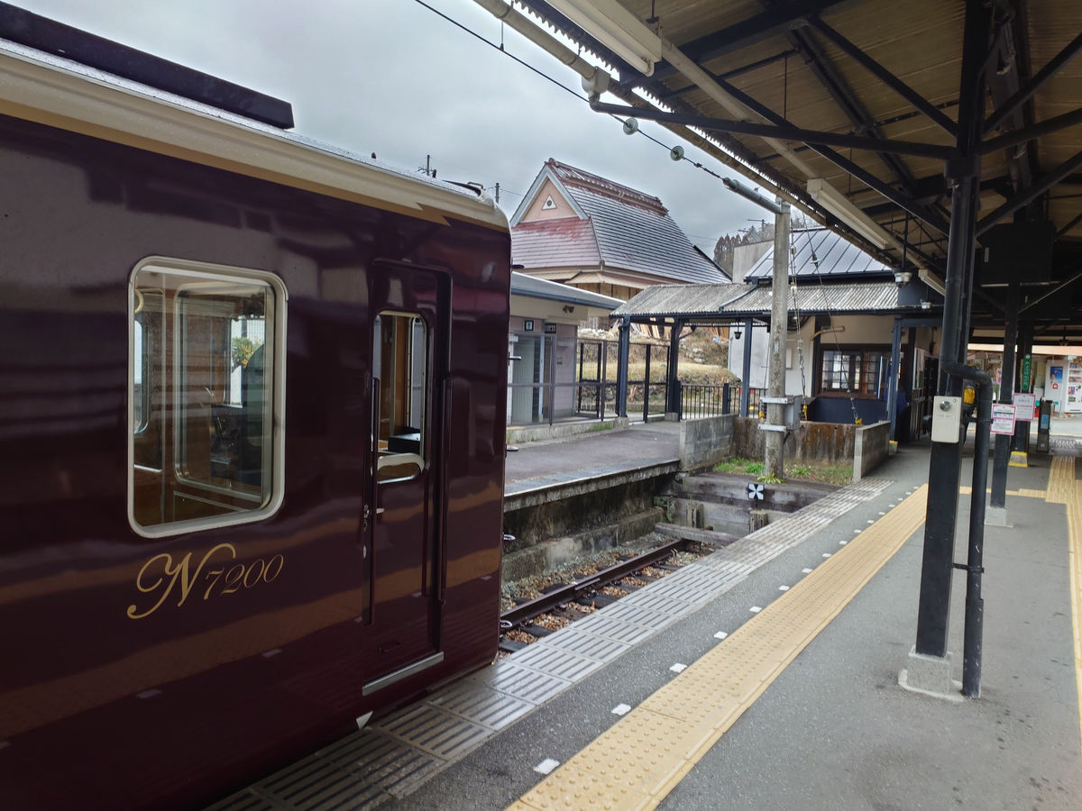
I could have waited on the bench at Kofudai Station, but it was raining so I decided to take the Nose Electric Railway to Myokenguchi. It was only a 4-minute train ride.
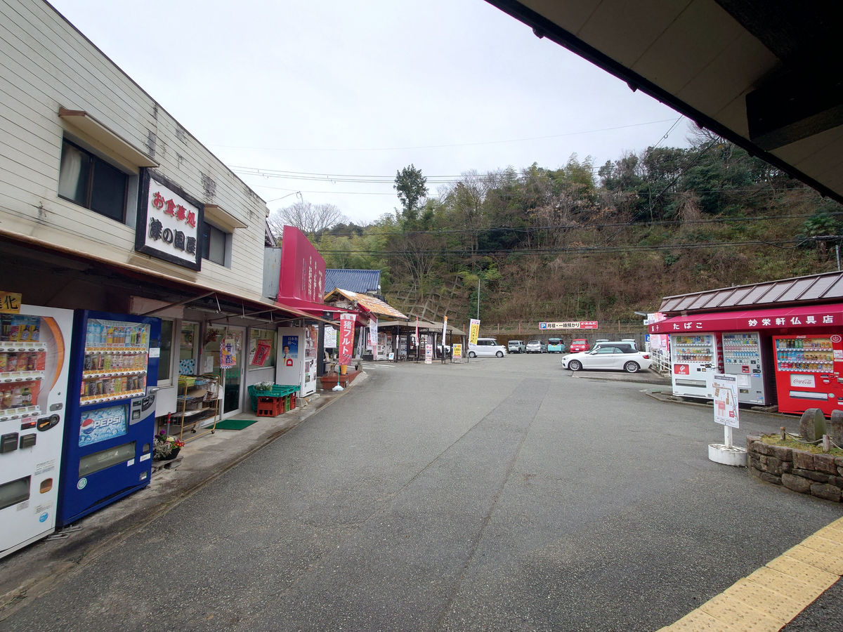
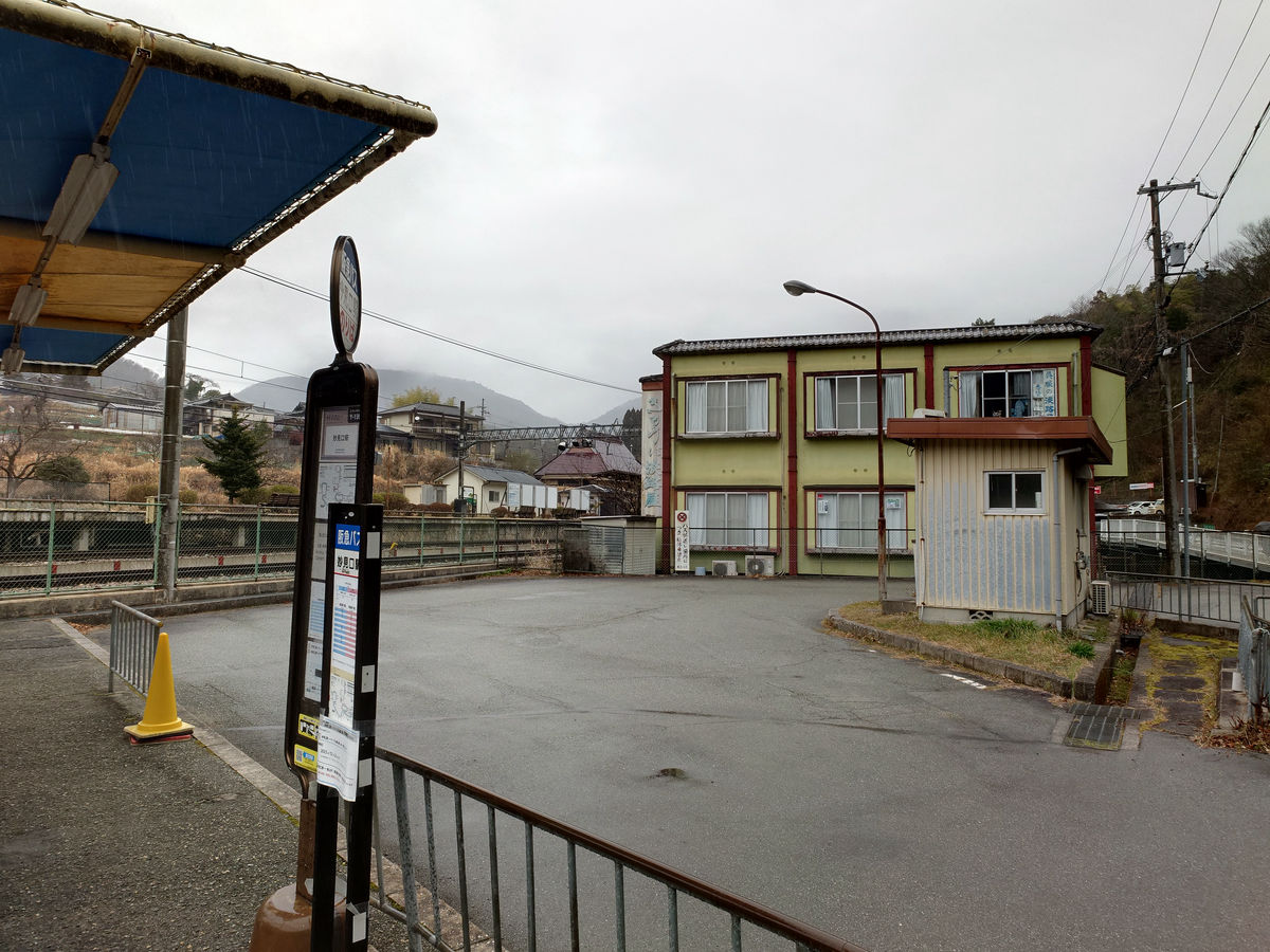
The station square at Myokenguchi.
There are two buses on weekdays from the Myokenguchi Station bus stop to the Minoh Morimachi Community Center.
The bus stop is around the east side from the ticket gate.
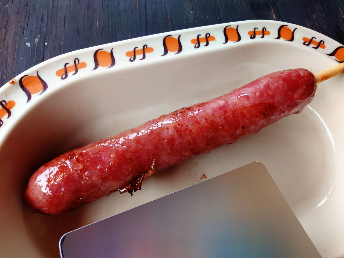
Since I wouldn't have a chance to eat or drink for a while after this, I decided to stop by Kametani in front of the station.
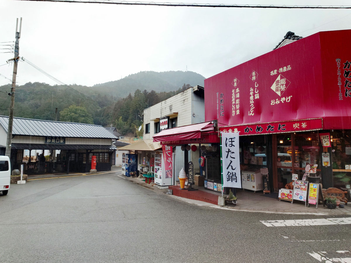
The specialty, 'Shishifrut' (400 yen including tax), is bigger than an IC card, packed with meat and has a rich flavor. It gives you a sense of energy.
From Kofudai Station to Senri Chuo
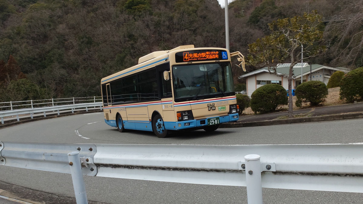
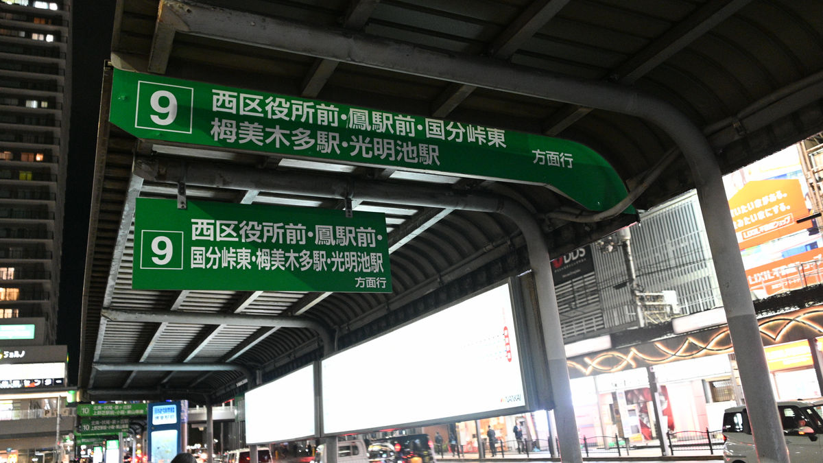
After filling our stomachs, we head back to Kofudai and board the 13:52 bus from No. 9 bound for Senri Chuo.
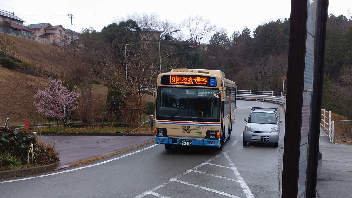
Several people got on at the 'Kofudai Station' bus stop, and several more got on after that, but all got off between Kofudai and Higashikeyakidai. Meanwhile, just under 10 people got on at 'Higashikeyakidai 9-chome' and headed for 'Senri Chuo'.
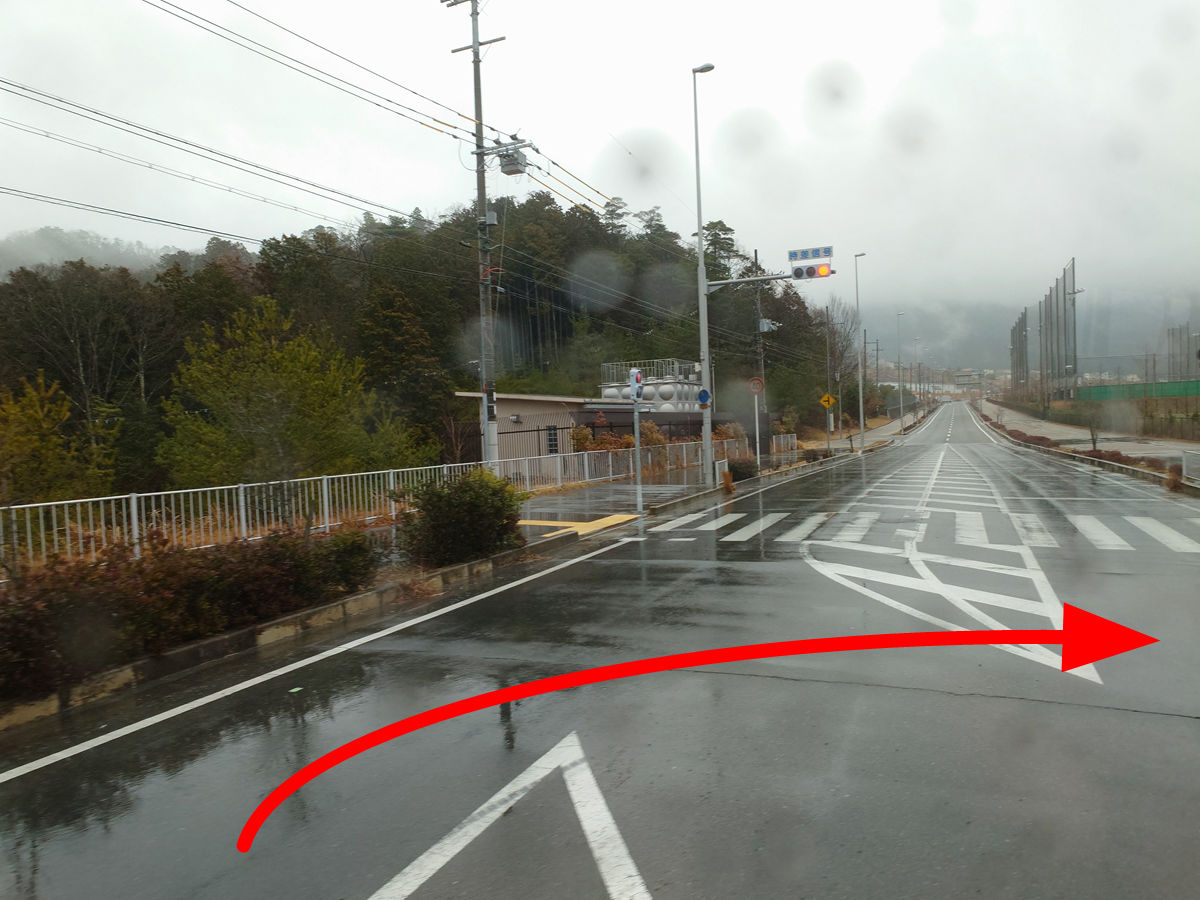
I entered Minoh City from Toyono Town on Prefectural Route 116, Toyono Ikeda Line. There was a traffic light on the way, and if I went straight I would have reached the center of Minoh Morimachi, but Route 9 turned right and skipped the Minoh Morimachi District Center.
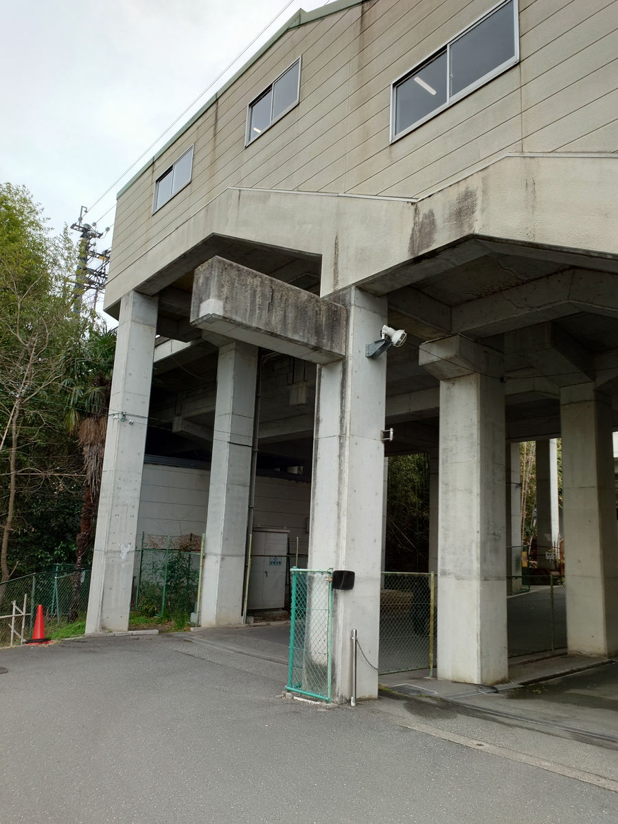
The bus passes next to the Minoh Todoromi IC on the Shin-Meishin Expressway and enters the Minoh Toll Road.
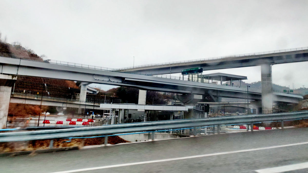
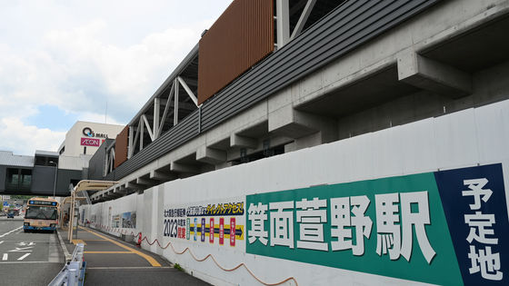
We passed through the tunnel of the Minoh Toll Road, passed by the unopened Minoh Kayano Station, and headed towards Senri Chuo. The gray box-shaped building in the center of the photo is an auxiliary facility for
When the extension opens, a bus terminal will be set up in front of Minoh Kayano Station, and the routes will be reorganized. The 9 route I was on will also run between Minoh Kayano Station and Kofudai Station, so I'll need to transfer if I want to go to Senri Chuo Station. I think it was a good idea to start my trip before the extension to Minoh Kayano Station opens.
[From Saturday, March 23, 2024] Changes to operation due to the extension of the Kita-Osaka Kyuko Line | Hankyu Bus
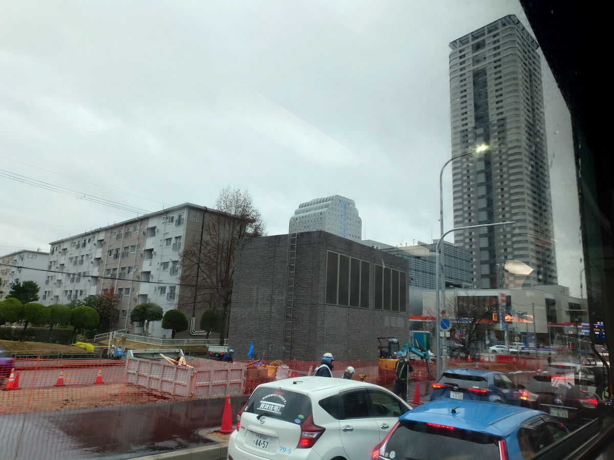
The bus arrived at Senri Chuo in about 40 minutes from Kofudai Station. The fare is 680 yen, the same as if you transfered at Minoo Morimachi District Center. There are no photos at Senri Chuo because it was hectic.
From Senri Chuo to Toyonaka, enter Osaka city
'Senri Chuo' is a major bus terminal in Hokusetsu, and you can go in various directions, such as Minoh on the Hankyu Minoh Line, Ishibashi-Handaimae, Toyonaka, and Sone on the Hankyu Takarazuka Line, Momoyamadai on the Kita-Osaka Kyuko Line, and Suita, Kishibe, and Ibaraki on the JR Kyoto Line. This time, I decided to head towards Toyonaka.
Between Senri Chuo and Toyonaka, there are four main routes: via Higashi Toyonaka, via Uenozaka 1-chome, via Nishi Midorigaoka, and via Kita Midorigaoka. The total time is about 40 minutes via Kita Midorigaoka, and about 30 minutes for the other three routes. The fare is 230 yen for all routes.
Arrive at Hankyu Toyonaka Station and get off on the south side of the station.
Go to the bus stop on the north side of the station. From there, board the No. 50 bus bound for Shin-Osaka.
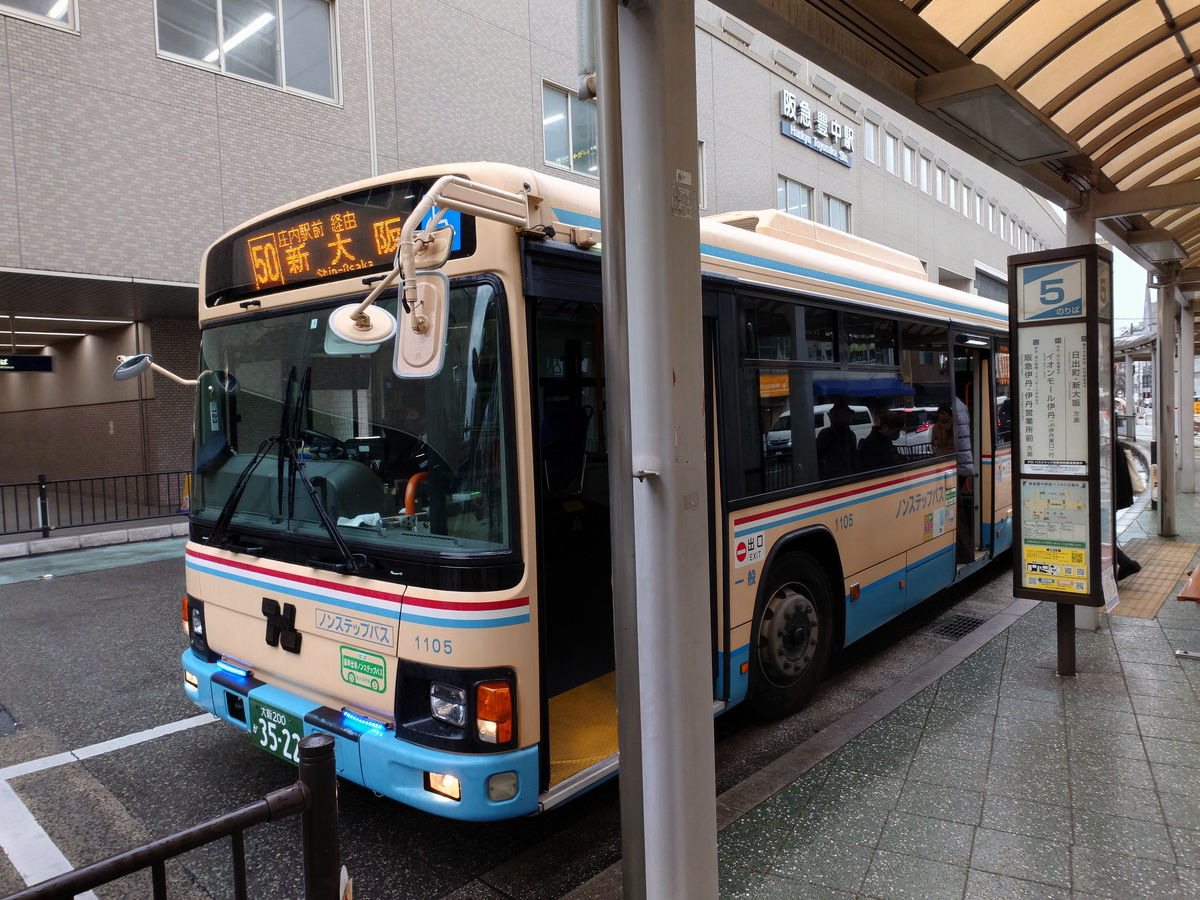
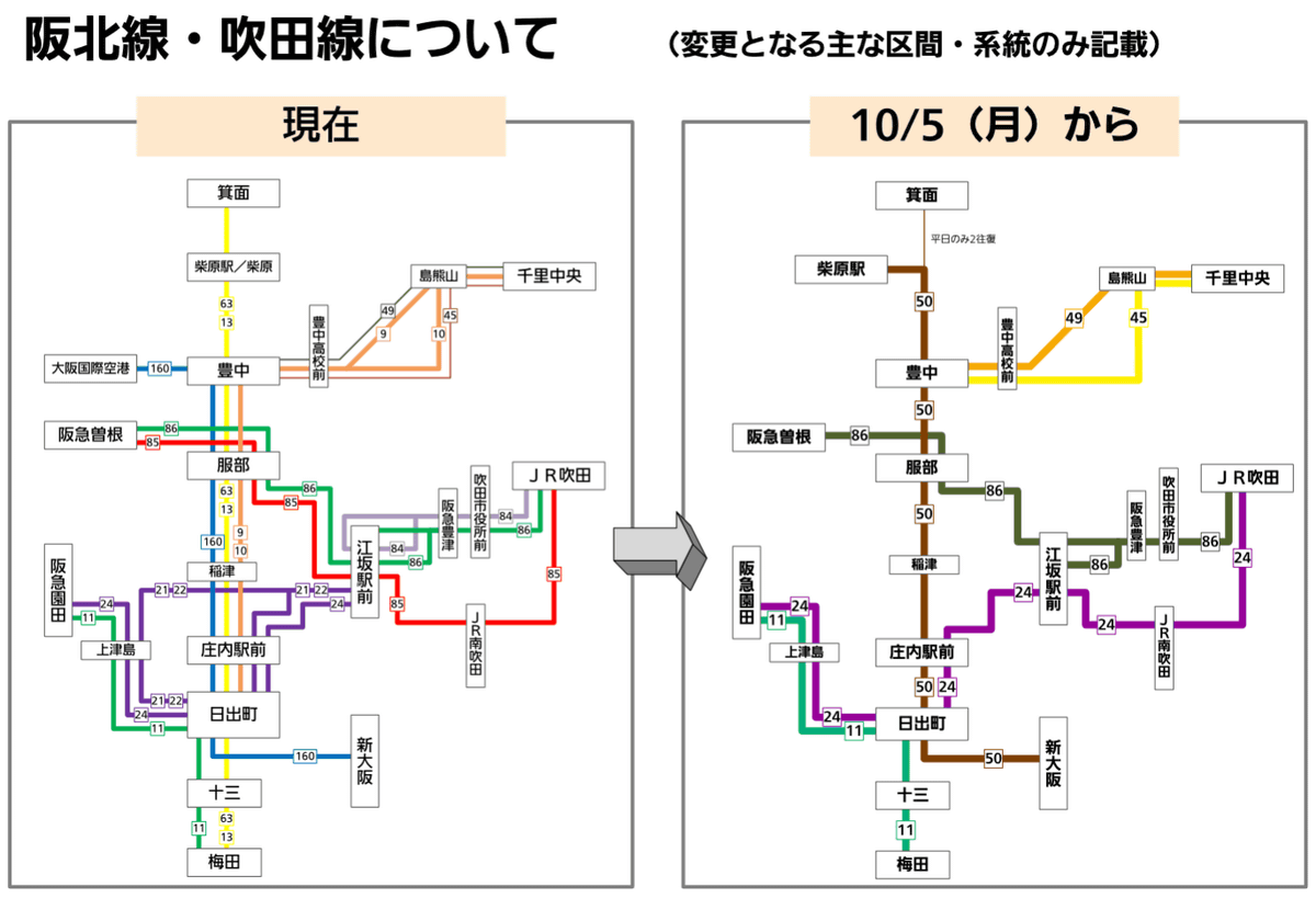
This line connects Osaka Monorail Shibahara-Handaimae Station and Shin-Osaka, with 12 round trips per day, one in the morning departing from Hankyu Minoh Station and one in the evening bound for Hankyu Minoh Station. This line is a shortened and integrated version of the Umeda-Juso-Hinodemachi-Shonai Ekimae-Hattori-Toyonaka-Shibahara-Minoh line, which existed before the reorganization on October 5, 2020, and the Shin-Osaka-Juso-Hinodemachi-Shonai Ekimae-Hattori-Toyonaka-Osaka International Airport line. The one round trip per day between Hankyu Minoh Station and Shibahara-Handaimae Station is scheduled to be discontinued with the reorganization on March 23, 2024.
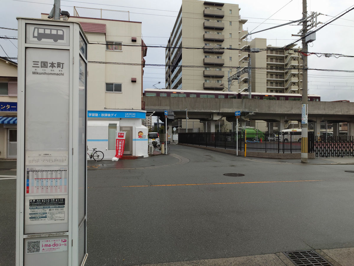
Route 50 does not go all the way to Shin-Osaka, so I got off at Mikuni Honmachi, which is under the Hankyu Takarazuka Line. The fare is 250 yen. In the back of the photo, next to the bus is the Hankyu bus stop, and in the foreground is the Osaka City Bus stop, where I transferred to the Osaka City Bus.
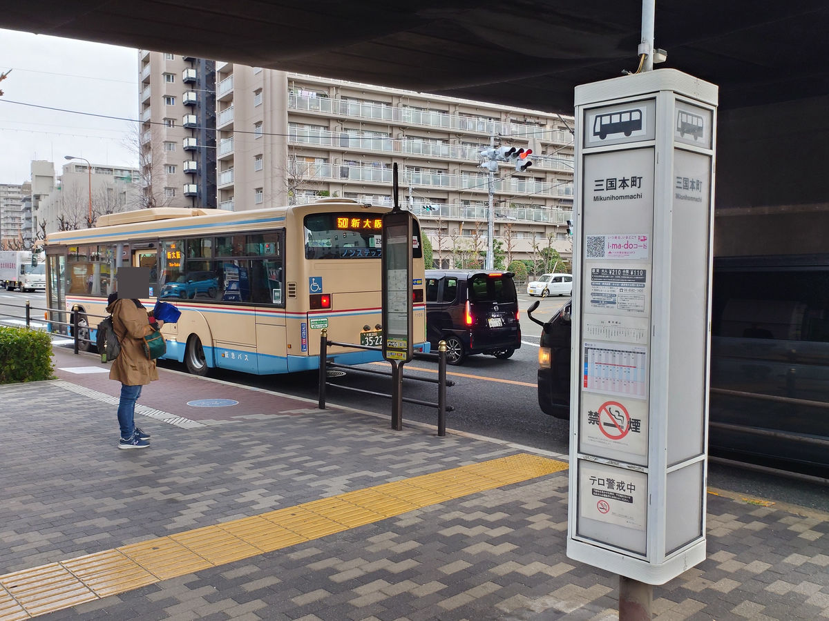
However, there are two Osaka City Bus routes that depart and arrive at Mikuni Honmachi: route 39 (Shin-Osaka Station North Exit to Noda-Hanshin-Mae) and route 69 (Enokibashi to Osaka Station), and the bus stops are in different locations. Since I want to board route 69 to Osaka Station next, I move to the bus stop on the east side of the elevated track.
I managed to transfer to the Osaka City Bus with plenty of time to spare.
◆From Osaka City to Sakai City
The 'Osaka Ekimae' bus stop is also a bus terminal with difficult transfer times. The 69 line arrives at stop E on the north side of Osaka Station, adjacent to the express bus terminal, which is particularly far from the other stops. You cannot transfer in a very short time.
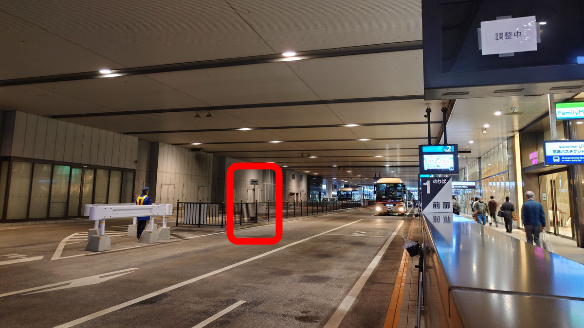
A diagram of the Osaka City Bus stop at 'Osaka Station.' There are 12 bus stops and 5 drop-off points. I moved to stop 1 to catch the next bus.
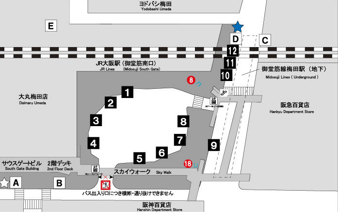
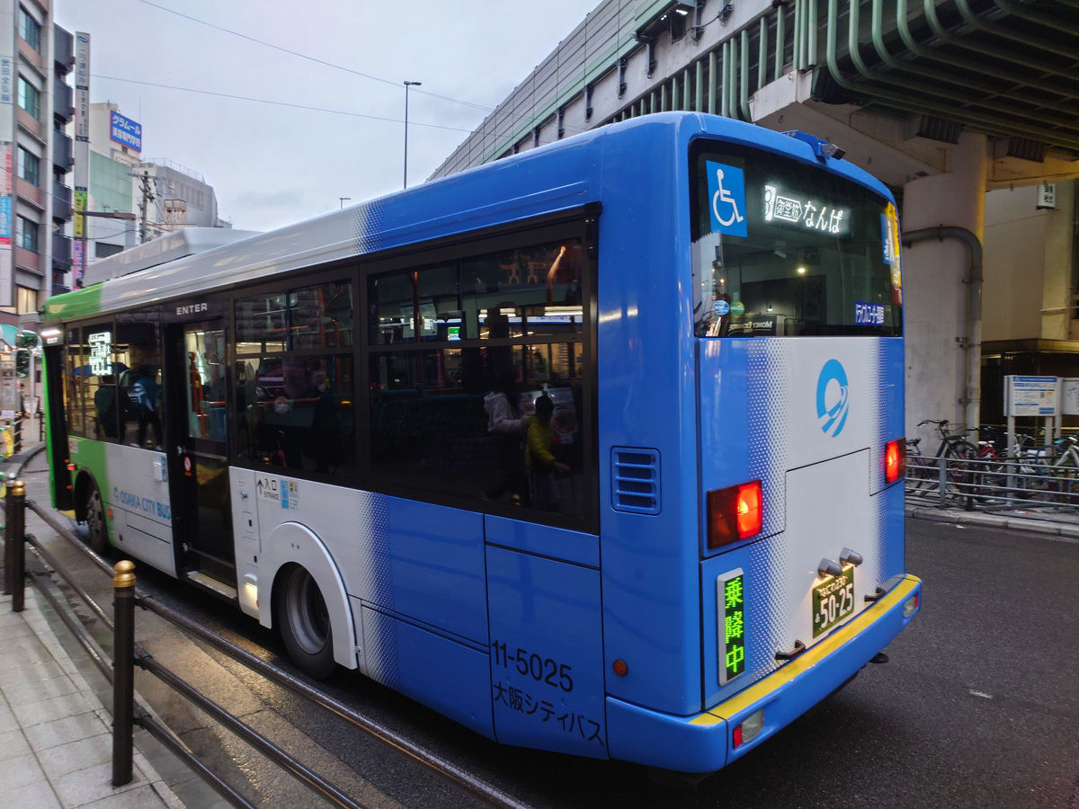
From platform 1, take bus number 8 to Namba. This route runs along Midosuji, the main artery of Osaka city, but because it overlaps completely with the Midosuji subway line, the frequency is modest, with only one or two buses per hour.
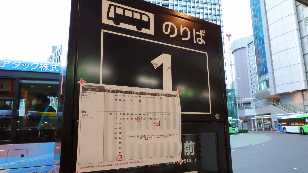
The No. 8 bus bound for Namba arrived right on time, departing at 16:43 as scheduled.
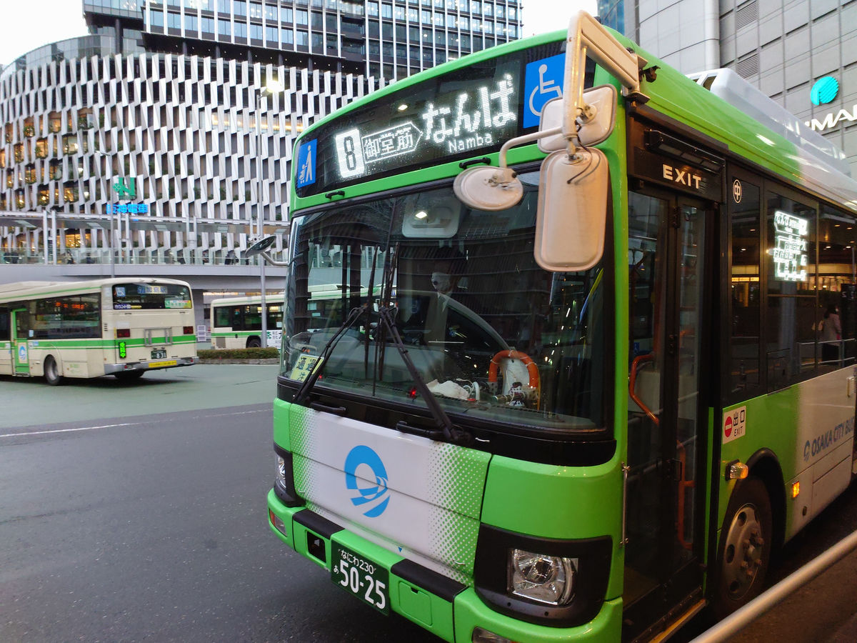
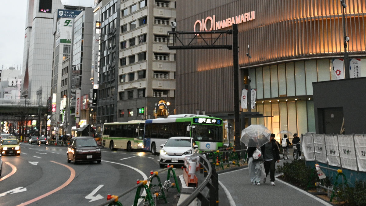
On the way, I caught a glimpse of Minami-Mido (Namba Betsuin) from the train window, which is where Midosuji got its name. The Osaka Excel Hotel Tokyu, which stands on the Midosuji side, looks like a gate.
Midosuji is a wide road with five lanes in the middle and one lane on each side, but buses that run on the side roads to stop at bus stops are plagued by cars parked on the road. The bus I took this time was also about five minutes late arriving at 'Namba'. The fare was 0 yen thanks to the transfer discount.
Construction is currently underway on Osaka City Bus's Namba bus stop, which will have seven bus stops (two of which are shared) and two drop-off points.
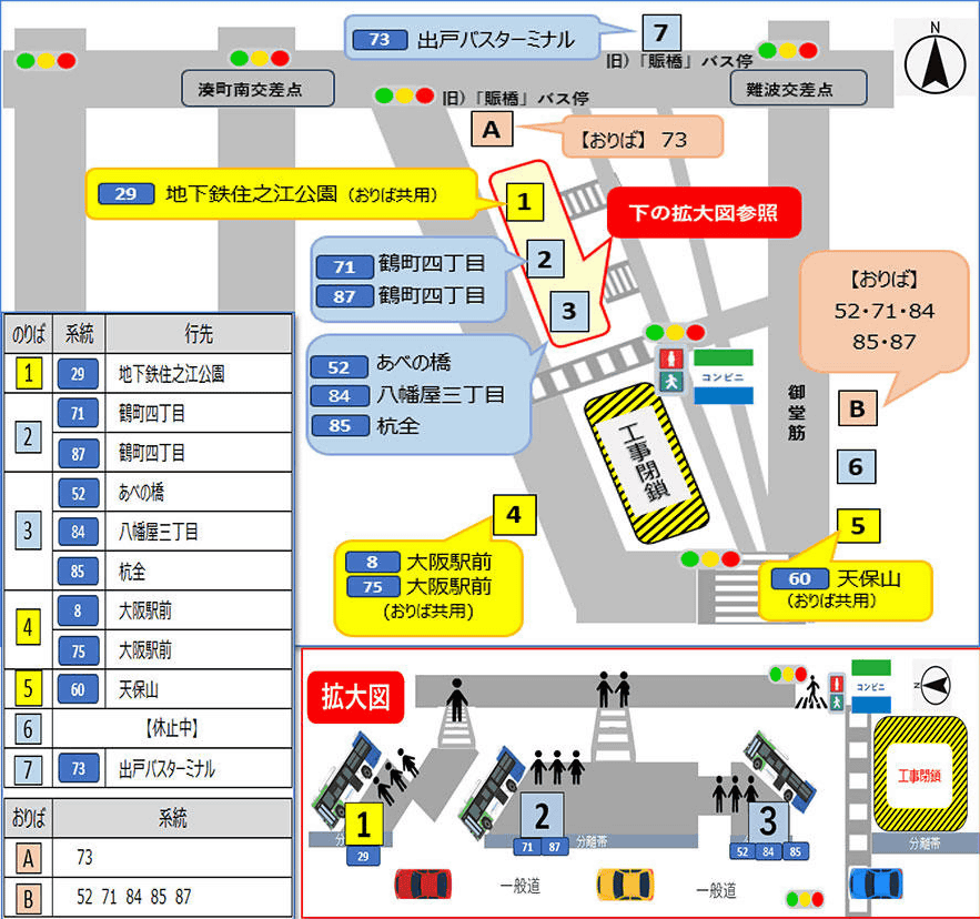
For a moment, I lost time as I headed towards platforms 5 and 6.
I quickly turned around and headed to platform 1, the northernmost platform under the Hanshin Expressway. This is a blurry photo I took when I saw the bus. There were a lot of passengers, so I made it just in time. I got on the 29th bus bound for 'Subway Suminoe Park' and it departed at 5:17pm.
Prefectural Route 29/Osaka Waterfront Line (Shin-Naniwa-suji) has a lot of southbound traffic, causing some congestion.
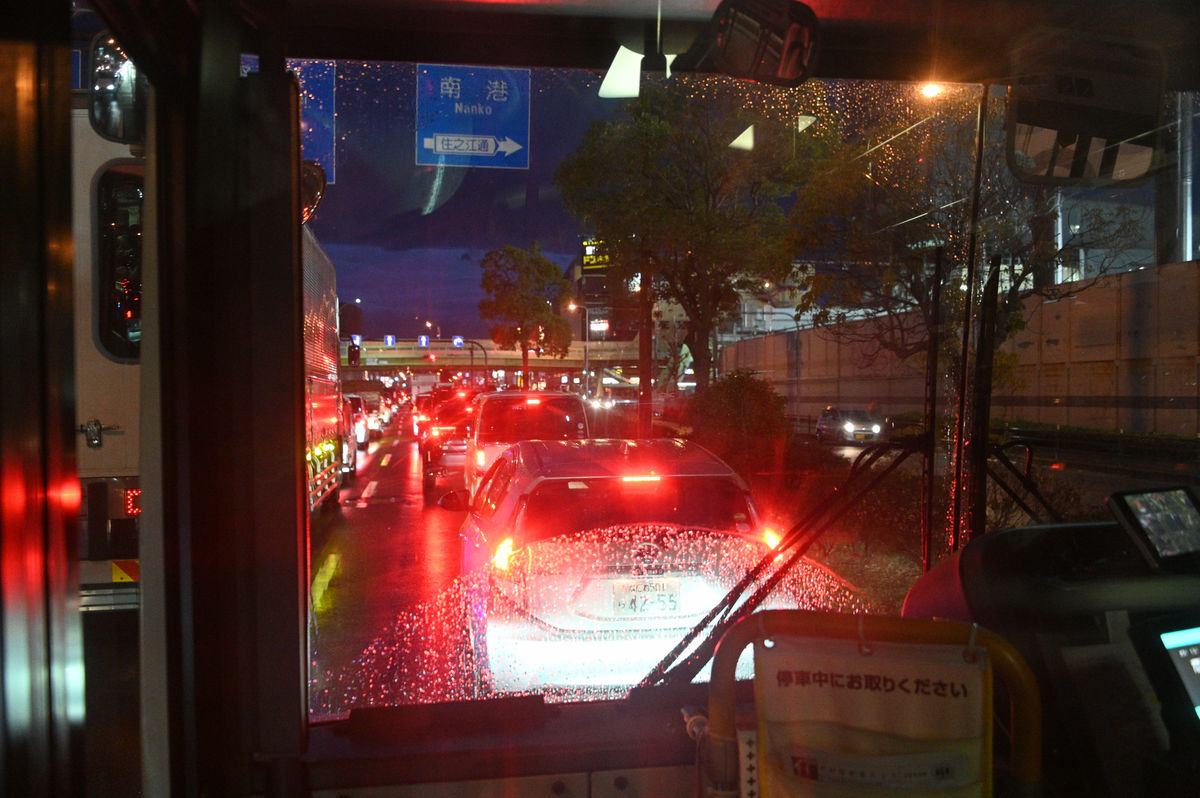
Even so, we arrived at the final stop, 'Subway Suminoe Park' bus stop, just 6 minutes late, at 18:03. The fare was 210 yen.
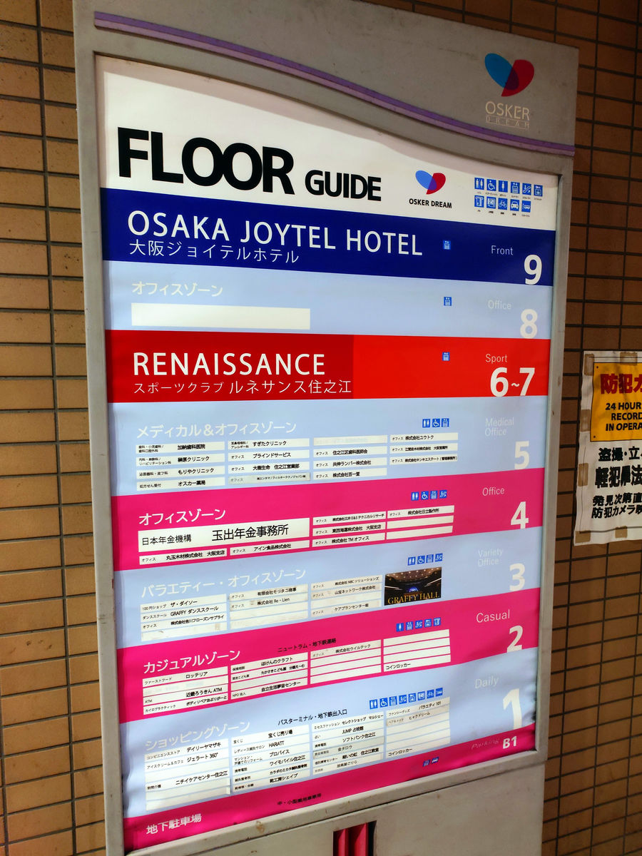
The Suminoe Park Subway Bus Terminal is located on the first floor of the
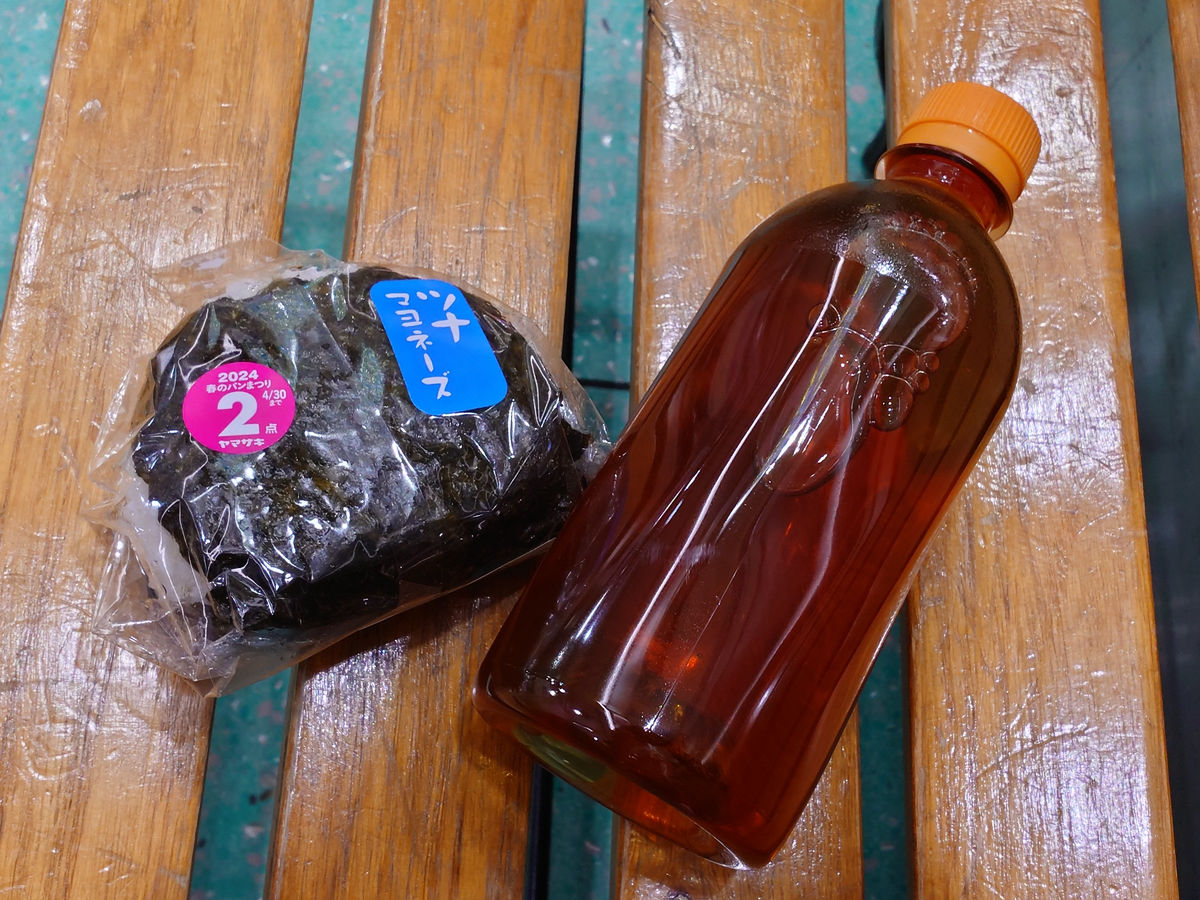
The next departure is at 6:23 p.m. It's about time for dinner, but we don't have much time to go into a coffee shop or fast food restaurant, so we quickly get something to eat at the Daily Yamazaki that we could see from the bus stop.
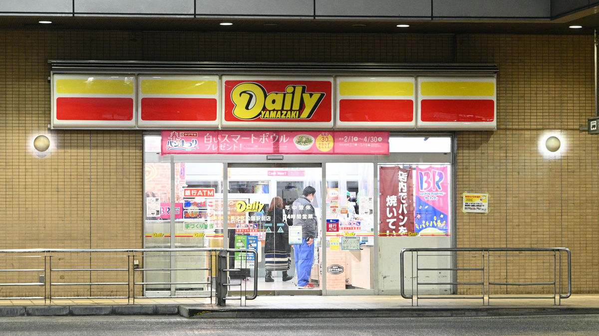
You can quickly finish your meal on a bench.
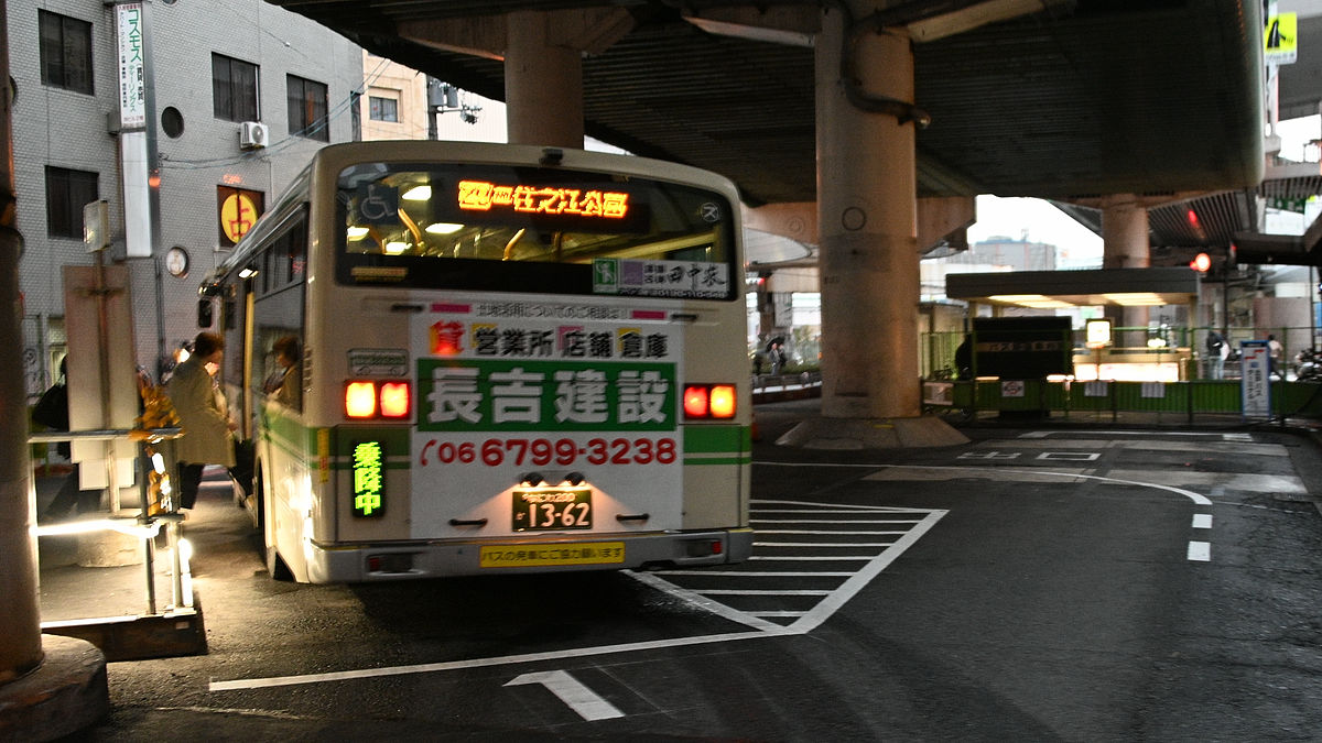
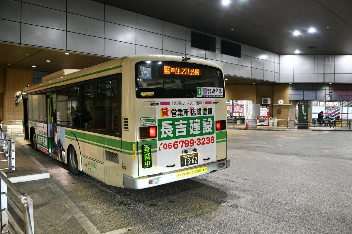
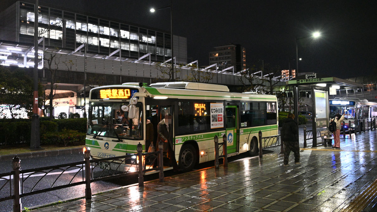
Next, I took the 89 bus bound for Sakai Station West Exit, and finally left Osaka City and entered Sakai City. Osaka City Buses do not cross city borders in the north or west, but they do cross the borders of Moriguchi City, Kadoma City, and Higashiosaka City to the east, and Sakai City and Matsubara City to the south.
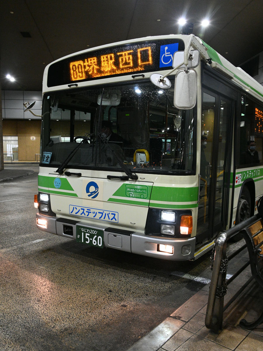
We arrived at the west exit of Sakai Station at 6:45 p.m., about two minutes late, with the rain making it almost impossible to see through the windows. The fare was 0 yen thanks to the transfer discount.
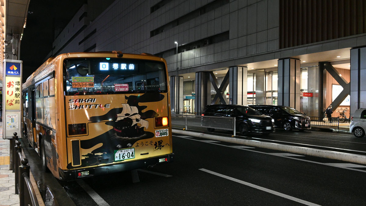
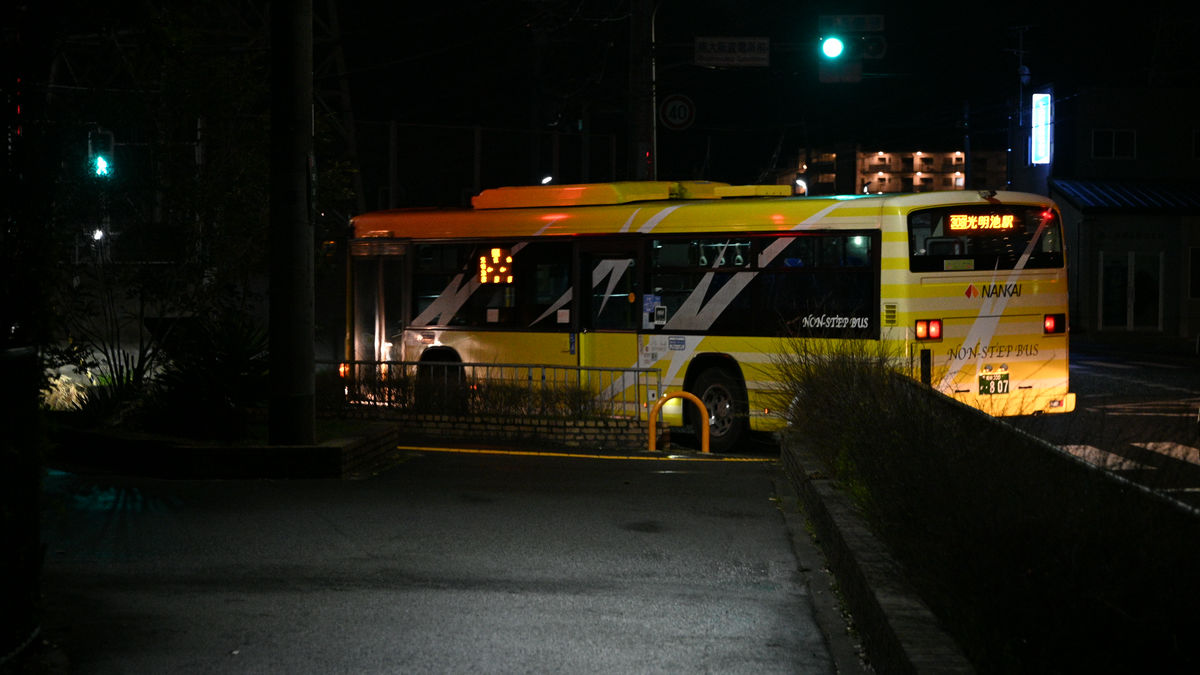
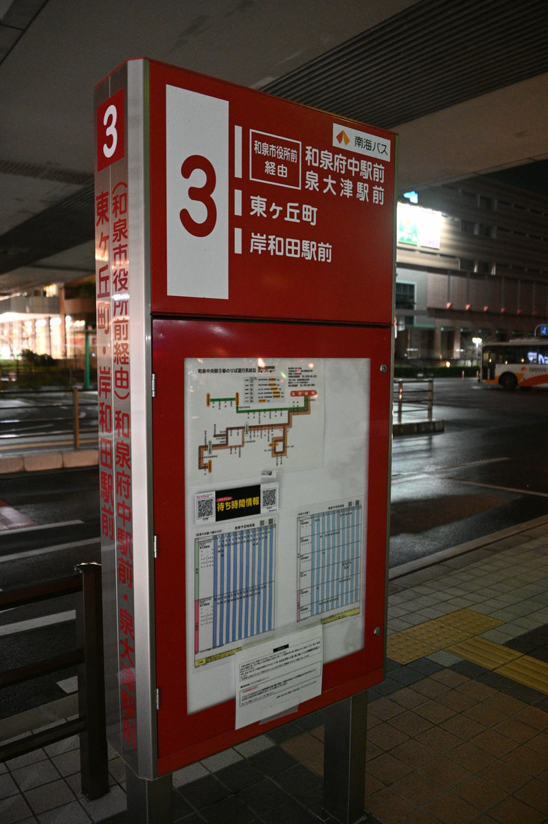
I quickly headed to the east exit of the station and got on the Nankai Bus Route 0 bound for Sakai Higashi Ekimae. This bus is nicknamed the Sakai Shuttle Bus, and it takes about 10 minutes to get from Sakai Station on the Nankai Main Line to Sakai Higashi Station on the Nankai Koya Line.
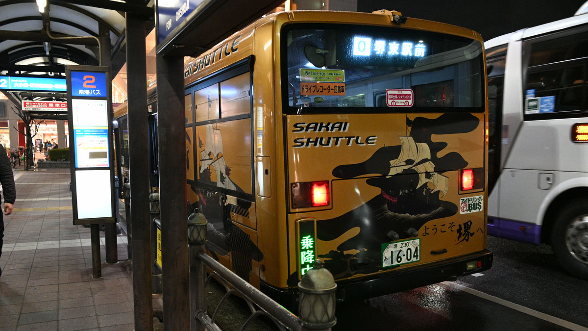
As this was a bus connecting major stations, there were a lot of passengers, and people got on and off at every stop along the way, and the bus stopped at almost every traffic light, but it arrived in front of Sakai Higashi Station at 7:03 p.m., only 2 minutes late. The fare was 220 yen.
◆ I want to somehow get through Sakai City and head to Izumi City.
At Sakai Higashi Station, I headed towards Komyoike Station on the Senboku Rapid Railway from platform 9. The previous bus had left just one minute earlier, at 7:02 p.m., so if I had gotten off the Sakai Shuttle Bus one stop earlier in front of Sakai City Hall and kept going, I might have been able to make it, but I ended up just missing it at the last minute, which was probably the most frustrating scenario.
As you can probably tell from the darkness of the photo, it would have been impossible to travel from the northernmost bus stop in Osaka Prefecture to the southernmost bus stop in one day unless I had chosen to take a train or taxi instead of a bus along the way. The next problem was how far I should travel on the first day to somehow reach my goal.
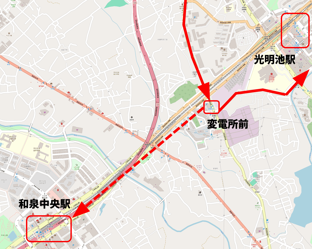
If I had been able to catch the 7:02pm bus mentioned earlier, I would have been able to transfer to a bus that went further from the final stop, Komyoike Station, but since I wasn't able to catch it, my final destination on the first day was Komyoike Station.
However, considering the route I would be taking the next day, stopping at Komyoike Station would be a little disadvantageous, so I decided to get off at the bus stop just before Komyoike Station, called 'Subdensho-mae,' and walk to Izumi Chuo Station. Here's how the location is shown on OpenStreetMap. The solid line shows the bus route, and the dotted line shows a possible walking route.
It was a bit disappointing because I'd basically taken the bus wherever I could, but even on my 'Local Bus Transfer Journey' I'd walk when the schedule didn't match, so I decided to follow my predecessors and be happy with it.
Once again, I boarded the Nankai Bus 308 bound for Komyoike Station, which departed from Sakai Higashi Station at 7:32 p.m. It was getting dark, so I was unable to take a photo of the bus.
After passing through Otori Station on the JR Hanwa Line and other stops, the bus arrived at the 'Substation Front' bus stop at 8:24 p.m. The fare was 550 yen. The bus sped off towards its final destination, Komyoike Station.
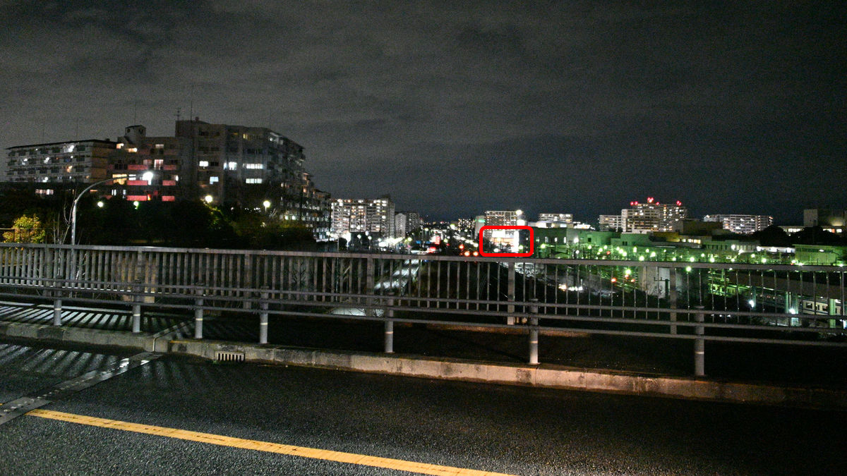
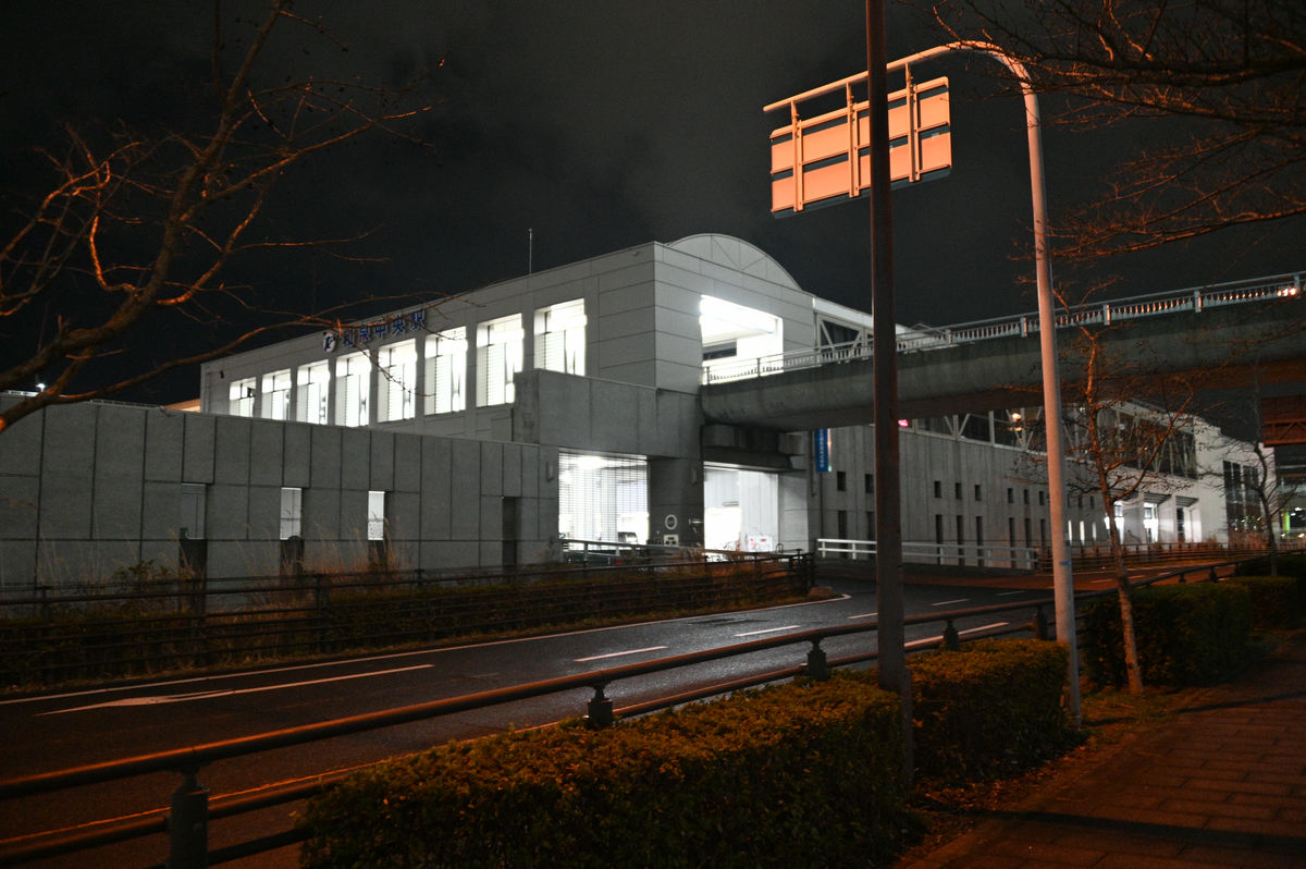
Looking northeast toward Komyoike Station from the overpass over the Semboku Rapid Railway on Prefectural Route 216. The supermarket Sunpia on the east side of the station is visible in the red frame.
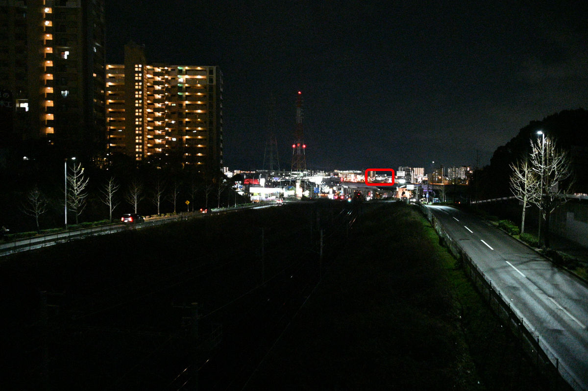
Looking southwest from the same position toward Izumi-Chuo Station. The lights of the Izumi-Chuo Station bridge building are visible in the red frame.
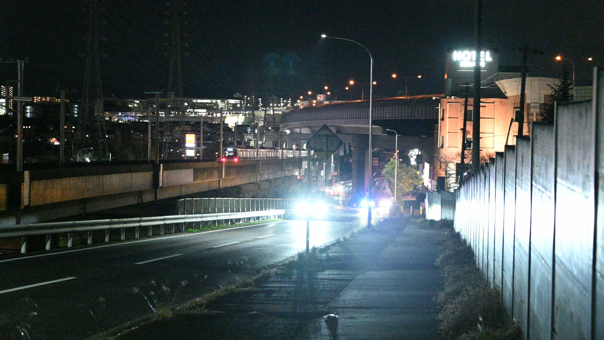
I prepared myself and walked along Prefectural Route 38, Tondabayashi Izumiotsu Line (Senboku Route 1). There were few streetlights, but the traffic was heavy so it didn't feel completely dark. On the way, a train bound for Izumichuo passed by. The large road that runs above the Senboku Expressway is the Hanwa Expressway.
Izumi Chuo Station is a 20-minute walk from the 'Substation Mae' bus stop.
I was heading towards Kishiwada, but when I checked the bus stop just to be sure, the last bus to Kishiwada had left more than 15 minutes ago. So that was the end of my itinerary for Day 1.
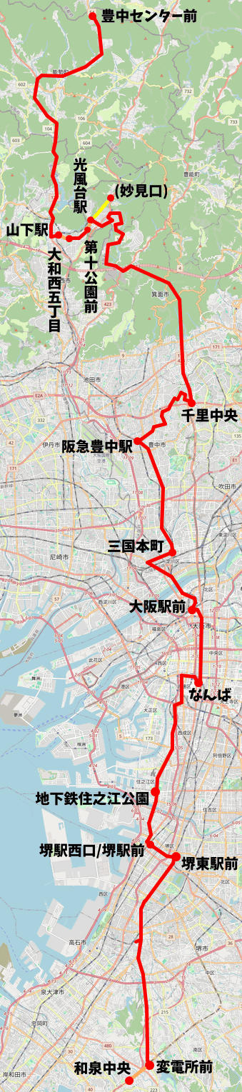
The map below shows the itinerary for the first day, using OpenStreetMap. The red circles indicate the bus stops where I got on and off, the red lines indicate the bus ride areas, and the orange lines indicate the walking areas. As a bonus, I've also included the round trip to Myokenguchi. The bus fare was 3,280 yen in total.
On the second day, we return to Izumi Chuo Station and head for Misaki Town.
Continued
Notes
・Hankyu Bus Route 9, which previously connected Kofudai Station and Senri Chuo , will operate between Kofudai Station and Minoh Kayano Station from March 22, 2024.
Related Posts: