How to create a 3D map of an area where you can't fly a drone with a GoPro attached to a bicycle helmet
Drones can be used to shoot buildings and towns from the sky and create 3D maps using software, but flying drones may be prohibited depending on the location. Therefore, software engineer Jake Coppinger explains how to create a 3D map without using a drone, using only a 360 degree camera attached to a bicycle helmet.
Creating aerial imagery with a bike helmet camera (GoPro) and OpenDroneMap - Jake Coppinger
Drones are great for surveying and mapping streets, and OpenDroneMap , an open-source software that processes drone images and generates 3D models, makes it easy to create 3D models of cities and buildings. . However, there are places where flying drones is prohibited for reasons such as safety, and in such places it is not possible to take drone photos used to generate 3D models.
However, OpenDroneMap usually uses geotagged drone image sets, but in fact, even if it is not an image taken by a drone, it is possible to generate a 3D model if it is geotagged. Therefore, Mr. Coppinger tried to generate a 3D model by `` taking a geotagged omnidirectional image with a 360 degree camera attached to a bicycle helmet and processing the image with OpenDroneMap ''.
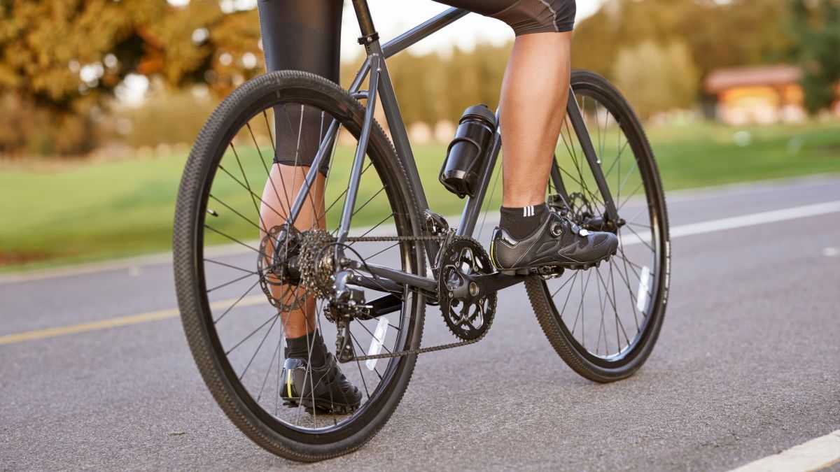
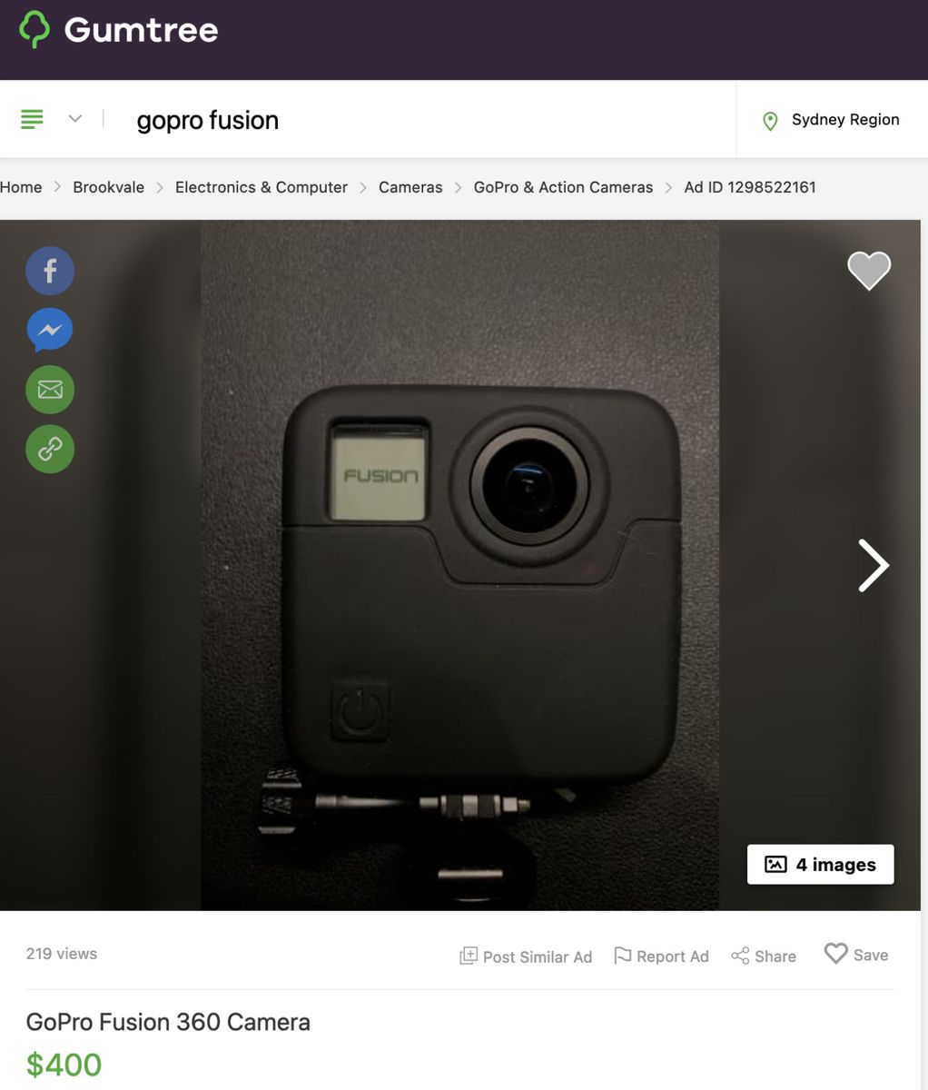
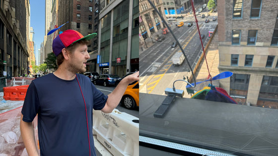
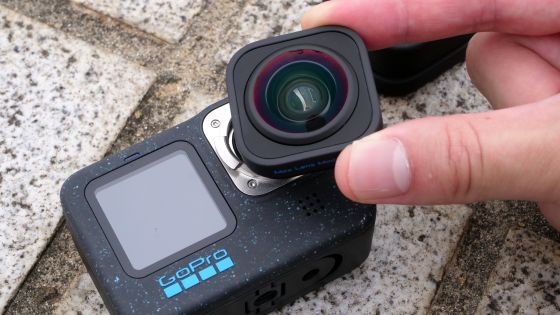
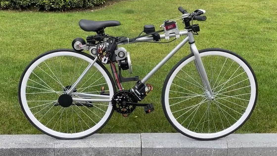
First, Mr. Coppinger purchased a second-hand GoPro Fusion that was sold for $ 400 (about 53,000 yen) and attached it to a bicycle helmet. Regarding the reason for using a bicycle instead of a car, Mr. Coppinger said, ``If you use a car, the roof will block your view. 'You can get more photos by riding in more places, such as roads, sidewalks, and bike lanes.' 'People who are interested in public spaces and urban development often like cycling.
When capturing images for processing in OpenDroneMap, GoPro Fusion sets the capture interval to '0.5 seconds' in time-lapse mode and enables GPS geotagging. Then attach the camera to your helmet, see the GPS icon light up, and run where you want to generate a 3D model.
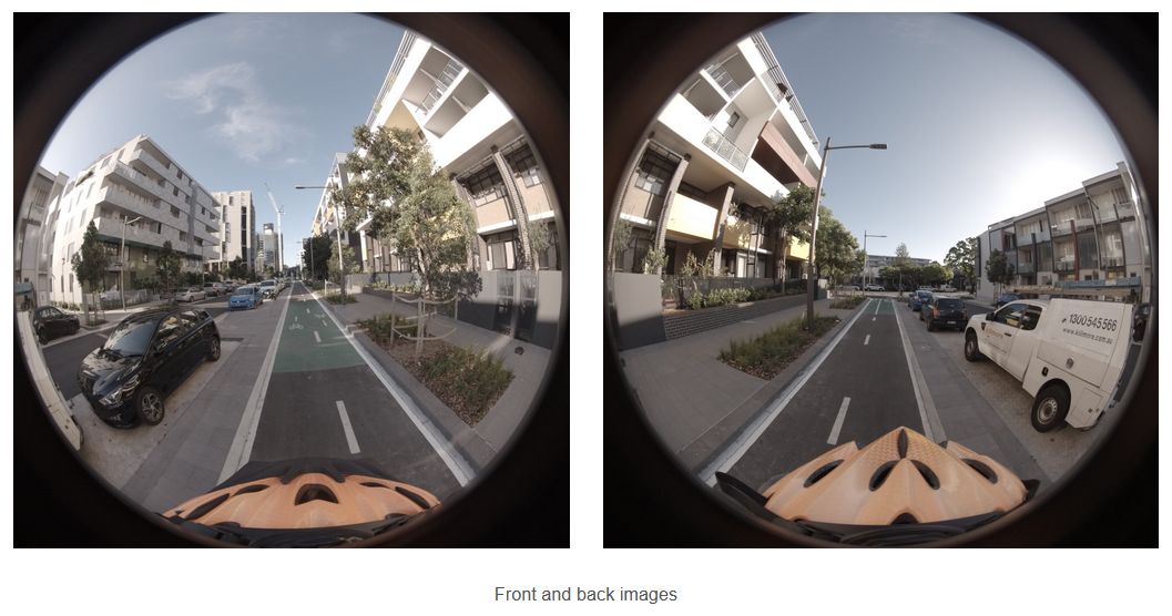
GoPro Fusion does not output one 360-degree image, but divides it into two 180-degree images and outputs it. Also, since only images taken in front are geotagged, once all the images have been moved to a folder on the computer, the exif data of the front image must also be copied to the rear image. Mr. Coppinger said that he created a dedicated terminal command for this work.
After image preprocessing, OpenDroneMap generates a 3D model, which requires significant computing resources. It takes several hours to several days to work on your own computer, so if you don't have enough resources, you should use
However, when uploading and processing images on WebODM Lightening, functions such as maps and 3D model viewers that can be viewed in a browser cannot be used. So Coppinger recommends setting up OpenDroneMap locally and adding WebODM Lightening as a processing node.
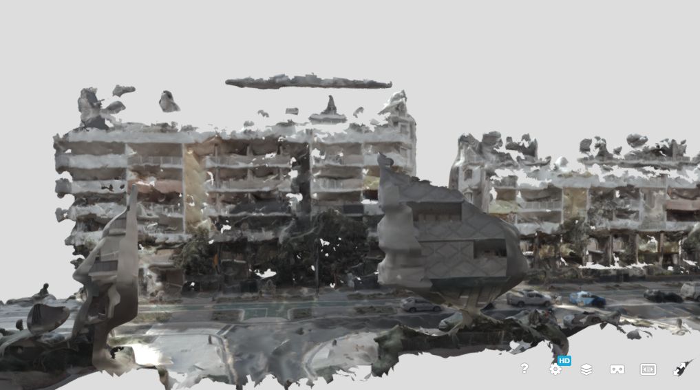
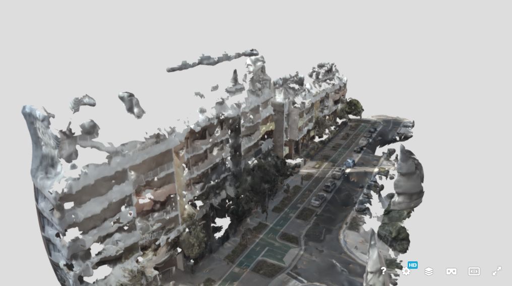
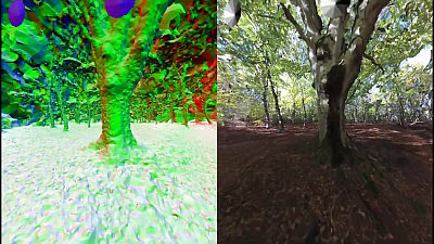
The 3D model actually created by Mr. Coppinger in this way is below.
The 3D model includes roads, buildings on the sides, cars, etc.
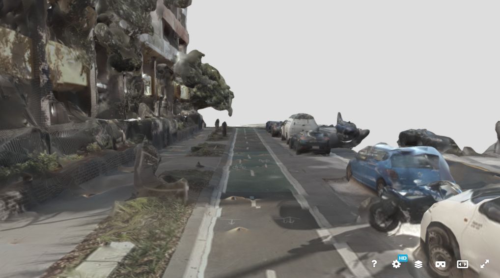
It looks like this when you change the angle.
Lines showing cars and bicycle lanes are also included in the 3D model.
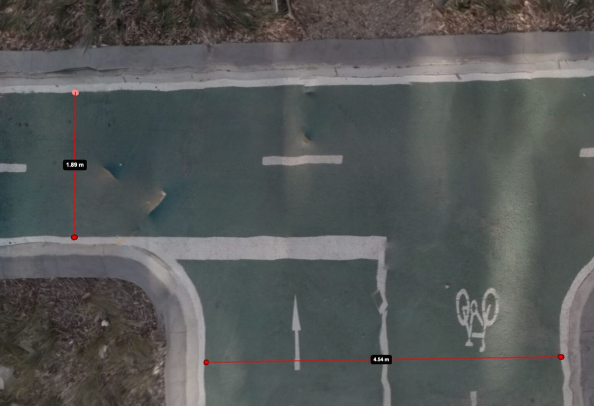
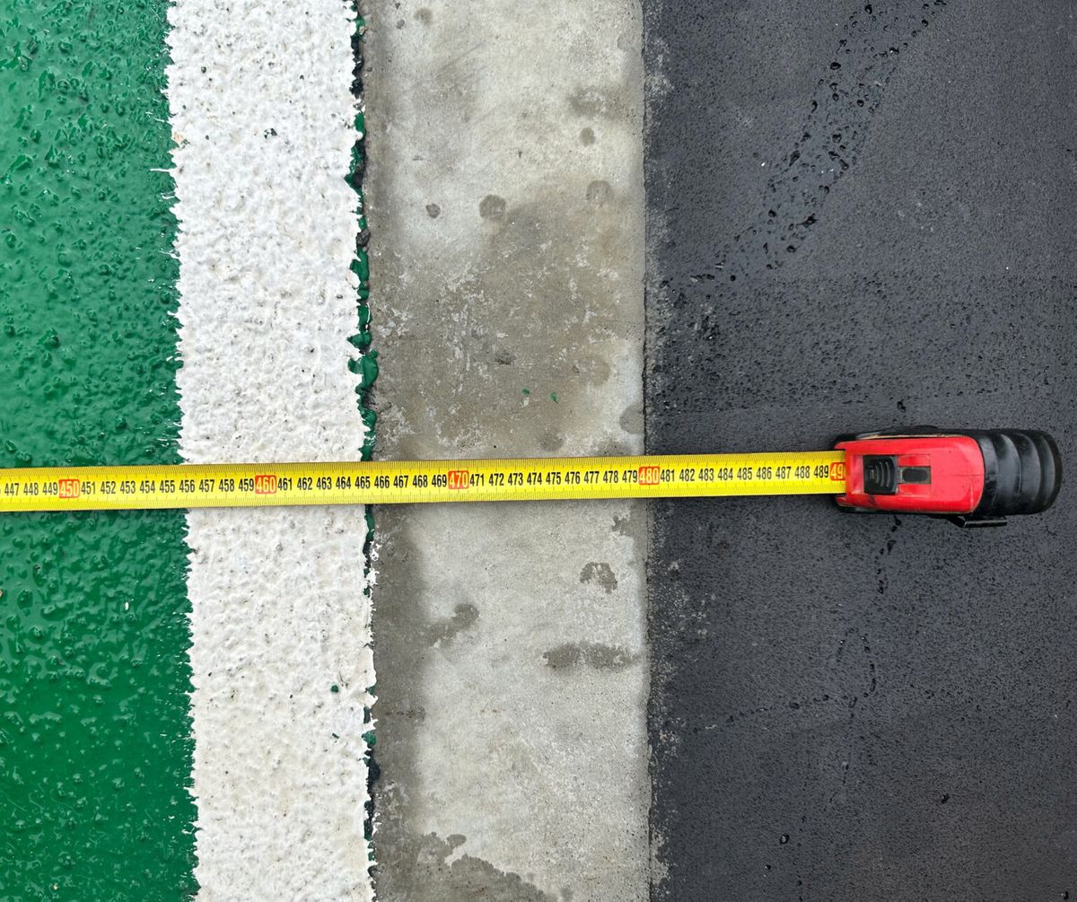
Coppinger also measures the measurement accuracy of the 3D model generated by OpenDroneMap and the error with the actual road. The measurement result on the 3D model is that the width of the narrow bicycle lane is 1.89m and the width of the wide bicycle lane is 4.54m.
When I measured the width of the real narrow bicycle lane, it was exactly the same as the 3D model at 1.89m. In addition, since the 3D model has distortion, there are places where it is not 1.89m depending on the measurement point.
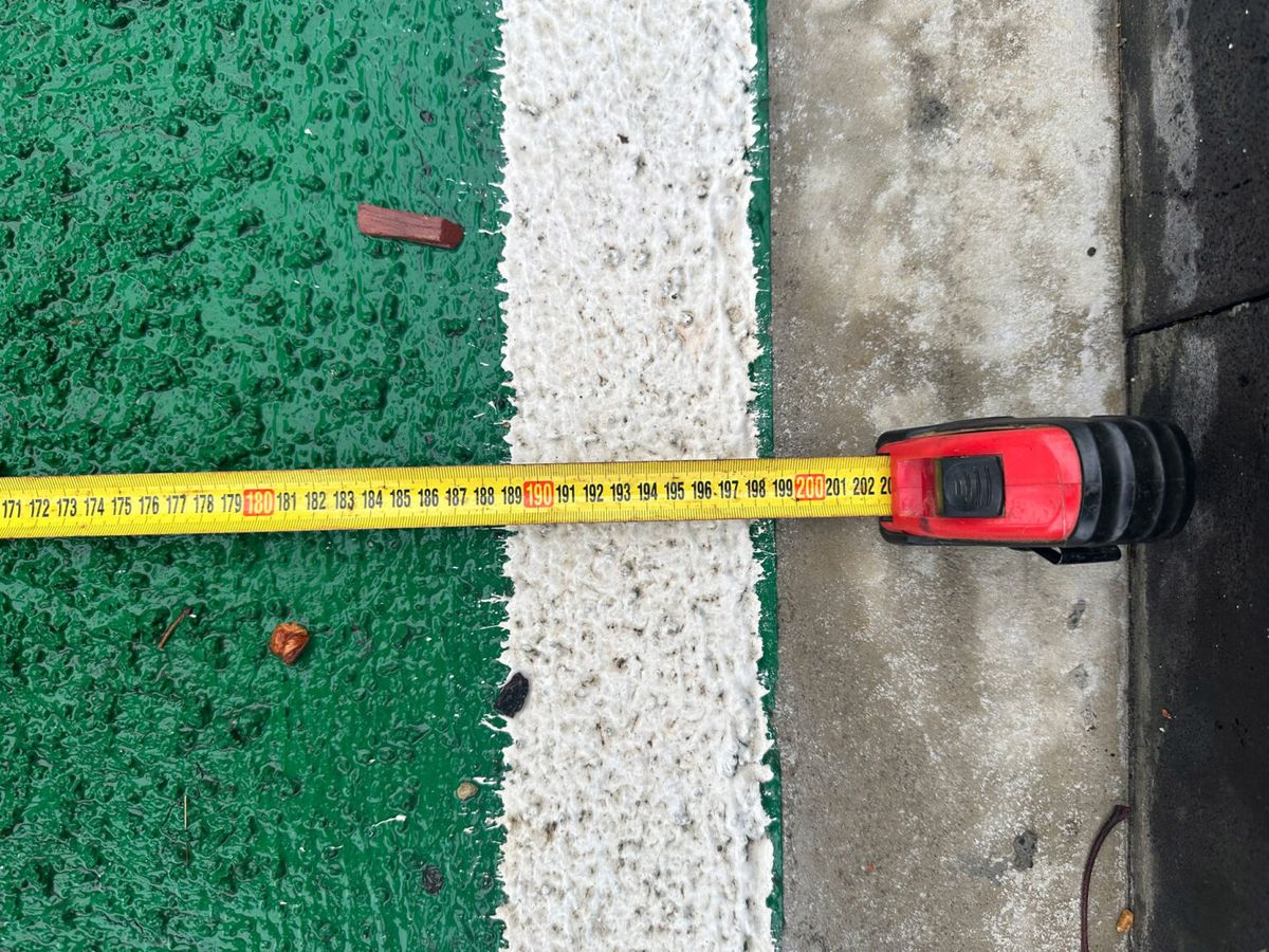
Also, the actual wide bicycle road is 4.56m wide, which is almost the same as the 3D model's 4.54m.
Related Posts:
in Hardware, Software, Web Service, Posted by log1h_ik