'Ukraine Interactive map' which is a map with the latest information of 'where and what is happening' in Ukraine

Since Russia started its invasion of Ukraine on February 24, 2022, the war situation throughout Ukraine has changed rapidly, and while lively local information is being transmitted on SNS in rapid succession, someone created it. There are many fake videos and hoaxes on the market. Using the service ' Ukraine Interactive map ' jointly created by Ukrainian software developers and journalists, from the easy-to-understand icons displayed on the map, news about what is happening in Ukraine is mainly posted on Twitter. You can browse with information.
Ukraine Interactive map --Ukraine Latest news on live map --liveuamap.com
Liveuamap-Google Play app
https://play.google.com/store/apps/details?id=com.altwork.liveuamap
Liveuamap on the App Store
https://apps.apple.com/us/app/liveuamap/id1003808504
The following is the access to 'Ukraine Interactive map'. Various icons are displayed on the map of Ukraine.

You can zoom in and out by operating the lower left button and the mouse wheel up and down. In the display on the map, the red area is the area occupied by the Russian army. The blue icon indicates the event of 'Ukrainian Government, NATO and other Western powers', and the red icon indicates the event of 'Russia, Russian militants, Belarus,

When I clicked on the red bomb icon, information that a Russian missile had landed around the TV tower in Kyiv (Kiev), the capital of Ukraine, was displayed with a photo.
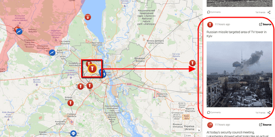
Click on the information ...

The photo is enlarged. You can also access the primary information by clicking Source.
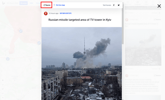
The following was actually accessed. You've seen tweets from your Twitter account that support local news media.
⚡️У Києві стріляли у телевежу
pic.twitter.com/rXzJM14QUA — Hromadske (@HromadskeUA) March 1, 2022
It is also possible to see where it happened on the map from the news. Information is arranged in chronological order in 'News Live', so if you click on the information that the Kharkiv Oblast State Building in Ukraine was damaged by a missile, the map moved to Kharkiv Oblast in the eastern part of Ukraine.
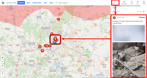
Clicking on the icon in the immediate vicinity displayed a video showing the moment the missile landed.
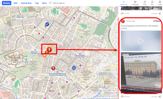
You can see past information from 'Time'.
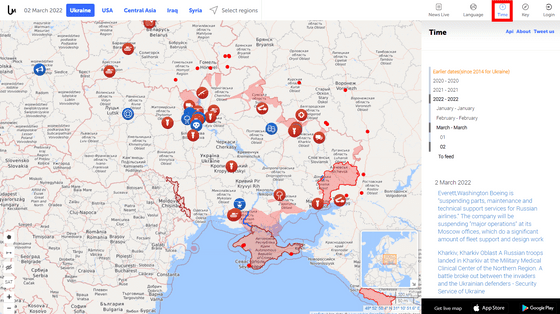
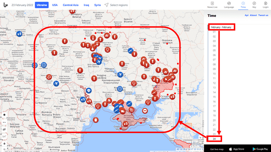
For example, if you choose February 24, when Russia started its invasion, you can see at a glance that Russia was initially invading from the southern part of Ukraine.
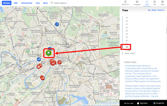
The 'Ukraine Interactive map' also contains trends outside Ukraine. For example, after switching the date to February 28, when I looked at Moscow, the capital of Russia, there was a fire icon.
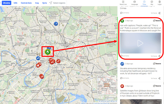
When I clicked on it, the news was displayed that a van with the slogans 'Wake up, people,' 'This is a war,' and 'Putin is a waste' collided with the fence of Moscow's Pushkin Square and burned. The green icon indicates the activities of 'paramilitary organizations and NGOs'.
You can also display only events in a specific category on the map. For example, select 'Rally, Protests, Demos, crowds' indicating demos from 'Key' ...
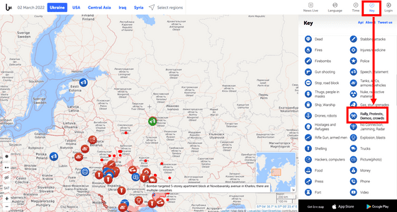
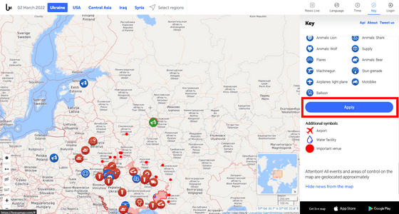
Scroll down and click Apply.
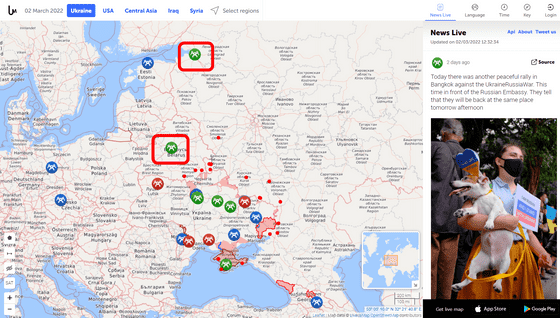
Then, it was found that anti-war demonstrations and protests were being carried out in St. Petersburg, Russia, and Belarus, which invaded Ukraine along with Russia.
'Ukraine Interactive map' may load the map slowly depending on the time of day. Liveuamap, which provides the 'Ukraine Interactive map',
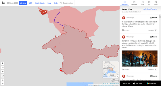
After that, it was restored with the support of Cloudflare, but it seems that some troubles still remain.
DDoS-> issues with server (will be fixed shortly) https://t.co/2ZZWSXb8va
— Liveuamap (@Liveuamap) March 1, 2022
Related Posts:
in Web Service, Review, Posted by log1l_ks
