'Wildfire Layer' Appears on Google Maps & Expanded Range of Functions to Identify 'Where to Plant Trees' in Urban Areas
Google will add a 'wildfire layer ' that allows you to see wildfire information on
New ways maps and AI keep communities safe and informed
https://blog.google/products/maps/search-on-maps-2021/
Google Maps tracks global warming with new “Fire” layer, Tree Canopy tool | Ars Technica
https://arstechnica.com/gadgets/2021/09/google-maps-tracks-global-warming-with-new-fire-layer-tree-canopy-tool/
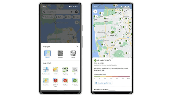
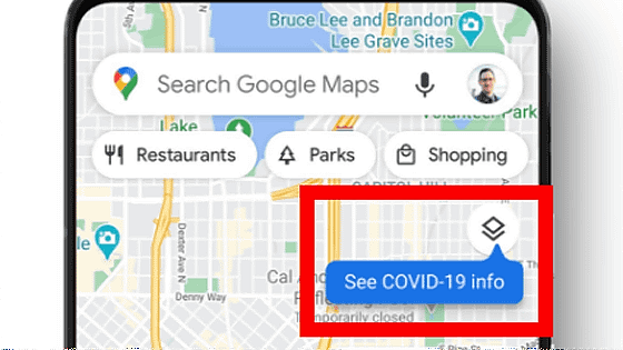
◆ Wildfire layer
In recent years, the frequency of wildfires has increased due to global climate change, and in September 2021, a wildfire in California, USA issued an evacuation order to more than 50,000 people. In order to protect yourself in an emergency, it is important to collect accurate information on wildfires, and in 2020 Google launched a 'wildfire boundary map' using satellite data in the United States. rice field.
The Wildfire Boundary Map gave Americans an idea of the size and extent of the fire, but Google has announced that it will be adding a new layer of wildfire information to Google Maps.
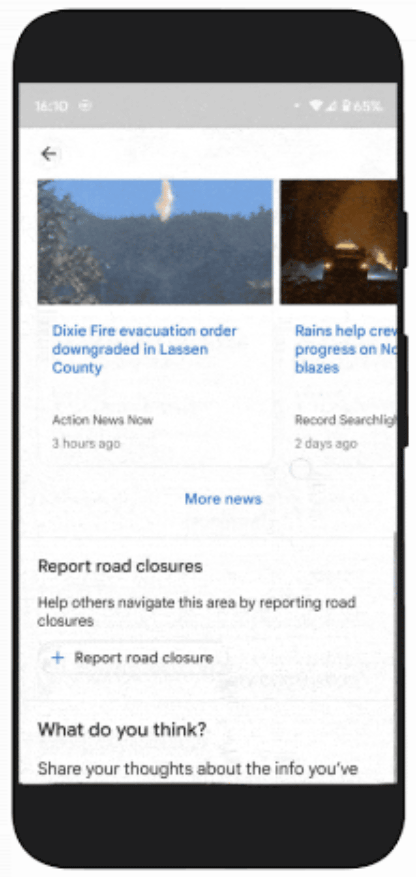
In the newly added 'Wildfire Layer', the range of wildfire is displayed in red on the map. When you tap the part of the forest fire ...
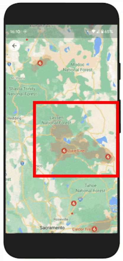
You can see detailed and up-to-date information about wildfires.
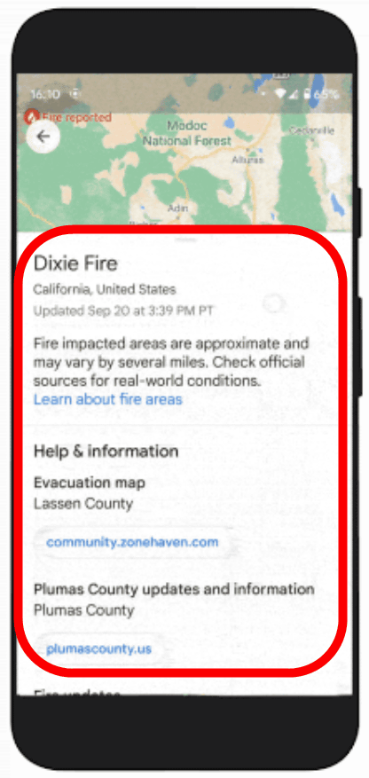
Get information on emergency websites, phone numbers to ask for help, evacuation order details, links to available resources provided by local governments, burn areas and fire response. The wildfire layer will be rolled out globally on Android from the last week of September to early October, and will appear on iOS and desktop in October. In the United States,
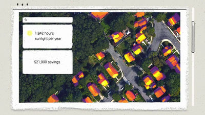
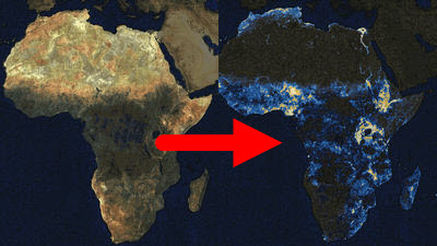
◆ Expansion of Tree Canopy Insights
The heat island phenomenon, in which urban temperatures are higher than in the suburbs, has a negative impact on low-income communities and causes many training hygiene problems such as poor air quality and dehydration. It is known that roadside trees and trees planted in parks protect people and buildings from direct sunlight, and prevent the temperature from rising by radiating heat and lowering the temperature as the water evaporates, making it efficient for urban designers. It is important to plant trees in a targeted manner.
Therefore, in November 2020, Google combined aerial photography and AI to identify places where there is a high risk of tree density and rapid temperature rise in urban areas, and a tool to support the selection of places where trees should be planted. Tree Canopy Lab (Tree Canopy Insights) 'has been released.
Google develops a tool to support tree planting plans by mapping 'places where trees should be planted' --GIGAZINE
Previously, Tree Canopy Insights was available only in 15 cities in the United States, but Google has announced that it will extend its reach to 100 cities around the world, including London, Sydney and Toronto.
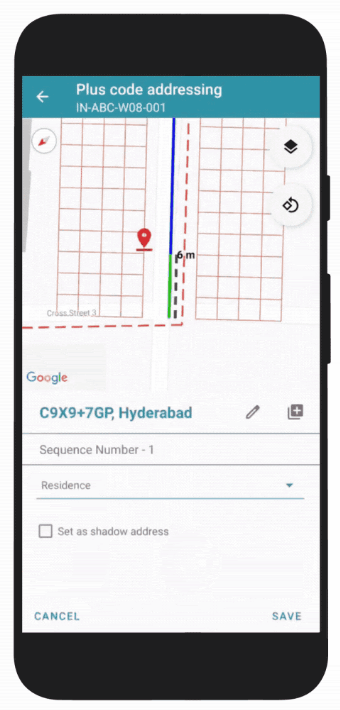
◆ 'Address Maker' app that allows you to create a new address
Many people may take it for granted that they have an address, but many people in the world do not have a publicly registered address and say, 'I'm home in an empty space for the time being.' It is said that the case of 'I live in a building, but there is no address to point to my house' is a problem in developing countries. Without a public address, various activities such as voting for elections, opening a bank account, applying for a job, and receiving mail are restricted.
So Google created an address creation app, Address Maker , using an open source system called Plus Codes that assigns unique codes to every area on the map. Address Maker says that the government can reduce the time it takes to create a new address and assign it to a map from a few years to a few weeks, and also reduce costs. Governments and NGOs such as Gambia, Kenya, South Africa, and the United States are already using Address Maker, so local governments and NGOs can request the use of Address Maker from the application form.
Related Posts:
in Web Service, Posted by log1h_ik