Google develops tools to support tree planting plans by mapping 'where you should plant trees'

As global warming progresses, many people can lose their health or suffer from heat stroke, especially in urban areas affected by the
Creating new tree shade with the power of AI and aerial imagery
https://blog.google/products/earth/helping-cities-seed-new-trees-with-tree-canopy-lab/
Rachel Malarich is planting a better future, tree by tree
https://blog.google/products/earth/rachel-malarich-planting-better-future/
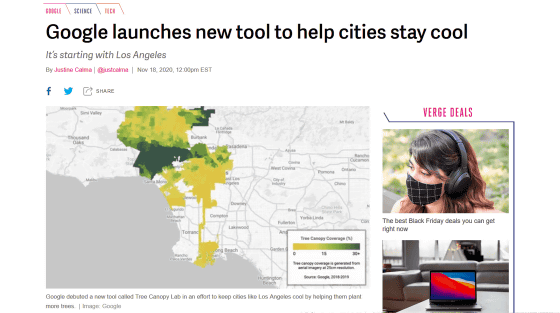
Google launches new tool to help cities stay cool --The Verge
https://www.theverge.com/2020/11/18/21573081/google-new-tool-hot-cities-trees-climate-change-temperature
In urban areas, the increase in concrete paved roads and buildings traps heat and tends to be hotter than in suburbs. As a result, the risk of heat stroke due to heat waves is higher in urban areas with less greenery than in the suburbs, so mitigating the effects of global warming is also important from the perspective of public health.
Roadside trees and park trees protect people and buildings outdoors from direct sunlight and radiate heat to lower the temperature when water evaporates, helping to lower temperatures in metropolitan areas.
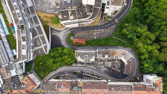
Many policy makers and urban dwellers understand the importance of tree planting, but it costs a lot of money to go to the site to investigate 'where should we plant trees?' Therefore, Google has developed 'Tree Canopy Lab', a tool that detects trees in urban areas by combining aerial photography and AI and reveals where trees should be planted.
Traditional methods have required personnel to be dispatched to the site for mapping in order to know the status of trees in each block of the city. However, with Tree Canopy Lab, Google's AI identifies the canopy that covers the city based on aerial photographs taken in spring, summer, and autumn, and automatically determines how many trees exist in various parts of the city. You can find out at. In addition, it is possible to build an interactive map by combining it with additional data showing places that are more vulnerable to high temperatures due to the density of buildings.
In fact, Google piloted the Tree Canopy Lab in Los Angeles to investigate the placement of trees in urban areas and areas at high risk of heat waves. As a result, it was found that more than half of the residents of Los Angeles live in places where 'the coverage of trees in the neighboring area is less than 10%'. This is more than 10% below the urban average. Google also states that 44% of Los Angeles residents live in areas where the risk of heat waves is extremely high.
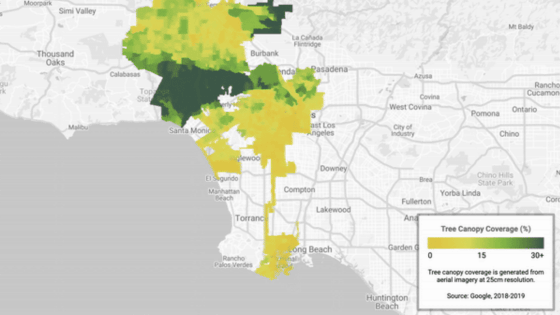
This is a color-coded diagram of each area of Los Angeles according to the proportion of canopies that cover the city. The darker the green color, the higher the tree coverage.
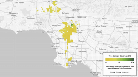
Of these, this is the area where the ratio of canopies is less than 10%.
The Tree Canopy Lab also allows you to check the location of trees in more detail.
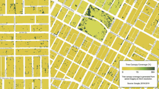
The city of Los Angeles has set a goal of 'planting 90,000 trees by the end of 2021 and continuing to plant 20,000 trees annually thereafter.' Tree planting is not just about finding vacant spaces and doing it properly, but beautifying neighboring areas, improving air quality, creating shade to lower street temperatures, and social, economic and environmental equality. It is important to achieve.
The Tree Canopy Lab's approach, which leverages AI and aerial photography, helps to plant trees in more effective areas. In the case of the city of Los Angeles, areas with few canopies tended to overlap with areas with poor city services, and investing in these areas could also strengthen the community.
'Tree Canopy Lab data goes beyond our expectations and helps us see where our actual tree planting needs are,' said Rachel Maralich, City Forest Officer, Los Angeles. We are excited to work with others to make a big impact and work towards the potential to improve the environment in the future. '
Related Posts:
in Software, Posted by log1h_ik


