Vehicle dispatch service 'Lyft' praises the accuracy of road information on 'OpenStreetMap'
How Lyft discovered OpenStreetMap is the Freshest Map for Rideshare by Clare Corthell and Mark Huberty | Lyft Engineering
https://eng.lyft.com/how-lyft-discovered-openstreetmap-is-the-freshest-map-for-rideshare-a7a41bf92ec
◆ Survey method
One way to verify the accuracy of a map is to manually survey all roads by the United States Census Bureau every 10 years. However, a large number of personnel are required to conduct the investigation by this method. In fact, the United States Census Bureau employs so many surveyors that it affects the unemployment rate in the United States.
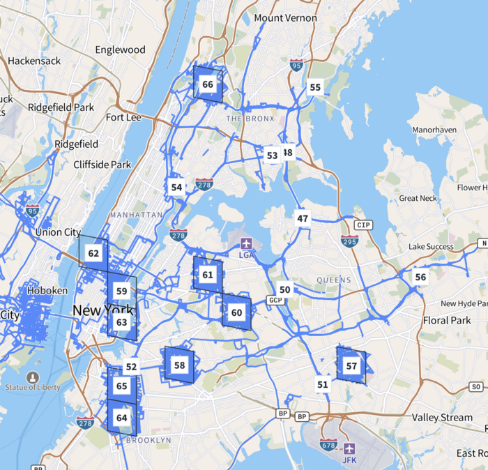
Lyft has services in more than 300 areas, and surveying roads in all service areas can be time consuming and costly, so we needed to figure out a way to verify the accuracy of OpenStreetMap while keeping costs down. ..
Therefore, Lyft focuses on sample surveys that are often conducted in the field of public health. We decided to statistically determine the accuracy of all service areas by extracting a part from Lyft's service area, investigating the actual road information, and comparing it with OpenStreetMap.
In addition, Lyft used the data of '
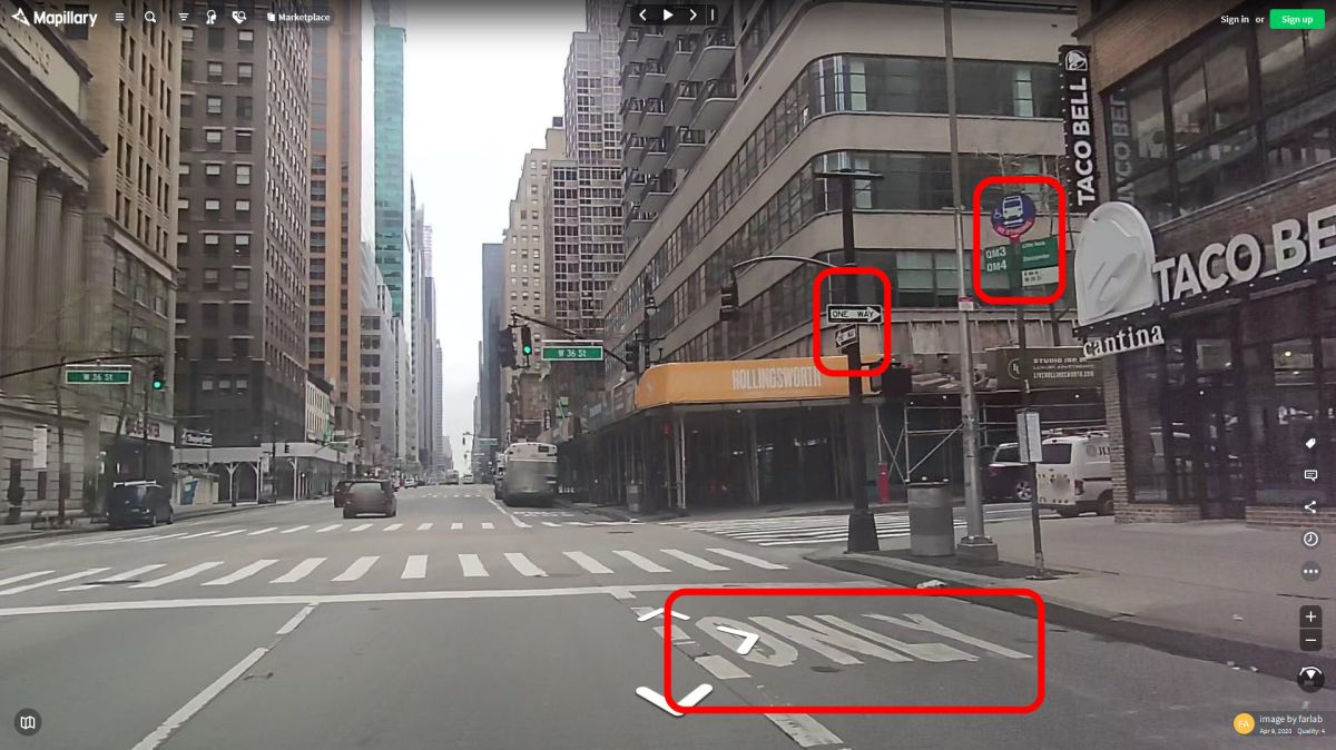
By adopting these survey methods, Lyft succeeded in verifying the accuracy of road information on OpenStreetMap across the entire North American continent in just three months.
◆ Result
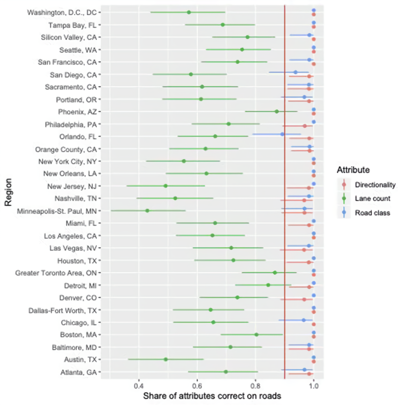
A study by Lyft found that Road Information on OpenStreetMap in North America was fairly accurate. In particular, basic information such as road type, direction, and name provided accurate information with a probability of 95% or more. In addition, information essential for navigation, such as entrance and exit lanes of trunk roads and restrictions on turning left and right, was accurate with a probability of over 85%.
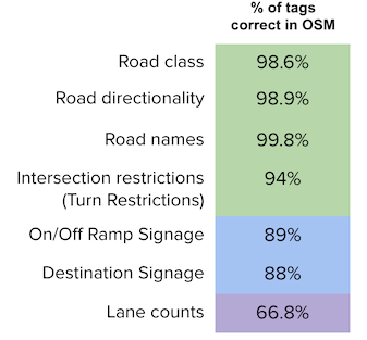
A diagram showing the accuracy of information for each city looks like this. The 'probability that the road type is correct' shown in red and the 'probability that the road direction is correct' shown in blue exceed 90% in most cities. On the other hand, the 'probability that the number of lanes is accurate' shown in green varies from city to city and does not exceed 80%. Lyft said, 'This study found that OpenStreetMap also contained inaccurate information, such as the number of road lanes. This finding makes us appropriate for improving OpenStreetMap information. You can make an investment, 'he said, showing his willingness to continue contributing to the accuracy of OpenStreetMap information.
Lyft also commented on how quickly OpenStreetMap responds to new roads: 'Updating the map is like looking for a needle in the hay. OpenStreetMap has a great community to keep information up to date.' I admire the whole thing.
Lyft concludes, 'The survey method we used this time can verify the accuracy of the map at low cost and in a short period of time. We hope that this survey method will be useful for research on other maps.' ..
Related Posts:


in Web Service, Web Application, Posted by log1o_hf