Google announces that it will improve the problem of 'my current location is greatly deviated' on Google Maps
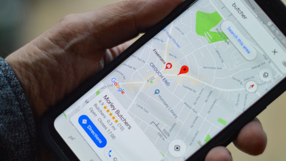
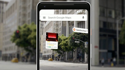
With the app version of Google Maps, you can automatically detect your current location and display your location on the map. Google has announced that it will improve the problem of 'low detection accuracy in urban areas' that exists in the automatic detection function of the current location by adding a new module to the Android device.
Android Developers Blog: Improving urban GPS accuracy for your app
Google promises “spectacular” city GPS improvement with 3D building data | Ars Technica
https://arstechnica.com/gadgets/2020/12/google-promises-spectacular-city-gps-improvement-with-3d-building-data/
According to Google, there have been many reports of cases where the current location shifts in urban areas on Google Maps. Due to this deviation of the current location, the ride sharing service that utilizes the location information of Google Maps sometimes had a problem that the requested ride sharing vehicle could not be found due to a GPS error.
The cause of this phenomenon is that 'GPS signals are reflected by skyscrapers'. GPS is a system that calculates the current position from signals emitted linearly from the satellite, but if there is a shield such as a mountain range or a skyscraper between the user and the satellite, the GPS signal that should go straight is reflected. This will result in a measurement error called multipath .
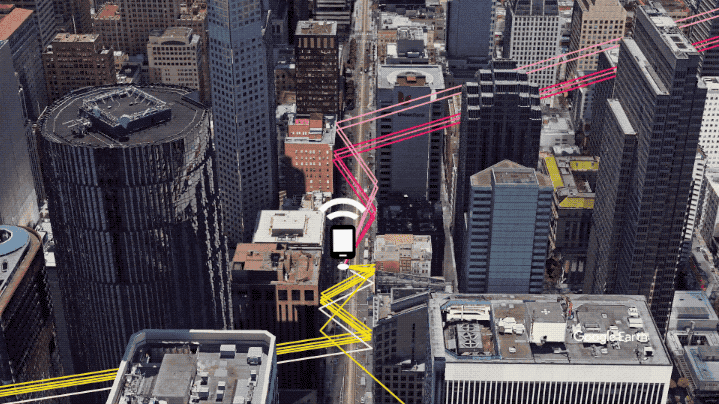
To address this multipath issue, Google corrects location information calculated from GPS signals by taking into account '3D models of high-rise buildings' in the
The 3D mapping support fix module is scheduled to be incorporated into all Android 8 or later devices in December 2020, but at the time of implementation, only Pixel 5 and 5G compatible version Pixel 4a are the predecessor version 2 3D mapping support fix The module is included. Below is an example of the current location measured by the Pixel 5 that implements the version 2 3D mapping support fix module. Yellow is the route actually traveled by the user with Pixel 5, red is the transition of the current location when there is no 3D mapping support correction module, and blue is the transition of the current location when there is a 3D mapping support correction module. If there is no 3D mapping support correction module, you can see that there is a measurement error as if you crossed the street many times, but if you have a 3D mapping support correction module, you can see that the measurement error is almost eliminated. I will.
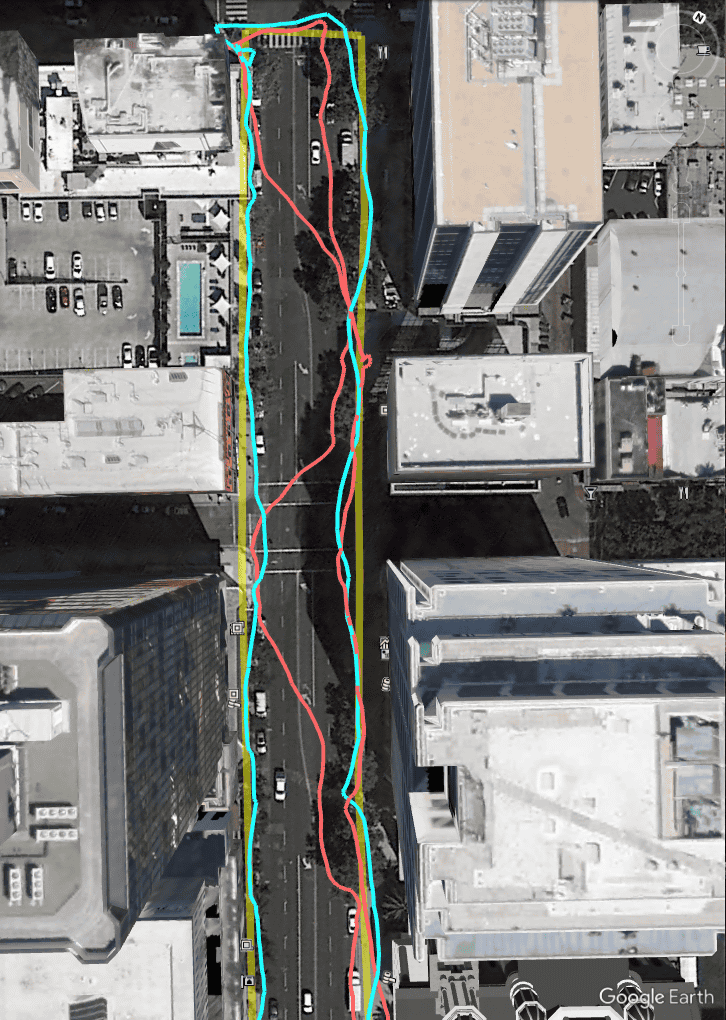
The probability of occurrence of the phenomenon of 'the current location shifts by one street' that occurred on devices that do not have the 3D mapping support correction module installed is reduced by 75% in version 2 of the 3D mapping support correction module and 50% in version 1. It will go down. Version 2 of the 3D Mapping Assistance Fix Module will be available to all Android 8 and later devices in early 2021.
Related Posts:

in Software, Web Service, Smartphone, Posted by darkhorse_log