A function to display bus delay information and congestion status of public transport is added to Google map

by
On June 27, 2019, Google announced that it has added the function to display 'bus delay information' and 'congestion of public transport' to the Google Maps app for Android and iOS. In the past, there was a function to notify when there was a problem with the operation of the train, but the new function used AI to predict the delay of the bus even if there is no formal announcement from the bus company. It is.
Grab a seat and be on time with new transit updates on Google Maps
https://www.blog.google/products/maps/grab-seat-and-be-time-new-transit-updates-google-maps/
Google AI Blog: Predicting Bus Delays with Machine Learning
https://ai.googleblog.com/20019/06/predicting-bus-delays-with-machine.html
Google will now tell you how crowded your bus or train is likely to be-The Verge
https://www.theverge.com/2019/6/27/18761187/google-maps-transit-crowded-delays-predictions-train-bus-subway
The use of public transport is a good option for traveling around the city, but unforeseen delays and horrific congestion can be a major stress. So, Google has added a new function of Google map, such as real-time delay notification of buses that are easily delayed by surrounding traffic conditions, and congestion prediction function in cars such as trains.
In the new bus delay notification function, when it is predicted that the bus is delayed when searching for a route, the delay display is displayed like '8 min traffic delay' in the route display screen. .
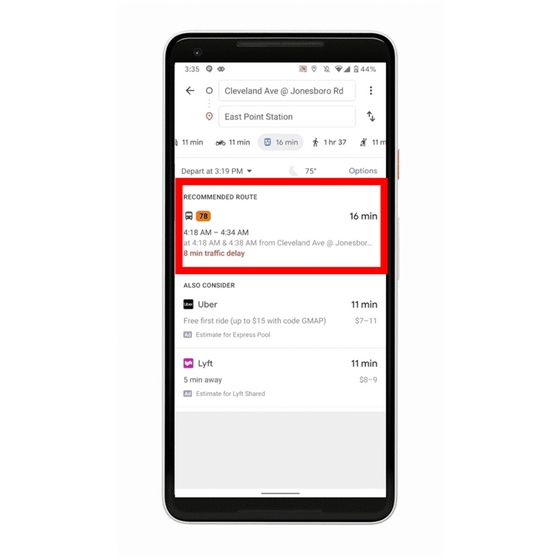
Since trains are unlikely to affect the operation status from other vehicles, in the case of delays, there are almost no regular situations such as accidents or inspections. As a result, it is often announced officially by the operator, and users can easily grasp the delay situation. On the other hand, in a bus that runs along the road with other vehicles, while delays are likely to occur due to traffic conditions and traffic lights, it is difficult to obtain a formal delay situation.
The image below shows the bus delays in Sydney and the distance traveled by cars and buses. The black dots represent the bus's original operation schedule, and it is scheduled to arrive at a distance of about 900 m from the start point at 4: 3 and a distance of about 2,900 m at 4:08. You However, if you look at the blue dots that represent the distance the bus has traveled from the start point, you can see that there is a delay of several minutes overall.

Linked to the movement of the blue dot is a red dot that indicates the traffic situation of the surrounding cars. If the car in the surrounding area is moving smoothly, that is, if the red point is on the right, then the blue point will also move relatively smoothly, but the red point will stop for the traffic light from 4: 7 The bus also stopped moving during 4:09. Thus, it is said that the bus operation situation is greatly affected by the traffic conditions in the surrounding area.

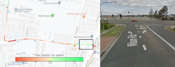
Also, the left side of the image below shows the speed at which the bus travels in color. Many spots show a lot of red for slower speeds, but the black square is green for faster speeds. In fact, the area enclosed by the black square seems to have a dedicated bus lane shown on the right side of the image, and the speed of the bus is greatly influenced by factors such as the dedicated road.
Furthermore, it is the lifestyle habits of the people in the area that greatly affect the bus operation situation. For example, the image below shows a bus running in New Jersey running in 10 minutes and in about 10 minutes. There is a clear difference between the running speed on weekdays shown in gray and blue, the running speed on soil and green shown in green, and the running speed in the morning and evening rush hours, etc. I can see it. However, this tendency is not uniform all over the world, but fluctuates depending on the living style of the residents and the nature of the city.

Google has developed a system that lets AI learn these elements and predict how much a specific bus route will be delayed from the traffic data of that day. We plan to release it as a new feature of Google Map.
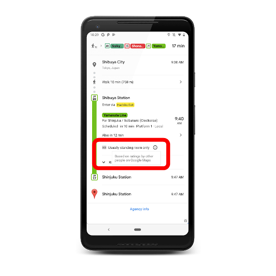
In addition, Google also introduces a function to predict the degree of congestion such as trains. Google has been busy Google map users for months with 'many seats available' 'less seats available' 'standing without vacancies' 'no vacancies available' From the four options of ',' we repeated the survey to have one selected. Based on this data, it calculates the result about how crowded a particular transportation agency at a specific time, and it is displayed in the route search of Google map.
Google will be releasing these features in 200 cities around the world, and according to the Wall Street Journal, a
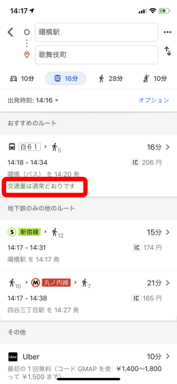
In addition, although Yamanote Line was used as a sample of the congestion condition display function in a train on Google's official site, it was not displayed on Google map at the time of article creation about the congestion condition in a train.
Related Posts:
in Smartphone, Web Application, Posted by log1h_ik


