Why "100% correct map" does not exist in this world?
Many maps on school textbooks, Google Maps, travel books, etc.Mercator projectionAlthough it is drawn by Mercator's map, some mistakes are included in the map. Although it will inevitably cause "distortion" when placing the earth as a sphere on a flat map, then how the map is distorted and how to choose an "accurate map" It is clearly explained in a YouTube movie.
Why all world maps are wrong - YouTube
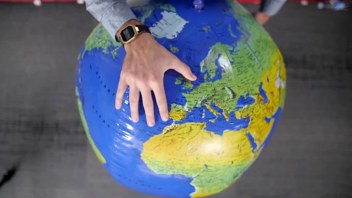
Google map etc. expresses the world map on the plane, but the earth is round in the first place. So, how do you round the round earth to a flat surface?
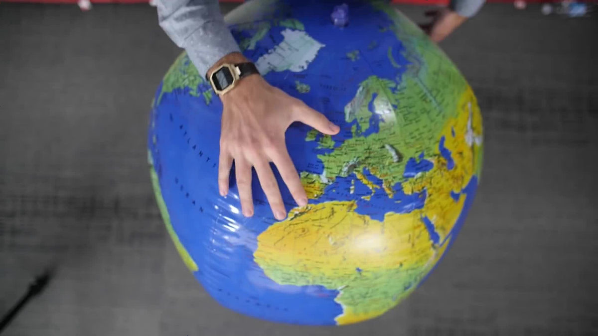
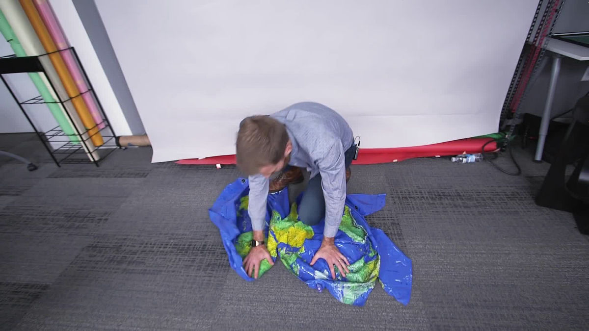
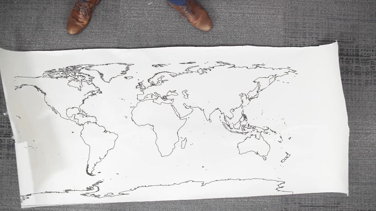
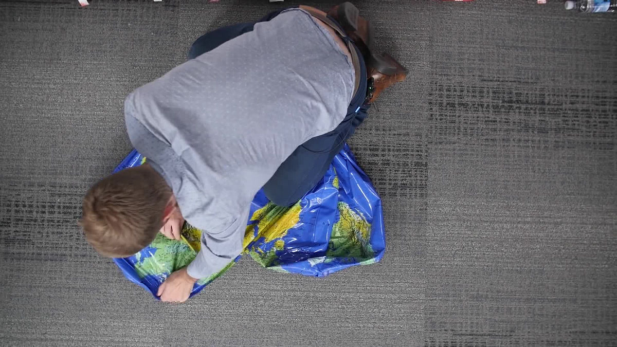
So I took out the knife.
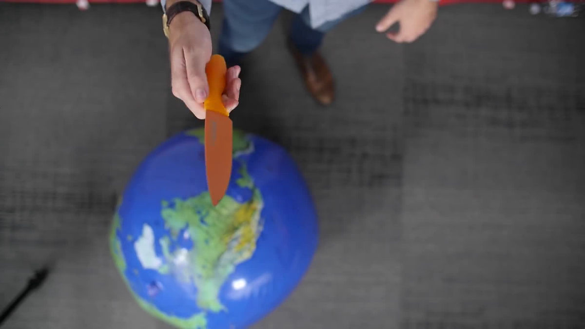
I will split the vinyl ball that shaped the globe with a knife.
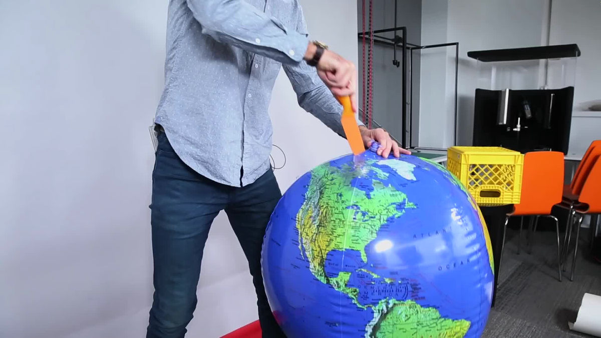
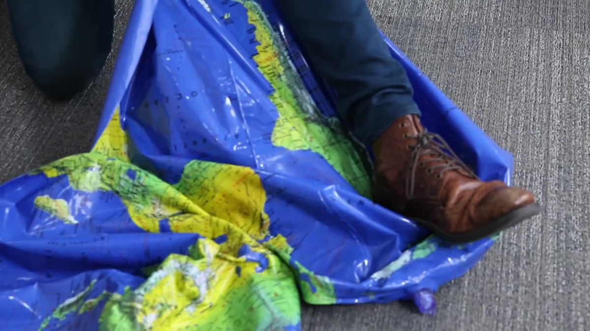
And I will fix the torn globe to the map of the plane ... ...
It will not be a flat and flat map without wrinkles, pulling and stretching and doing whatever you do your best.
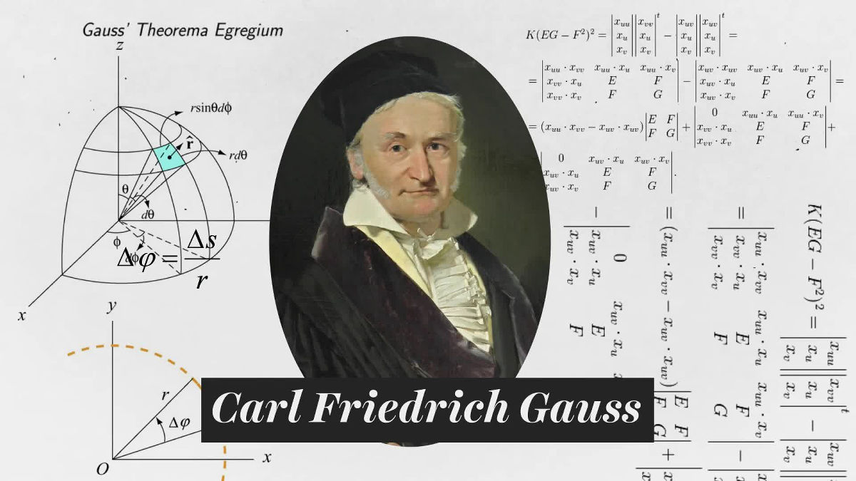
It is impossible to repair a globe that is a sphere to a flat map without distortion because physicists and mathematiciansCarl Friedrich GaussThat is what I have proved.
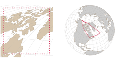
From around 1500, mathematicians were thinking about algorithms to correct the globe to a flat surface.

This process is called "projection". famousProjection methodOne of the ideas of putting the globe into the cylinder ... ...

There is a thing to project the globe onto the surface of the cylinder.
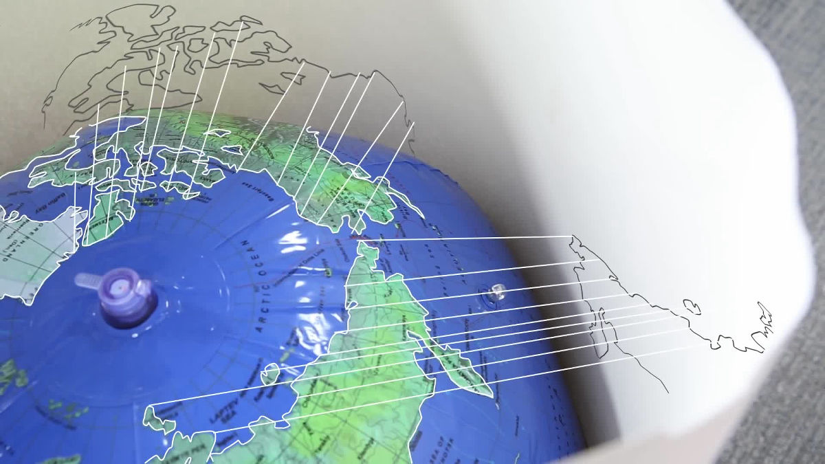
When opening this barrel, the map of the plane will be completed.
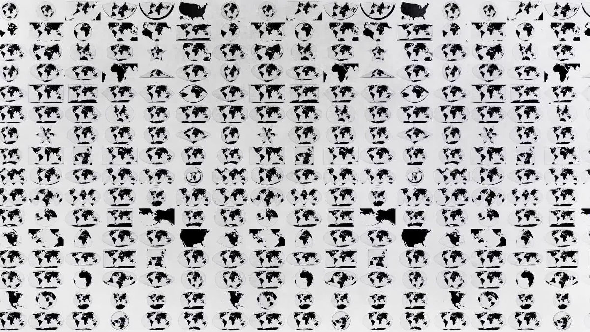
There are various kinds of "projected objects" used in the projection method in addition to the cylinder, and the difference in the shape of the planar map is caused by the difference in the projected objects.
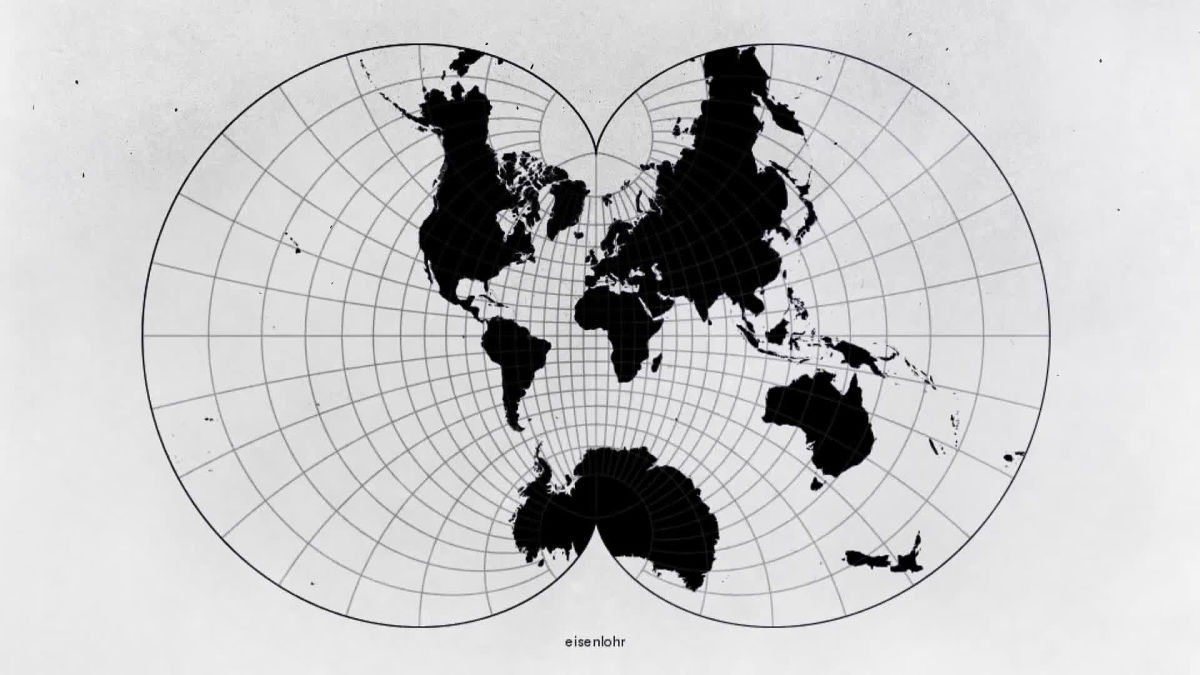
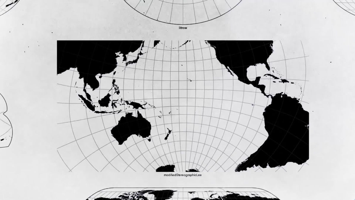
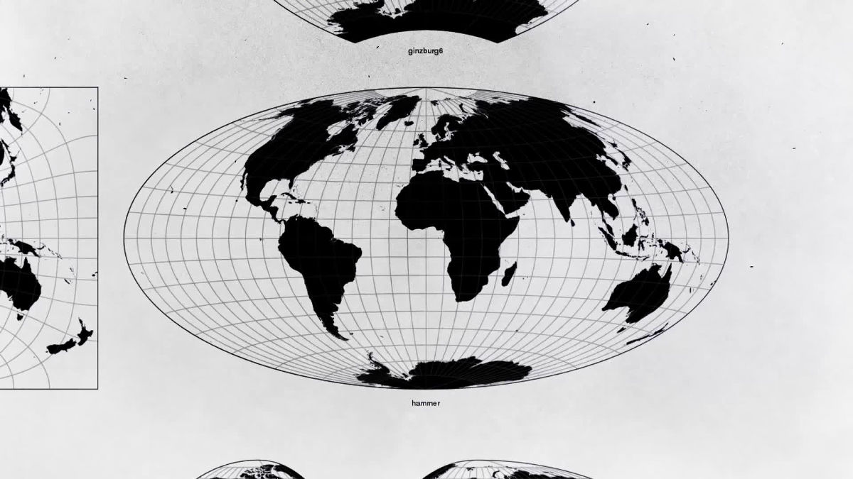
These maps are not "one of the most accurate maps" because the shape, distance, direction, land area are in a trade-off relationship. For that reason, it depends on the purpose of the map whether the map makes people misunderstand or help.
For example, maps used in educational settings in the United States and Japan,Mercator projectionIt is due to.

Google Maps is also using the Mercator projection map.
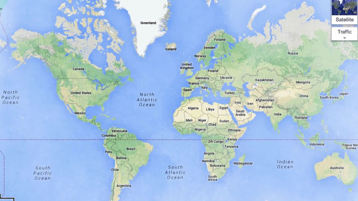
The advantage of the Mercator projection is that the shape is almost exactly reflected in a narrow range.
However, the true purpose of the Mercator projection is in "navigation". As Mercator 's projection shows the' direction 'correctly, it shows the accuracy when traveling around the Pacific Ocean using a compass.

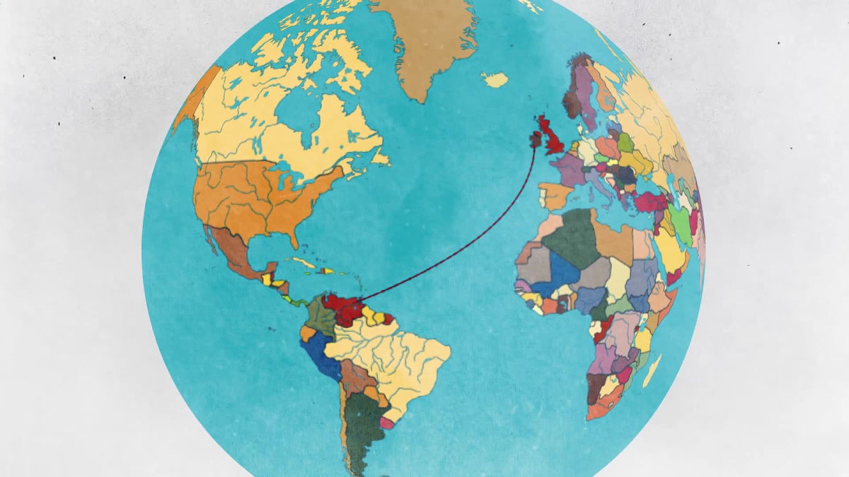
When we connect two places on the map ... ...
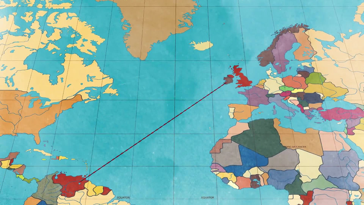
By reproducing the angle that appears on the compass, we can reach the destination.
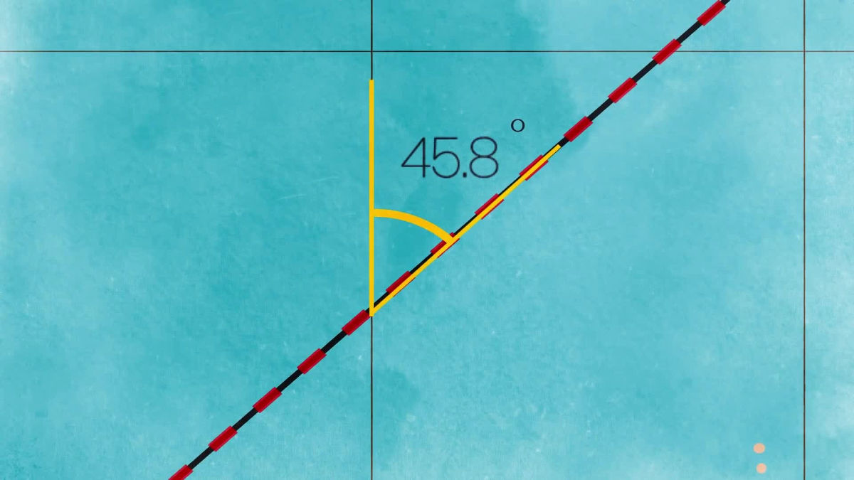
The straight line drawn on the Mercator projection map does not become the shortest distance when returning to the globe, but it shows a very simple and reliable path.
Geraldus MercatorWhen he created the Mercator projection in the 16th century, he adjusted the distance between the latitude line and the latitude line to show exactly the direction of each land.
Also, it was also adjusted to be an accurate angle lattice with longitude.
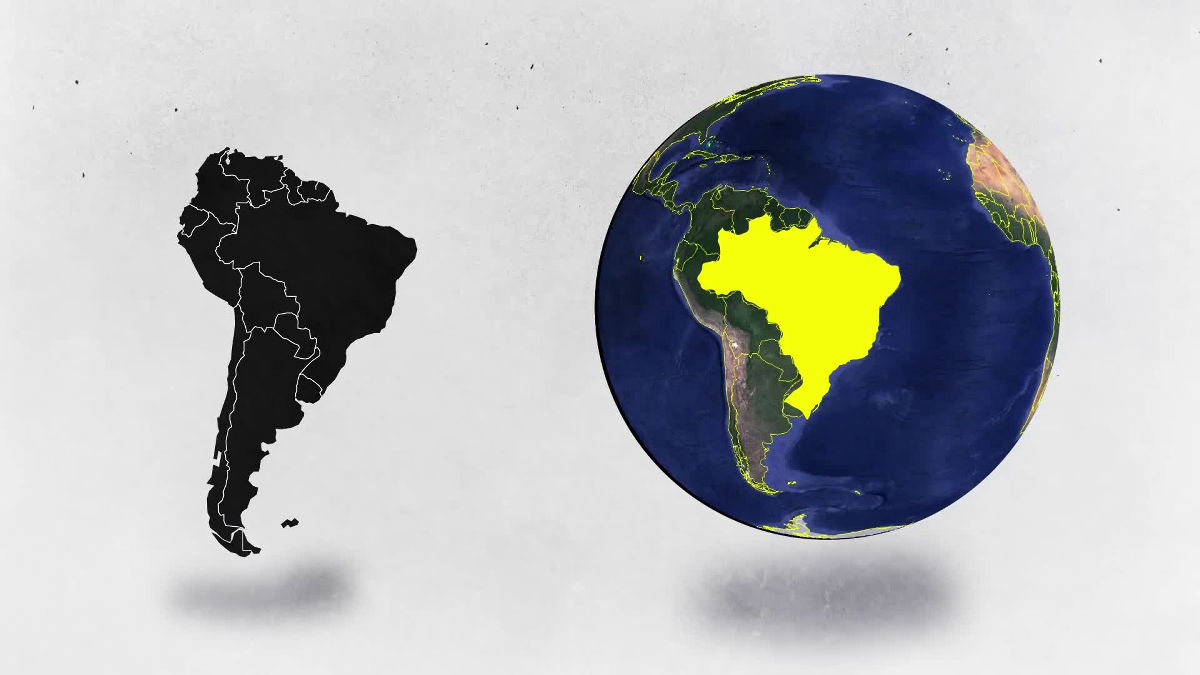
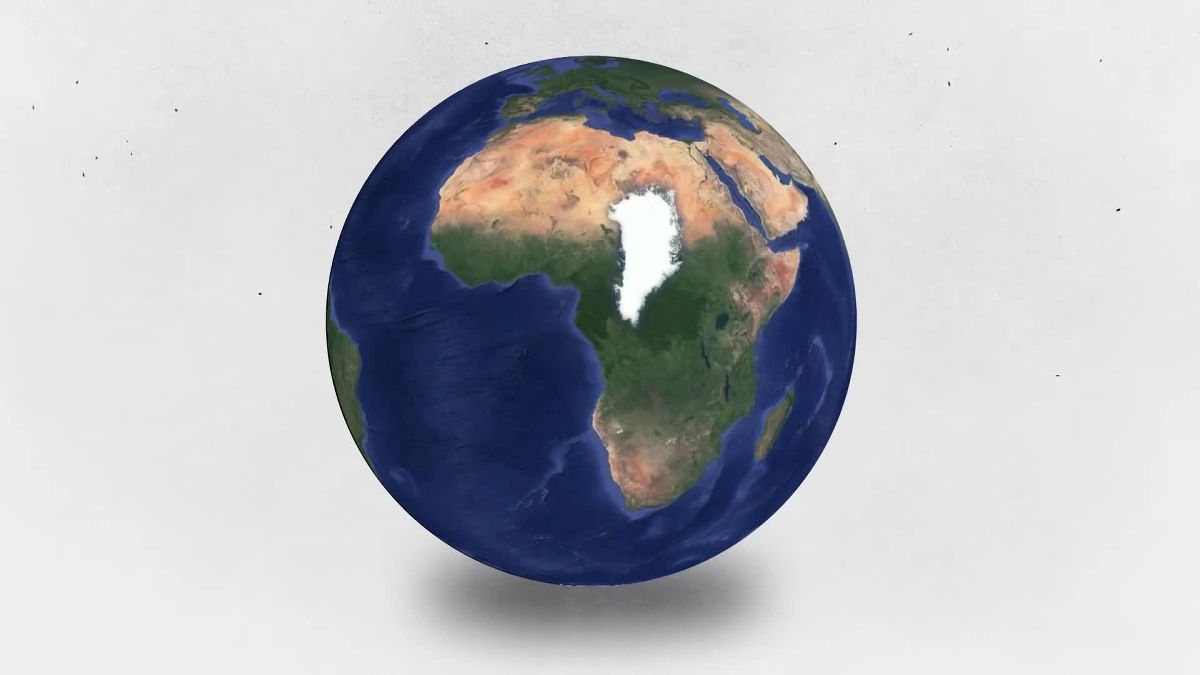
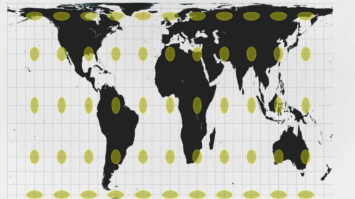
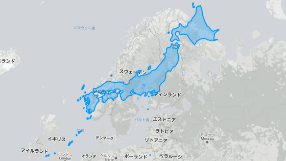
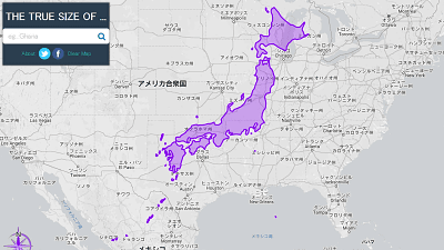
As a result, using the Mercator projection makes the area inaccurate. Greenland and Africa on the Mercator projection map are the same size, but ...
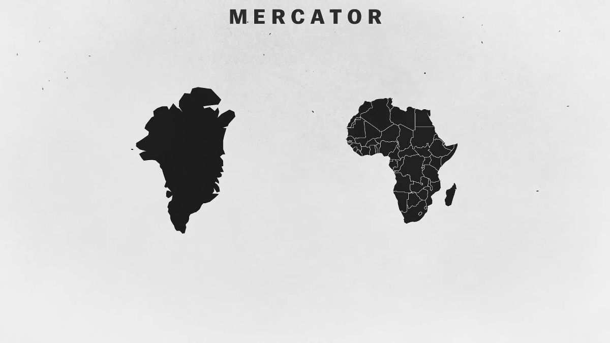
Actually Greenland is much smaller than the African continent.
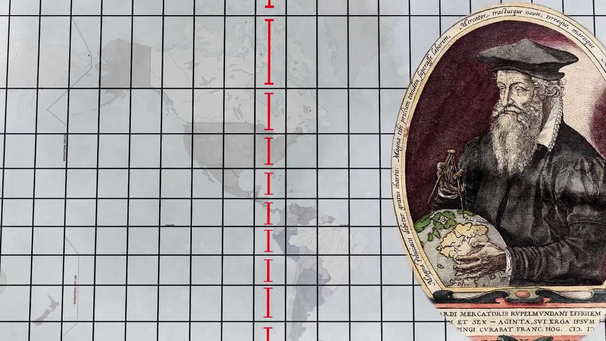
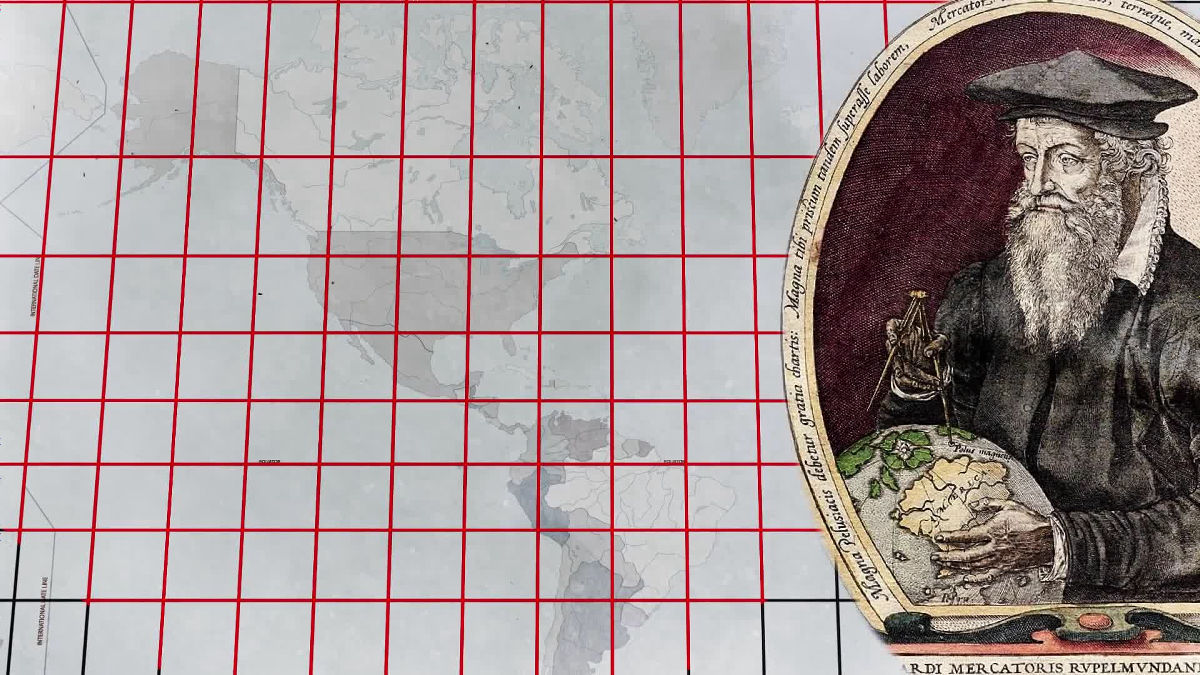
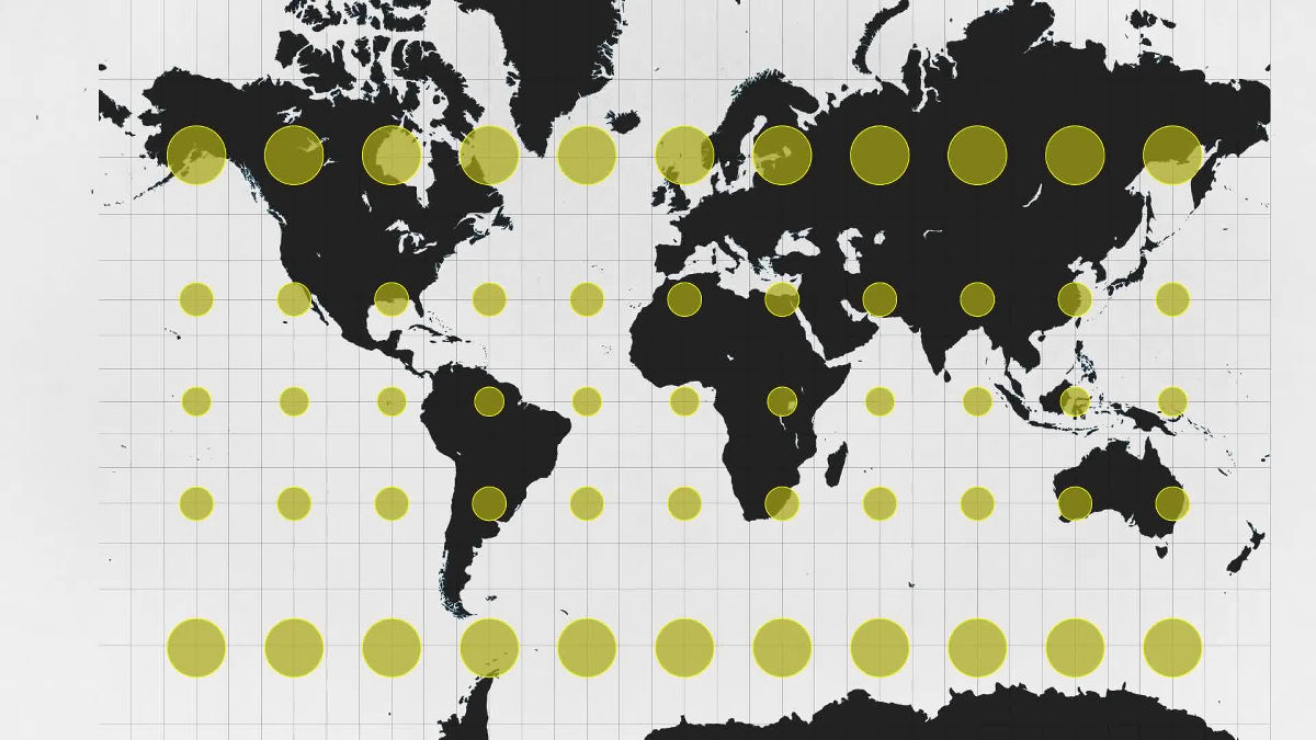
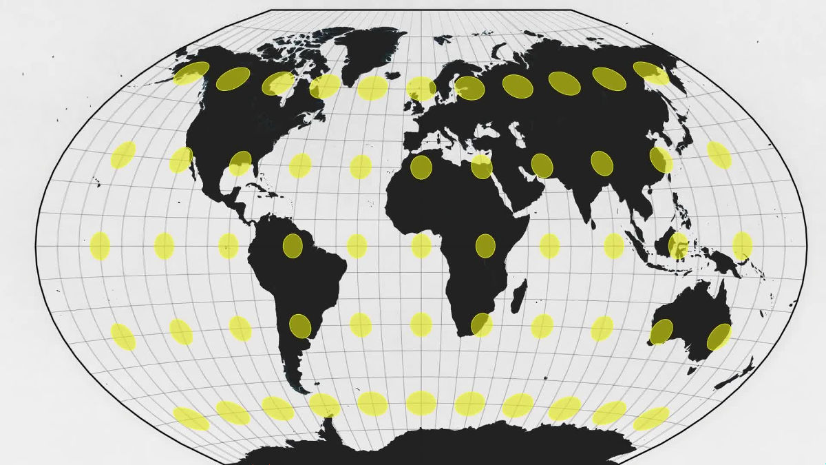
After drawing the same sized polka dots on the globe, if you project with the Mercator projection, you can see how the land size actually differs.
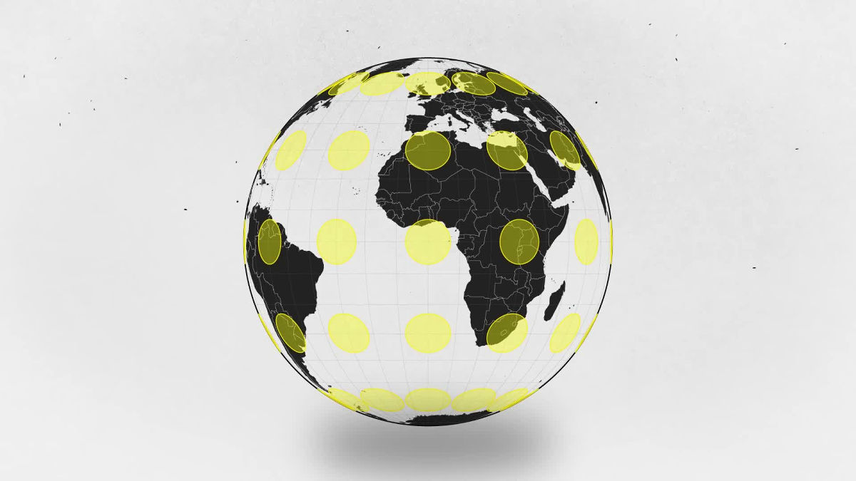
Looking at the map below, all the polka dots are of the same shape, but their sizes are different, and they are getting larger as they approach both poles. Therefore, it is also criticized that Mercator 's projection is "an emergence of European imperialism".
Therefore, it accurately reflected the size of the country map by Gal · Peters projection.
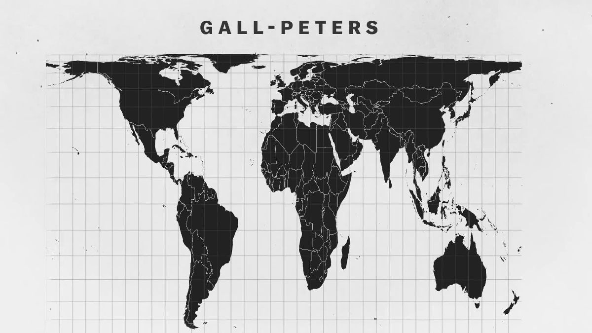
Greenland and Africa, which were drawn in the same size as before, when projected by Gal · Peters projection, you can see that the sizes are completely different as follows.
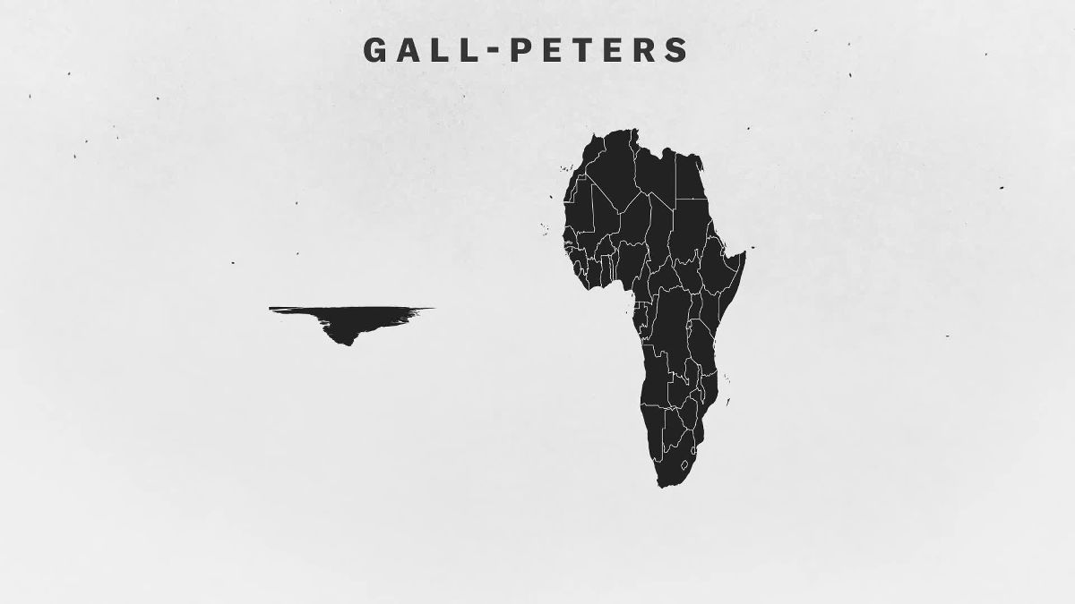
However, this time distortion has occurred in the "shape" of the country.
As mentioned above, there are no "most accurate maps at all", so various maps have been created. However, in the 1960's, the biggest use purpose of the plan map, "navigation", will change.
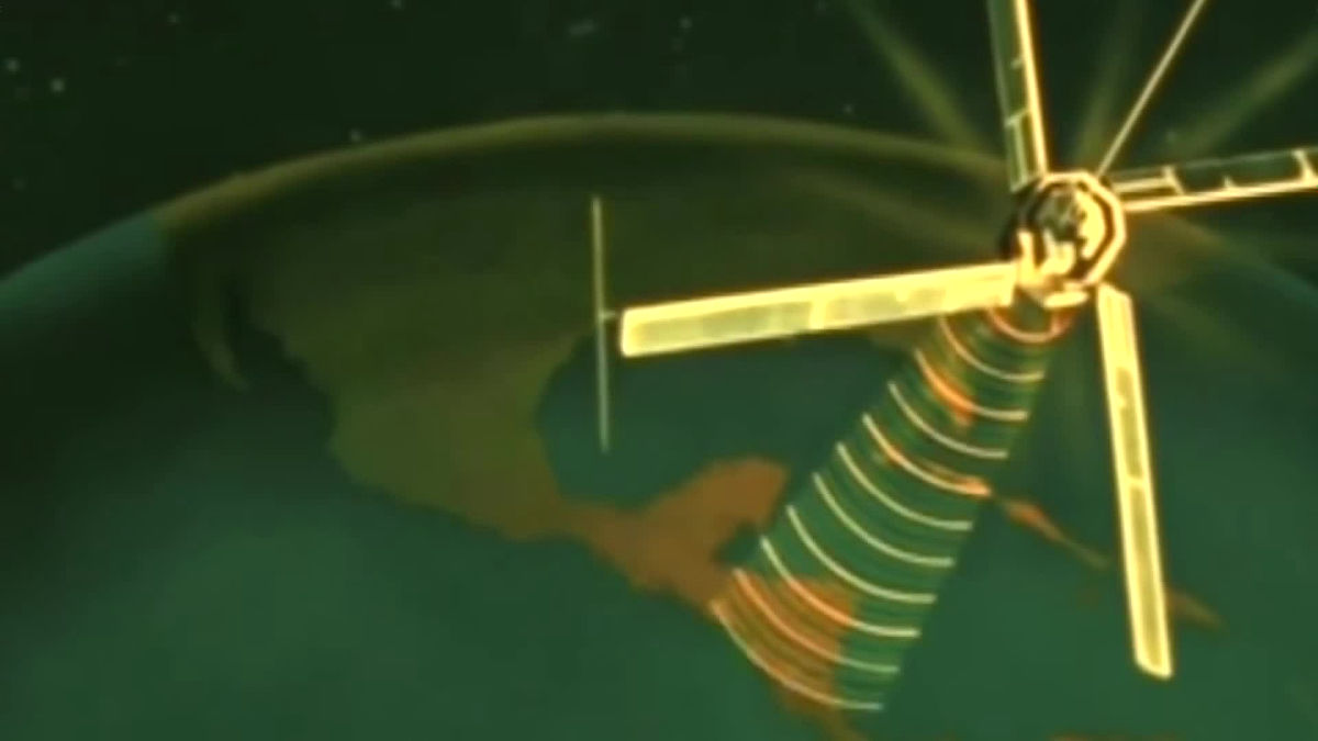
When a satellite sent to space sends position information and navigation data to receivers all over the world, what is required of a planar map is "beauty" or "design" rather than "accurate navigation" "It came to be. And some cartographers who think "I want to prevent misunderstanding" have avoided Mercator 's projection.
However, the map of Mercator is still used in Google Maps.
This is because the shape and angle of the land are accurate if it is within a narrow range. It is because there is a turning angle of 90 degrees even in the real place where "It turns 90 degrees on the left side looking" on the map is shown.

On the other hand,National GeographicWe adopt the map projected by the method called "Winkel projection" because "size and shape are accurate".
Thus, in modern times maps projected by various methods are used according to the purpose, but the important thing is "There is no" 100% correct map that can be used in any situation ". When choosing a map, it is important not to forget the viewpoints of whether the land size should be accurately displayed, whether the shape should be accurately displayed, and whether distances and directions should be displayed.
Related Posts:

in Video, Posted by darkhorse_log