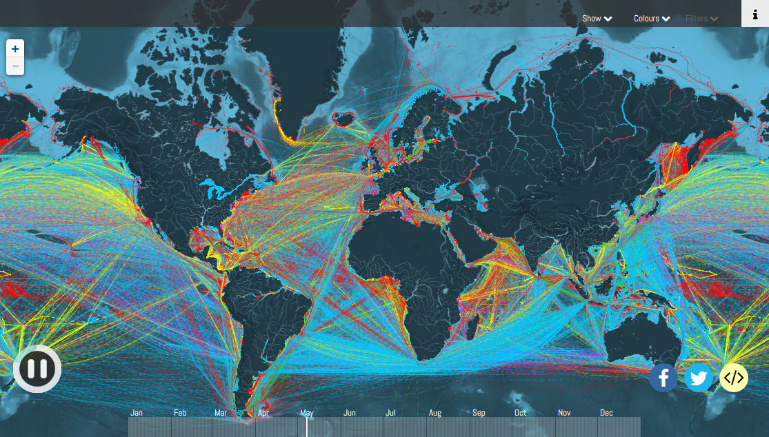
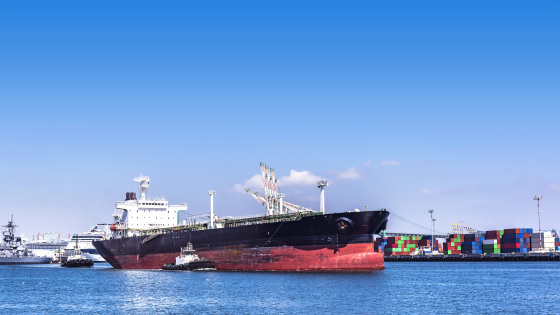
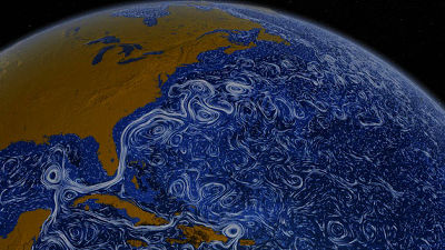
"Shipmap" which realistically reproduces the movement of container ships and tankers going around the seas all over the world with color and point
In the world the amount of transport by airplaneGradual increase trendAlthough the data shows that it is in fact, transportation vessels such as container ships are the mainstay of international cargo transport even today. website"Shipmap", The movements of all cargo ships are faithfully reproduced on the browser based on the route data that such a cargo ship actually sailed, so that the flow of things around the world can be understood as getting in touch It is. .
A Map Showing Every Single Cargo Ship In The World - Digg
http://digg.com/2016/every-ship-in-the-world
Shipmap.org | Visualization of Global Cargo Ships | By Kiln and UCL
https://www.shipmap.org/
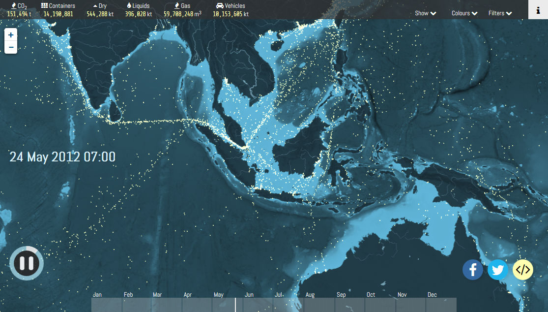
Shipmap is a web app that shows the position of a cargo ship on a world map with a small dot. There are many cargo boats going and leaving the sea, there are places dotted in the wide ocean, there are places where many points draw a line invisible to the eyes on the ocean. The data used is as of 2012, but it seems that there is not so much difference as of 2016.
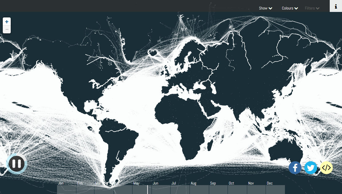
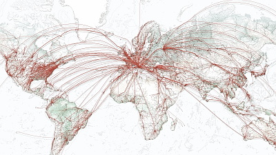
When you display the route of the whole world by a line, almost all the sea is filled up like this.
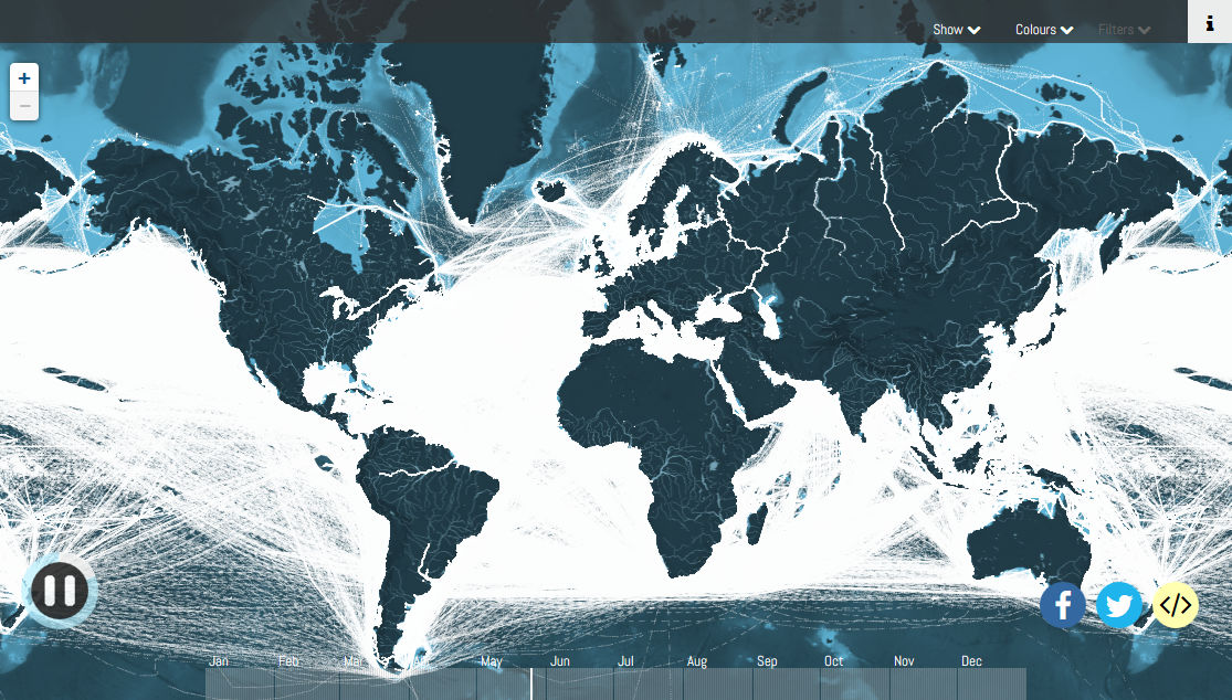
Even if you delete the display of the world map, the state of each continent is understood well. You can see how the cargo ship is sailing all over the world throughout the world.
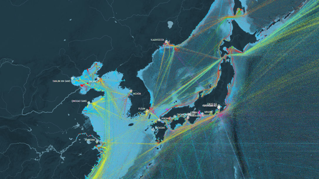
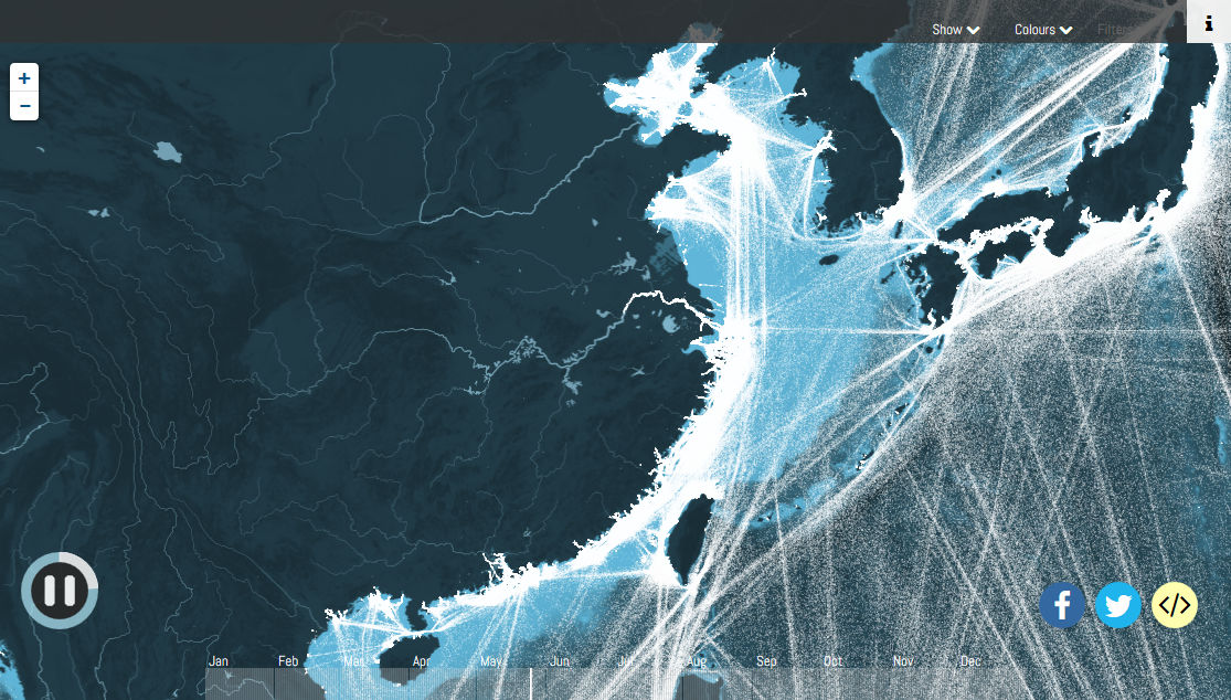
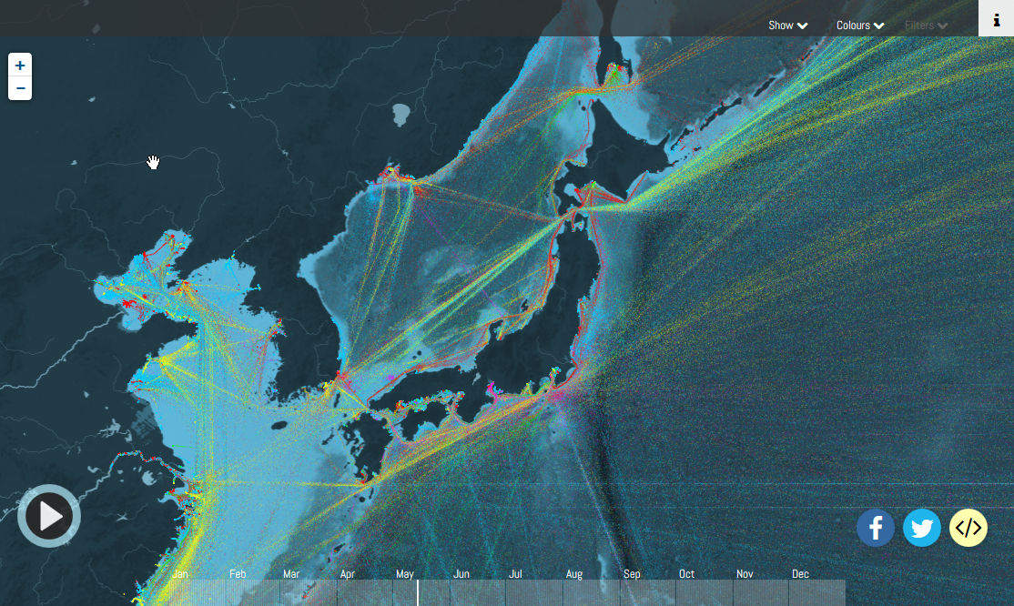
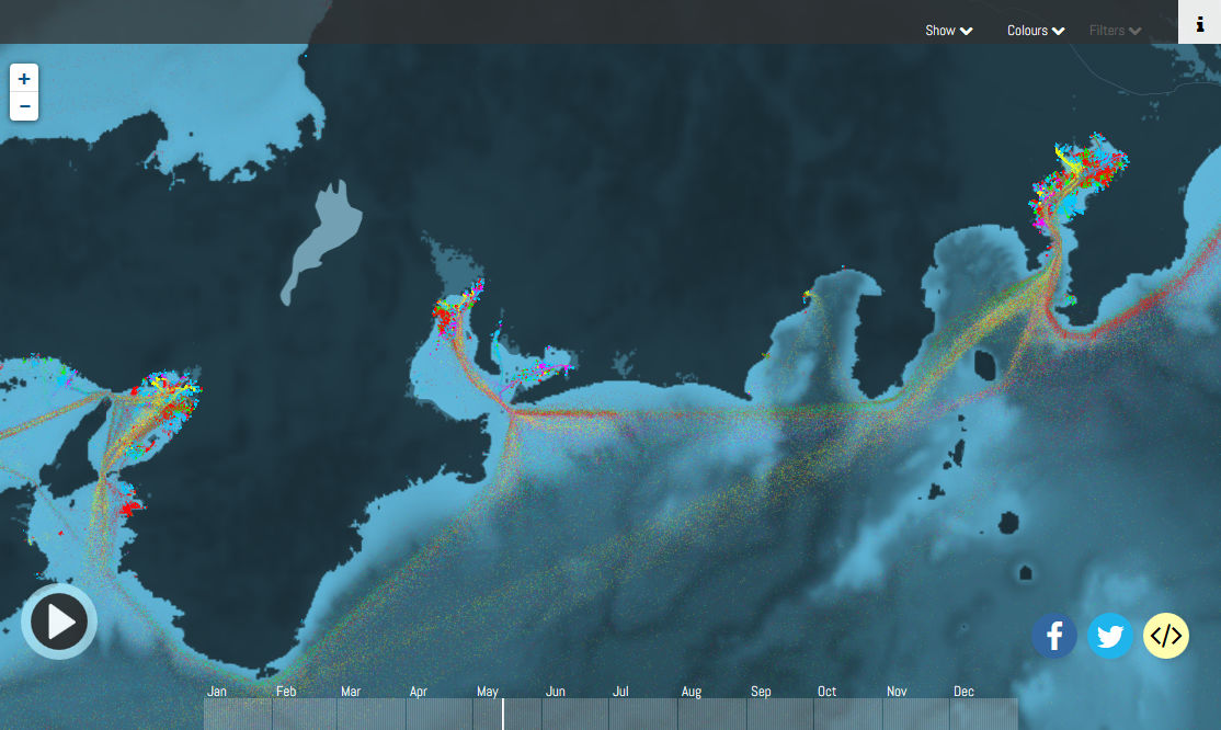
When you display near the coast of Japan and the continental coast of Mainland China, you can see how many ships are concentrating along the land. In this way, there are places where active logistics are taking place ... ...
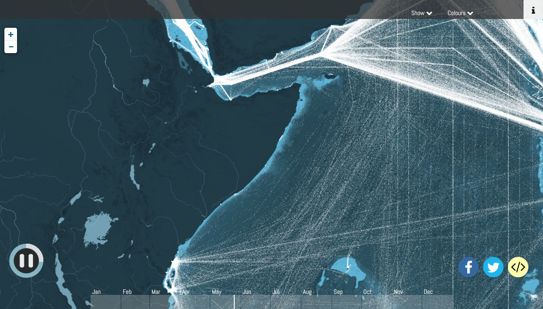
Some places like the Somali coast in Africa are in a state close to the blank area. It is said that the pirates that existed in the area at the time were affected. By the way, the pirates off Somalia have declined drastically around the border around 2012 and almost disappeared. To that background, President Kimura of "Sushi Zamai"I taught tuna fishing to piratesIt is said that things are related.
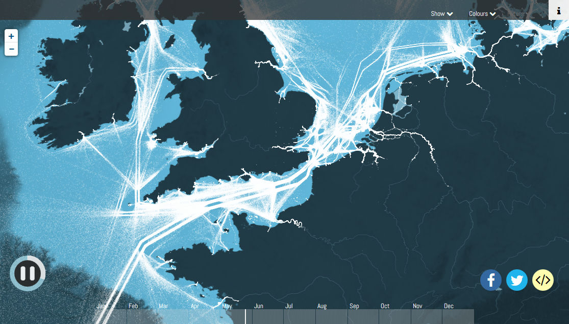
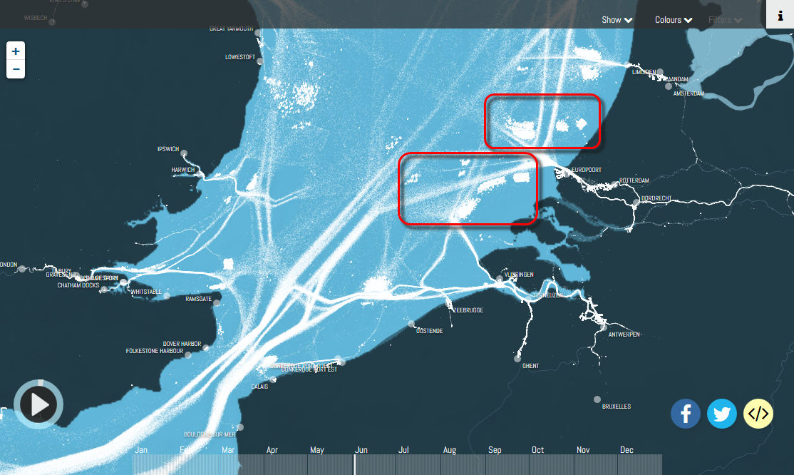
When you look around Europe, you can see that the route is arranged in order. Between Hamburg, Germany, Amsterdam and Rotterdam in the Netherlands, and the two routes passing through the Dover Strait to the Atlantic Ocean clearly appear clearly, the ship is also sailing on the right side of the route I understand.
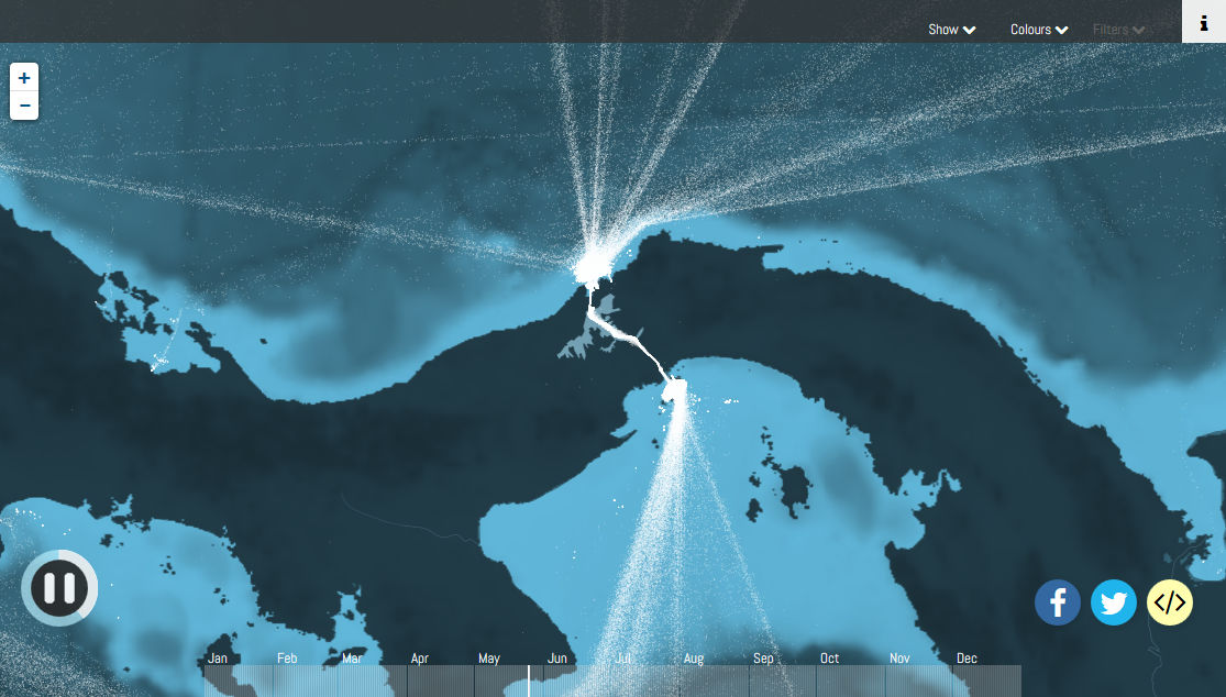
Looking at the Panama Strait connecting the Pacific and the Atlantic Ocean, the ship concentrates as expected.
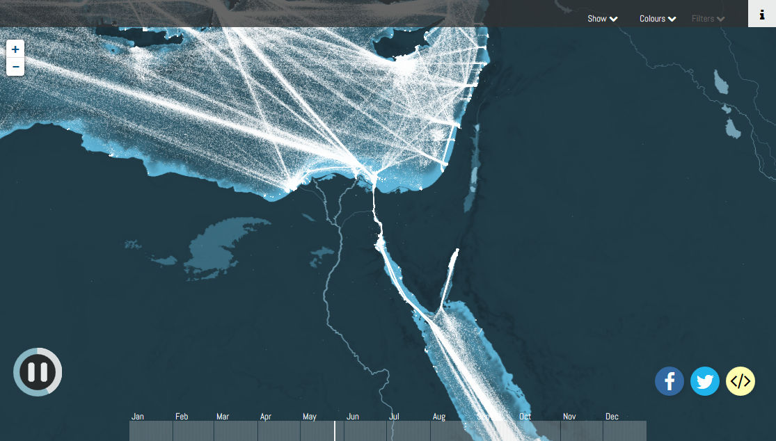
Similarly, many ships concentrate on the Suez Canal.
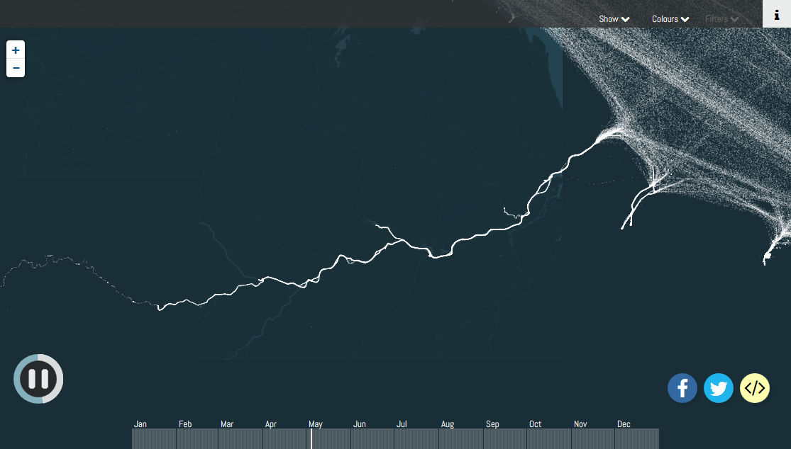
This white line is how the movement of a ship going back to the Amazon River. You can see well that the ship is carrying luggage along the river to far upstream from the mouth.
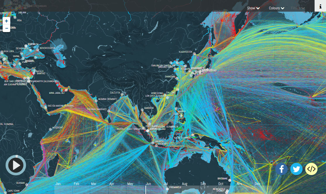
It is also possible to change the color of points for each type of ship. A red dot indicates a tanker, and a yellow dot indicates a container ship. The majority of ships sailing the Persian Gulf where oil-producing countries concentrate are tankers.
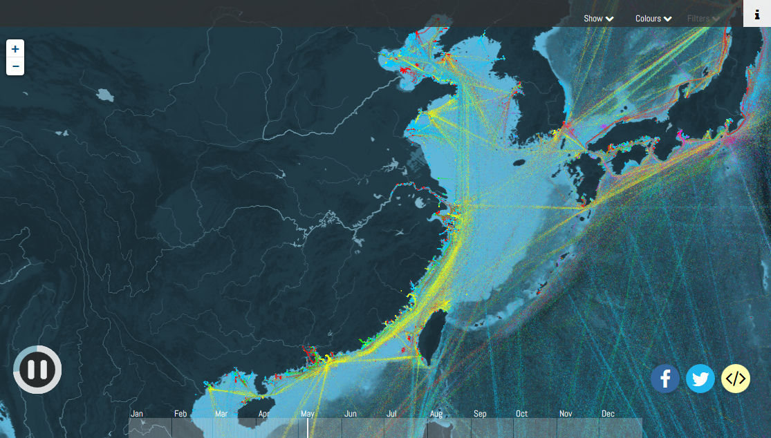
When looking at Japan's waters again, it is obvious that many container ships are sailing from Guangzhou · Hong Kong in the south to Shanghai to Qingdao freight port along the coast of Mainland China. Also, in the waters around Japan, red tankers are sailing in addition to yellow container ships.
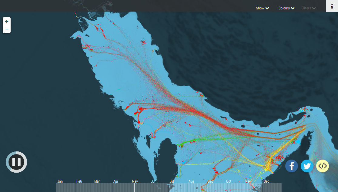
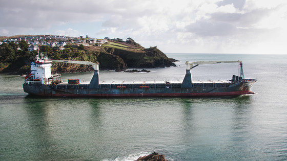
Coloring ship of all over the world is like this. Yellow is a container ship, light blue transport iron ore, coal, cereals, etc.Dry bulk ship, Red is an oil tanker, green is a gas tanker, and purple is a vehicle carrier.
It is also possible to find interesting points by zooming in to a specific area. In the offshore of Rotterdam there is a white and square place, but it seems that this is apparently a place to wait for a ship waiting for entry to the port of Rotterdam, the so-called "europort".
In the Middle East region, oil tankers are mainly used because they are reddish, with the Indian Ocean Traffic around Africa and around Australia and Southeast Asia mainly in dry bulk carriers, and the Pacific Route is somewhat larger container ships, The features of this will be highlighted.
Oil tankers and container ships are mainly in Japan. Since purple can be confirmed in the vicinity of Toyota City and Hamamatsu City, we can also see that many vehicle carriers go and go.
It is like this when you display Tokyo, Nagoya, Osaka, Kobe. The maps around Nagoya and Osaka are a little strange, but it became clear that many logistics were still coming and going in these three cities as well.
In this way, Shipmap makes it easy to understand the actual condition of sea transportation. At the same time, the site also touches on the fact that these ships are emitting large quantities of carbon dioxide, and that amount is comparable to the amount emitted by countries such as the UK, Canada and Brazil .
Related Posts:
in Web Service, Review, Vehicle, Posted by darkhorse_log