I have seen the ruins in the vicinity of Sawayama Castle which Oda Nobunaga made with castle attacks is highly likely
In the excavation survey of Matsubara Uchiho ruins in Hikone city, Shiga prefecture, a remnant called "Horikiri" or "Horibori" was found. Thinking from the situation, when Ichino Momotoshi set up at Sawayama Castle on the south side of the ruins, it was probable that Oda Nobunaga made it, so I went to see it.
Shiga Prefecture Cultural Property Protection Association
http://shiga-bunkazai.jp/
Excavation survey of Matsubara Uchiko-ru site Information on field explanatory meeting | Shiga Prefecture Cultural Heritage Protection Association
First we arrived at JR Hikone station which is the nearest station.
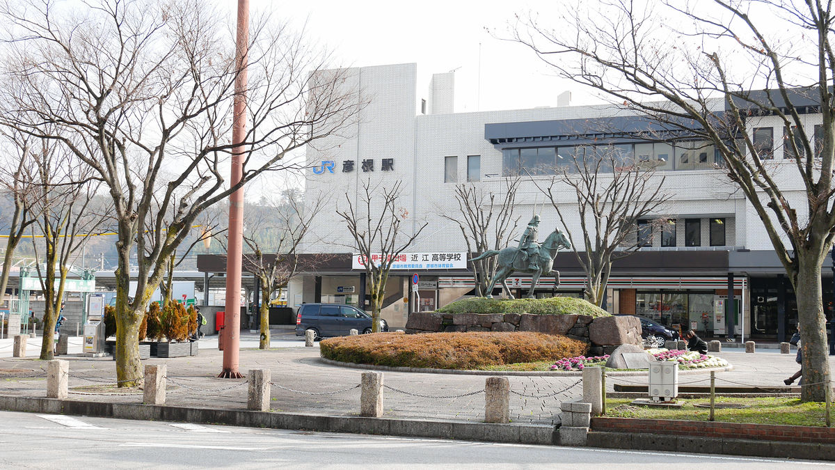
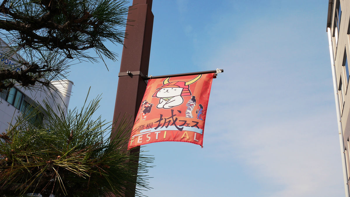
It should have ended on November 30, 2014 "Hikone Castle Festival"The Hikoban banner was swaying in the wind with fluttering.
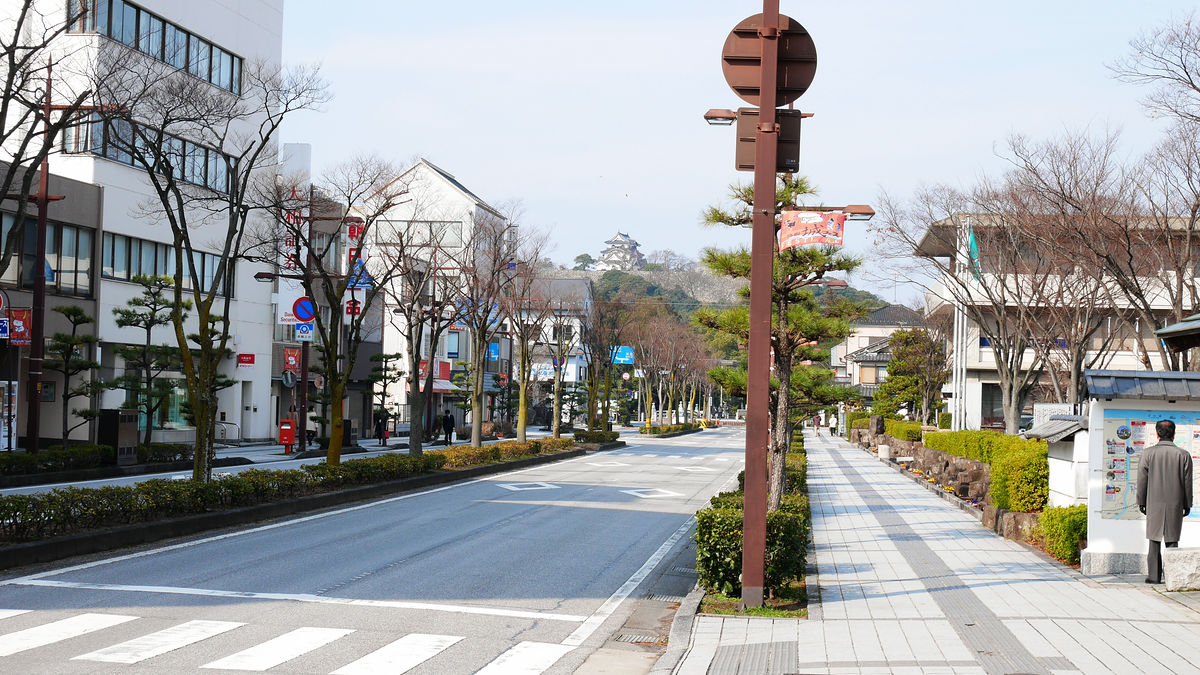
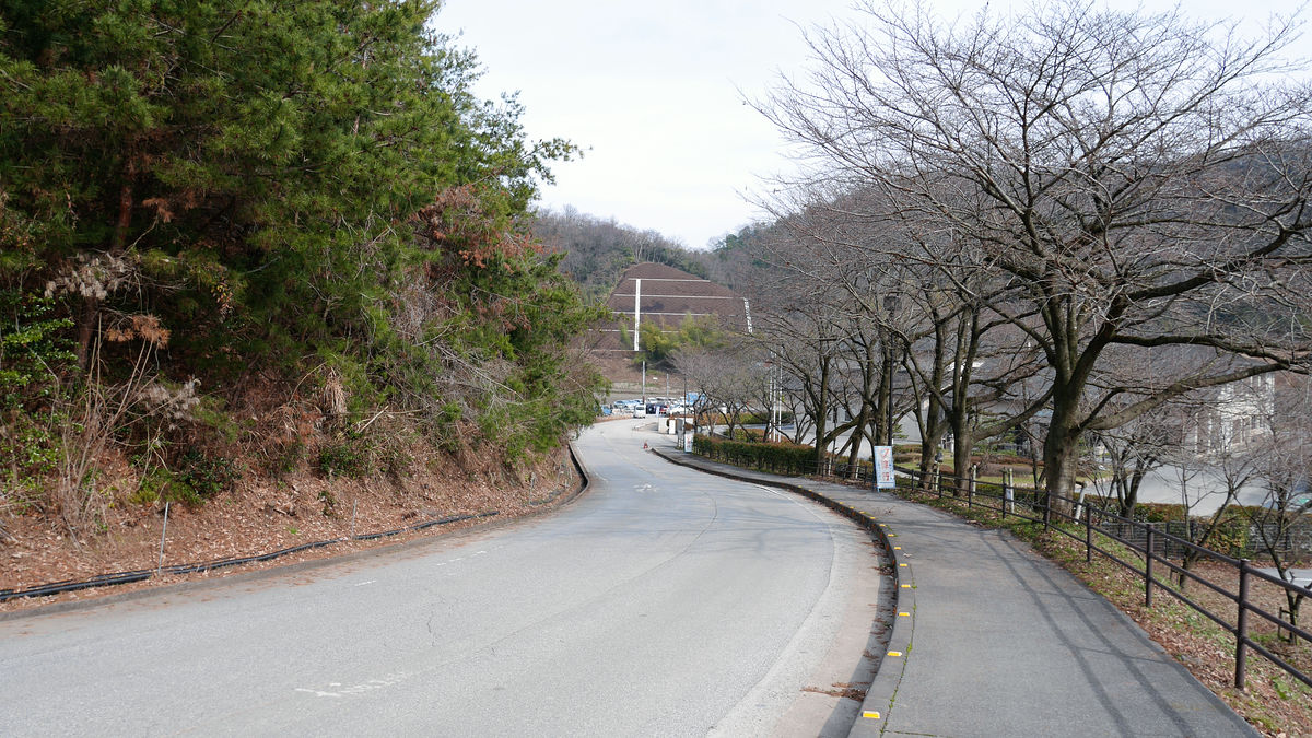
As you walk to the west towards the street in front of the station, you can see Hikone castle at once. But this castle is not this castle.
Looking northeast side there is a mountain with a lot of humor. This is Sawayama, there was Sawayama Castle in the part where the peak of the summit of the mountain was flat. It is the Matsubara Uchiho ruins that we are aiming for this time, when Oda Nobunaga struck this Sawayama Castle and found a remnant that was thought to be made.

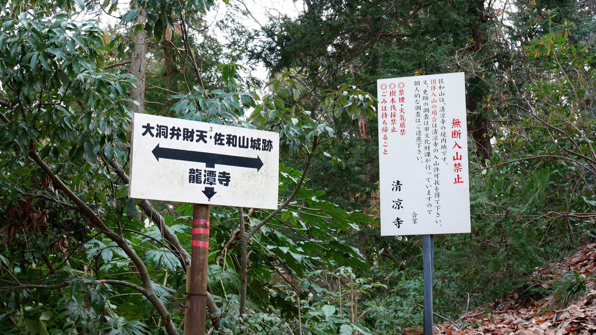
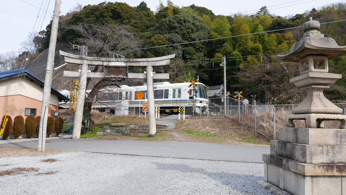
Towards the north side along the way passing through the east side of the Hikone-shi joint government building, a guide board will come out to "Sawayama castle tower", so turn right.

The signboard of Ishigaki and "Sawayama castle ruins" can be seen where crossing the railroad crossing, but as I climb the castle, after crossing the railroad crossing, turn left.

Here is the street where temples and shrines line up.
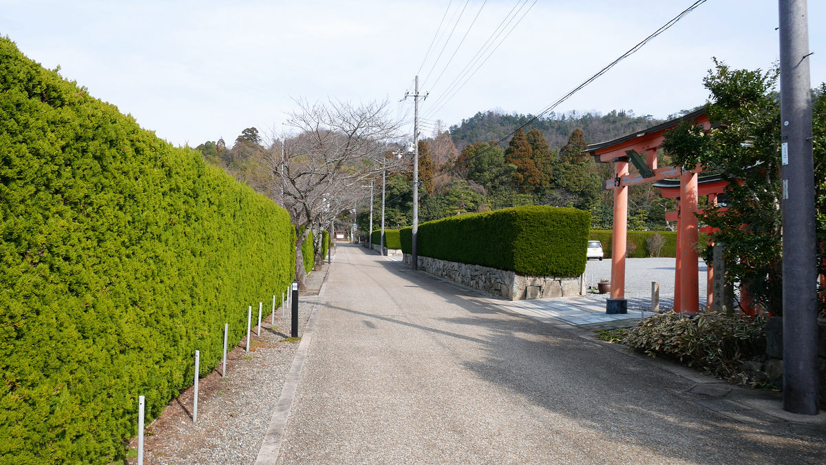
Behind that is the "Hongdon Mountain Ryu Railway National Temple" (Ryuan Temple).
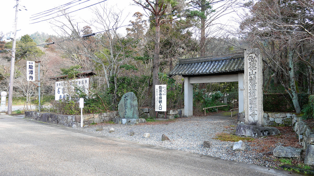
An information board of "Sawayama castle ruins" is standing opposite the temple.
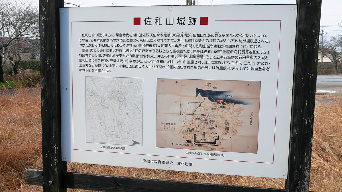
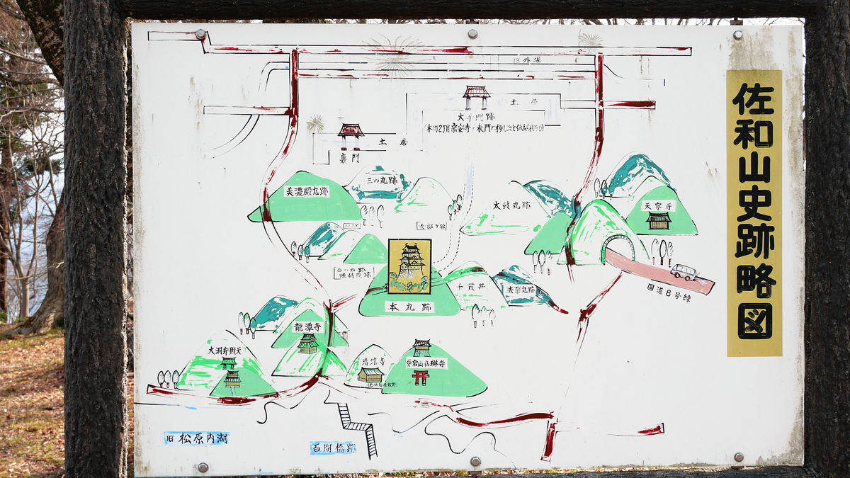
It is here at Yongtan Temple on the upper right corner of "Sawayama Castle Ruins History Overview". It is going to go up as the mountain path extends to Nishinomaru through the precincts. The front side of the original castle is on the east side, there is an entrance exit along the national highway No. 8, but this time it gave up this time because it is not maintained as compared with the road on the side of Ryuanji temple.
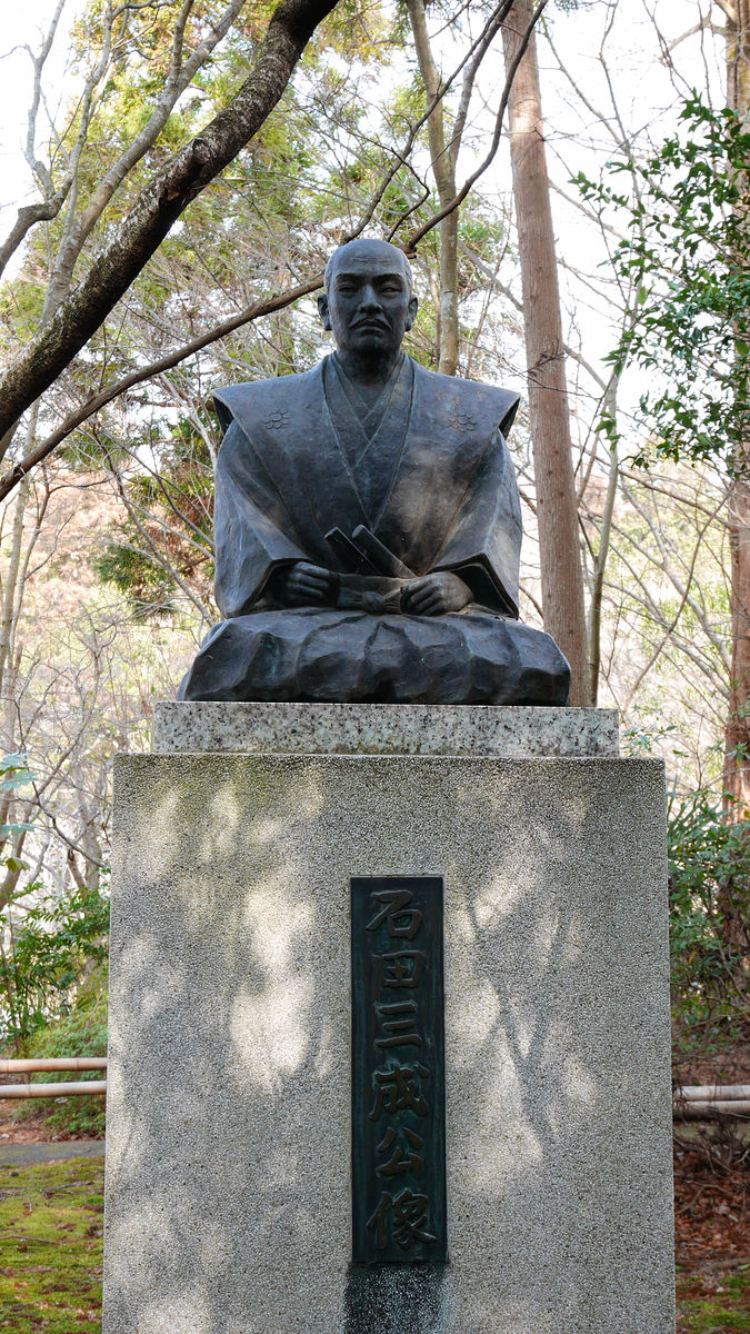
In the precincts there is a statue of Mitsunari Ishida who entered Sawayama Castle later.
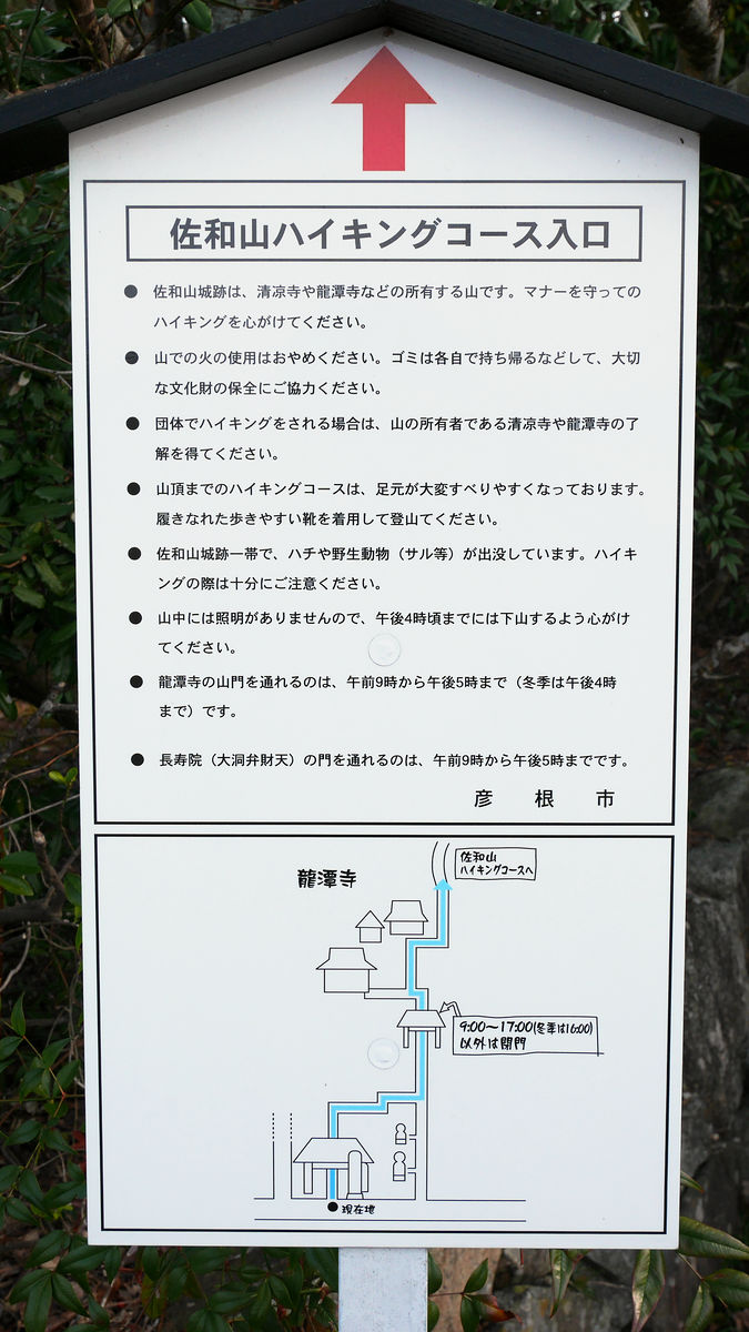
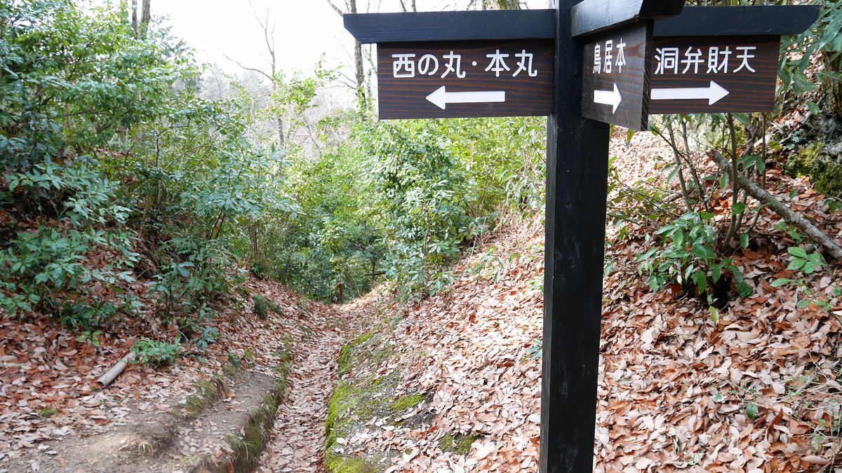
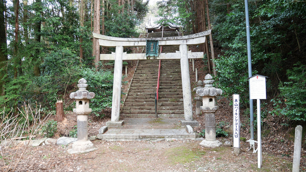
Anyway, if you walk this "Sawayama Hiking Course" you will get to the castle ruins.
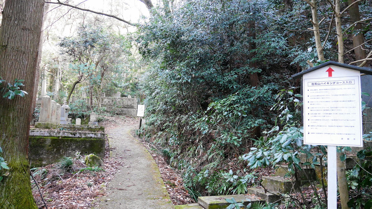
I will pass through Kannondo's sideways.
It is the way to go through the cemetery, but this is correct.
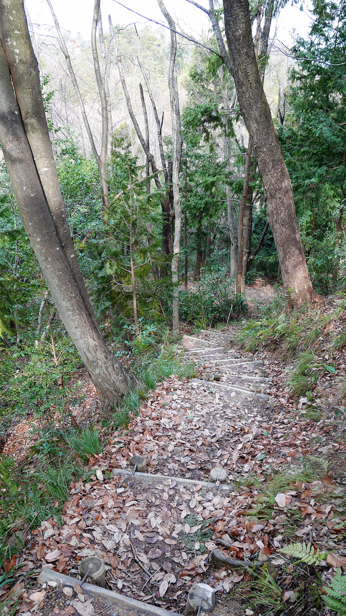
Although the temple grounds are paved, it will immediately become unpaved and become a violent road up and down. At the very least it is "mountain castle", so at minimum, easy to walk shoes and clothes are necessary.

The slope of the upload continues quite a bit, but if it is less than 15 minutes it should be able to come to this branch point.

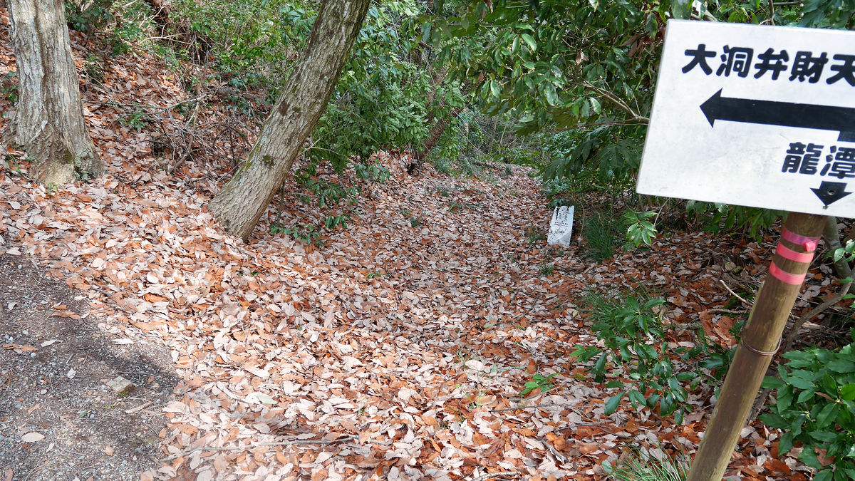
When Tsuji rises from the side of Yongsan Temple, the left is the Daitong Benzait Temple and the right is the Sawayama Castle Ruins. In addition, because the whole mountain is in the premises of Qian Qi Temple, which is at the foot of the mountain, it is said that an entry permit is required for groups.
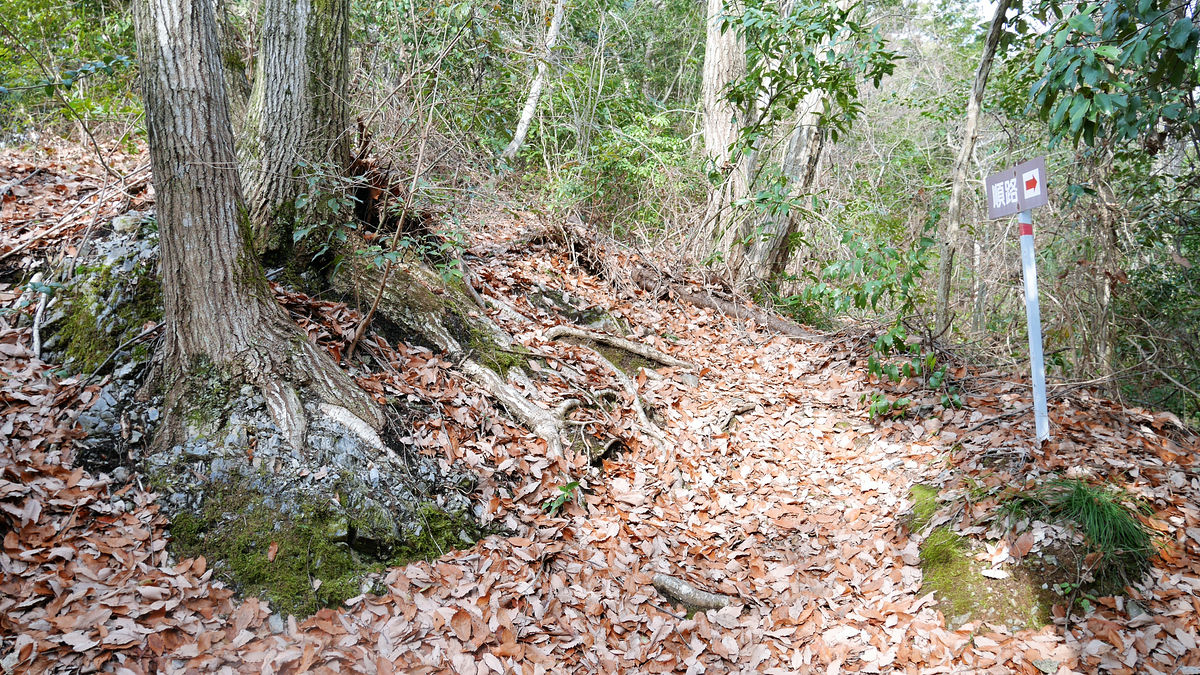
Upwards continue to the castle remains after this.
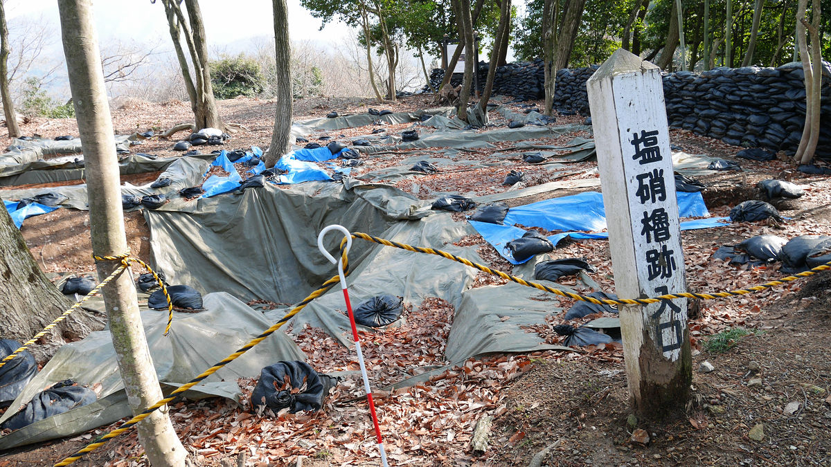
It seemed that the site was under maintenance and was off limits.
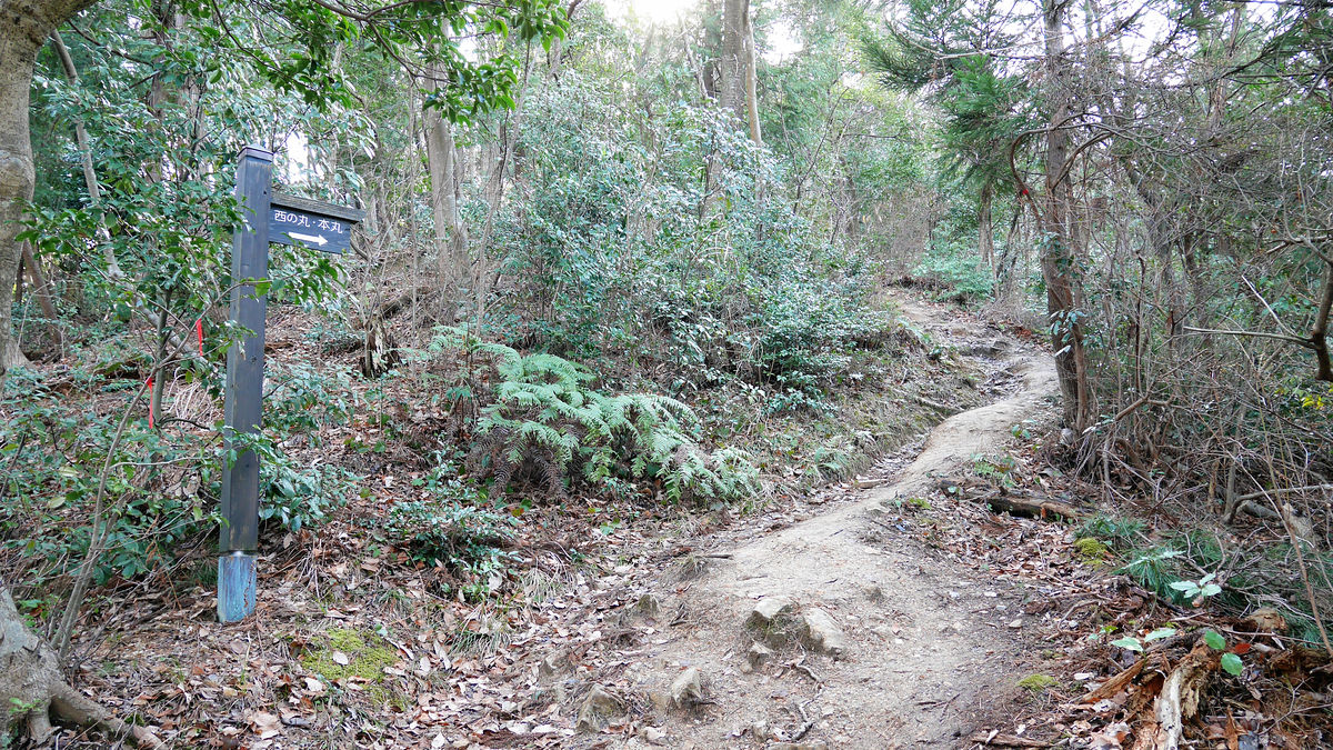
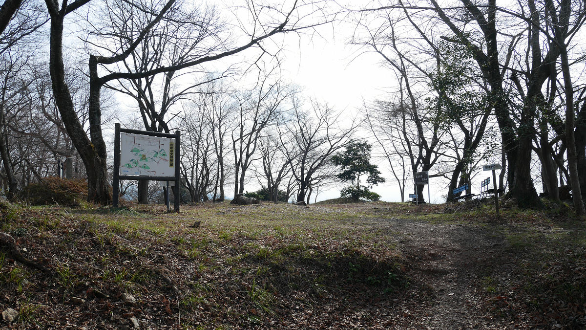
When it gets up a bit from there, a small square-shaped place that flattened is a trace of Nishinomaru.
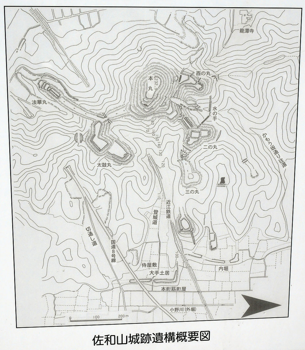
This is the Northwest side as seen from Honmaru. As a result of the survey, bends, basements, wells etc. have been found around here.
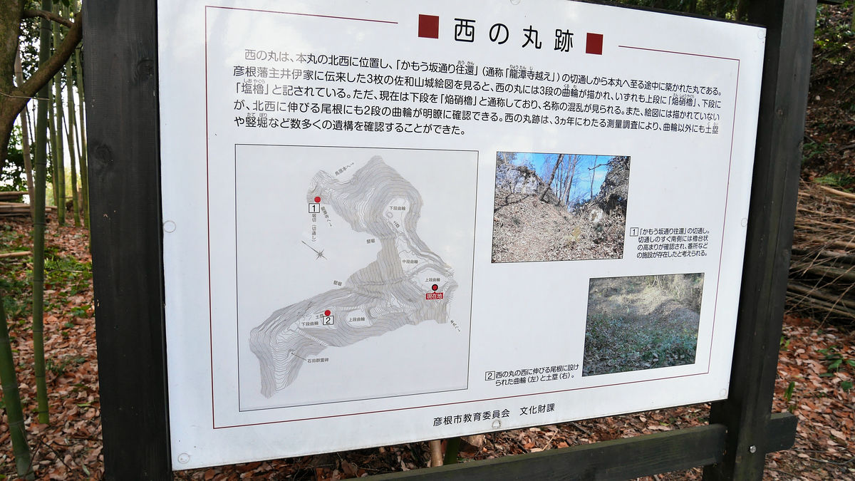
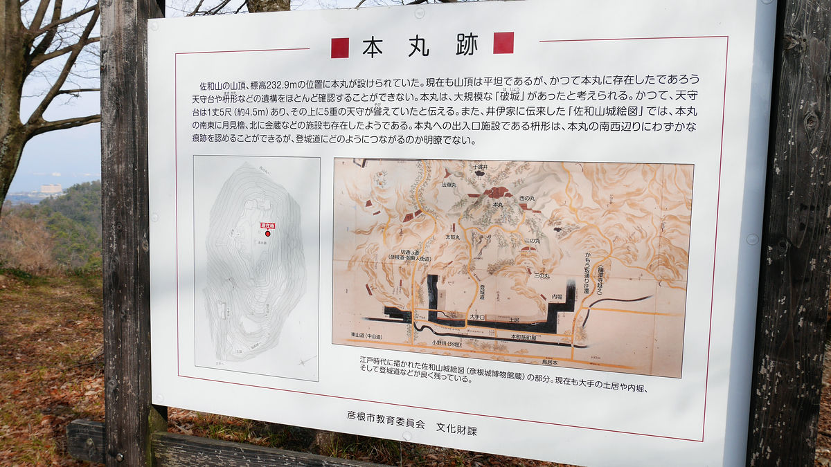
If you do a little more from Nishinomaru, it will be the summit of the mountain, Honmaru ruins. Arrival at the summit in approximately 15 minutes, the distance is 1 km, even if you go up slowly it is about 30 minutes distance.
Looking at the schematic diagram like this. ...... It looks like too short ... ....
The altitude is 232.9 m. It is thought that "castle castle" destroying the facility of the castle in advance was done, and a part such as Ishigaki is left, but there are no facilities such as a tower left.
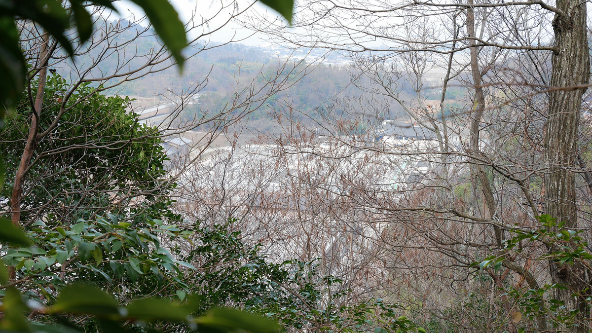
However, the scenery is very good, in the direction of the sign that "Samurai's dream Sawayama" ......
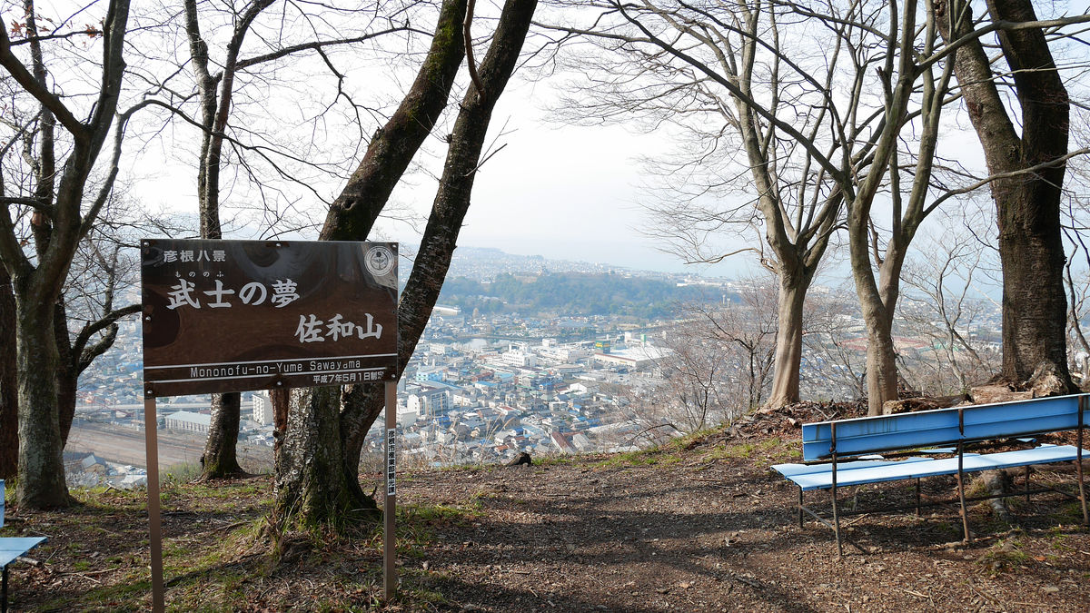
Hikone castle is visible. Around the area covered with green right hand, green.
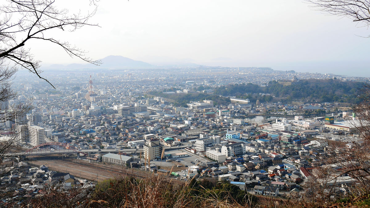
Furthermore, JR Hikone station (part overlapping the photo left / branch) can be seen when moving the line of sight to the left side.
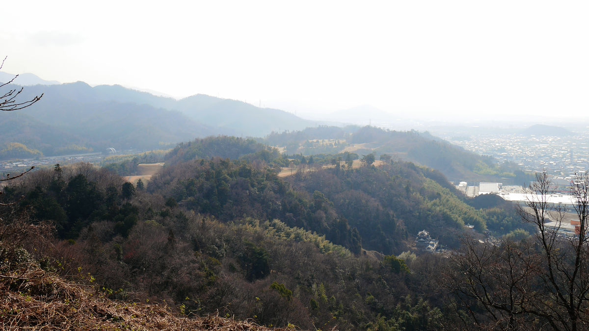
The mountain leading to the south side was a golf course.
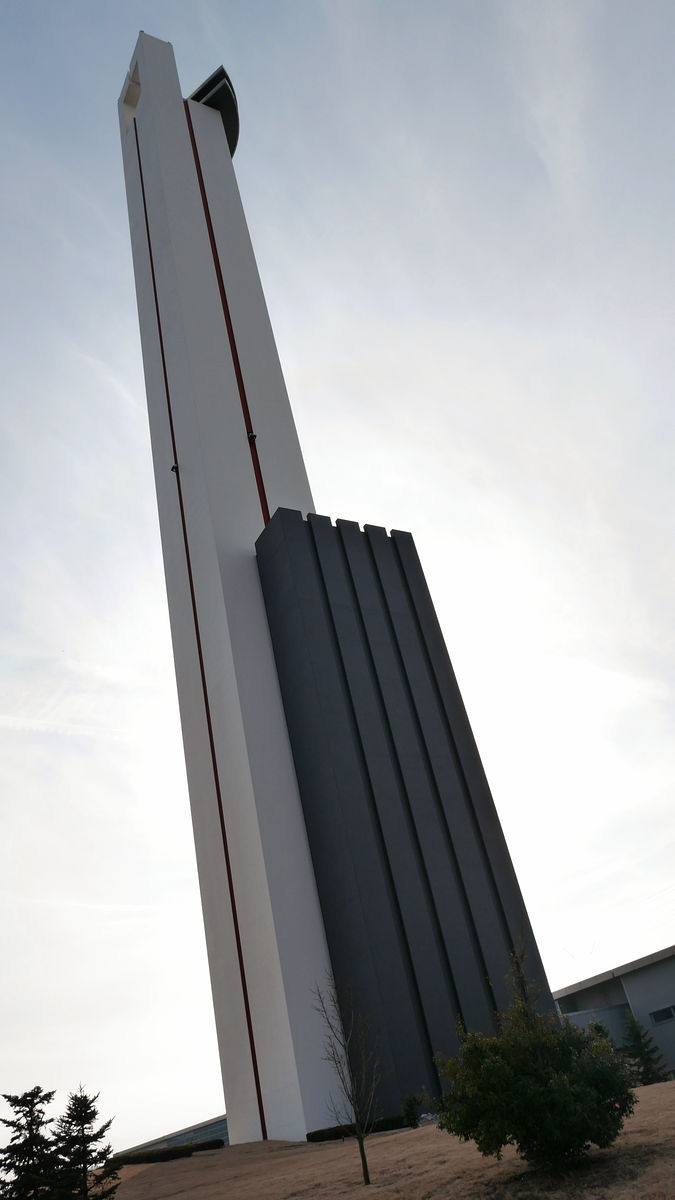
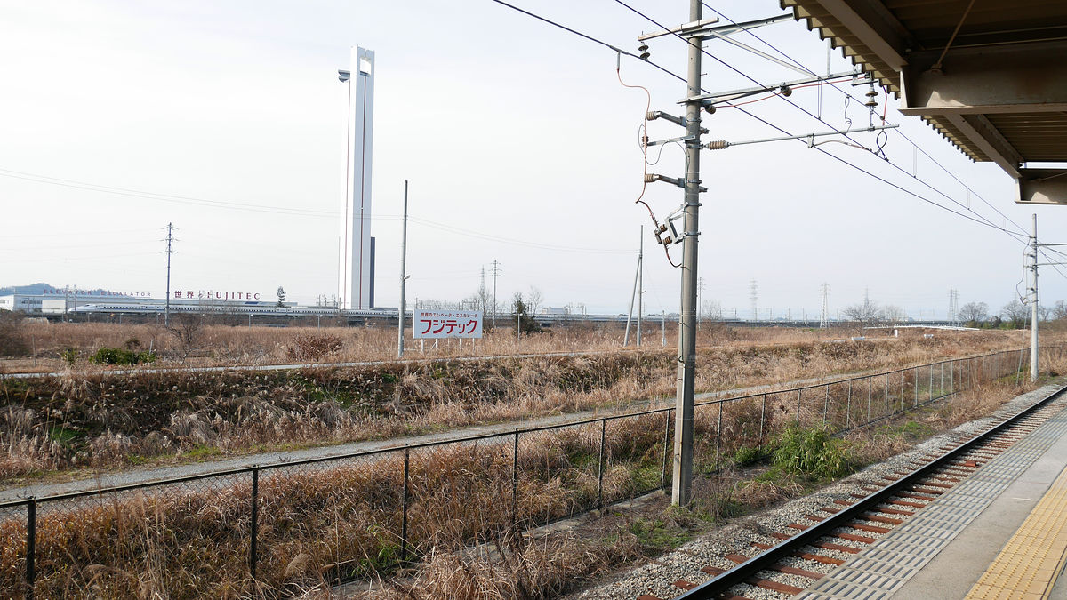
The east side is like this. The white high-tower that looks to the right isFujitecofElevator research tower. The height is 170 m.
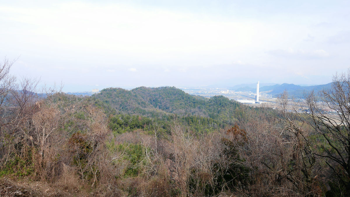
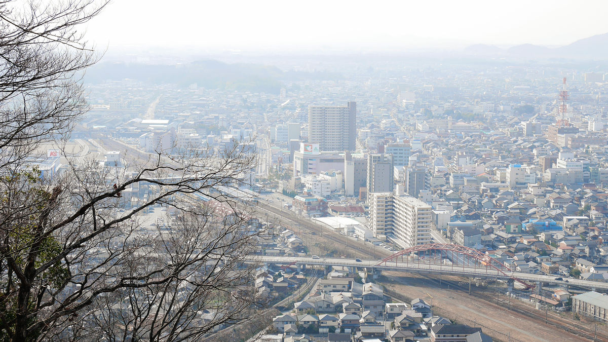
A freight train passed under the eyes. It is said that the Sawayama hills were the boundary between Jiangbei and Gangnam, and it seems that it also understands that the warriors named as important points were included.
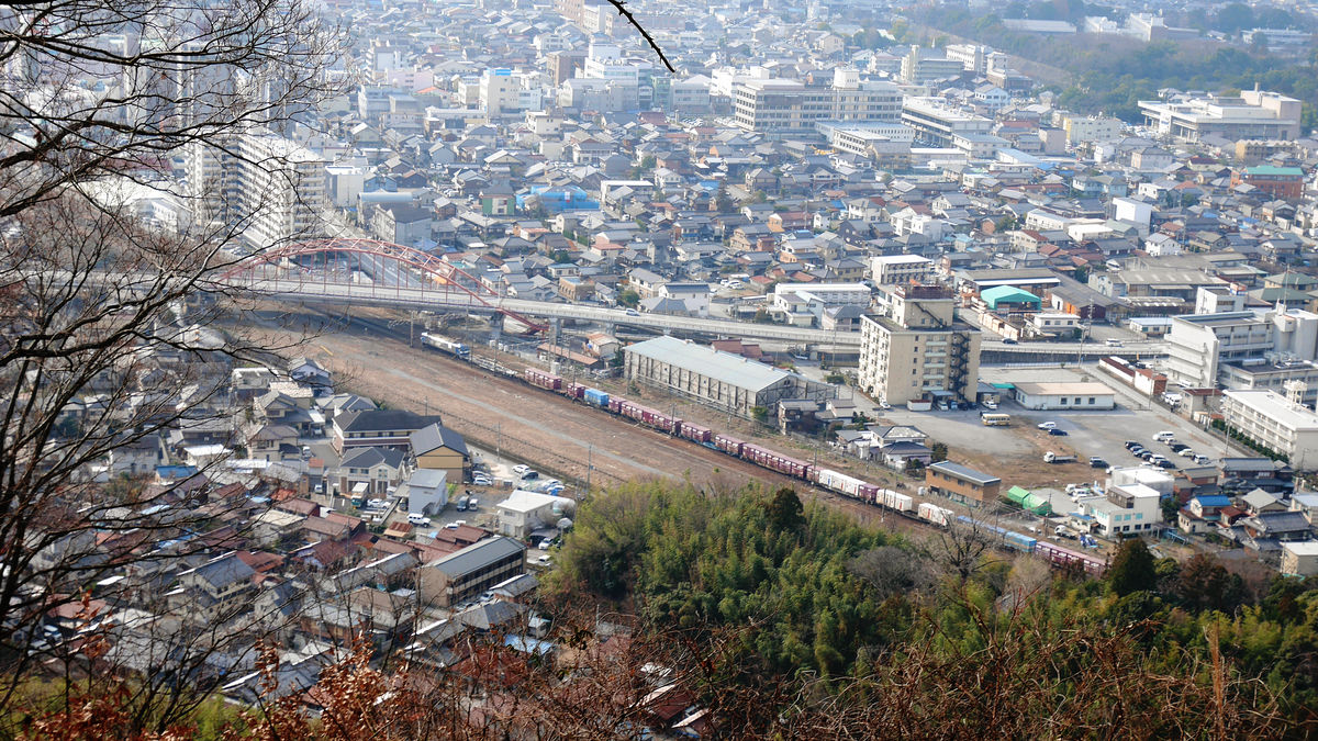
This is the place which turned to the northwest. There is Omi High School in the center left, the JR line running diagonally downward. There is a lake called "Matsubara Naka Lake" in the area around this picture, and Matsubara Uchiho ruins are located on the right hand side of the photo. Inner Lake was reclaimed from 1944 after the war and became high school premises and paddy field etc.
I confirmed Sawayama Castle and I will go down the mountain.
The left side of the photo is Sawayama Castle Ruins, the front side is the Yongtan Temple side where the front has risen earlier, the right is the Daito Benzaiten. Hand is facing forward "Tottori" and guidance is out ... ...
The road was buried with fallen leaves. This road which passed from Toriomiya direction to Longdamn Temple is "It's already Saka Dori returning", commonly known as "Ryutanji Temple Beyond".
Since I had time this time, I decided to turn around from Daito-Benzaiten, but I will regret as soon as the up / down is fierce than before. If you are accustomed to mountain walking, it is not such a difficult course.
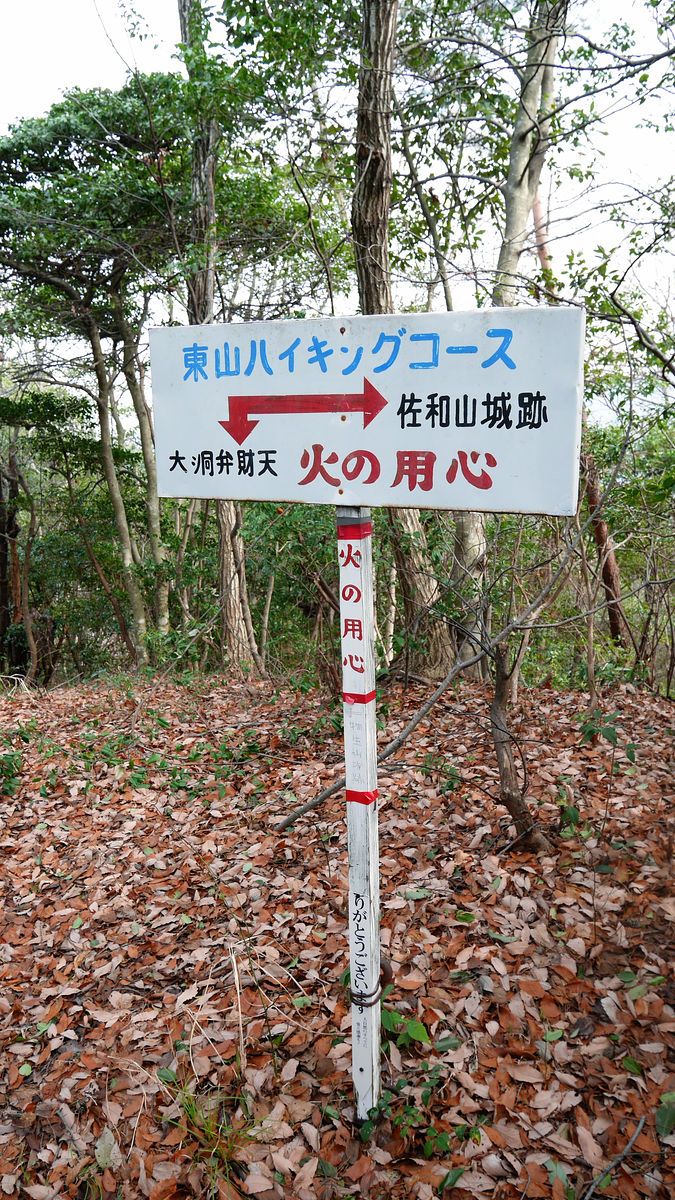
This road seems to be "Higashiyama Hiking Course".
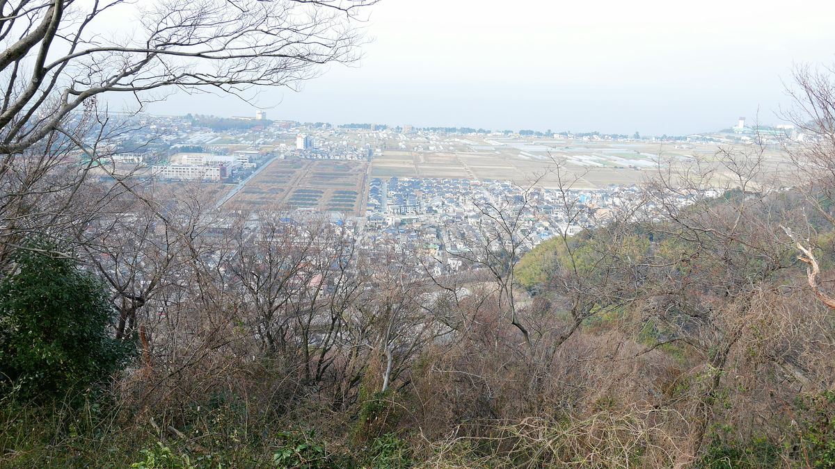
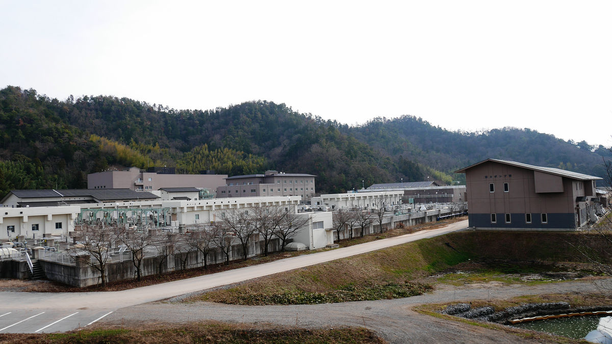
When going past the pass, you can see the northeastern purification center in the north. The northern part of this center is Matsubara Uchiho ruins.
It roughly circled around and arrived at the back of Daitong Botanical Garden in about 15 minutes.
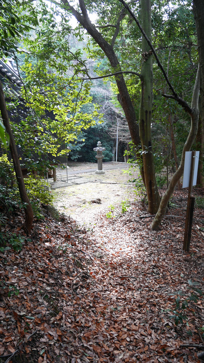
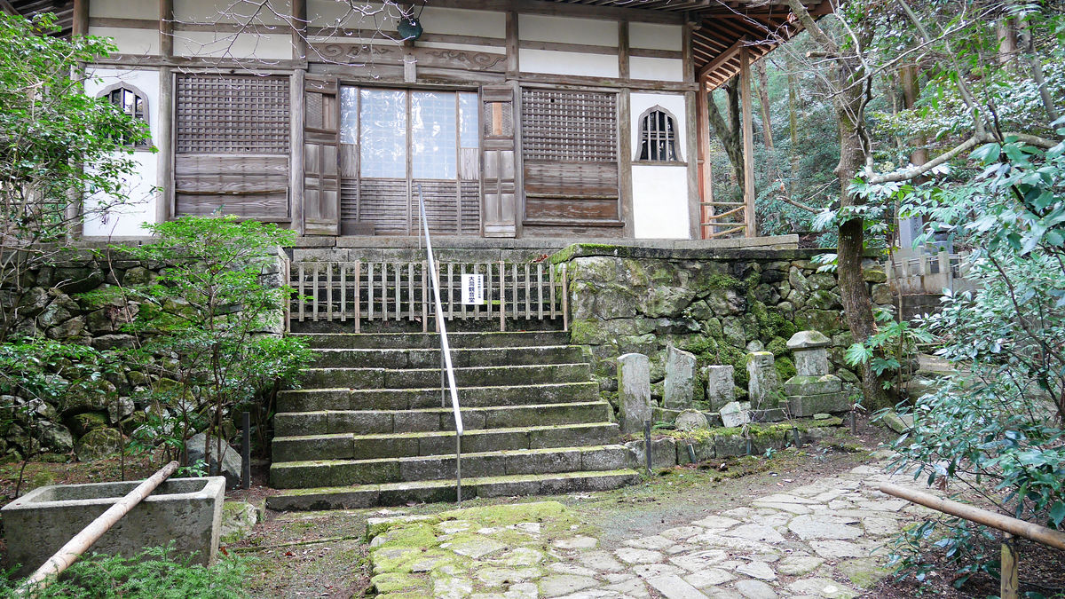
Since I came out from the back, the building in front of me is Okunoin.
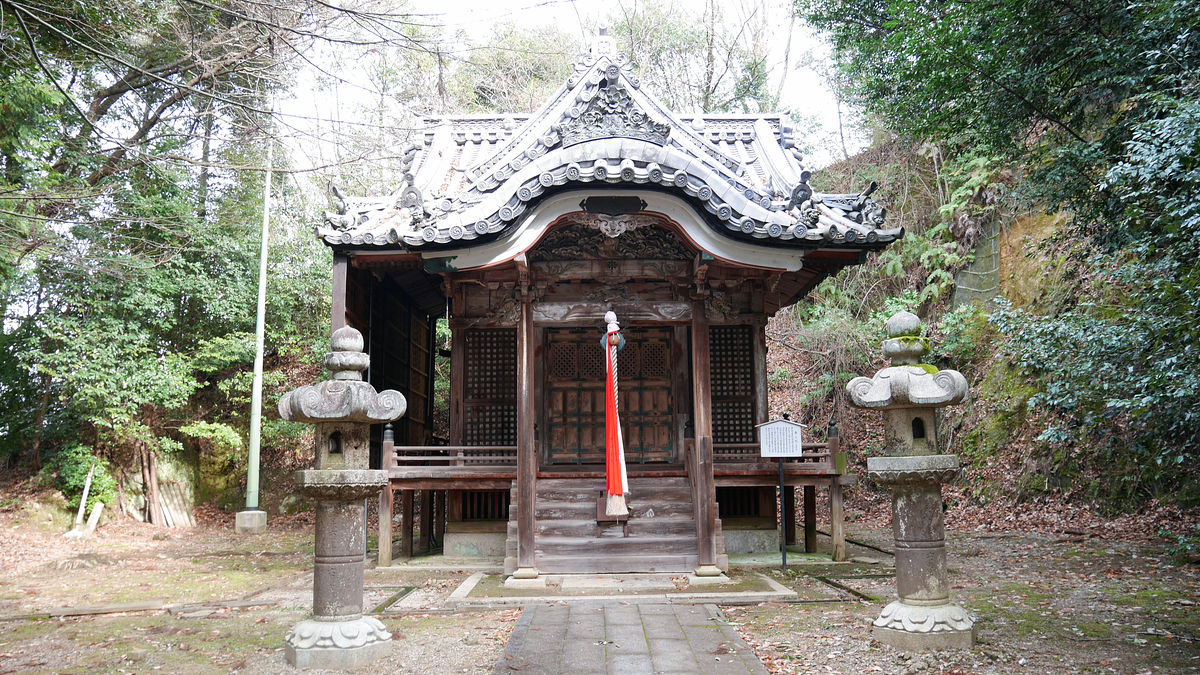
Located one step down the stone steps is the Longeviciary Ranburetaido. Not in the Warring States Period, Hikone clan 4th generation castle ownerNao IiIt was built from Genroku 8 years (1695) to the following year.
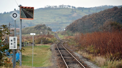
I will aim at the ruins through a railroad crossing different from when I headed to Ryuzanji.
When going to the north along the JR railroad track, you can see the overpass.
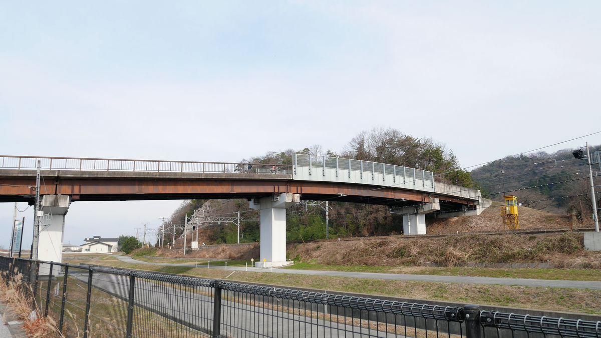
This overpass is the road to the northeastern purification center.
It is the purification center that spreads to the right hand side.
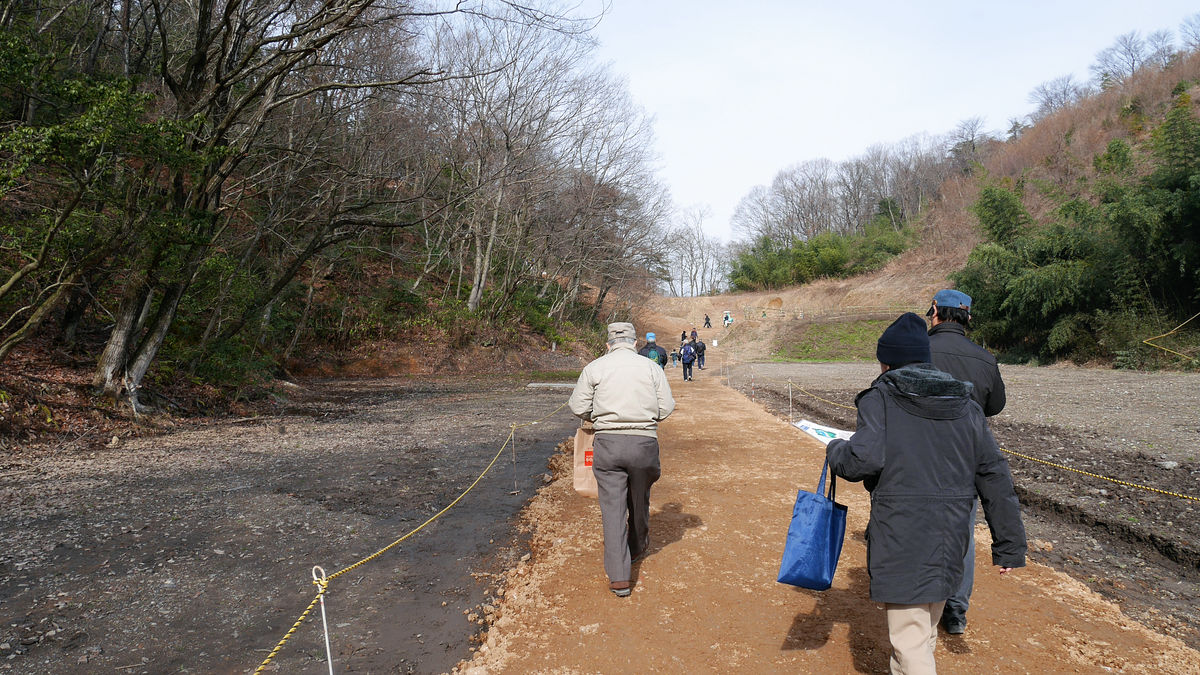
The ruins are in the far back.
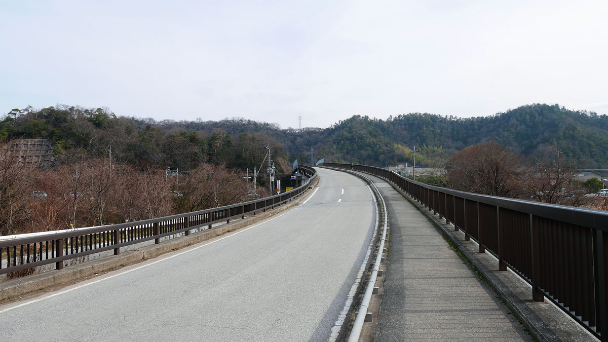
To the site.
It does not seem like a slope ... ...
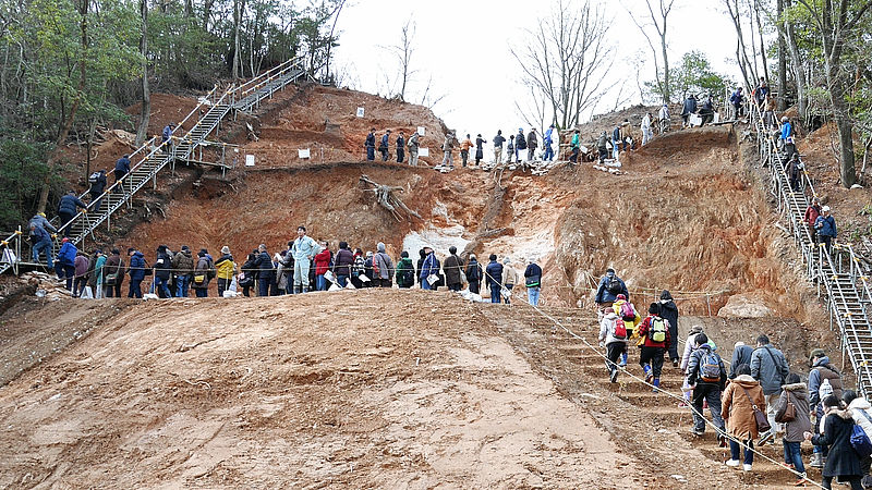
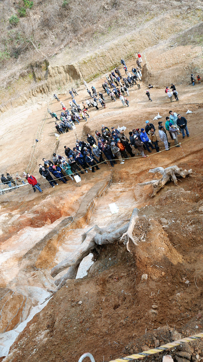
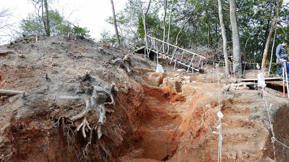
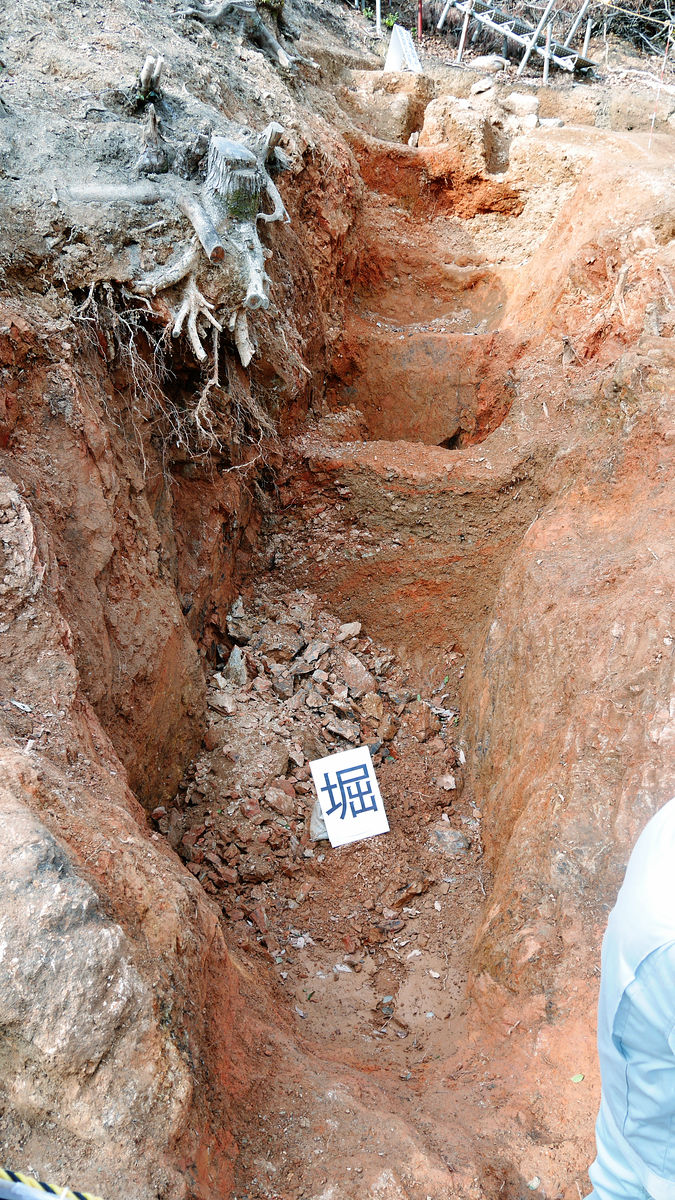
On the upper side "Horibori (Tatebo)" is showing her face. There is no direct evidence as to what the remains of this is,Battle of AnekawaIt is likely that the possibility that Oda Nobunaga made when Mr. Isono who was crowded in Sawayama Castle attacked afterwards would be high in terms of the situation.
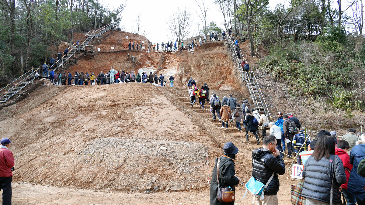
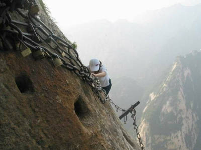
While dividing the number of people due to the fact that my feet are muddy, just crossing the scaffolds that cross the boundary between "Horikiri (Hikiriku)" and "Horibiri", what can be seen in the immediate future To
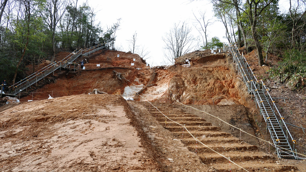
I can not understand the whole picture if it is from this obliquely below angle ......
As you approach, you can see that the ridges are sculpted roughly. This is what is called "Horikiri". When a soldier with a basket in the castle moves, it is a hilly area so it is quick to move to the ridge promotion, so we are scraping the ridge to hinder the movement.
It is said that 3 meters is dug down if it is deep.
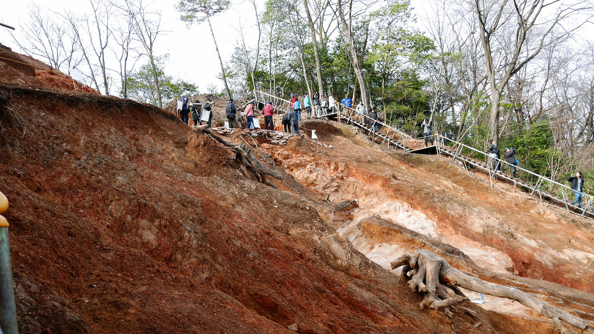
"Horibori" goes to the slope almost without bordering from that Horikiri. Just like Horikiri, the one that aimed at inhibiting movement by digging the ground surface. It is dug in the direction perpendicular to the contour line.
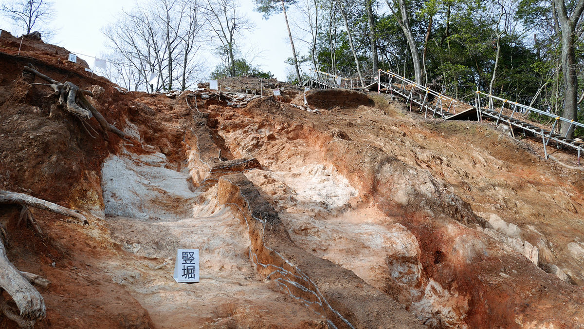
Looking up from below it looks like this. In addition, although it seems that there are two straight vertical moats, the center is left to confirm the overlapping of the strata, originally a thick vertical moat was digged. It is thought that the rocks were left as it was on both sides, and furthermore the remaining soil was stacked up like an earth base.
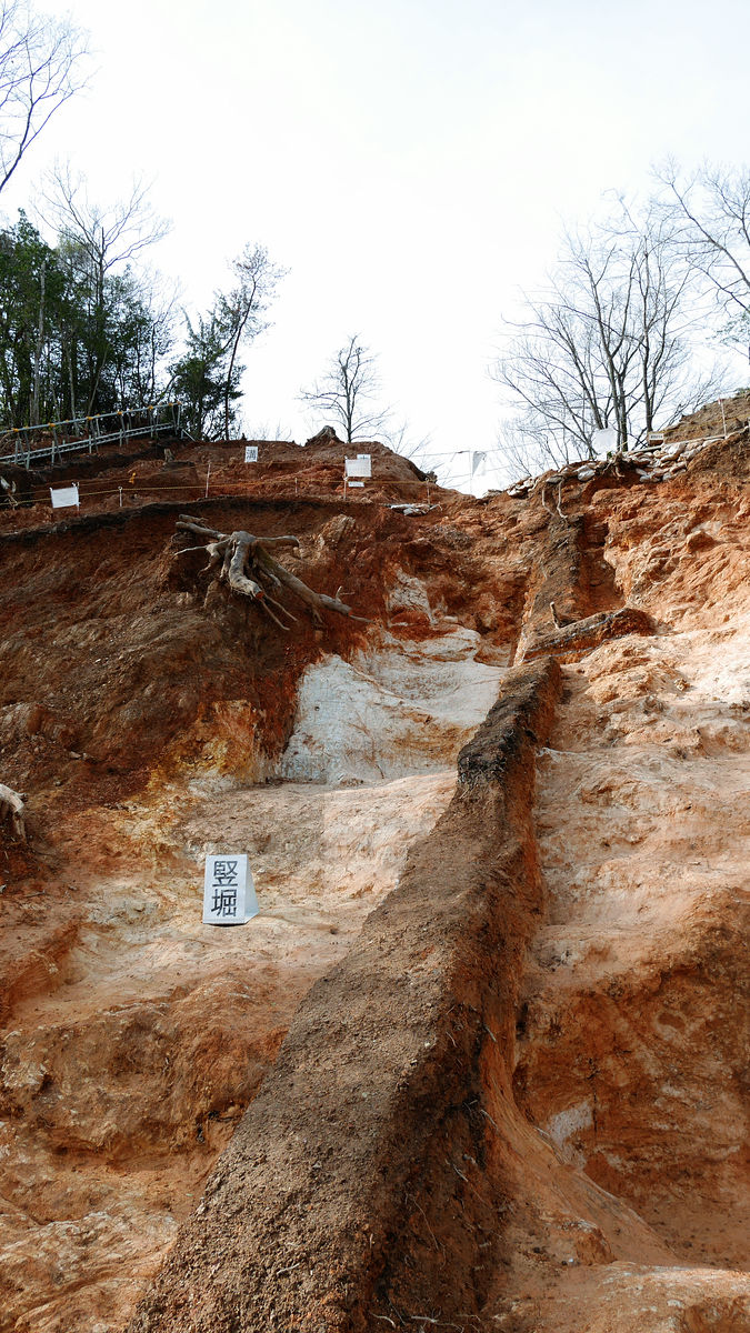
Looking at the other side from the climbing scaffold is like a valley. It seems that the well is not continued ... ...
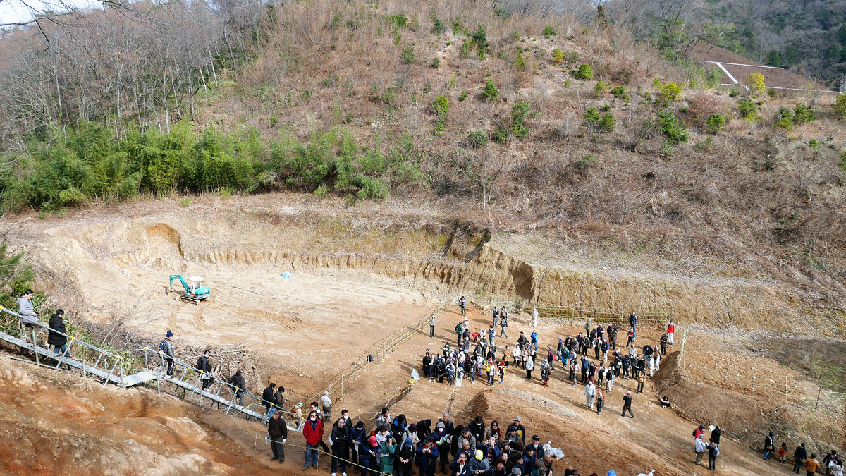
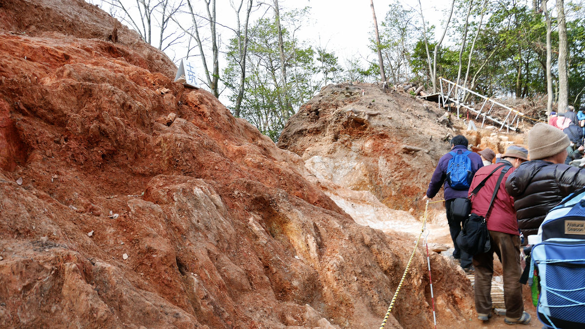
According to the survey, as Horikiri has been confirmed even around a tower far far away, so as to connect hereKagaki(A barrier to hinder the movement of pests, etc.) may have been established.
In addition, there is a part which was dug down even from the line that follows Horihori - Horikiri from diagonally.
It seems that we do not know why this "oblique moat" was dug for the moment.
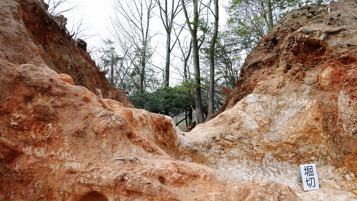
By the way, the upper part of the moat has been dug by breaking the stone row in the latter period of the Kofun period.

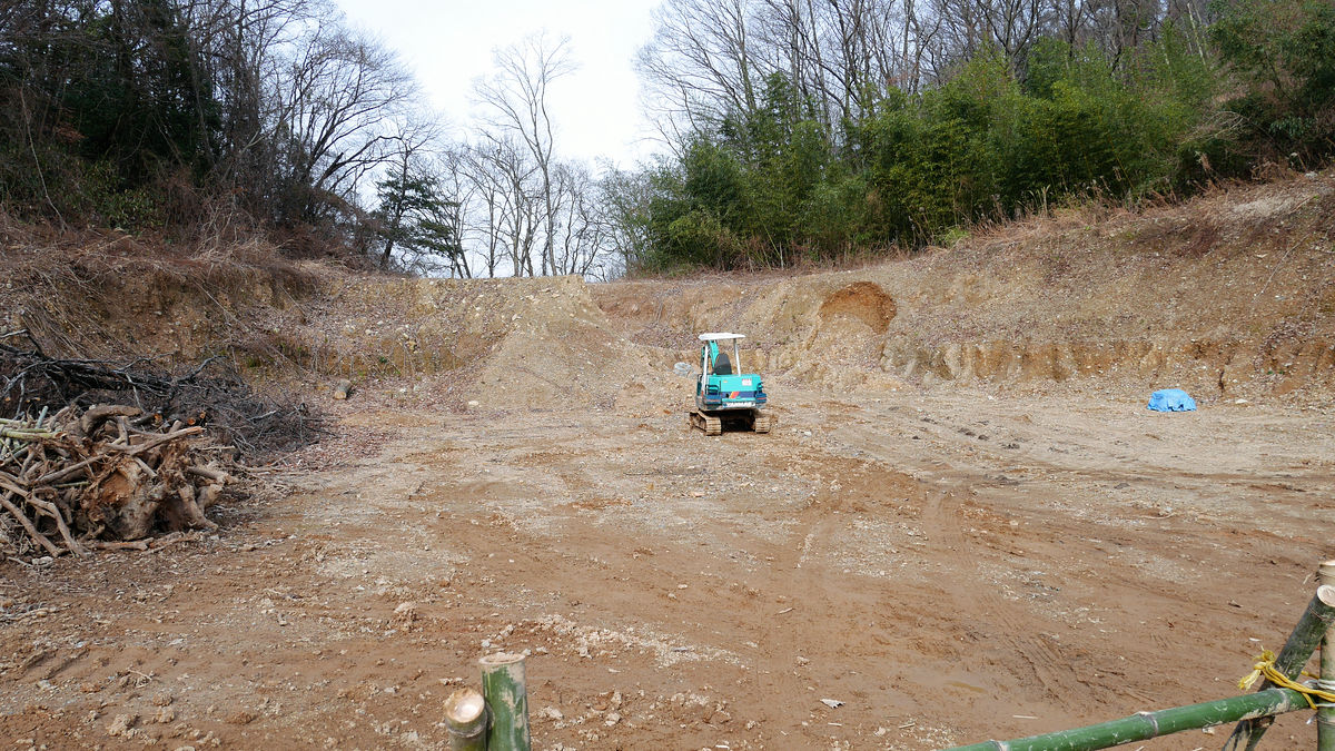
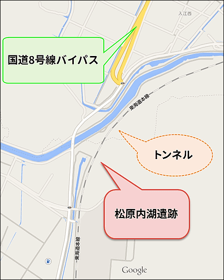
The ruins of Matsubara Uchinoko are being excavated from the time when the Northeastern Purification Center was established in 1983, and evidence of ancient work has been found, but this time in the Sengoku period It seems that the announcement was made extensively because it was a strange thing to be seen. here(PDF file)National Highway No. 8, Maibara BypassIt is planned that the ruins will be backfilled at that time.
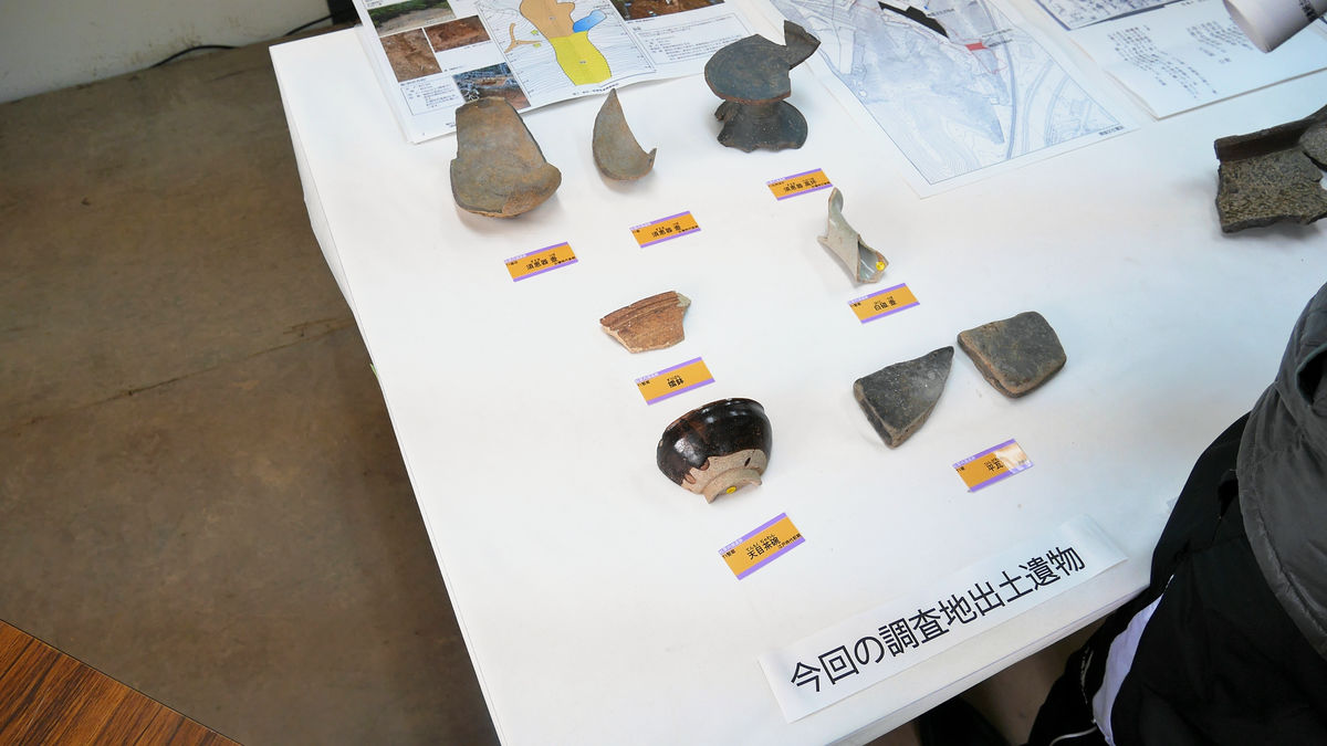
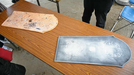
In the prefab which had been set up at the entrance of the ruins, exhibits of excavated items were being held.
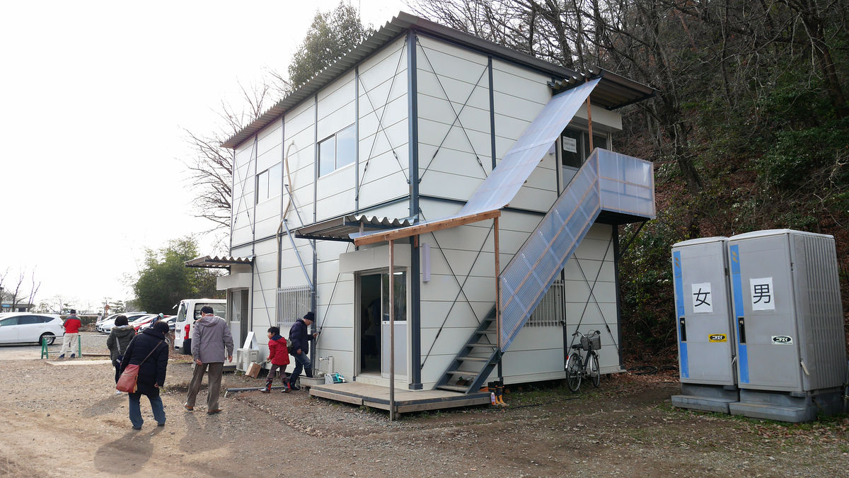
Excavated are such items. There are Suebu in the Kofun period when it is old. White porcelain pots and Tenma tea bowls are considered to have been in the Edo period, since this area became satoyama. The thing of the Edo era was excavated from the part that was considered after the Horikiri · Horiba was disposed of, and it was speculated that this remains would be from the Kofun period to the Edo period, and from various situations, Nobunaga's It was narrowed down that it would have been made at the time of Sawayama castle attack.
This is the end of the remains itself, but it is nothing more than that, so I decided to go check out what is going to be with Yonehara Bypass. The JR Biwako line goes to the west side of the ruins and the Hikone Yonebara line of Shiga prefecture road 329 goes further to the west side.
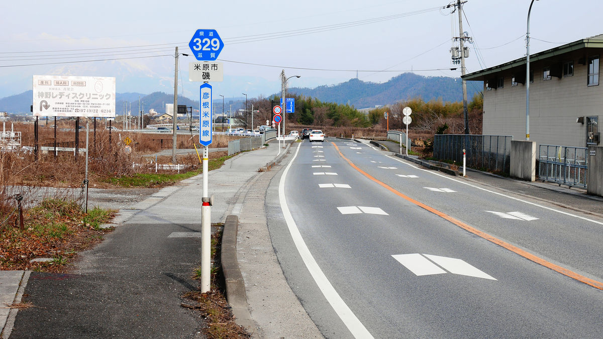
To the prefectural highway No. 329, it is Mihara Bypass that confronts confidently.

As you go from the south, if you go straight road No. 329, you will enter the city of Maibara, but you can shortcut to Tsuruga and Nagahama by going to the left and passing through Yonehara bypass.
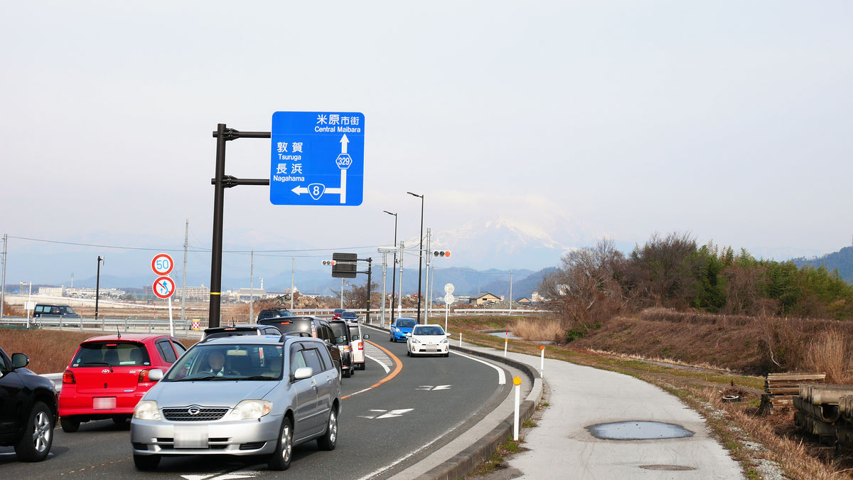
Looking at the map like this. There is National Route 8 which runs east of Sawayama as the main road connecting Maehara and Hikone, but due to the heavy congestion, it was made to bypass Yonebara city area. After this, we will go over the mountain to climb the northern part of the northeast part of the purification center and plan to join the national road No. 8 around Toriimoto.
Looking back at this point, looking at the extension line of the bypass, the figure of the tunnel buried in the grass behind JR ... ....
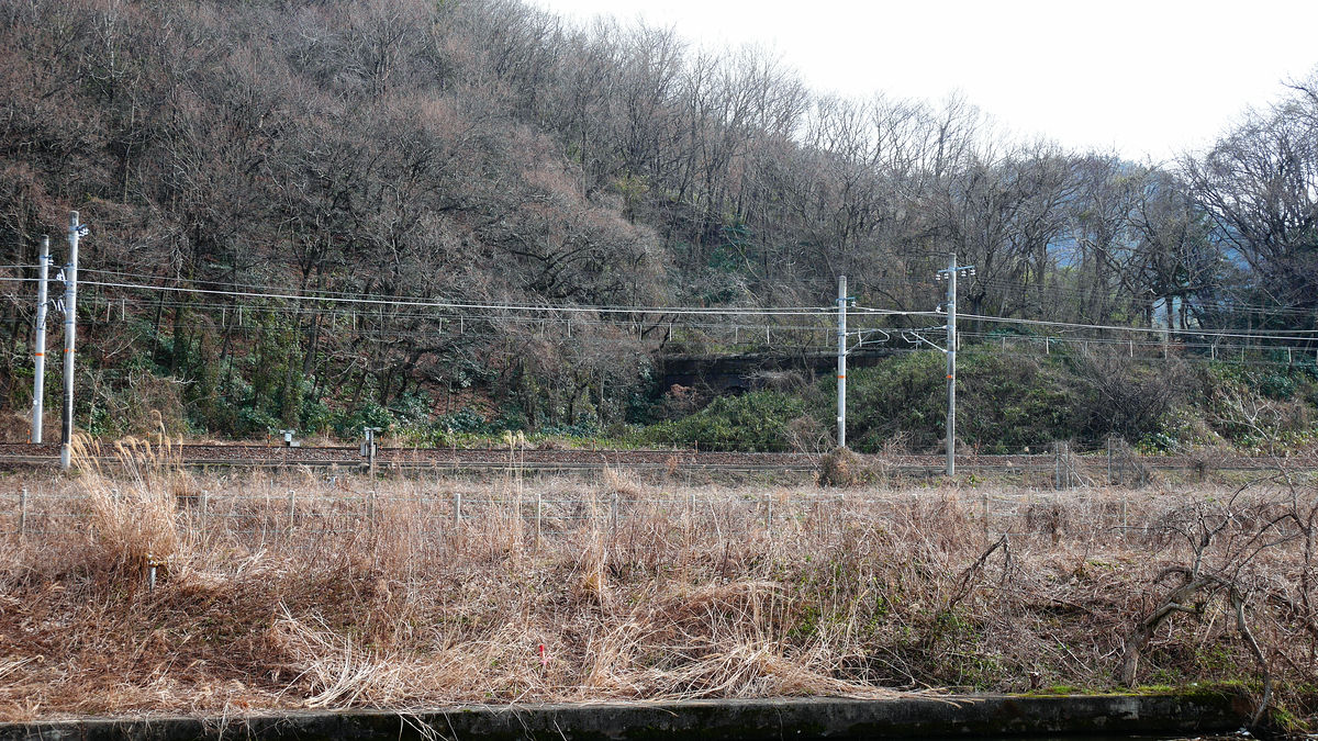
Although the positional relationship is quite rough, it looks like this. According to the information held in the area early in the field, it was said that the railway passed through this tunnel until the Showa 30s around the national railway era.
When I visited the Matsubara Uchinoko ruins, there was a part that looked like a valley, but it seems that this was a former line trace. As a trace of it, things like faces still remain slightly on the slope of the front of the photo.
By the way, this area is around the middle point between Yonehara and Hikone roughly. As I headed to the east, thinking that it was the same unusual direction ...... I decided to go beside Fujitec's elevator research tower overlooking from Sawayama Castle.
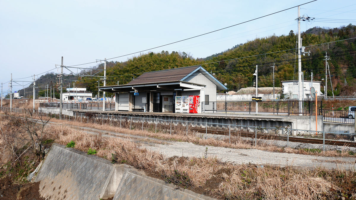
Walking from Matsubara Uchiho ruins 45 minutes, Omi railwayFujitec Front StationArrival in. ...... In this case, maybe it was earlier to walk straight to Mihara.
However, thanks to walking to here, I could see the Shinkansen running in front of the Sawayama castle ruins.
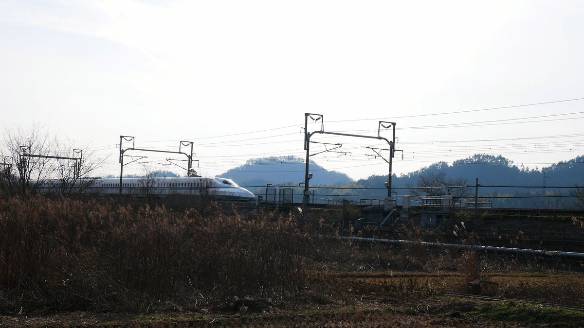
Fujitec's elevator research tower looks better from the Shinkansen, but seeing the Shinkansen running in front of it, it is the second one.
This, the Shiga Prefecture excavation research result meeting meeting for Heisei 20th, including the survey result of Matsubara Uchiho ruins etc, will be held on Saturday, March 7, 2015Collaboration but 21The meeting will be held on the third floor of the conference room. Reception starts at 9 o'clock, from 9:30 to 16:30. Pre-registration is unnecessary, entry fee is free.
In the briefing session, in addition to the Matsubara Uchiho Ruins site, the Mizuguchi Okayama Castle ruins of Koka-shi ruins, the Kikukawa ruins, the Shimoku east remains of Ritto city, the Ohara ruins, the southern Shiga remains ruins of Otsu-shi, Kota ruins, the scenic grand prix prestigious park of Hikone city, The announcement will be held about the temple of Nagahama City, the temple of Kamigaura Castle in Omihachiman City, and the site of Hatto Motoda, so please visit those interested.
Related Posts:

in Coverage, Posted by logc_nt