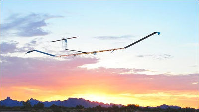
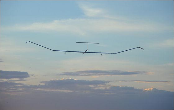
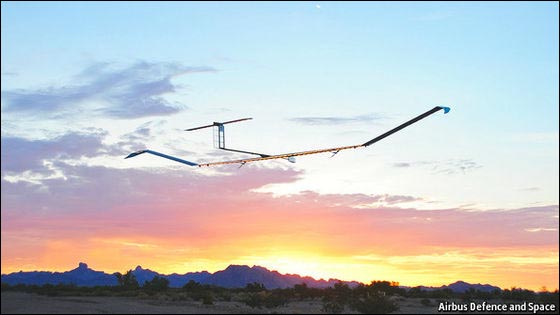
Unmanned aerial vehicle "Zephyr" that can fly with Airbus sunlight updates long-time continuous flight record

High altitudes of about 20,000 meters in height are expected to be effectively utilized as a space where passenger aircraft will not fly, and it is becoming a fierce fighting zone where Google and Facebook compete to advance. Airbus, one of the two biggest airliner manufacturers in the fierce battlefield, is an unmanned aircraft capable of flying with sunlightZephyr (Zephyr)We steadily develop the development of leading IT companies such as Google and Facebook one step ahead.
Pseudo-satellites: The west wind blows afresh | The Economist
http://www.economist.com/news/science-and-technology/21614095-cheap-alternative-satellites-starting-take-west-wind-blows
Zephyr Solar UAV Operates 11 Days in Winter Conditions | Defense News | defensenews.com
http://www.defensenews.com/article/20140828/DEFREG01/308280034/Zephyr-Solar-UAV-Operates-11-Days-Winter-Conditions
In August 2014AirbusAnnounced that the unmanned aerial vehicle "Zephyr 7" which can fly on its own by solar power generation under development succeeded in non-stop flight for 11 days. Zephyr 7 is an unmanned machine that generates driving power by solar panels spread over 23 meters of both wings and fly over 70,000 feet (about 21 km) above the sky. Aircraft weight reduced to the limit is 50 kg, which is lighter than the average adult male, can fly at 21 km / h during the day when the sun is out, and can fly at 15 km / h even after sunset.

This time, Zephyr 7 flies in the southern hemisphere in the winter, realizes a long flight, it was a flight in a bad condition that the sunlight energy is small and the sunshine time is short, so summer favorable conditions Under the bottom it is possible to expect a further continuous flight.
Zephyr 7 is called "High Altitude Pseudo-Satellite (HAPS)" because it fly in the middle space of 10 km above the airplane where the regular flight flies and 800 km above the orbiting circle. Main applications of HAPS are "observation" and "communication" from the sky.
Satellite pictures used in Google Maps and others are taken from the satellite as the name implies, but in HAPS it is possible to shoot from nearly 40 times more than the satellite so that you can expect more detailed topography and building shooting . Also,GoogleYaFacebookIt is thought that mobile communication can be realized in a remote area where communication infrastructure is not established by using HAPS as we are developing to compete to enable mobile communication from the air using a drone.

ByMoyan Brenn
The unmanned aircraft developed by Boeing, an rival of Airbus "SolarEagle"Was a major sponsor of the US Department of DefenseDARPAAirbus' rival in HAPS now can be said to be Google and Facebook, as Paul Brooks, spokesperson for HAPS program at Airbus, said, "Google and Facebook are not competitors , Both of which are considered to be collaborators to prove the flight durability of the drone in the high altitude region and promote the development of new flight regulations and operational standards necessary to realize safe use I'm sorry.

Airbus is planning to fly the new model "Zephyr 8" which evolved batteries etc. in the spring of 2015 spring slightly bigger than Zephyr 7 for the first time.
Related Posts:


