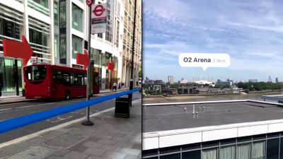
I actually tried walking using the application "MapFan eye" that draws the path to the destination in the streets reflected by the iPhone camera
Carrozzeria's latest model of car navigation "Cyber Navi" that is mounted in "AR scouter modeJust like iPhone 's camera, the iPhone application that draws the path itself to the destination in the streets is "MapFan eye"is.
IPhone 3GS found on the iTunes App Store, iPhone 4, iPhone 4S, iPhone 5, iPad 2 Wi-Fi + 3G, iPad Wi-Fi + 4G, iPad Wi-Fi + Cellular (4th generation), and iPad mini Wi- MapFan eye for Cellular
https://itunes.apple.com/jp/app/mapfan-eye/id578549863?mt=8&ign-mpt=uo%3D4
I came to Hankyu Umeda station to see how much use it actually is.

Launch the application.

"MapFan eye uses location information. Are you sure?" Since it is asked "OK" is selected.

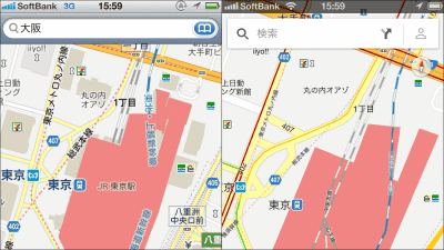
In this way, the map is displayed in the lower half of the screen and the camera screen is displayed in the upper half.
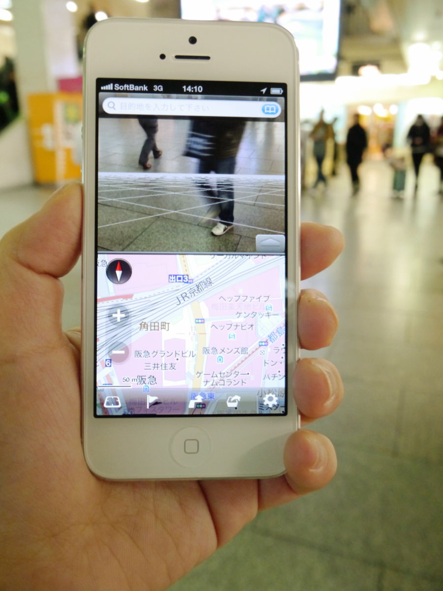
Fill in the destination at the top of the screen. The destination can also be searched from address, station name, telephone number, etc.

Then, since multiple places are displayed, tap the destination from among them. This time Umeda Loft was set as the destination.

Tap 'Start Direction'.

After confirming that departure place "present place" and destination "Umeda loft", tap "decision".
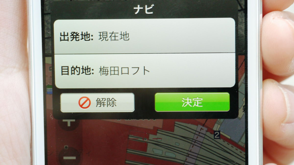
Directions began.
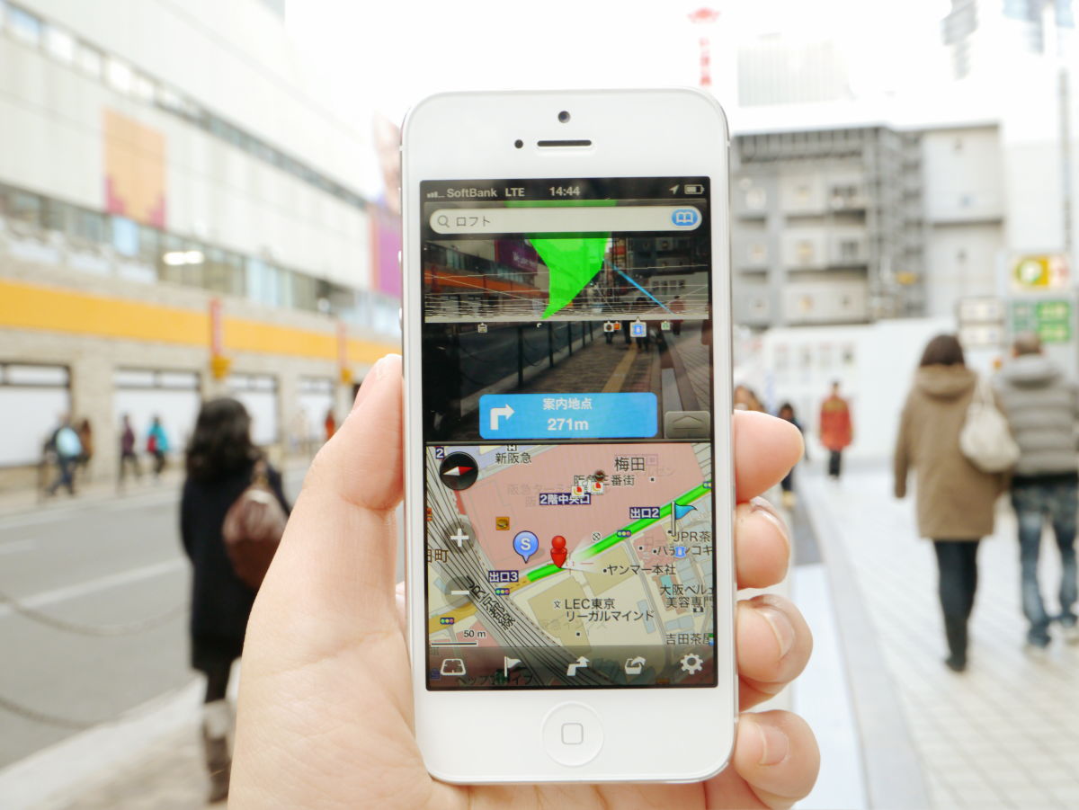
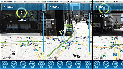
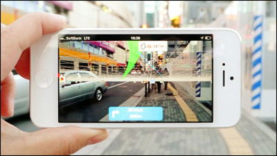
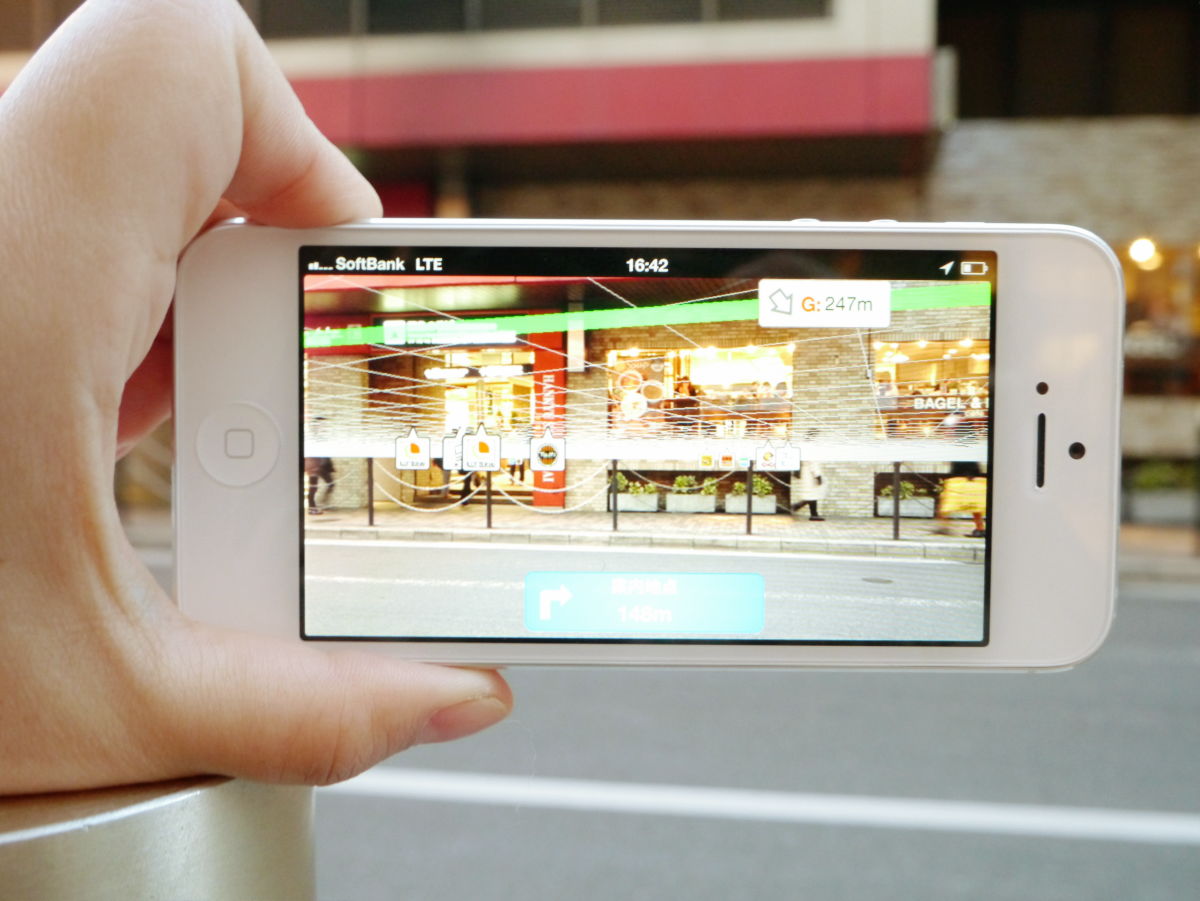
The distance to the next guide point is 227 m, you can check the current position on the map under the screen. You can also check the direction of yourself, so it will not happen that you go on a jump in the opposite direction.

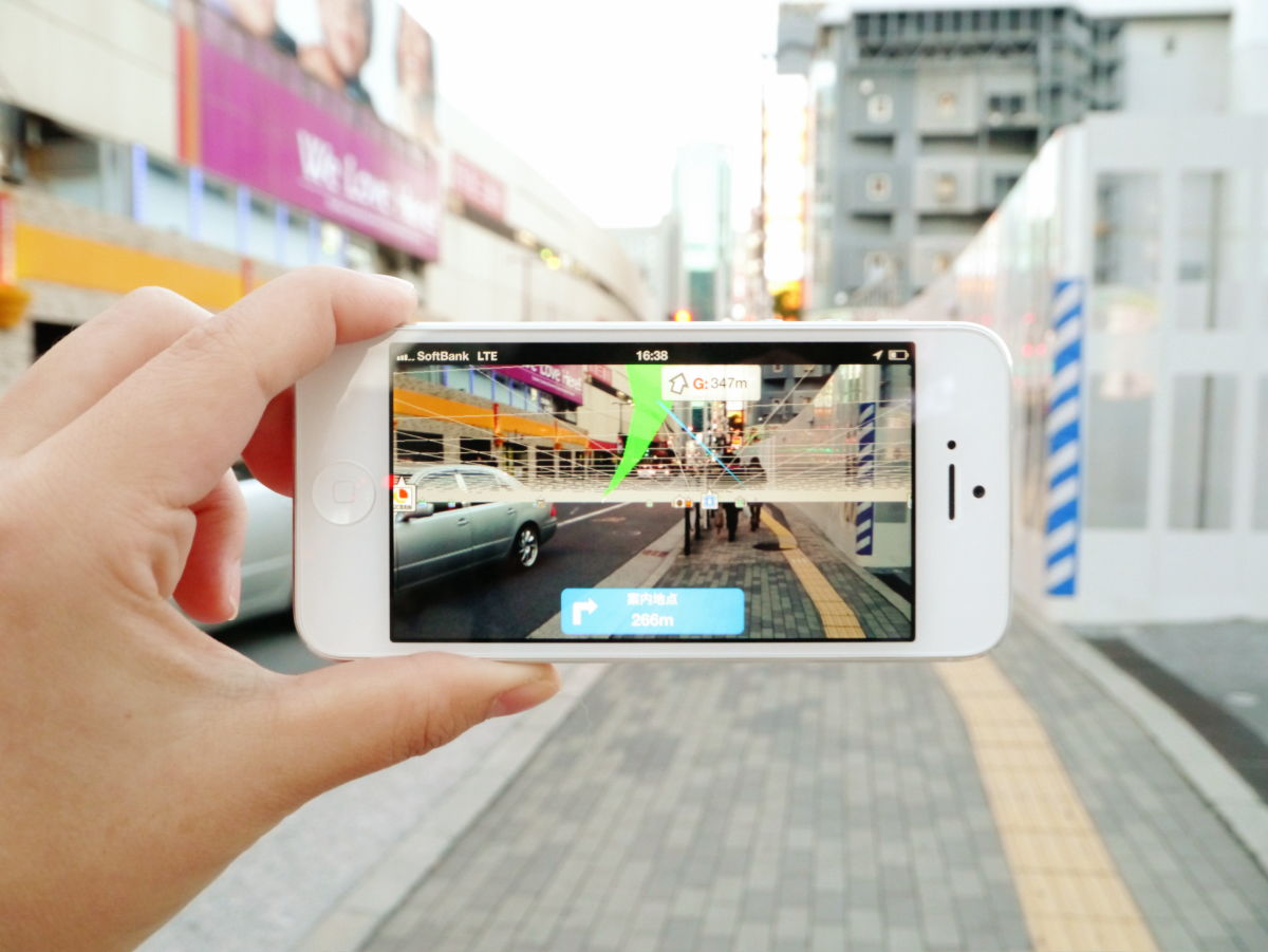
If you turn the iPhone sideways, only the camera screen is displayed. The green line on the screen tells you where to go, so there is no problem without having to display the map.
You can see how you actually use the application from the following movie.
I tried using 'MapFan eye' which displays the path to the destination in the city skyline - YouTube
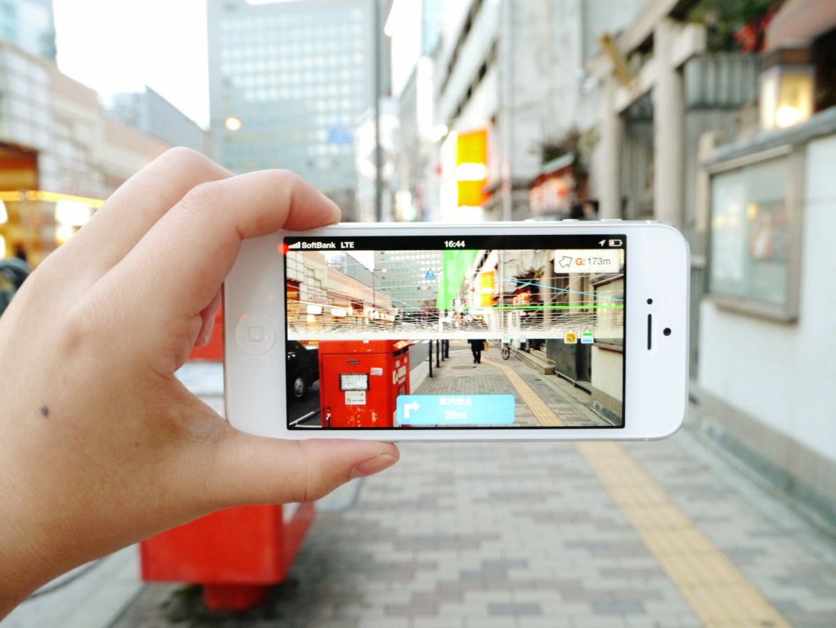
When turning to a direction different from the destination, the green line also changes sideways. Icons of shops that are likely to become markers such as convenience stores and coffee shops will also appear on the screen.
Since the iPhone vibrates when approaching the guide point, it is OK even if you do not always look at the screen.
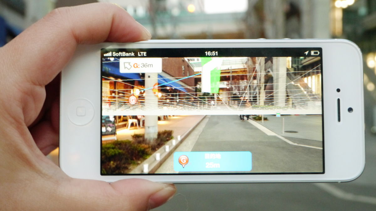
I came along to a corner. At this point the distance to the guide point is 5 m, but ...
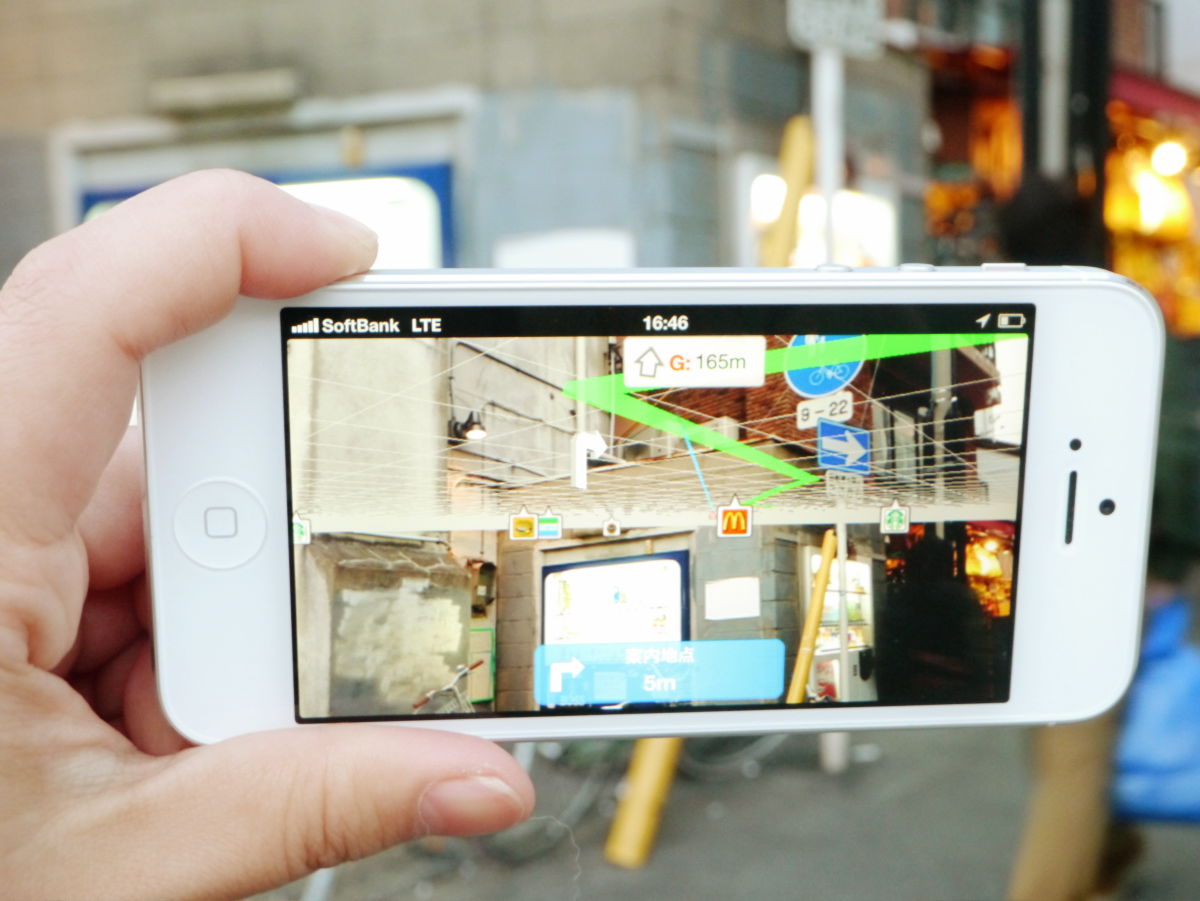
When turning completely, the distance to the next guide point changes to 70 m.

The closer the shop serving as the marker is, the bigger the icon is displayed.

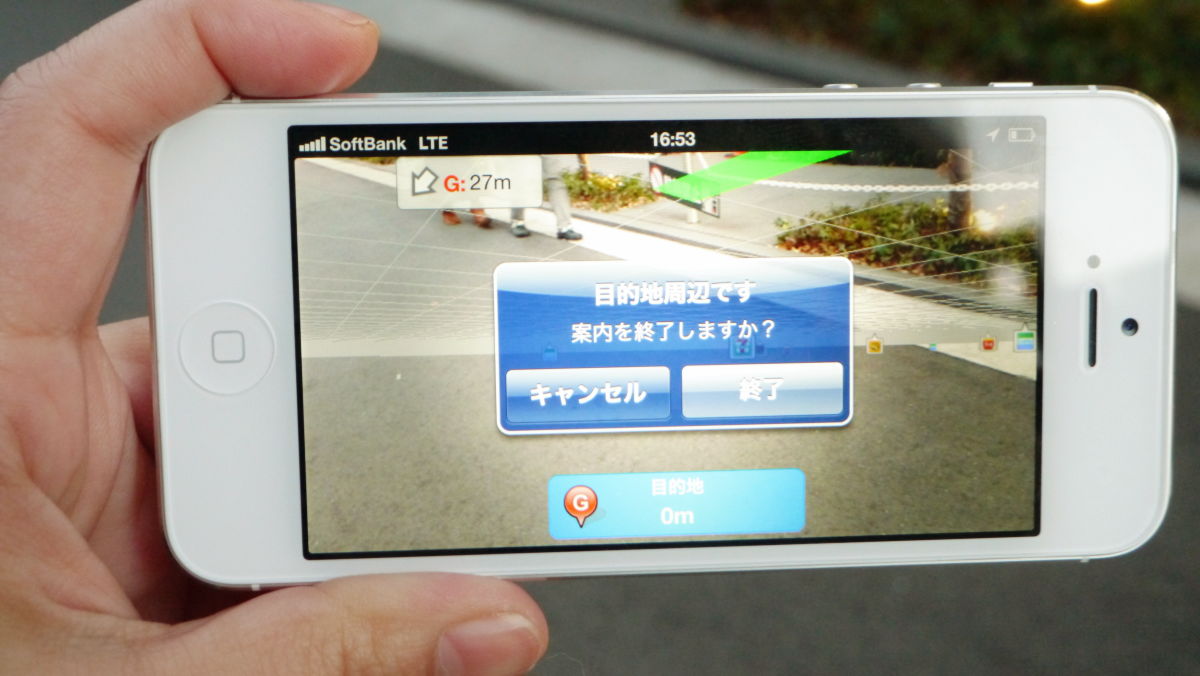
And arrived at the loft.
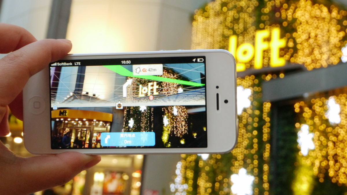
...... However, the directions are not over yet and it is indicated that the destination is still 25 meters.
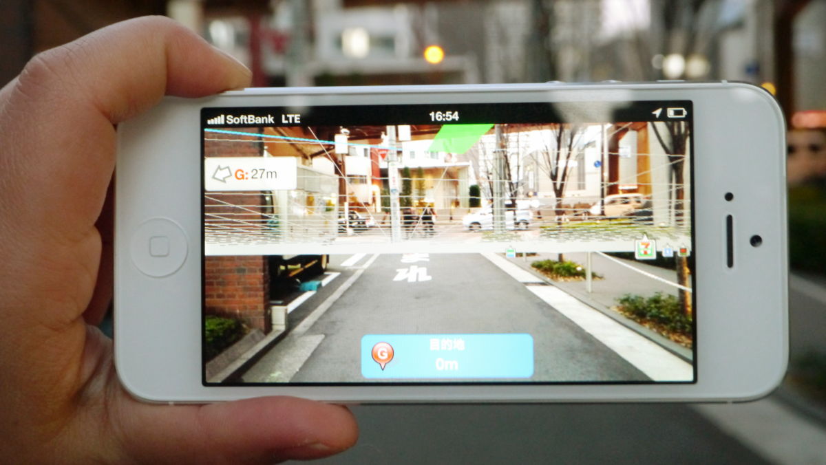
So, as we walked along the building along the green line, it became 0 m before the road.
As you are asked "Do you want to end the guide?" Tap "Exit" is OK.
In addition, the application is for pedestrians only, and it can not be used for cars and bicycles because it is extremely dangerous in the first place.

Related Posts: