Japan Space Imaging urgently shoots and releases satellite images before and after the Tohoku Region Pacific Offshore Earthquake occurred
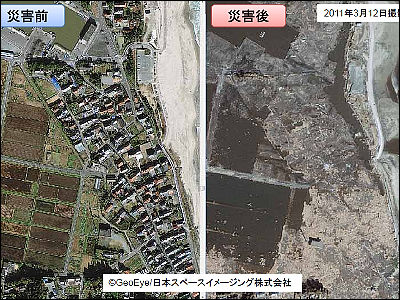
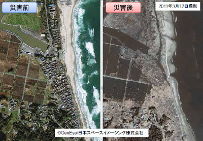
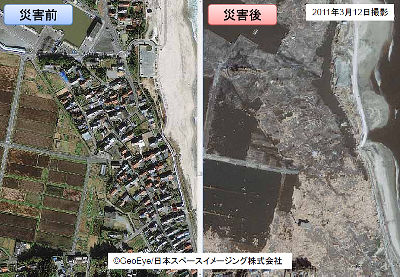
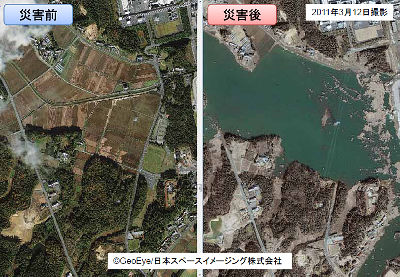
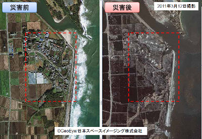
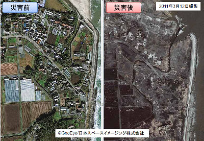
The world's first commercial high resolution earth observation satellite launched in 1999IKONOSFrom Ishinomaki City in Miyagi Prefecture (2 places) and Onagawa Town (1 location) around Mt. Ishinomaki, taken at 1 m resolution on March 12, 2011 (Saturday), Sendai Airport around Sendai City, Miyagi Prefecture, Fukushima About Soma city (5 places) around Soma City, prefecture, the data compared with the images taken in the past are listedJapan Space ImagingIt is open to the public.
Details are as below.
Announcement of Tohoku Region Pacific Coast Earthquake / Emergency Photographing Condition
~ Pre- and post-disaster materials ~

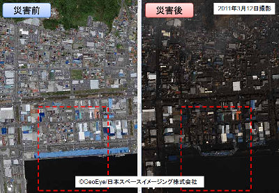
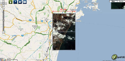
There are three photographing areas of Ishinomaki city around Ishinomaki-shi, Miyagi prefecture

First of all Ishinomaki City area 1

Extend the red frame further

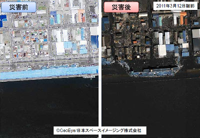
After enlargement
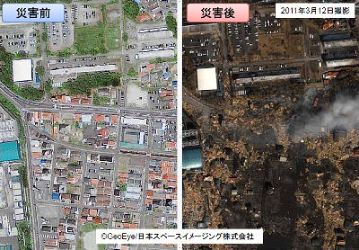
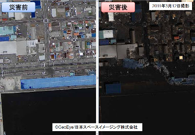
Area 2 of Ishinomaki City
This is a further enlarged red frame part. A fish market wishhouse is likely to disappear.
Onagawa Town in Area 3
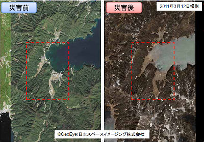
Further expansion
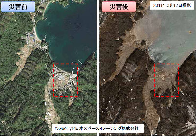
After enlargement
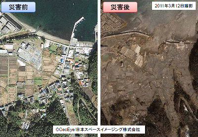
Next is Sendai
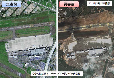
Sendai Airport
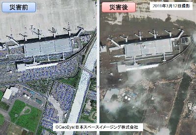
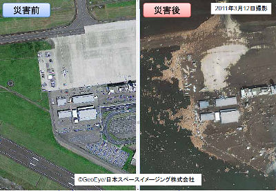
Soma is divided into five areas
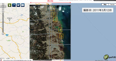
Soma area 1
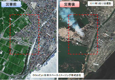
After enlargement
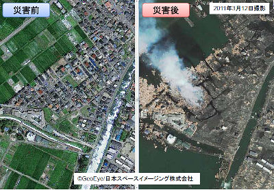
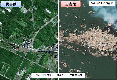
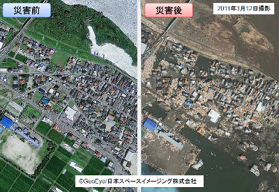
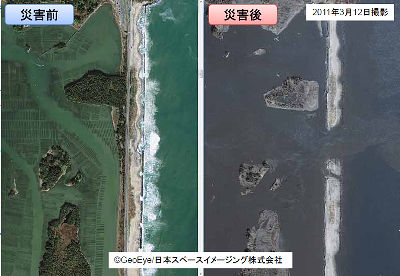
Soma area 2
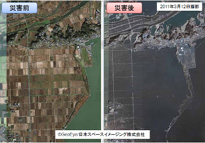
Soma area 3
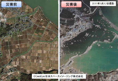
Soma area 4
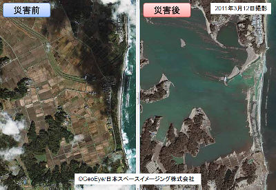
Soma area 5
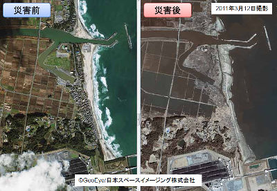
Related Posts:
in Web Service, Posted by darkhorse


