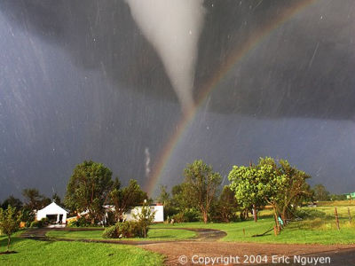
While an explorer was looking at Google Earth, he discovered a mysterious mark on the ground, and experts investigated the area and found that an 'unrecorded phenomenon' had occurred

'Google Earth,' which allows you to view satellite images from all over the world, is a popular tool for easily exploring the world on your smartphone or PC. It has been revealed that a cave explorer who was looking at Google Earth discovered a weather phenomenon that was occurring without anyone knowing.
CSIRO PUBLISHING | Journal of Southern Hemisphere Earth Systems Science
A man scouring Google Earth found a mysterious scar in the Australian outback – and now scientists know what caused it
In early 2024, a cave explorer was poring over satellite images of Australia's Nullarbor Plain in search of karst formations and caves when he discovered a mysterious mark in the barren, stone-and-sand landscape. It was a single, huge line of ink-brush marks stretching across the ground from Western Australia across the state border into South Australia, measuring about 11km in length.
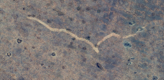
The discovery of the traces was reported to Mattei Ripar, a researcher at the School of Earth and Planetary Sciences at Curtin University in Australia, through a network of karst researchers and explorers. After Ripar and his colleagues compared several years of satellite imagery using Google Earth, they determined that the traces were made between November 16 and 18, 2022.
Based on the presence of flooding in the photo, Mr. Ripar speculated that the traces were caused by a tornado. When he visited the site in May 2024 to investigate, it became clear that a 'destructive tornado' with a wind speed of more than 200 km per hour had occurred, not just a rainstorm.
This tornado was equivalent to an F2 or F3 on
However, the source of the outbreak was far from residential areas, and no damage to human life or buildings was reported. Therefore, no one even noticed that it had occurred, and it was only during this investigation that its existence became apparent.
'The tornado probably lasted between seven and 13 minutes, and the scar pattern suggests that the winds swirling inside the tornado were moving clockwise and from west to east,' said Lippard. Local weather records also recorded heavy cloud cover and rainfall over the same period, which would support the tornado's formation.
Perhaps due to the remoteness of the area and the lack of witnesses, tornadoes are rarely reported on the Nullarbor Plain, with only three recorded tornadoes having been observed in the area - in 1982 (Balladonia district), 1986 (Forrest district), and 1997 (Balgare district). Interestingly, all three of these tornadoes occurred in the same month of November as this one.
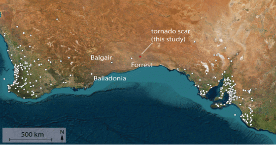
'This discovery is particularly significant as tornadoes on the Nullarbor Plain are not often reported, and the fact that Google Earth was used highlights the importance of using satellite imagery and weather data when analysing weather events in remote areas where traditional observation methods are limited,' said Mr Ripar. 'Without the power of technology, this natural disaster would have gone unnoticed. Studying the aftermath of this tornado is important to predict and prepare for the next big one.'
Related Posts:
in Science, Posted by log1p_kr


