Why do 19th century fire insurance maps have such historical value?
From the late 19th century to the early 20th century, many large fires occurred in the United States. In order to minimize losses from fires, the Sanborn Map Company, founded by Daniel Alfred Sanborn in 1866, created insurance documents called
From Fire Hazards to Family Trees: The Sanborn Fire Insurance Maps — The Public Domain Review
https://publicdomainreview.org/essay/sanborn-fire-insurance-maps/
The modern oil industry began with the discovery of the Drake Oil Field in 1859, when railroad worker Edwin Drake was the first to mechanically extract oil in America. Lighting using kerosene refined from petroleum was cheaper than whale oil and brighter than candles, but it was highly flammable and caused many large fires in densely built-up American cities. The Great Chicago Fire of 1871 destroyed approximately 17,500 buildings, and the Great Boston Fire the following year destroyed 776 buildings, including most of the financial district, causing serious economic losses.
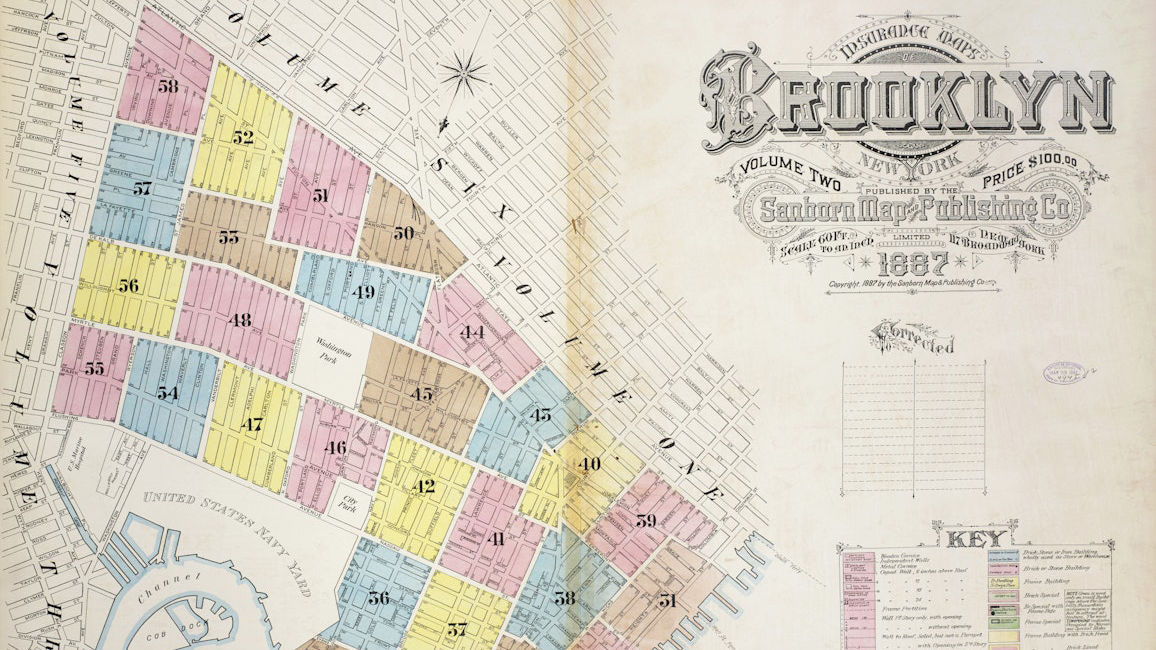
That's where insurance companies and the Sanborn Map came in. The Sanborn Map used a complex system of color coding, symbols, and abbreviations to show more information than a regular map could, from building materials to road widths, the location of water towers to the presence of flammable chemicals, building heights to the number of skylights. So even if a major fire burned a city to the ground, insurance companies could still find the information they needed to assign premiums.
Below is an example of a Sanborn map from the Library of Congress (LC) , which shows city halls, theaters, factories, and even gambling halls. In addition, detailed notes are included on whether the buildings had night watchmen.

The Sanborn Map Company eventually produced the Sanborn Map, which covered more than 12,000 cities and towns in North America, as well as almost every community with a population of over 1,000. The company sent employees to the areas they were surveying and spent several months there sketching and measuring all the roads and buildings to create the maps. There is even an anecdote that during World War I, a surveyor was reported as a German spy while he was creating the maps.
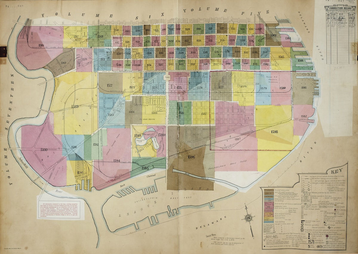
Another feature of the Sanborn maps is that they were regularly updated by 'pasters.' If there were changes to buildings or scenery in an area that had already been mapped, the changes were pasted on top to keep the map up to date. Below is a Sanborn map updated by pasting from 1922 to 1951, and a record of each update is available, so you can see the streetscape of each era.
The Sanborn Map Company experienced a significant drop in profits as more sophisticated fire risk assessment methods and new data storage formats made the large, heavy Sanborn maps obsolete, and the company stopped producing new maps in 1961 and ceased pasting and updating the maps in 1977. That same year, S. Greeley Wells, who was the company's president at the time, donated 45 of the old Sanborn atlases to the Library of Congress.
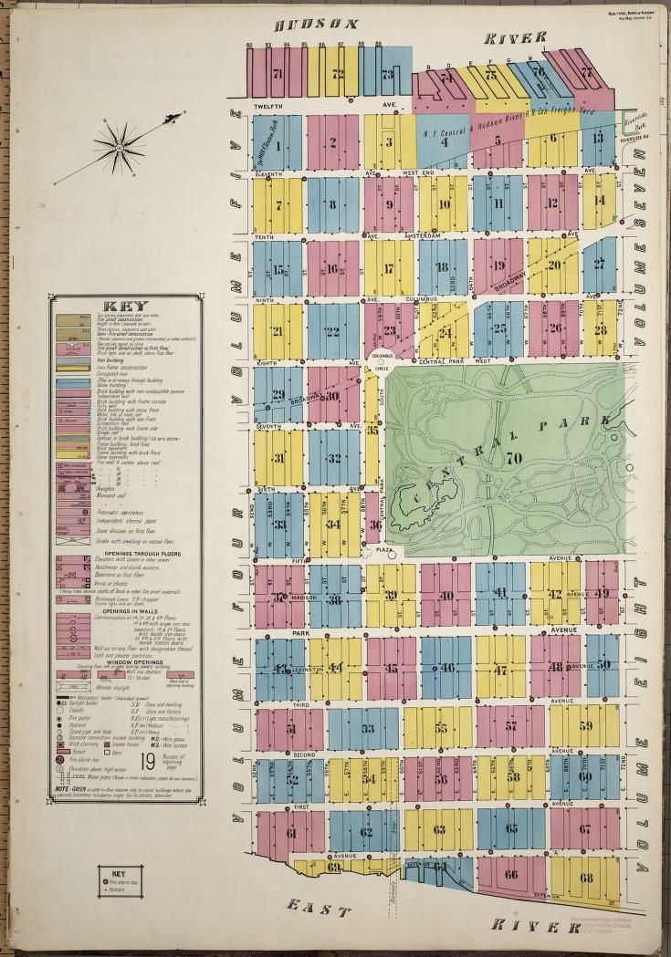
Although the Sanborn Maps business ended, they were gradually reevaluated after being donated to the Library of Congress. City officials refer to the Sanborn Maps when deciding whether to preserve buildings, and historians and historical novelists refer to the Sanborn Maps when they want to understand what a particular street looked like at a particular time. Demographers also use the Sanborn Maps to study the growth and decline of cities by 'pasting' updates. The following image shows a detailed view of
'When the Library of Congress announced that the Sanborn map collection was available online, we saw the largest response ever, and a significant portion of it came from genealogists,' said Paulette Hassier, head of the Library of Congress' Geography and Map Division .
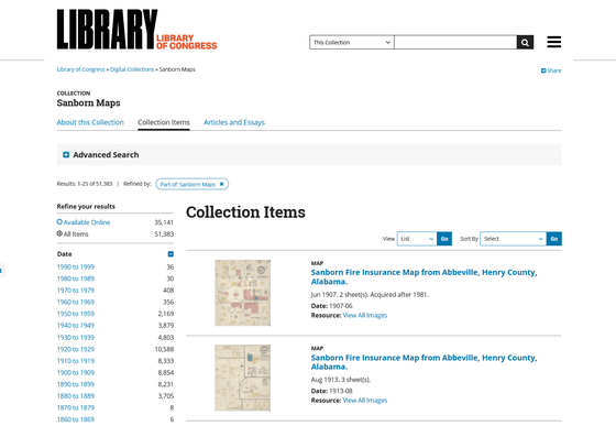
The Library of Congress, which has the largest collection of Sanborn maps, has made them available online. The Library of Congress page allows users to search and browse 35,141 Sanborn maps online, as well as 51,383 maps that are not yet available online, by year and region.
Sanborn Maps | Library of Congress
Related Posts:


in Note, Posted by log1e_dh