What is the world's first practical in-car navigation system, the 'Etak Navigator,' which is said to be 'a product that forever changed the way we reach our destinations'?
In 1985, about 10 years before GPS became available to the general public, the world's first practical in-car navigation system, the Etak Navigator , was released and caused a stir. Map expert James Killick explains what this revolutionary system was like at the time.
12 Map Happenings that Rocked our World: Part 9 – Map Happenings
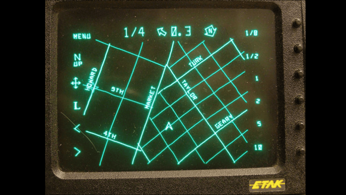
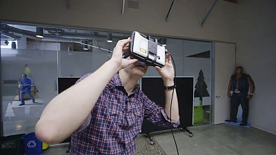
Here is a photo of the 'Etak Navigator'.
When the Etak Navigator was introduced in 1985, navigation systems used a technology called 'dead reckoning.' Dead reckoning used sensors to check distance traveled and direction of travel, but the drawback was that the further away you went, the greater the error became.
To solve this problem, American vendor Etak invented 'augmented dead reckoning,' a process that uses matching the position indicated by navigation sensors to a topographically correct electronic map, and every time the vehicle turns, it automatically adjusts its position to the known correct part of the road at that point, resetting the sensor error. This technology was later adopted by all navigation apps, and is still used in the 21st century.
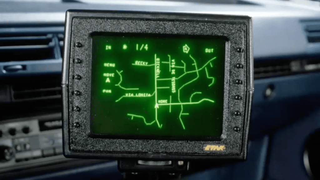
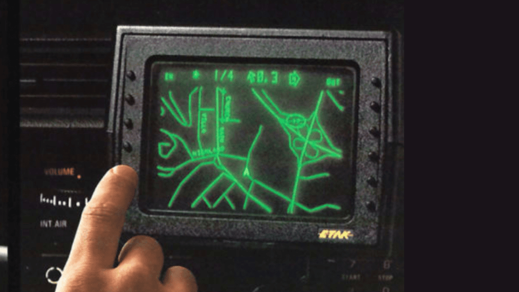
Etak's second major invention was a moving map display called 'Heading Up,' which means the car stays in the center of the navigation screen, and the map moves and rotates around the car. This concept is common in the era when maps can be viewed on smartphones, but at the time it was revolutionary.
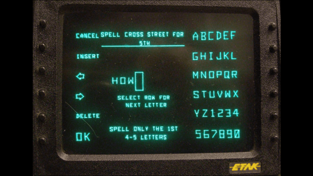
It also had an address search system that allowed you to enter destinations by address, street or intersection, and also allowed you to save common locations like your home or work.
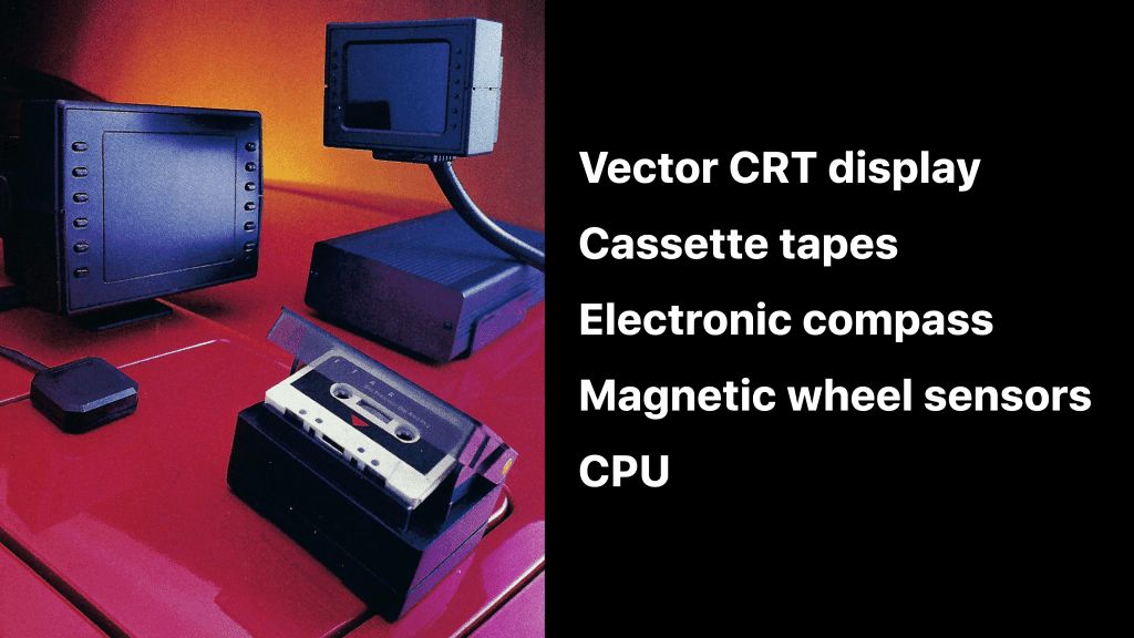
The Etak Navigator had five main components. The first was a vector CRT display like those found on oscilloscopes, and the second was a specially made cassette tape drive. The Etak Navigator navigation app and data were stored on cassette tapes, and the cassette tape drive was specially developed to read the tapes very quickly. While a regular music player reads at about 5 cm per second, the Etak Navigator cassette tape was read at about 200 cm per second.
The third was an electronic compass mounted on the rear window of the vehicle, a magnetic wheel sensor to measure distance traveled and augment the heading information from the compass, and a shoebox-sized metal box containing the CPU and motherboard.
The original price of the Etak Navigator was $1,395, which is equivalent to about $4,000 in 2024. In addition, even an experienced technician would take about four hours to install, and the installation costs were high, not just the cost of the device itself.
In addition to its price, the Etak Navigator had significant technological limitations: At the time, the government prohibited anyone other than the military from building systems that could achieve an accuracy better than 100 meters, and the GPS receivers that got around that were still large and expensive.
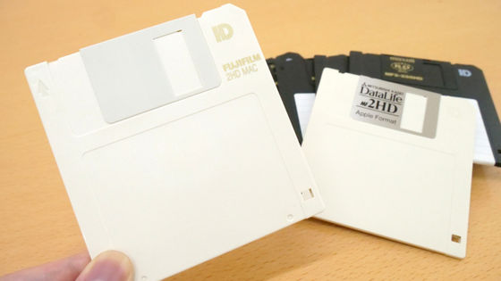
In addition, there was no large-capacity replaceable media, and neither floppy disks, which could store enough information, nor CD-ROMs, which were brand new and too costly, could be adopted. Another major challenge was overcoming navigation errors using only wheel sensors and compasses.
The biggest challenge was dealing with slopes. The map does not have elevation information, so when going up or down a slope, the distance traveled on the road does not match the distance traveled on the map, causing errors in the system. Therefore, Etak engineers invented and installed a special inclinometer using fluid and capacitance sensors.
According to Killick, the name 'Etak' was taken from an island used as a reference in Polynesian navigation. The ancient Polynesians knew their direction by the stars and the swells of the sea, but in the vast ocean, even a slight deviation of one degree could cause them to lose sight of their destination. So, navigators used visible islands as a reference, thinking that 'their ship was stationary and the islands were coming toward them,' and used the passing islands to estimate the distance.
◆ Forum is currently open
A forum related to this article has been set up on the official GIGAZINE Discord server . Anyone can post freely, so please feel free to comment! If you do not have a Discord account, please refer to the account creation procedure article to create an account!
• Discord | 'When was the first time you used a car navigation system? How was the accuracy of the route guidance compared to now?' | GIGAZINE
https://discord.com/channels/1037961069903216680/1231902903288205402
Related Posts:


in Hardware, Posted by log1p_kr