The UK air traffic control problem that caused more than 2,000 canceled flights was due to a software bug that treated points 7,400 km apart as the same.

At the end of August 2023, a large-scale air traffic control disruption occurred in the UK, resulting in the cancellation of more than 2,000 flights. The cause of the problem, which is thought to have affected hundreds of thousands of people and caused more than 100 million pounds (approximately 18.4 billion yen) in damage, was initially reported as ``possible French air traffic control error.'' However, it turned out that the actual reason was that the identifiers of two points (waypoints) 4000 nautical miles (about 7400 km) apart were duplicated in the air traffic control software.
UK Air-Traffic Software (NATS) Misread Two Spots on Map, Causing Outage - Bloomberg
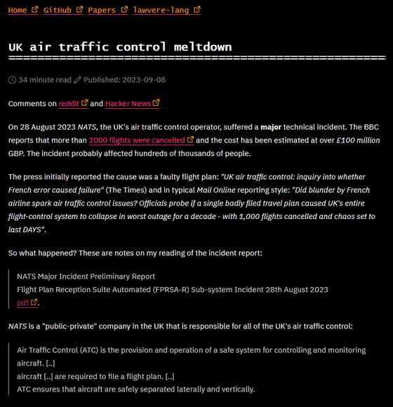
UK air traffic control meltdown
European airlines submit their flight plans to Eurocontrol 's Integrated Initial Flight Plan Processing System (IFPS), which controls air traffic across Europe.
Flight plan information received by IFPS is sent to all air traffic control service providers (ANSPs) required for air traffic control.
The data sent by IFPS is in the 'ICAO4444' format specified by the International Civil Aviation Organization (ICAO). However, the National Air Traffic Control Service (NATS), which manages domestic air traffic control in the UK, uses the European flight plan specification ``ADEXP'' format, so conversion is performed using a system called ``FPRSA-R'' at Swanwick Air Traffic Control Center. Masu.
On August 28, 2023, when the issue occurred, a flight plan with the following content was submitted to IFPS. Although it is not written in a way that is easy to understand at a glance, it includes information such as route, overall speed, overall altitude, and waypoints.
(FPL-TTT123-IS
-C550/L-SDE1E2GHIJ3J5RWZ/SB1D1
-KPWM1225
-N0440F310 SSOXS5 SSOXS DCT BUZRD
DCT SEY DCT HTO J174 ORF J121
CHS EESNT LUNNI1
-KJAX0214 KMCO
-PBN/A1L1B1C1D1O1T1 NAV/Z1 GBAS
DAT/1FANS2PDC SUR/260B RSP180
DOF/220501 REG/N123A SEL/BPAM
CODE/A05ED7)
When converted to ADEXP format, it will look like the following.
-TITLE IFPL
-BEGIN ADDR
-FAC LIIRZEZX
[...]
-FAC LYZZEBXX
-END ADDR
-ADEP EDDF
-ADES LGTS
-ARCID KIM1
-ARCTYP B738
-CEQPT SDGRWY
-EOBD 170729
-EOBT 0715
-FILTIM 280832
-IFPLID AT00441635
-ORIGIN -NETWORKTYPE SITA -FAC FRAOXLH
-SEQPT C
-WKTRC M
-PBN B2
-REG DABHM
-SEL KMGJ
-SRC FPL
-TTLEET 0210
-RFL F330
-SPEED N0417
-FLTRUL I
-FLTTYP S
-ROUTE N0417F330 ANEKI8L ANEKI Y163 NATOR UN850 TRA UP131 RESIA Q333
BABAG UN606 PEVAL DCT PETAK UL607 PINDO UM603 EDASI
-ALTRNT1 LBSF
-BEGIN RTEPTS
-PT -PTID EDDF -FL F004 -ETO 170729073000
-PT -PTID RID -FL F100 -ETO 170729073404
-PT -PTID ANEKI -FL F210 -ETO 170729073856
-PT -PTID NEKLO -FL F214 -ETO 170729073911
-PT -PTID BADLI -FL F248 -ETO 170729074118
-PT -PTID PABLA -FL F279 -ETO 170729074348
-PT -PTID HERBI -FL F308 -ETO 170729074624
-PT -PTID NATOR -FL F330 -ETO 170729074911
-PT -PTID TITIX -FL F330 -ETO 170729075154
-PT -PTID TRA -FL F330 -ETO 170729075323
-PT -PTID ARGAX -FL F330 -ETO 170729080055
-PT -PTID RESIA -FL F330 -ETO 170729080731
-PT -PTID UNTAD -FL F330 -ETO 170729081243
-PT -PTID DIKEM -FL F330 -ETO 170729081627
-PT -PTID ROKIB -FL F330 -ETO 170729081824
-PT -PTID BABAG -FL F330 -ETO 170729082816
-PT -PTID PEVAL -FL F330 -ETO 170729082916
-PT -PTID PETAK -FL F330 -ETO 170729091754
-PT -PTID PINDO -FL F330 -ETO 170729093322
-PT -PTID EDASI -FL F165 -ETO 170729094347
-PT -PTID LGTS -FL F000 -ETO 170729095713
-END RTEPTS
-SID ANEKI8L
-ATSRT Y163 ANEKI NATOR
-ATSRT UN850 NATOR TRA
-ATSRT UP131 TRA RESIA
-ATSRT Q333 RESIA BABAG
-ATSRT UN606 BABAG PEVAL
-DCT PEVAL PETAK
-ATSRT UL607 PETAK PINDO
n -ATSRT UM603 PINDO EDASI
'ADEXP' is longer than 'ICAO4444' because it also includes altitude information and estimated time for waypoints passed along the way.
Due to the large number of waypoints, organizations such as ICAO are working to eliminate duplicate names, ensuring that at least two identical identifiers are not close together.
Unfortunately, two waypoints, one near the departure point and one near the destination, 4000 nautical miles (about 7400 km) apart, were given the same identifier.
While processing this data, FPRSA-R was unable to find a route to fly between the two overlapping waypoints. Systems are always designed with safety in mind, so if they cannot proceed in a safe manner, they enter a state that requires manual intervention, but in this case, the affected system was unable to continue processing. It appears that a serious exception has occurred.
Naturally, 'FPRSA-R' has a backup and stores 4 hours worth of data, but this time we were unable to restore it in 4 hours. The engineering team responsible for the recovery tried several standard recovery processes without success, and finally contacted Frequentis AG, the company that created FPRSA-R, to successfully recover the data.
The airline is seeking compensation for this incident, but NATS CEO Martin Rolfe said, ``This event had a 1 in 15 million chance of occurring.We have completed 15 million flight plans in the past. I've been dealing with it, but this is the first time something like this has happened to me.'
In response to CEO Rolfe's defense, James Haydon, who investigated the report, said that since FPRSA-R was introduced in 2018, ``CEO Rolfe's argument is that this type of incident should not occur. It was said that it could happen 'once every five years', which I think is enough frequency to completely dismantle air traffic control.'
Related Posts:
in Vehicle, Posted by logc_nt


