MIT develops a model that predicts the occurrence of traffic accidents with high accuracy by deep learning
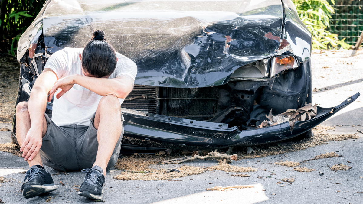
Researchers at the Massachusetts Institute of Technology (MIT) Computer Science and Artificial Intelligence Laboratory (CSAIL) and Qatar Computing Research Institute (QCRI) have developed a model that predicts
Inferring High-Resolution Traffic Accident Risk Maps Based on Satellite Imagery and GPS Trajectories --He_Inferring_High-Resolution_Traffic_Accident_Risk_Maps_Based_on_Satellite_Imagery_ICCV_2021_paper.pdf
(PDF file) https://openaccess.thecvf.com/content/ICCV2021/papers/He_Inferring_High-Resolution_Traffic_Accident_Risk_Maps_Based_on_Satellite_Imagery_ICCV_2021_paper.pdf
Deep learning helps predict traffic crashes before they happen | MIT News | Massachusetts Institute of Technology
https://news.mit.edu/2021/deep-learning-helps-predict-traffic-crashes-1012
Despite the low frequency of road accidents, road accident losses account for about 3% of global GDP and are the leading cause of death for children and adolescents. According to the research team, the sparsity (sparseness) of traffic accidents makes it difficult to create high-resolution maps. If you estimate the occurrence of a traffic accident with an accuracy of 5 meters x 5 meters, the probability of an accident occurring within a year is about 1/1000, and it seems that accidents rarely occur in the same place.
In addition to the accident records so far, the research team uses satellite images showing traffic density, speed, GPS trajectory pattern showing direction, number of lanes, presence of shoulders, number of pedestrians, road structure, and danger. We identified high-lying areas by machine learning and created a risk map showing the probability of accidents up to two years later. According to the research team, even in places where there is no record of accidents, there are areas where the risk is judged to be high only by the traffic pattern and terrain.
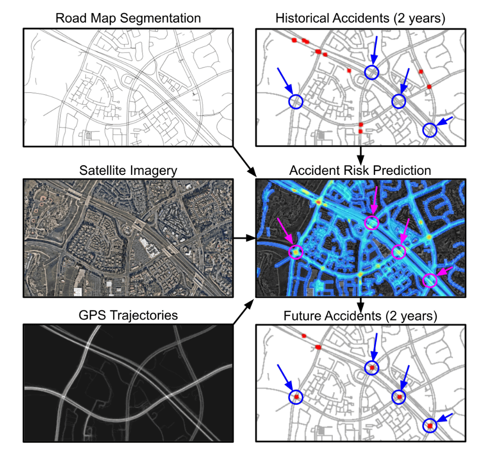
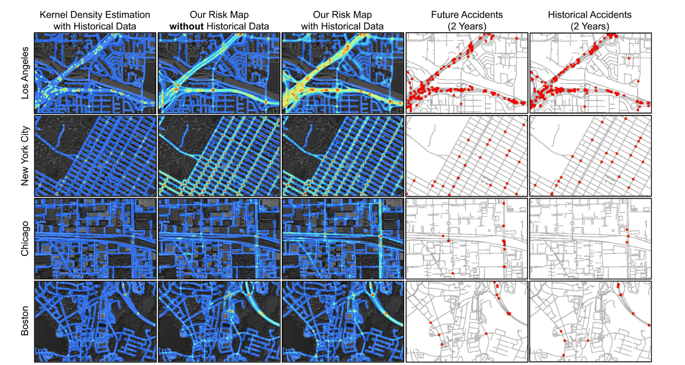
Attempts have been made to predict the risk of a traffic accident and overlay it on a map, but since it was predicted with a low accuracy of several hundred meters, the details are blurred and the important parts cannot be seen. The research team pointed out. On the other hand, the risk map announced by CSAIL and the Qatar Artificial Intelligence Center is in units of 5 meters x 5 meters, and the point is that the resolution is much higher than before.
To evaluate this AI model and risk map, scientists used 2017 and 2018 data to test their ability to predict collisions in 2019 and 2020. As a result, it was found that a collision accident actually occurred in a place recognized as 'high risk of accident occurrence' in an area where the accident was not recorded in the input data.
The map below is a map of Los Angeles, New York, Chicago, and Boston from the top, and the three on the left are 'conventional
QCRI Principal Investigator and Paper Author Amin Sadegi said, 'Our model predicts collision maps in unknown territories by combining multiple clues from seemingly unrelated data. This model can infer useful accident maps without historical accident data and can be actively used for city planning and policy making. '
In addition, Sadegi said, 'If you can use risk maps to identify potentially high-risk roads, you can reduce the risk of going out in advance. Apps like Waze and Apple Maps have real-time accidents. There is a feature that will notify you, but we are trying to take the lead before the accident happens. '
Related Posts: