Ruts that circled the world by bicycle can be displayed with online map service such as Google map

If you are using GPS from the beginning of the journey, you can leave a bicycle rut on the map with quite high accuracy. If there is no GPS log, it will take a bit of trouble, but by drawing a line on the map, the former route can be reproduced. By combining these two, I tried to display the map of 130 thousand km running around the world of the bicycle on Google Maps.
Hello,Takuya Sudo @ circle around the world bicycle @ Charridermanis. As I got a little time, I gently stole a line on the map while staring at the record of the past. Work that was halfway through has been completed and it is clear. This method can be applied not only to the world round but also to bicycle trips in the short term and day trips. If you know this, it will fit even more by bicycle.
◆ Bike Map
When I left Japan about 10 years ago, I could not think of having "GPS." At that time there was no smartphone, GPS was not so major. Speaking of bicycle journey records, it is about the line marker drawn on the map on hand. It was my trip to Australia, Southeast Asia, Eurasia Continent, Bulkan Peninsula to Hungary.
These analog data can draw lines to the online map by using overseas sites called bike maps.
Bikemap
https://www.bikemap.net/
Bike map is a site collecting bicycle routes around the world, and it is used for many cyclists. This time I use it only for recording, but it is a useful site that can be used for planning. How to use this siteFriend's CharidaI was taught.

The default was Dutch, but you can switch languages by scrolling down the page to the footer. Since it does not correspond to Japanese, I will proceed with English. Let's make an account in order to manage the completed data. After creating the account, click "NEW ROUTE" at the top right of the page.
We will move on to the work screen. You can move, enlarge, and shrink the map with operations like Google Maps.

I will draw a line starting from the local Fukuoka Tenjin.

I used the "magnet tool" at the top left surrounded by an orange frame as the main. It automatically traces the optimum route between points.

However, even though I want to draw a straight line, the line that I saw was displayed.
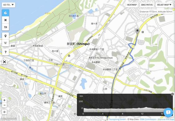
In such a case, it can be corrected by decreasing the interval between the points.
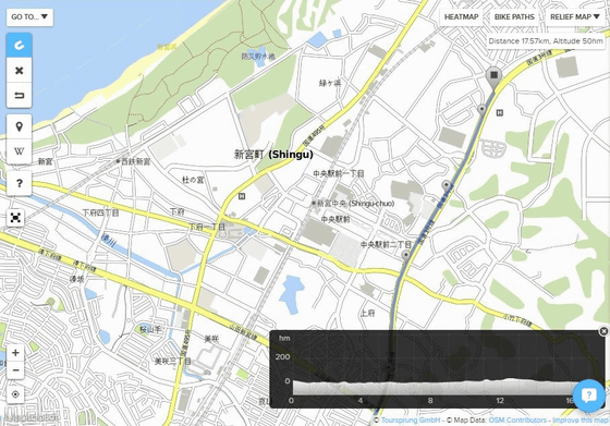
I was tracing the National Highway No. 3, but I do not know where it is.
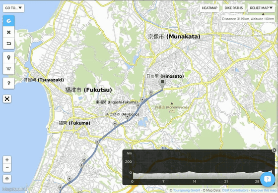
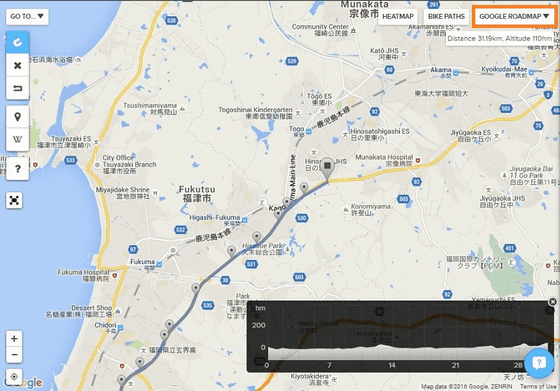
In such a case, you can deal with by switching the map on the upper right of the map. With Google Maps, there were national road numbers on the road. I switched the map even when it is Hangul or Arabic, or when I can not read the local place name.
Occasionally, there are things that the magnet tool can not be used. I wanted to draw a straight line, but this has become such a thing. Even if narrowing the interval between points, it can not be modified.
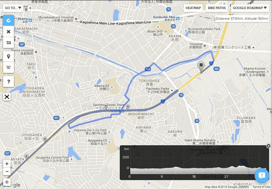
In such a case, use "line tool". Here it is possible to draw lines with freehand.
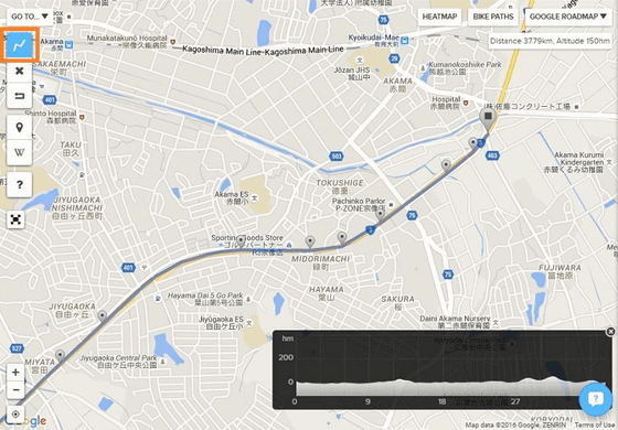
Oh, my hands slipped and the lines were distorted.

In such a case, you can fix it by pulling the middle point. We could add points on the line, and the line on the map could freely bend with Guignaguna.
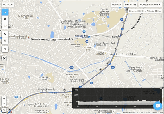
Pulling the line with the rugged trick and completing the route Fukuoka → Kitakyushu (Shin Moko). Before Australia, it was digitization of the route which ran cyclically from Fukuoka to Narita. The Seto Inland Sea uses a ferry.
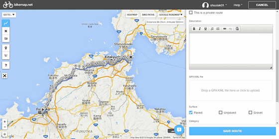
This is the top screen of the route that was completed.
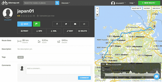
I repeated this kind of work and digitized the route that I ran in the past.
As a caveat, when you zoom in / out the map, it takes time to load the page. Attempting to save data even though this reading is not completed will fail. It is OK to save it badly, but because it was not so, the work that took nearly 2 hours had disappeared with water bubbles.
In addition, the operation is unstable if you can not use or use the magnet tool. When pulling a line on the Balkan Peninsula, the magnet tool inevitably shifted to a line tool and pulled a line with free hand. However, since the accuracy of the line tool is reduced, I do not want to use it much. I felt something was wrong, so I finished work on the way. When we resumed work on another day, then the magnet tool moved crispy at that time. Where it was useless only with the line tool, the magnet tool was supposed to move, so we are redoing the same work from scratch.
◆ Analog to digital
When I was not using GPS, I was traveling with a paper map.

The work that I was tracing with the line marker on the road that I ran was helping digitize this time.
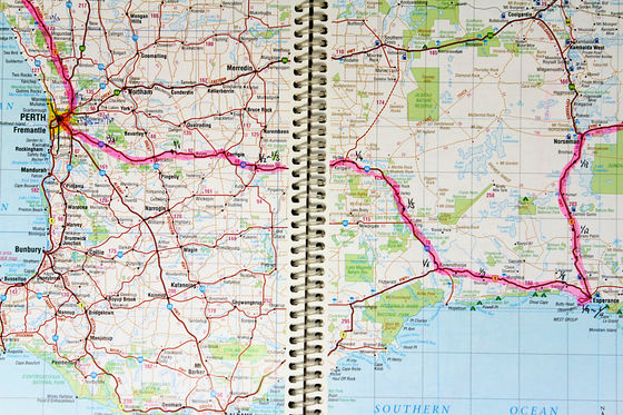
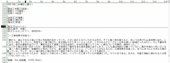
At that time I kept a diary. The place where the map could not be found was reading the past diary where the accommodation place was recorded.
Iki, who began crossing the Eurasian Continent, draws a line while looking at this picture.
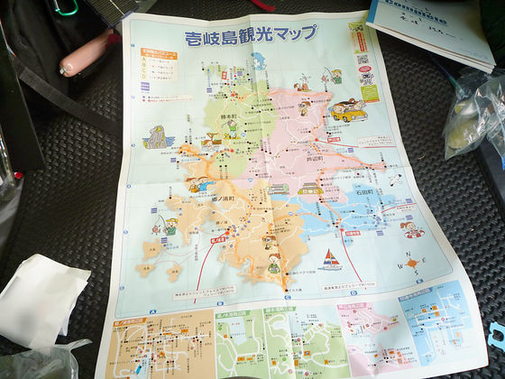
With this feeling, I digitized the past runs.
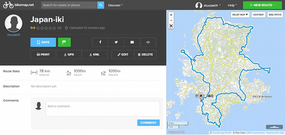
◆ Conversion of data
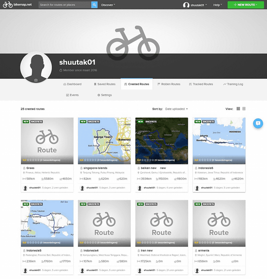
The route created by the bike map is
1: Download GPX file using bike map
2: Organizing data using software called map source
3: Convert GPX file to KML file with software called Rut
Follow the step of processing it into a file that can be handled on Google Maps.
I found the time and digitized the past route. When using a ship or an airplane, the rut was interrupted, so we divided the data. Since Indonesia is moving six islands, there are six data.
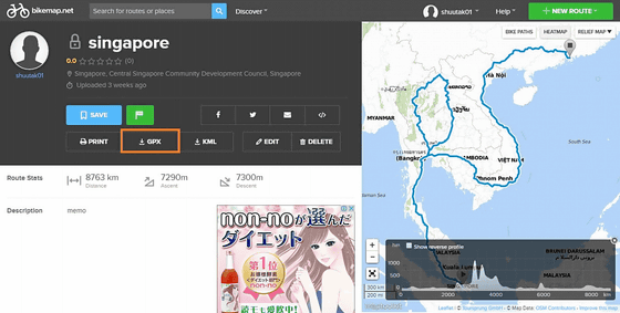
It is the route which ran from Singapore to Hong Kong. Click on the red frame GPX to download the GPX file.
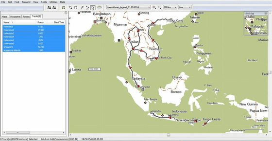
I gathered the GPX file thus spewed with software called Garmin's map source (MapSource). In the image we are uniting from Indonesia to Hong Kong. I wanted to lighten the data, so I was thinning out points using the filter function.
The GPX file processed with the map source is read with free software called "Rut (Wadachi)" and converted into KML file.
RUT ONLINE - Display and share GPS logs on a map with photos
http://map.cyclekikou.net/

◆ GPS data
In this round of the world we used two GPS devices to leave the data.
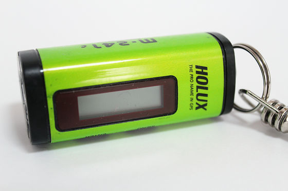
From Hungary in Eastern Europe to Mari in West Africa I used a HOLUX M-241C GPS logger. You can not display the map, but it will record the route you moved. I wanted to digitize the route I ran and I bought it online through mail order. When sending luggage from Japan to Hungary, GPS logger was also packed together.
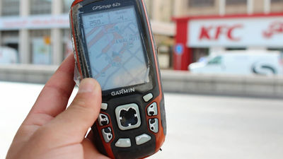
From Mari, I use this Garmin (GARMIN) GPS. Since my friend 's GPS was surplus, I sold it. Here you can also record the route you moved. If you have an adapter you can also attach it to the handle, so you can run while checking the current position with a map like a car navigation system. It was a big success in Europe where roads stretch radially. If you go around the world again, I will bring this GPS from the beginning.
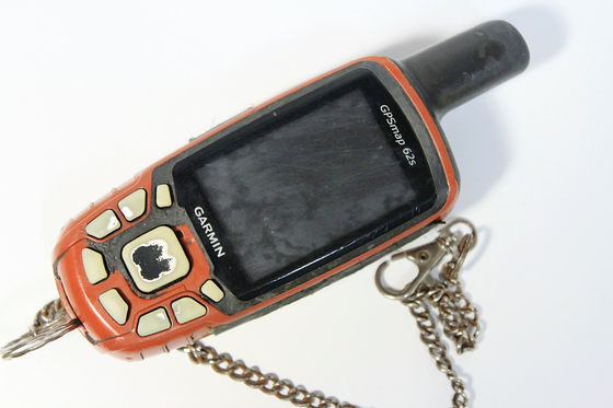
The data recorded by the GPS device
1: Organize data using software called map source
2: Convert GPX file to KML file with software called Rut
I took the procedure of.
Garmin's GPS log recorded every day. I will extract only the day when I ran the bicycle and summarize it.
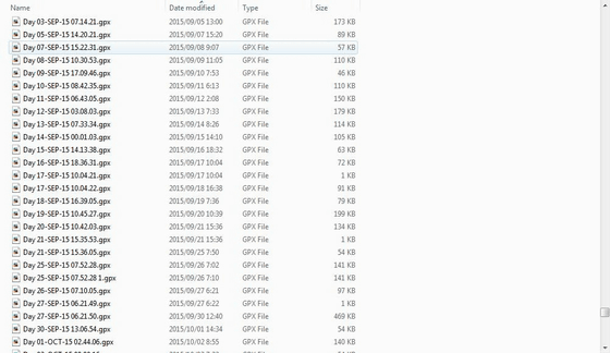
With this kind of feeling, Taiwan also had a round.
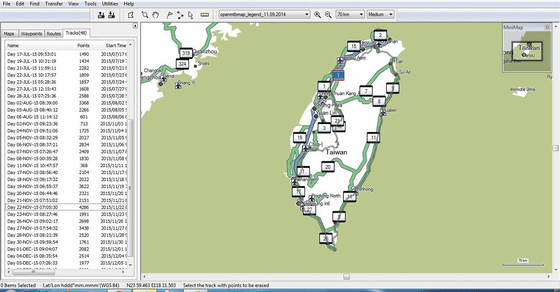
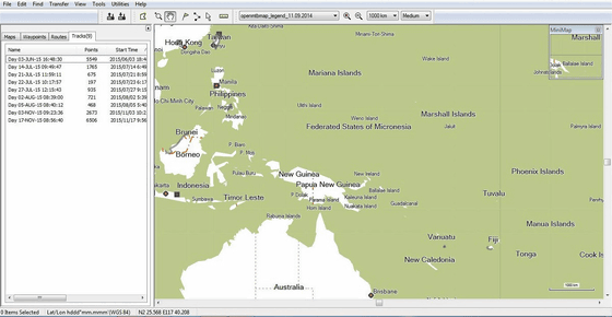
You can combine consecutive logs or thin out too many points. Then we completed one file that summarizes Borneo, Pacific Island, Philippines and Taiwan. Save it as a GPX file and also create a KML file through this.
◆ Online Map
Then, when you display the exhaled KML file on the online map ......
I will show Charlerman's bicycle track around the world on Google Maps
http://shuutak.com/gps/gps.html
It was like this.
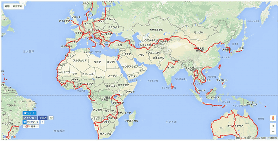
I am sorry that I'm short cut short, but I think I tried hard as it is. After this, I am planning to travel a bit more, but because it becomes a backpacker, this is the final version of my bike round around the world.
I wanted to print out the rut of the cycle around this world to people who took care of around the world, but it seems that it caught on the terms of Google Maps. Since I wanted to make commercial use, I found out how to do something, I found a way to use an open street map that can handle data freely regardless of commercial or non-commercial use. Through a site called "uMap (uMap)", you can easily create a map that reads KML files.
UMap
https://umap.openstreetmap.fr/ja/
Charriderman's bike Round around the world - uMap
https://umap.openstreetmap.fr/ja/map/map_79999
With uMAP this looks like this.
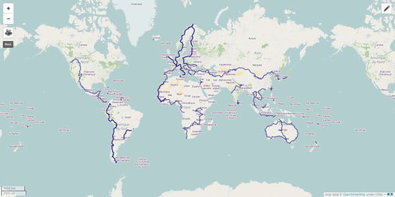
Now that the trip is about to end, this map has been completed, but I regret that I should confirm my own rut in real time. I wanted to tackle the world more. However, even after the end of the world round it is possible to run overseas by bicycle. If there is a chance, I would like to add a line to this map. I found a hobby that will not get bored until I die.
Not only me but also a friend's charrider carved a rut on the world.
Yoshida Tadashi (Yoshida Aikiji)
http://www.acml-jp.net/cyclists/yoshidasekiji/index.html
Hiimuta Jinbo (Hiromu Jinbo)
http://www.acml-jp.net/cyclists/jimbohiromu/index.html
Ryo Asada (Asasa Ryo)
http://www.acml-jp.net/cyclists/asajiryo/index.html
With this feeling, you can digitize bicycle ruts.
While the world has become more convenient, it has become an era where such things can be done. Even if I do not understand everything in all, I do not want people to travel by bike from now on, so I tried to summarize this way this time.
(Sentence / photo: Takuya S. Narou Charriderman
Cycling around the world for a bicyclehttp://shuutak.com
Twitter@ Shuutak)
Related Posts:
in Review, Web Service, Hardware, Vehicle, Posted by logc_nt
