Application to display the damage of the Great Hanshin-Awaji Earthquake AR "Earthquake Disaster Photo Archive Map"
January 17, 2014 is the day 19 years passed since the Great Hanshin-Awaji earthquake occurred. A major earthquake hit a city with a population of 1.5 million people,Official announcement by the Fire Department, 6402 people who died, about 540 thousand households were damaged, and up to 320 thousand people suffered great damage that forced the evacuation life. In the town, the reconstruction proceeded and the things that left the side of the time came back to almost none, but if you return the back, it means that the memories of the earthquake disappeared. While attempts to keep the memories of various earthquakes weak are continued, the smartphone application developed by Kobe City synthesizes the actual landscape and computer-generated imagesAR technologyAttempts are being made to display the scenery of the point where it is standing at the time of the earthquake on the screen and to inherit its memory.
Hanshin earthquake disaster "seen by the smartphone" Earthquake photograph archive map "
http://shinsai-ar.kobe-shashinkan.jp/
Kobe City: Earthquake photograph archive map
http://www.city.kobe.lg.jp/information/public/media/archive/archive_map.html
"Earthquake photograph archive map"Is an application that combines information into an actual landscape using a smartphone and displays it as ARJunaio(Gunaio) "is used and it seems that this is how it actually used in the streets.
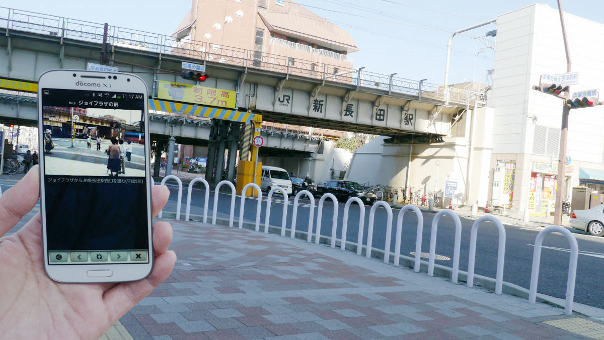
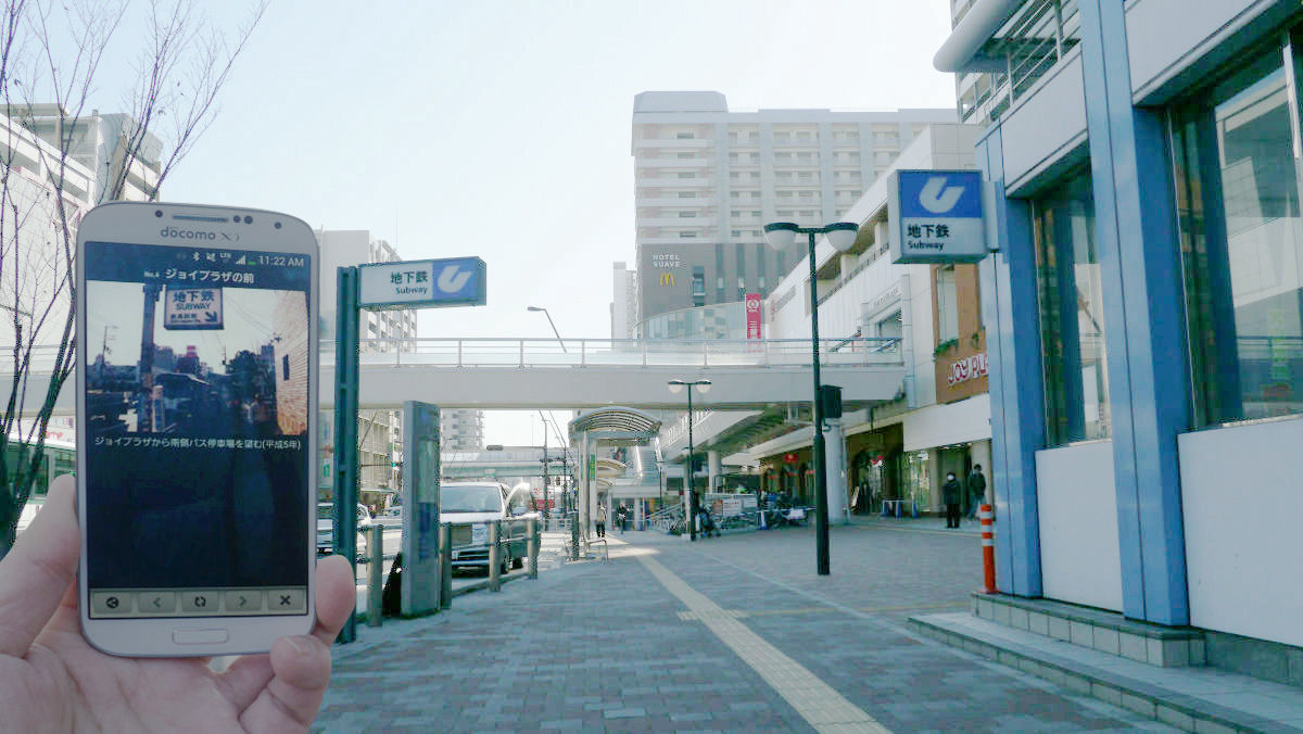
JR Shin - Nagata Station West Exit, "Before Joy Plaza"
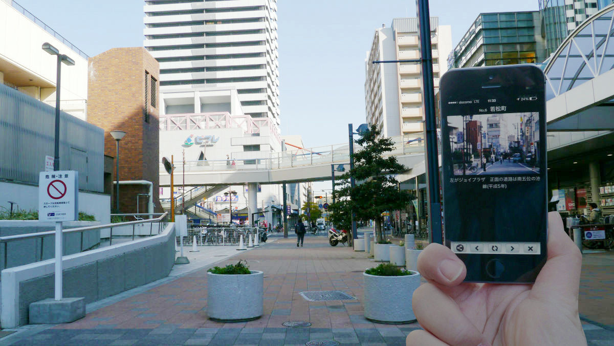
South of JR Shinagata station, "Wakamatsu-machi"
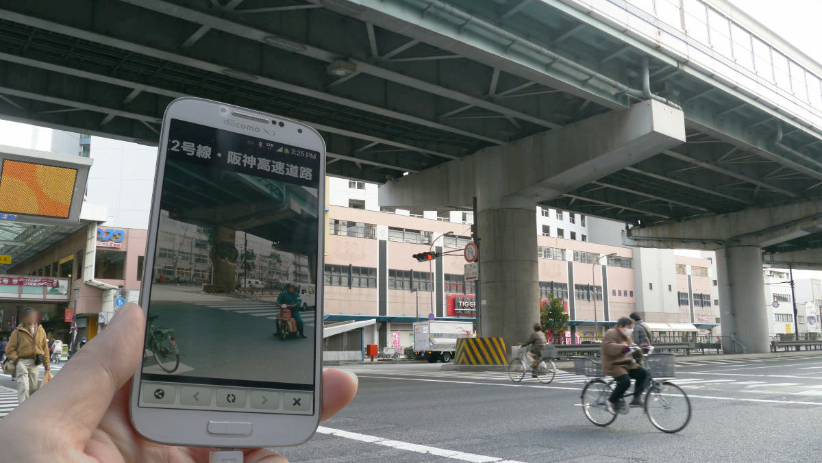
"National Highway No. 2 and Hanshin Expressway"
◆ Install application
Two kinds of AR application "junaio" are released, iOS version and Android version.
To install iOS version, please visit the following site.
Junaio Augmented Reality Browser on the App Store on iTunes
https://itunes.apple.com/us/app/junaio/id337415615
Tap "Install" → "Open" to launch the application.

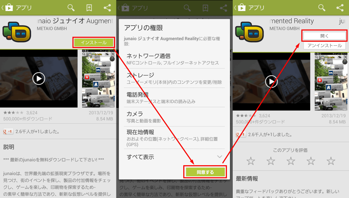
To install the Android version, go to the following site of Google Play.
Junaio Augmented Reality - Android application on Google Play
https://play.google.com/store/apps/details?id=com.metaio.junaio
Follow the on-screen instructions, tap "Install" -> "Accept" -> "Open" to complete the installation and launch the application.
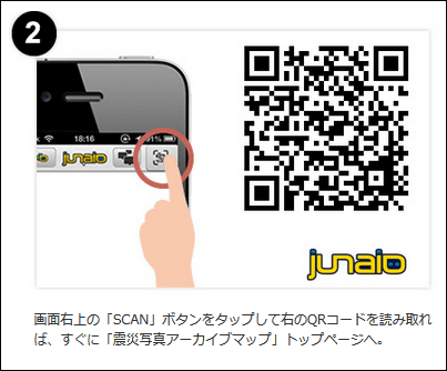
When the application starts, download contents such as photos. Tap the icon displayed as "SCAN" at the upper right of the screen, and click on the "Earthquake Disaster Photo Archive Map"Top pageRead the QR code that is described in.
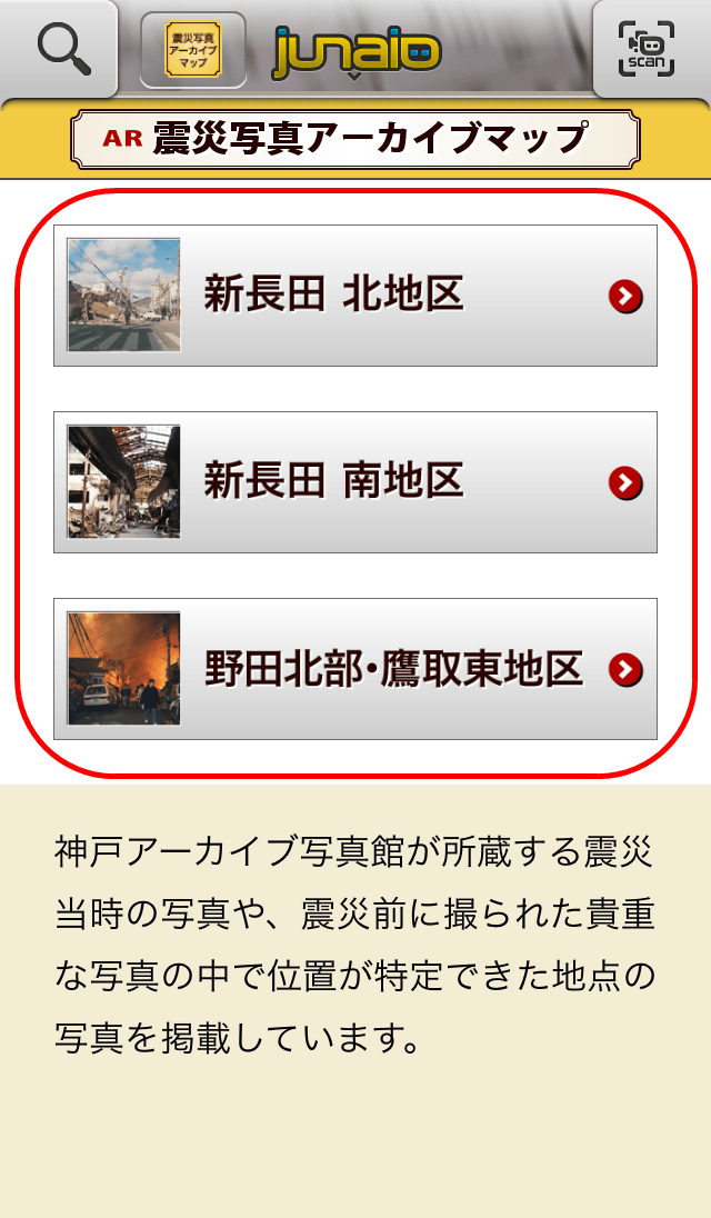
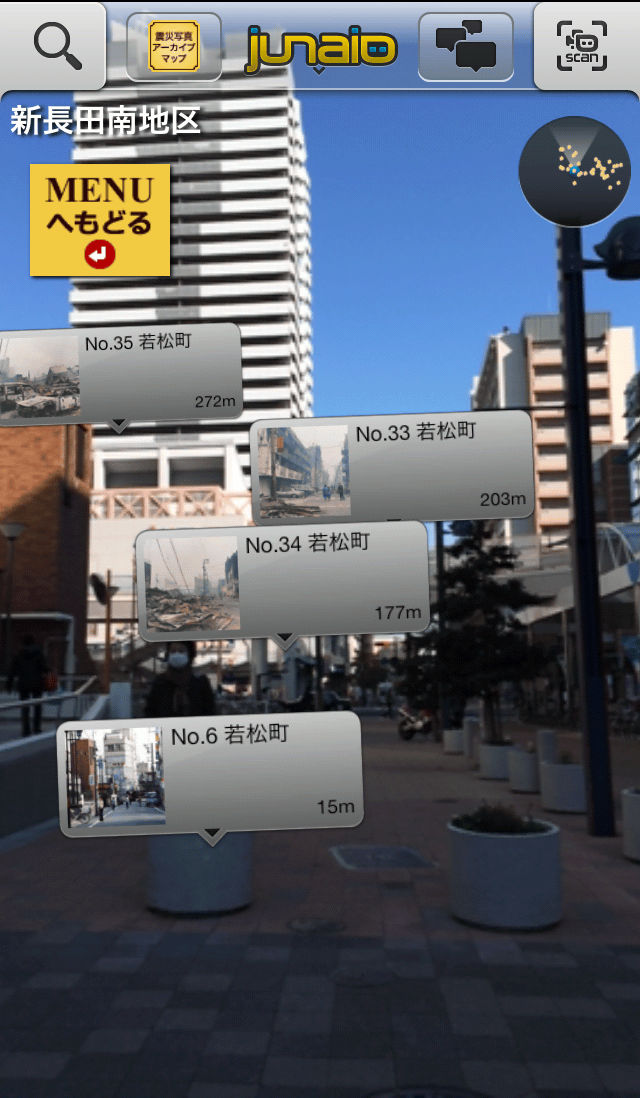
Data of "earthquake photograph archive map" channel has been read. By tapping the name of the area you want to see, the icon showing the location of the picture on the screen will be displayed as AR.
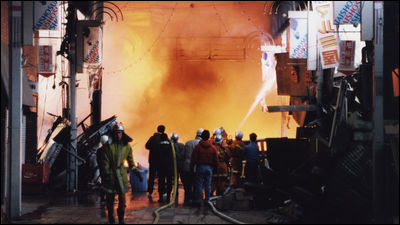
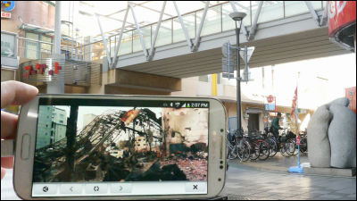
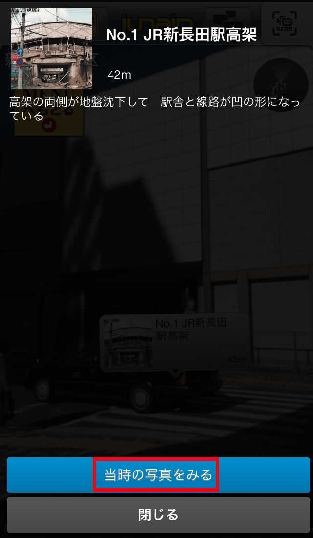
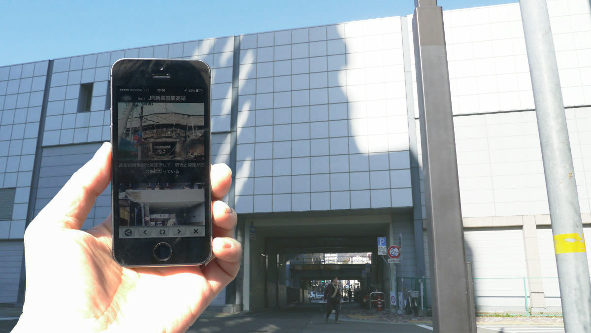
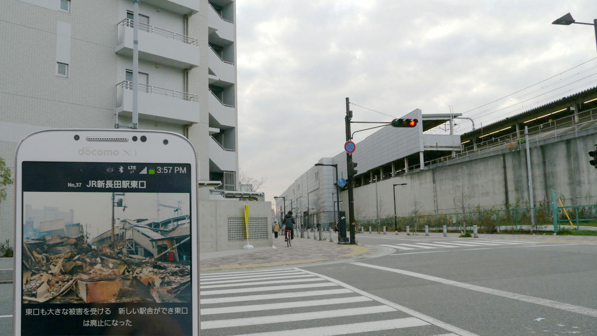
Here is what I have selected "Shin-nagata south district" and actually displayed it. In the elevated part of the newly replaced JR Shin - Nagata station, you can see the icon of the photograph at the time that was damaged by the earthquake disaster.

Tap the icon to display the description of the situation at that time. Tap "To see the picture at the time" ...
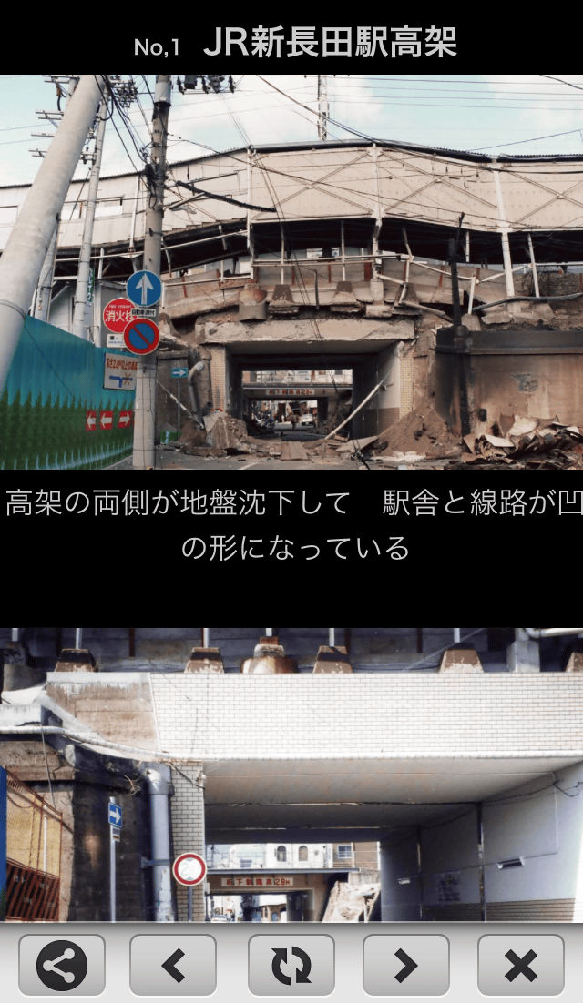
The picture will be enlarged.
In the center of the city, there were times when many icons were displayed like this.
The following movie is the one that actually used the application. In the current landscape, an icon showing the position of the photo at the time of the earthquake disappears is displayed, and when tapping it, you can see that the enlarged picture is displayed.
Operate "Earthquake Disaster Photo Archive Map" application - GIGAZINE
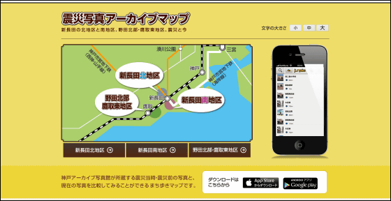
From the web site of "Earthquake Disaster Photo Archive Map", you can download the route map of the corresponding area. I actually walked around the "Shinchonada South area" center. The number of the photo corresponds to the number on the map.

JR Shin - Nagata station which is the starting point. Fountains etc were maintained in the square in front of the station.

◆ 1. JR Shin Nagata station elevated
◆ 2. JR Shin-Nagata Station West Exit

◆ 4. In front of Joy Plaza
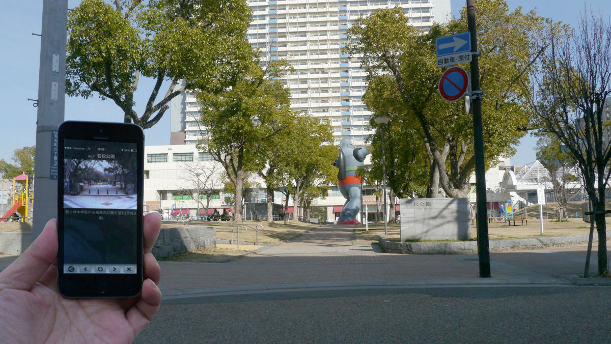
◆ 7 Wakamatsu Park
A life-sized monument of Tetsujin No. 28 is exhibited.
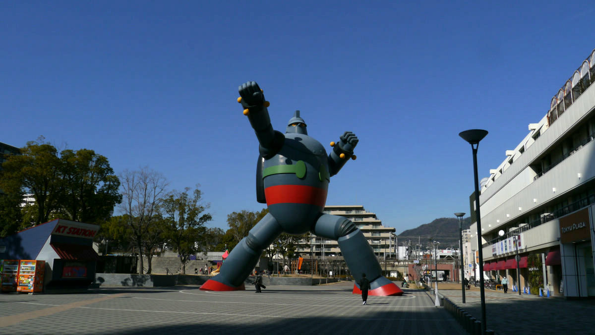
Angle of Tetsujin No. 28 viewed from the side
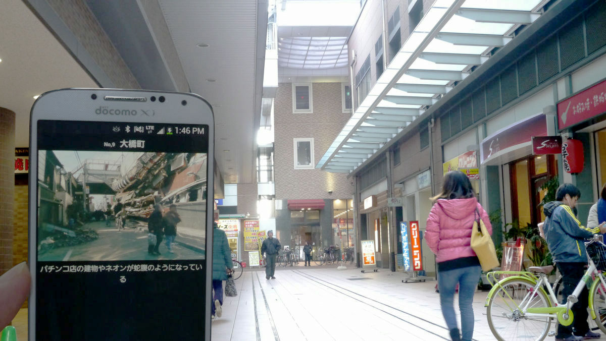
◆ Ohashi-machi
◆ Showa muscle shopping street
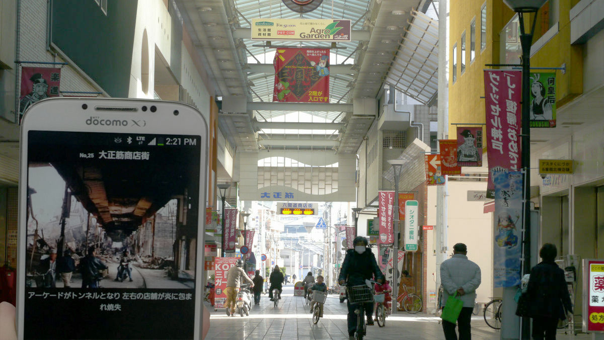
◆ 24. Taisho muscle shopping district
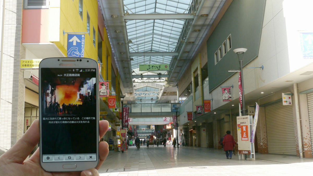
◆ 25. Taisho muscle shopping district
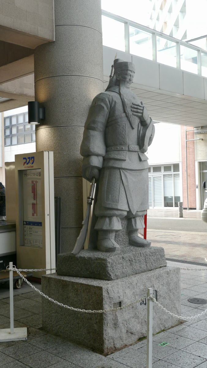
Because Kobe city is home from Mr. Mitsuki Yokoyama, the author of the cartoon "Mikunashi", and there is the "Temple of Seki" that enshrines Kanu and Chinatown "Nanking Street", in the shopping streetSangokushi gardenhad.

The statue of Kanuhi is also put.
I bought a croquette at a shopping street where peaceful air flows.
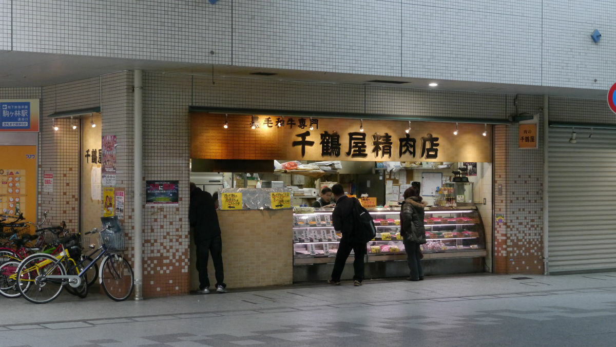
I made a butcher and croquette and munch cutlet. It seems to be a popular shop in the local area.

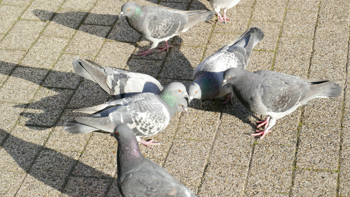
A group of pigeons that will puckle the spilled croquette pieces. The relaxed air flows, and it is almost impossible to feel the nail after the earthquake. Because it is such an era, it may be necessary to have such an application.
◆ 37. JR Shin-Nagata Station East Exit
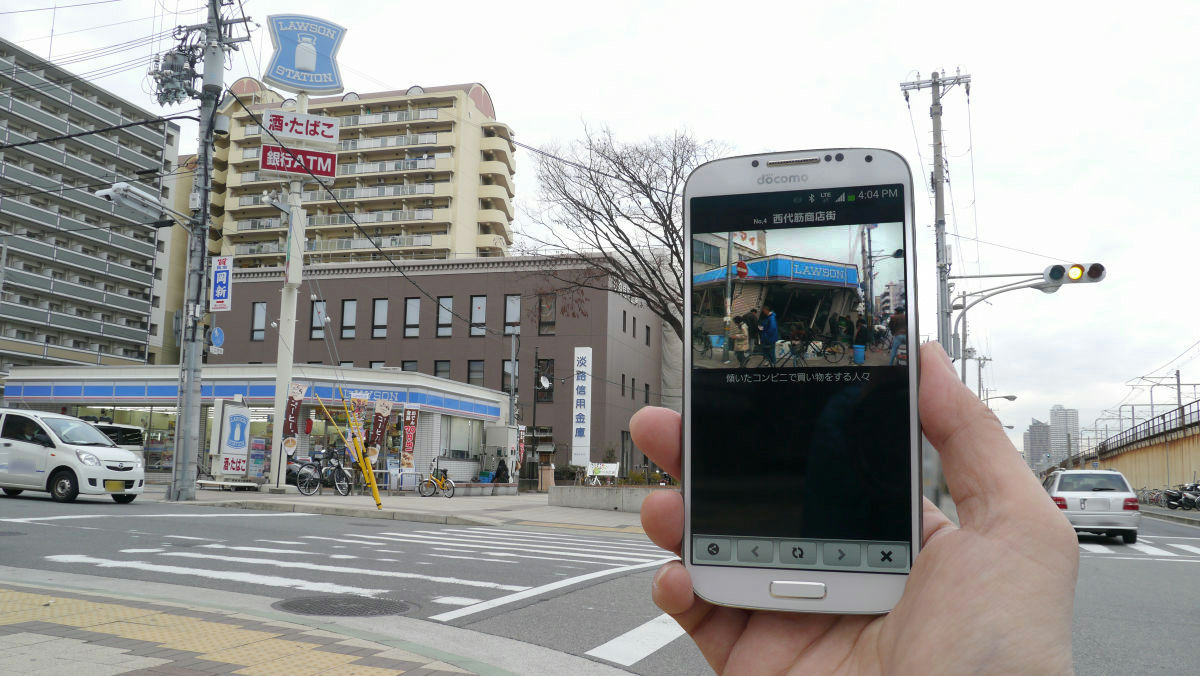
◆ "Shinnagata Kita District" 4. Seishi muscle shopping district
The sight of the Fukushima area where the damage of East Japan great earthquake still remains, and it is expected to occur in the near futureTonankai earthquakeJapan, etc. are inseparable from the damage of the earthquake. Do not forget weather the memory, and do not forget to recognize that Japan is always a country like this kind of disaster, it is an application that makes me feel once again that it is important to prepare for damage as "Disaster comes around when I forget" .
Related Posts: