Osaka Umeda Underground map for helping to capture underground labyrinths etc. "Osaka Easy Track Transit Map"
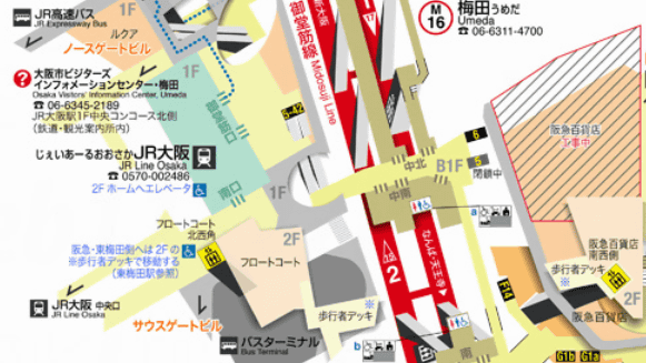
Trains in Osaka are becoming complicated lines that line up with New York, Paris, Tokyo, etc. Hus which is often confused by transfers and the like. Especially since the ticket gate and the home often straddle the multiple floors of the subway, if you can not grasp the hierarchical structure even if you have a map, you will not know where to go.
So, in order to solve such troubles for free, specializing in moving by train, the structure of the station across different floors is drawn with a stereoscopic illustration of free "Osaka Easy Track Transit Map". Originally it was a map made for purpose such as to locate a dedicated toilet and elevator for people using wheelchairs etc, but there was also no extra display such as store information etc. General It is content that is relatively easy to use for users as well.
Take a map and take a look like this.

Because it is folded in four, it is quite large when spreading. Areas covered are Nishi Umeda, Umeda, Higashi Umeda, Shinsaibashi, Shitsubashi, Namba, Tennoji.

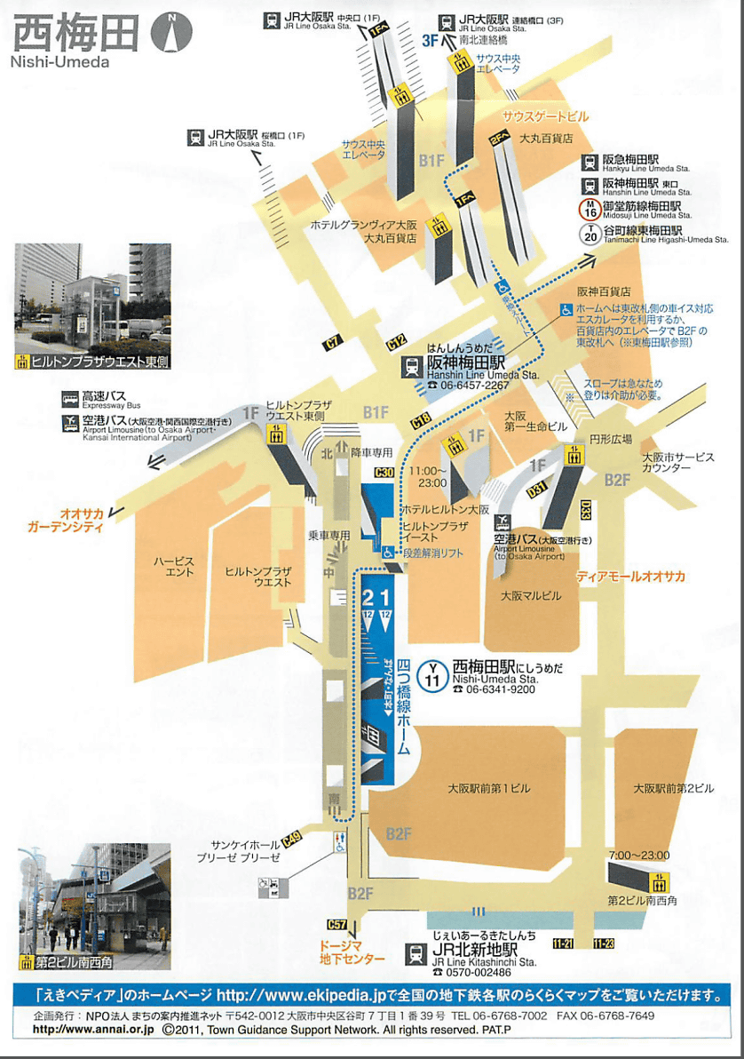
In general map of the plane as follows, it is difficult for images on the upper and lower floors to be hard to imagine.

On the other hand, in the case of "Osaka Easy Track Transit Map", the display is three-dimensional, making it easier to grasp the positional relationship between the upper and lower floors.

For those who use the wheelchair, not only the information on the elevator, but also the positions of the stairs and other streets that can not pass are indicated by the icons shown below.

Details of each page are as follows.
◆ Route map
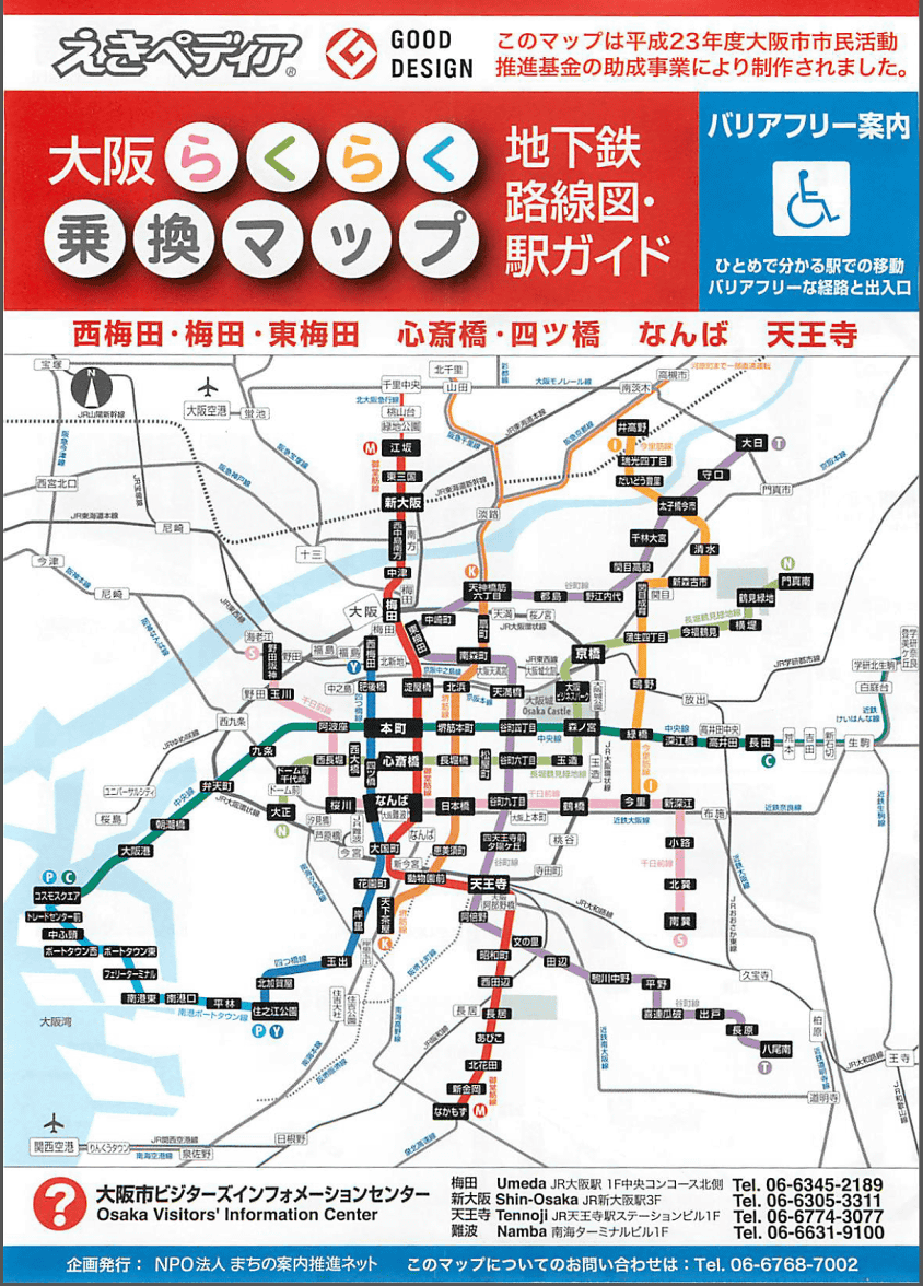
Umeda

◆ Nishi Umeda
◆ Higashi Umeda

◆ Namba

◆ Yotsubashi Shinsaibashi

Tennoji

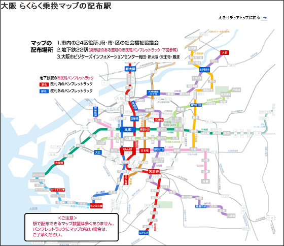
Distribution place is 22 Osaka Municipal Visitors Information Center in 22 stations and ward offices, Umeda and Shin Osaka etc. Click on the map below for details.
Also on the webPublish the map for freeSo you can print it yourself in advance.

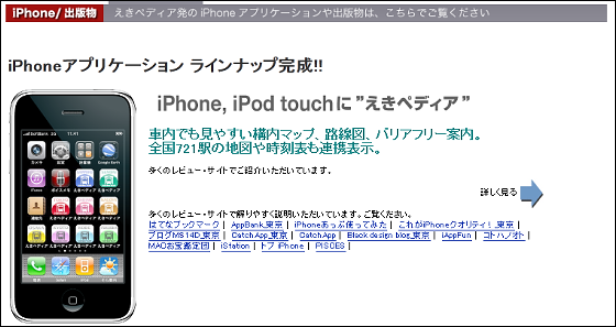
Also selling iPhone applications (85 yen each) that also supports Tokyo and Nagoya.
People who come to Osaka by travel and business trips as well as Kansai people are also useful maps and are distributed free of charge, so when you see them at the station you are safe to get one.
By the way, I made this mapNPO corporate city promotion guide promotion netI am also building a barrier free map of Yokohama and Kyoto.

Related Posts: