Mapion releases "evacuation radius map" and "wind direction" of Fukushima Daiichi Nuclear Power Plant and Fukushima Daii Nuclear Power Plant
Evacuation orders have been issued to residents around the Fukushima Daiichi Nuclear Power Plant and Fukushima Daiichi Nuclear Power Plant where the Units 1, 2 and 3 were exploded, but the "evacuation radius map" that can grasp where the relevant area is located is It was released.
It is also possible to check the "wind direction" of the municipality of the nuclear location.
※ I changed the URL for access rush
Details are as below.
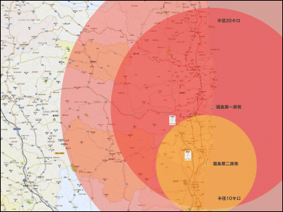
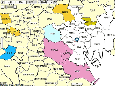
As of March 15th at 14:00, Mapion's "evacuation radius map" looks like this. You can learn from where to where is the evacuation radius.
Evacuation radius map of Fukushima Daiichi, second nuclear power plant
![]()
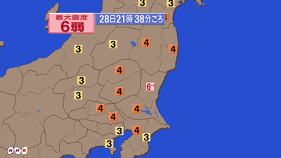
In addition, Flash version is also available, so you can know not only the evacuation radius but also the direction of the city, town, village of the nuclear location.
Evacuation radius map of Fukushima Daiichi, No. 2 nuclear power plant and wind direction: Mapion
![]()
The wind direction looks like this.
![]()
· 2011/03/15 11:08 postscript
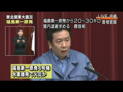
At the Prime Ministerial Meeting, which began at 11:00, the concentration of radioactivity in the area around the nuclear power plant has increased, and indoor escape was instructed to people living within a radius of 20 to 30 km.
20 ~ 30 km area Indoor refueling instruction NHK News
· 2011/03/15 11:18 postscript
Currently access is rushing and it is difficult to connect.
· 2011/03/15 14:01 Addendum
I changed the URL for access rush. In addition, a radius of 30 km area where new indoor standby was instructed at 11:00 on March 15 is also added.
Related Posts:

in Web Service, Posted by darkhorse_log