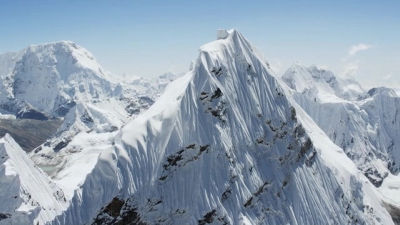
A picture of the pass "Marshmik Pass" at the highest place in the world and the top 7 following it
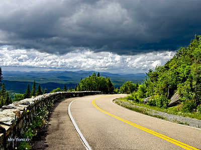
(ByNew Yorkled)
As you climb up the mountain path, there is a place to go down from a certain place. That is "Pass." There are various things from gentle ones to steep ones even if they say pass, and rugged ones are becoming a bottleneck of traffic even now with the spread of automobiles and railways.
This time I will introduce the top 7 in the world, which is located at a particularly high altitude. The highest Mt. Fuji in Japan is at an altitude of 3776 m, but these passages are located in tremendously high places with altitudes above 5000 m.
Details are as below.
The View from the Seven Highest Mountain Passes on Earth
The first place:Marshmik Pass(Mashimiku La:Marsimik La) Altitude 5582 m
View Larger Map
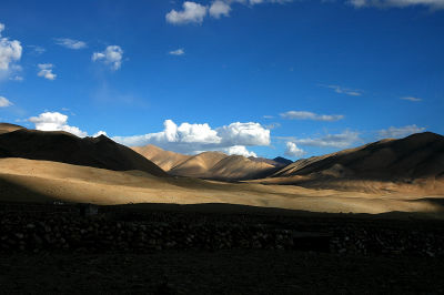
Mashmiku Pass is a northern India, Jammu and Kashmir Province Ladakh Province Pass, the central city of this regionLehIt is in the place where I went east 100 km. By the way, the Indian army claims that the altitude is 18634 feet (about 5679 m).
(By~ FreeBirDR ~)
There is a street saying that the road has passed through the pass and there is a story that the car has been reconstructed according to this, but the road condition is very bad and it is difficult to pass by a normal car. If you can drive properly, it will be the highest motorway in India. It is because there are rumors that roads go to Tibet at higher altitudes because there are rumors that the road is passing in Tibet, but it is not confirmed in Tibet because it can not be investigated freely.
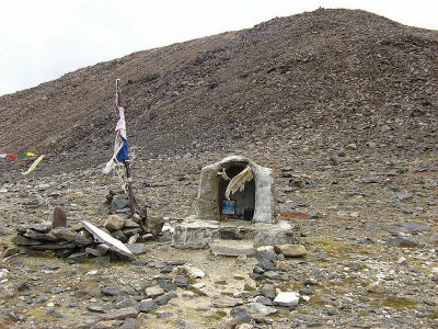
People traveling to this pass in India have posted pictures. The road is not thin and there are no cliffs, and in a word it's a place where there is only "no thing".
Marsimik La !!!!!!!! - Page 3 - India Travel Forum, BCMTouring.com
A wide wilderness that you can imagine that you'll be pleasant when you run on a motorbike.
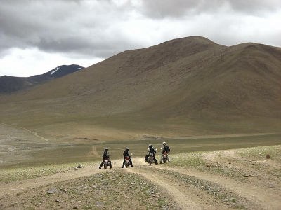
Plants can only be found as grass growing to stick to the ground.
No. 2:Semo Pass(Semo · La:Semo La) Altitude 5565 m
View Larger Map
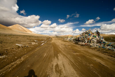
Semo pass is located on the road marked "S206" on Google Maps. Located in central Tibet Autonomous Region, West Tibet andMount KairasIt is one of the access routes to. Although roads parallel to the south side are mainly used, there are things that can not be used due to muddy ground because it is in a swampy place, and in such a case, detouring via Semo Pass will be done. The road is unpaved and old, but it does not hurt for a journey by mountain bike. There is no crossing of the river and no dangerous steps, only unpaveddirtIs followed. Since there is a doubt as to whether the car can pass normally at the No. 1 Mashmiku Pass, the highest highway that was measured accurately is this pass.
It seems Flickr that John Town traveled through the pass in 2007.
Semo La, Tibet 2007 - a set on Flickr
No. 3:Karakorum Pass(Karakoram Pass) Altitude 5540 m
View Larger Map
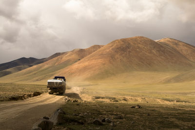
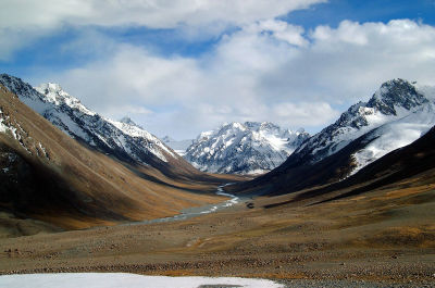
Lay in India · Ladakk region and China · Xinjiang Uighur autonomous regionJarkandOne of the ancient caravan routes connecting the highest pass is the Karakorum Pass. The altitude and lack of feed are known for bringing death to the animals used to carry luggage and bones scattered all over the pass. It is located between the two mountain ranges and is frequently hit by windstorms, but it is thought to be relatively easy to pass because of the gradual slope of the pass, and it is open almost without being shut down almost all the year I will. However, the vehicle is closed for traffic.
(ByRule 37)
No. 4:Changla Pass(Chang La:Chang La Pass) Altitude 5425 m
View Larger Map
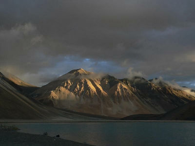
Changla Pass with LeiPangon lakeIt is also on the route connecting the Chang Tang Plateau. "La" means a pass in Tibetan language, so it may be correct to say "Chang Pass".
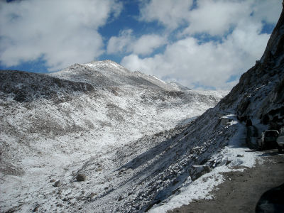
(BySistak)
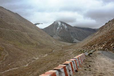
(ByAjit Karthik)
This is Pangon Lake
No. 5:Kardun Pass(Cardhun La:Khardung La) Altitude 5359 m
View Larger Map
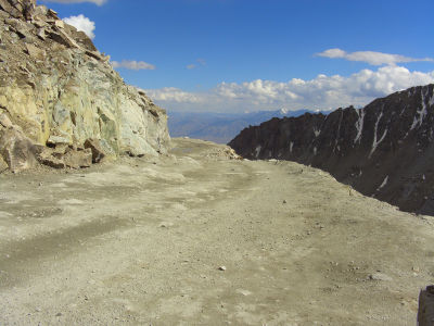
The Carduun Pass, which is said to be "the highest in the world as a motorway road" for a long time is actually losing in height above the above pass. In the past, there were times when the altitude was set to 5600 m, but this is considered to be a padded number to make it the highest pass, and it is settled to 5359 m by the latest figures measured by GPS.
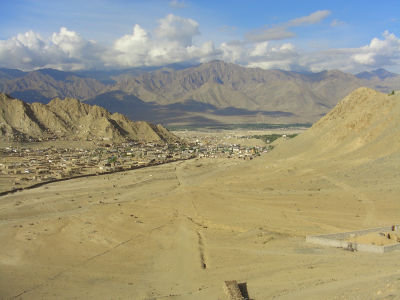
(ByMummybot)
This pass is also near Lay in the Indian · Ladakh region, leading to the Shoke River and the Nubra Valley. The road which passed through the pass was built in 1976, and since the car became passable since 1988, many cars and motorbikes are using it for traveling. Even from the historical perspective,KashgarIt is an important trade route that connects 10,000 horses and camels across the pass. There was also an attempt to transport munitions supplies to China through this route during the Second World War.
(ByMummybot)
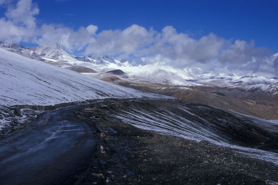
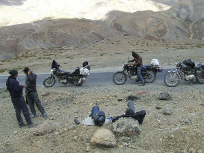
No. 6:Tan Lan pass(Tan Lan La:Tanglang La) Altitude 5359 m
View Larger Map
It is the pass which is the height next to Kardun Pass at the pass which is in the route which connects the city Leh and the Manali region of Ladakk region.
(ByEricmenendez)
(ByIbangalorean)
No. 7:Tangla Pass(Karakora Pass:Tanggula Pass) Altitude 5231 m
View Larger Map
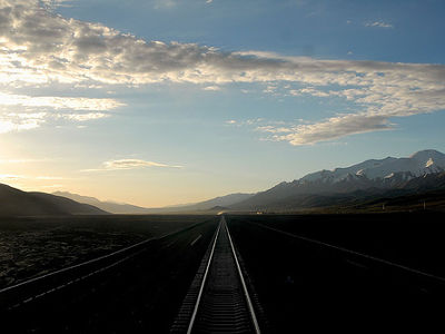
Pass over the Tan Ra mountain range in the central part of the Tibetan Plateau. Link Lusha of Xining City and Tibet Autonomous Region of Qinghai ProvinceBlue RailwayAlso runs near this pass,Tangla StationIt is the station in the world's highest place located 5068.63 meters above sea level.
(ByLuo Shaoyang)
The altitude is 5231 m. Since the area spreads gently, it does not feel like "This is the top of the pass".
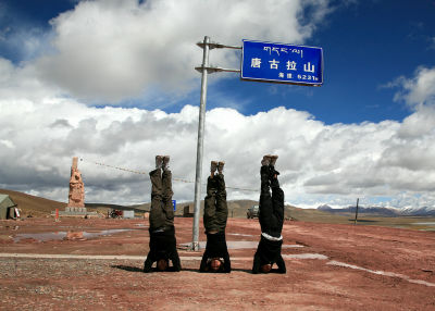
(ByAhsup)
As the highest peak in the world is Everest (Chomoranma / Sagar Mata) of the Himalayas, it is convinced that there are many high passs around them. There is no pass near the highest peak of each continent such as Kilimanjaro and McKinley because the Himalayas exist on the caravan route continuing from ancient times.
Related Posts:
in Note, Posted by logc_nt
