A satellite launched during the Cold War has discovered hundreds of Roman castle ruins
Copyright © The Author(s), 2023. Published by Cambridge University Press on behalf of Antiquity Publications Ltd
Declassified photographs taken by early spy satellites in the 1960s and 1970s reveal the Roman Empire's eastern border as a vibrant trading center.
A wall or a road? A remote sensing-based investigation of fortifications on Rome's eastern frontier | Antiquity | Cambridge Core
Cold War satellite images reveal nearly 400 Roman forts in the Middle East | Live Science
https://www.livescience.com/archaeology/romans/cold-war-satellite-images-reveal-nearly-400-roman-forts-in-the-middle-east
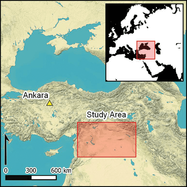
In the 1920s, a person named Antoine Poidebard used an airplane to take photographs and discovered 116 ruins from the Roman Empire era spanning Syria, Iraq, and Jordan. Poidebad hypothesized that ``square-shaped forts formed a defense line running north and south, repelling the attacks of the Parthians and later the Sassanid Persians,'' and this theory remained popular until recently. It was widely believed.
Copyright © The Author(s), 2023. Published by Cambridge University Press on behalf of Antiquity Publications Ltd
However, as a result of analyzing photographs taken during the Cold War era by Jesse Casana of the University of Cambridge, 396 previously unknown forts and buildings resembling forts were discovered.
Copyright © The Author(s), 2023. Published by Cambridge University Press on behalf of Antiquity Publications Ltd
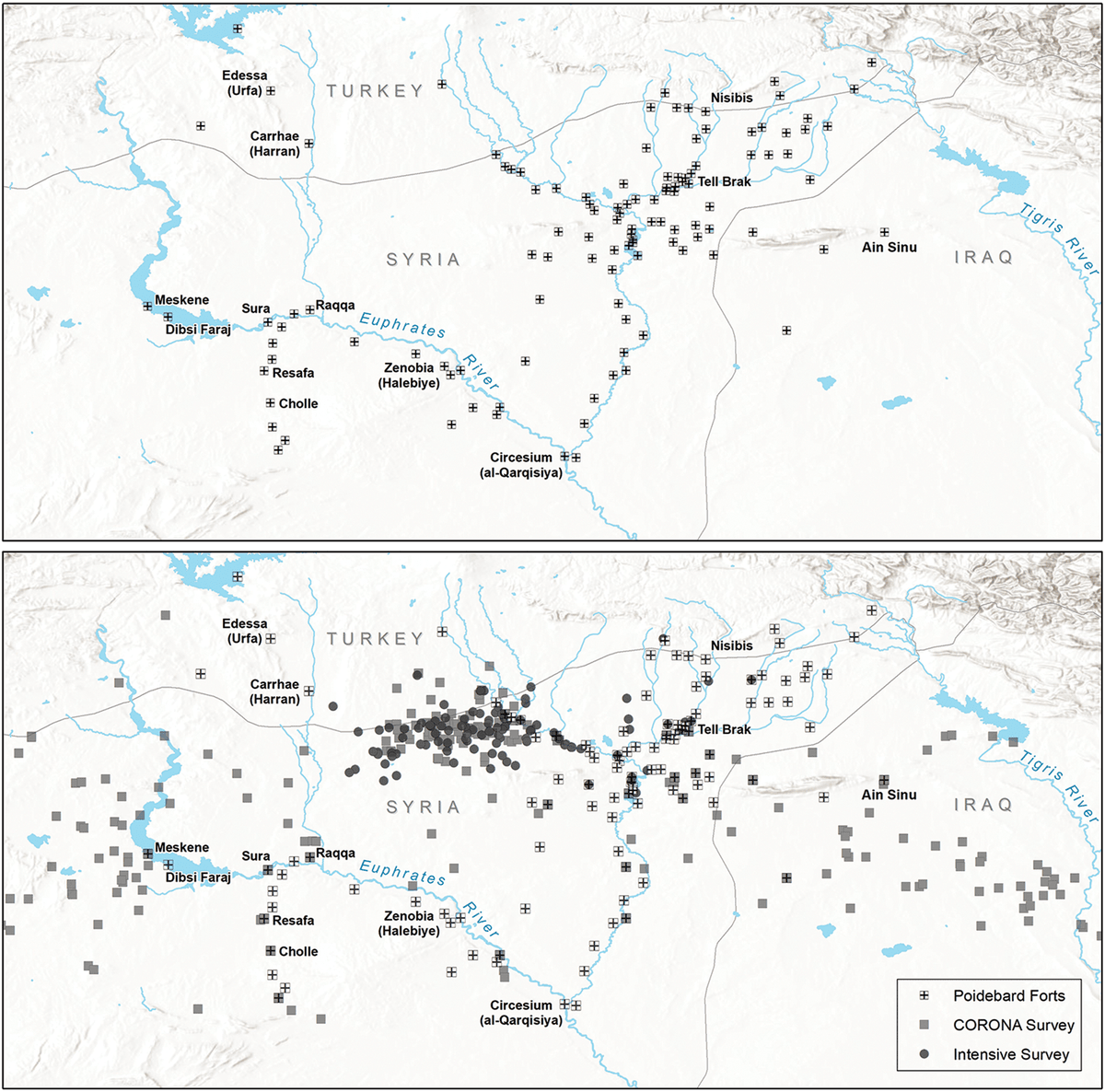
As a result of analyzing the locations of forts, it was found that forts were widely distributed not only in the north-south direction but also in the east-west direction, and the theory that ``forts were built across the north and south'' proposed by Mr. Poidebad is no longer supported. A conclusion has been drawn.
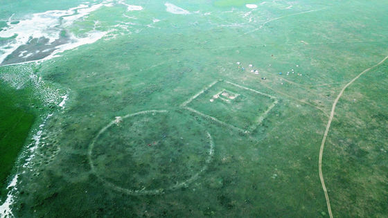
The top of the image below is the distribution map that Mr. Poidebird thought of, and the bottom is a diagram with the forts added based on the theory of Mr. Casana and others. Mr. Casana and colleagues said, ``The distribution of the forts seems to support Mr. Poidebad's theory that ``the forts were lined up in a line.''
The discovery suggests that the borders of the Roman Empire were much more fluid than originally thought, providing shelter for trade caravans transporting people and goods between the Roman Empire and the neighboring Parthian Empire. A possible theory is that it was.
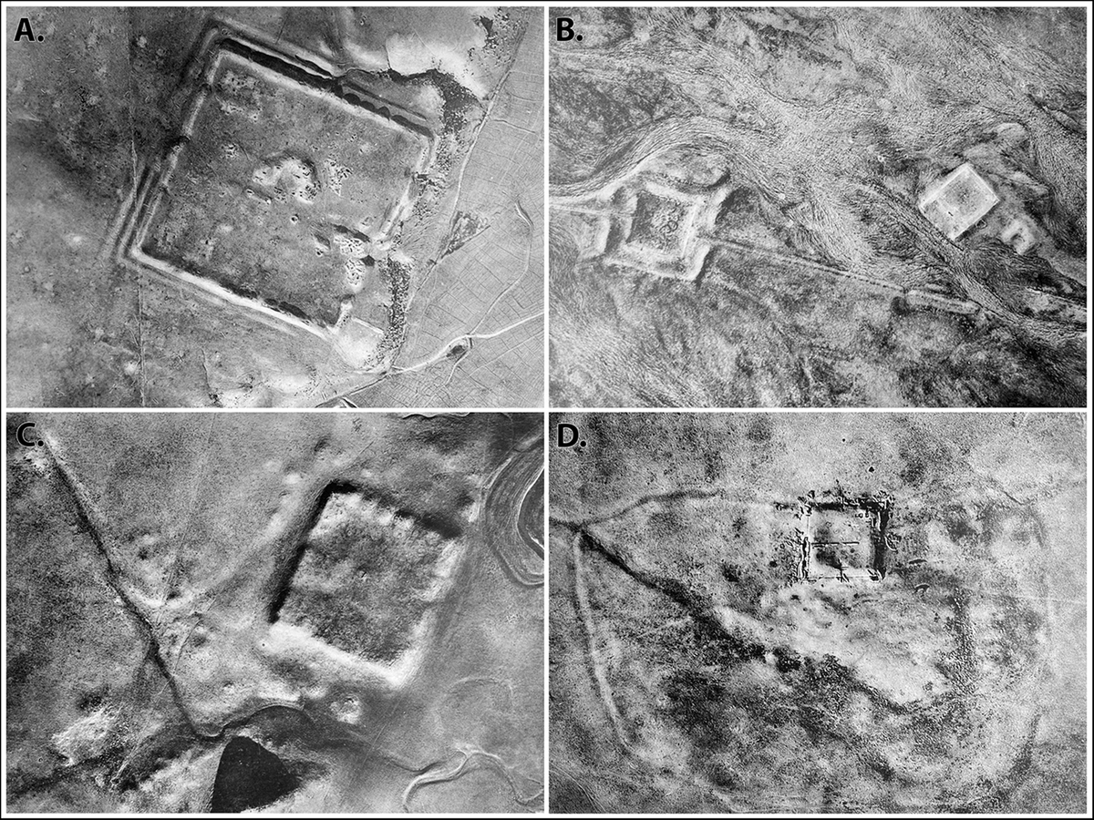
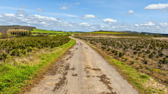
Casana et al. ``Most square forts are 50 to 80 meters on a side, but huge forts with sides of up to 200 meters have also been found.Were the roads between the forts walls or roads? 'The mystery remains, but we believe that more will be discovered as other aerial photographs, such as those taken by spy satellites, are declassified.'
Related Posts:


in Note, Posted by log1p_kr