A detailed geological map of Mars such as the highest mountain in the solar system, Mount Olympus, will be released, and will it affect future missions?

The Center for Planetary Geology Science has released a detailed Mars geological map that may affect future missions on Mars.
A Martian Mons Mystery, (Paleo) Climate Change, and Rivers of Lava: What Three New USGS Maps Reveal About Mars | US Geological Survey
The maps of the highest peak in the solar system, Mount Olympus, Aeolis Dorsa (a ridge with a wrinkled structure), and the Athabasca Valley, and related materials were released.
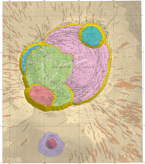
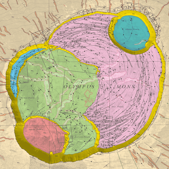
Geologic map of Olympus Mons caldera, Mars
https://doi.org/10.3133/sim3470
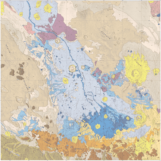
Geologic map of the Aeolis Dorsa Region, Mars
https://doi.org/10.3133/sim3480
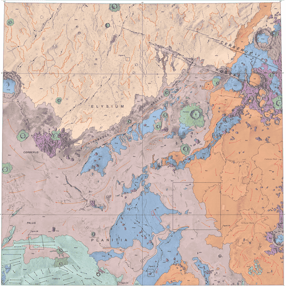
Geologic map of the Athabasca Valles region, Mars
https://doi.org/10.3133/sim3477
Below is an interactive map of Mount Olympus.
Geologic Map of Olympus Mons Caldera, Mars, 1:200K. Mouginis-Mark (2021)
https://usgs.maps.arcgis.com/apps/webappviewer/index.html?id=1e3decd17b8840a39fb8c31fa27bf390
The imaged map is at the link below, but since the file size is 64.6 MB, be careful when viewing in a mobile environment.
USGS SIM 3470: Geologic Map of Olympus Mons Caldera, Mars | US Geological Survey
https://www.usgs.gov/media/images/usgs-sim-3470-geologic-map-olympus-mons-caldera-mars

The map was created by a team of Dr. PJ Moginis-Mark of the University of Hawaii at Manoa. It was made based on past research by Dr., and it turned out that the highest point was different from what was expected so far. One of the points of this map is the presence of contour lines, which have not been drawn in many previous maps of Mars. thing. Regarding the 1/200,000 scale, Dr. Moginis-Mark revealed that he wanted to put the entire caldera on paper that could be hung on the wall, and that 1/100,000 and 1/150,000 were too big. , On the other hand, he says that it was because the details could not be seen if it was 1/500,000.

Below is an interactive map of Aeolis Dorsa.
Geologic Map of Aeolis Dorsa, 1:500K. Burr and others (2021)
A dorsa is a low, continuous, winding ridge that resembles an inverted river channel. The map was created by Dr. Devon Barr of Northern Arizona University who `` thought to understand the history of winding river topography '', and the imaged map is posted on the following page. The file size is 97.7MB.
USGS SIM 3480: Geologic Map of the Aeolis Dorsa Region, Mars | US Geological Survey
https://www.usgs.gov/media/images/usgs-sim-3480-geologic-map-aeolis-dorsa-region-mars

Below is an interactive map of the Athabasca Valley.
Geologic Map of the Athabasca Valles Region, Mars, 1:1M. Keszthelyi and others (2021)
Mars has many terrains that suggest that there was a flood in the past. The Athabasca Valley has long been thought to be a landform formed by large-scale floods, but after that, there was a debate as to whether it was caused by floods or by eruptions of high-temperature lava. Today, it is believed to be composed of young flood basalt , formed by the flow of erupted lava. The map was created by Dr. Laszlo Kestai and others, and we originally planned to create four maps with the aim of mapping at a higher resolution, but from the decision that it would be more ``confusing'' than ``useful'', It is said that the current one was made. “The Mars rover InSight has been observing earthquakes in the region, suggesting that geological activity in the region is not over yet,” Kestai said. I think there is a great need for maps on the global and global scales, but new discoveries will come more often from detailed maps, especially on the rover scale, because mapping on such scales is more familiar to terrestrial geologists. I think it will be something,' he said.
Below, the file size of the map of the Athabasca Valley is 96.4MB.
USGS SIM 3477: Geologic Map of the Athabasca Valles Region, Mars | US Geological Survey
https://www.usgs.gov/media/images/usgs-sim-3477-geologic-map-athabasca-valles-region-mars

Related Posts:
in Note, Posted by logc_nt


