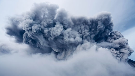
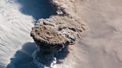
It is estimated that the large eruption of Tonga had an explosive power more than 500 times that of the Hiroshima-type atomic bomb.
A large-scale volcanic eruption occurred in Tonga, an island country in the South Pacific Ocean on January 15, 2022, and it was reported that the tsunami that was thought to be the cause of the eruption reached Japan. The detailed damage situation remains unknown because the communication network such as the Internet was cut off. Meanwhile, NASA researchers who have been studying volcanoes around Tonga before the eruption gave their views on the scale of the eruption.
NASA: Tonga blast was 10 megatons, more powerful than a nuclear bomb: NPR
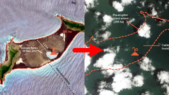
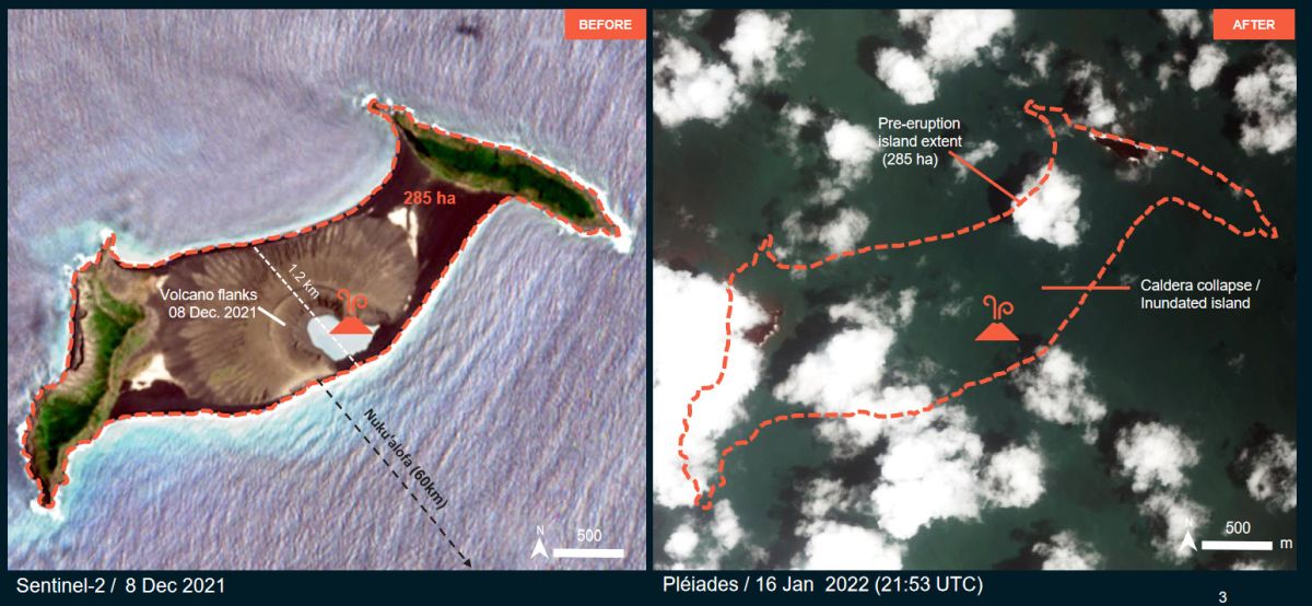
The eruption this time was at Hunga Tonga-Hunga Ha'apai volcano , located 65 km north of Nuku'alofa, the capital of Tonga. This volcano had repeated large-scale eruptions even before this eruption, and the eruptions that occurred from 2014 to 2015 were large enough to form a new crater and expand the land. However, experts have pointed out that the scale of this eruption is far larger than those eruptions, and there are concerns that the situation may remain unstable over the next few weeks to years.
Volcanologists explain why the volcanic eruption in Tonga is so fierce and a sign of a major eruption in the future --GIGAZINE
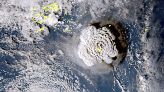
Meanwhile, NASA researcher James Garvin, who has been studying Tonga volcanoes for several years, said, 'As a result of estimating the scale of this eruption, it is equivalent to 10 megatons (10 million tons) of trinitrotoluene (TNT). It was calculated to be the power to do. ' The NPR, which reported this statement, emphasized the magnitude of the eruption, stating that the explosive power exceeded 500 Hiroshima-type atomic bombs.
In addition, Mr. Garvin said, 'This eruption in Tonga is a large eruption comparable to the Krakatau eruption that occurred in Indonesia in 1883,' and said that the volcanic eruption in Tonga was a rare scale in human history. It is appealing.
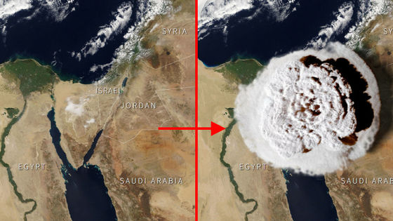
As mentioned above, the scale of damage in Tonga is not known in detail at the time of writing the article because the telephone and the Internet were cut off. Under these circumstances, the United Nations Satellite Center released a satellite image of Tonga to clarify a part of the damage situation in Tonga.
???? ️ ???? Before and after of #Hungatonga
— UNOSAT (@UNOSAT) January 17, 2022
First preliminary damage assessment for the volcanic eruption and induced tsunami for #HungaTongaHungaHaapai available
➡️ https://t.co/GXTJhcifNp #TongaVolcano #tongatsunami @OCHA @UNOCHA_Pacific @UN_Pasifika @TongaMissionUN @disastercharter pic.twitter.com/K37etvDRkV
Below is a satellite image released by the United Nations Satellite Center. The left side is around Hunga Tonga-Hunga Ha'apai volcano before the eruption, and the right side is the state after the eruption at the same point. If you look at the pictures, you can see that the entire island has disappeared.
Looking at the satellite image around the airport, the runway on the diagonal is buried in volcanic ash.

At the beach, in addition to being buried in volcanic ash, it can be seen that storm surges and tsunamis have washed away coastline structures.
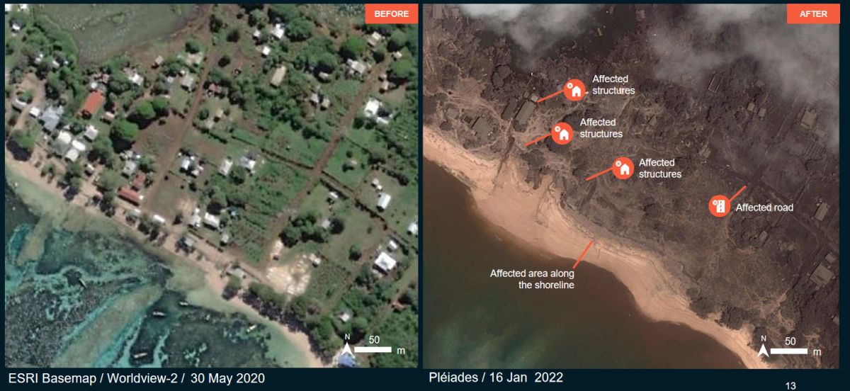
It should be noted, also, such as transport of relief supplies is difficult to state the fact that removal of volcanic ash that has accumulated on the Tonga domestic airports are difficulties that followed is that of the.
Related Posts:

in Note, Posted by log1o_hf