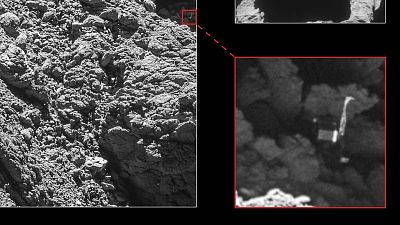
The person who identified the location of the hiker who was in distress from one image explains the identification method

On April 13, 2021, amateur radio operator Benjamin Kuo, whose hobby is 'identifying images,' identified the approximate location from a single image taken by a hiker in distress and was contacted for a search. An event occurred in which the corps rescued safely. Mr. Kuo, who showed a wonderful performance, explains 'How did you find your whereabouts' this time.
Since people are asking, how to geolocate a
#hiker given only a general location and a grainy photo of their legs hanging off a cliff (thread) 1 / x pic.twitter.com/81V0LGQdUk — AI6YR (@ ai6yrham) April 14, 2021
On April 12, 2021, a hiker named Rene Compean was distressed in the mountains and lost communication after sending an image to a friend. A friend reported to the authorities, and after an overnight search, the images were posted on SNS, and Mr. Kuo noticed this and started analyzing the images. Mr. Kuo quickly determined the approximate coordinates, and the search team found Mr. Compean at a point about 1.2 km away from the coordinates and rescued him safely.
A hiker in distress is quickly discovered by 'a person who has a hobby of identifying photos' --GIGAZINE

Below is an image that Mr. Compean sent to a friend. On this day, Mr. Compean was hiking on Waterman Mountain , located in the Angeles National Forest, California.
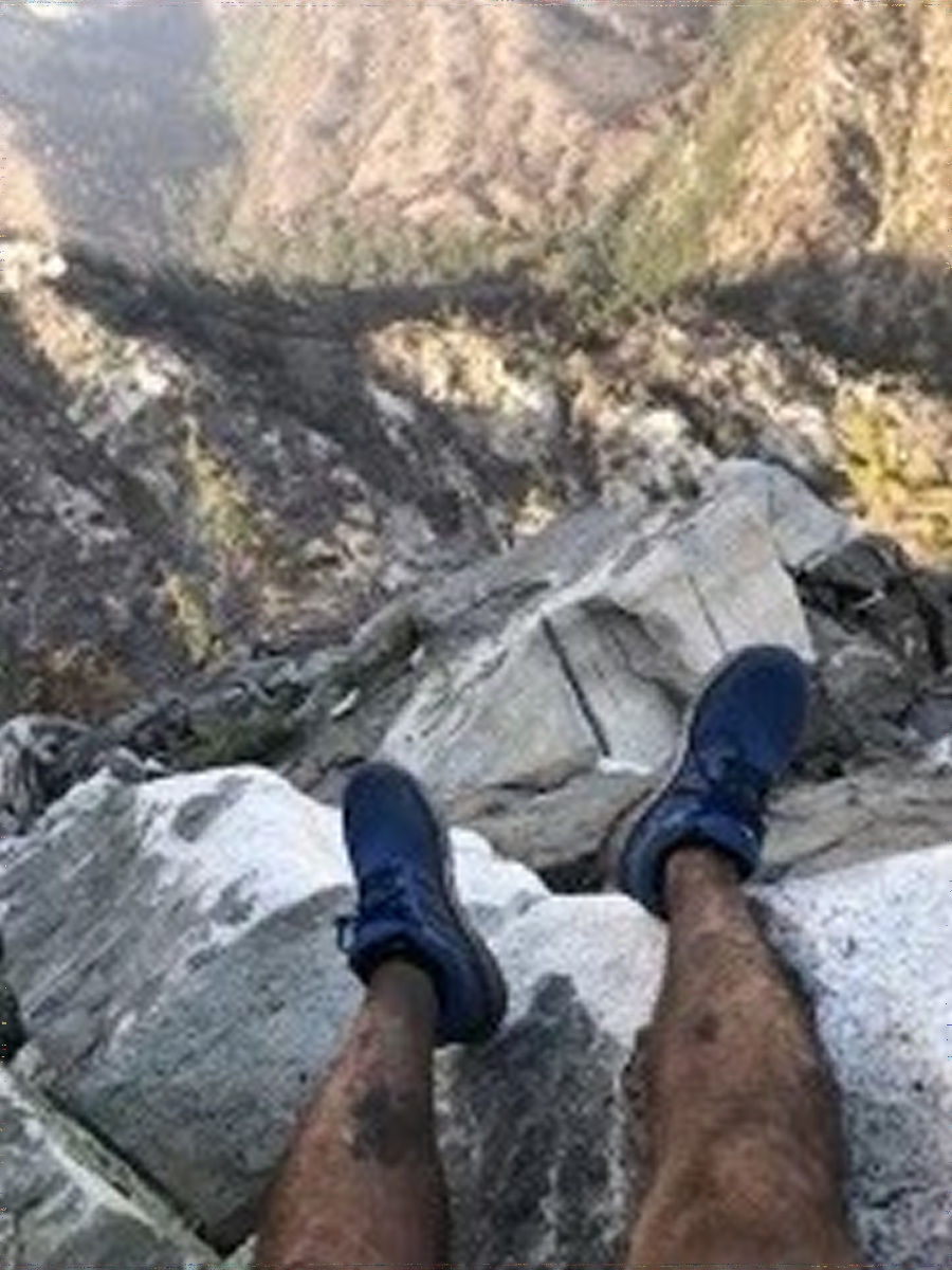
Mr. Kuo first asked to identify 'in which area Mr. Compean was hiking.' We already knew from official tweets that Mr. Compean was in distress on Mount Waterman, so we'll narrow down whether he was in distress on the Angels Crest Highway 'north' or 'south' across Waterman Mountain. did.
2. If someone is lost along the Angeles Crest (if you keep tabs on the posts of @SEBLASD they post regularly on rescues), you find they are either NORTH of the Angeles Crest Highway or SOUTH of the Angeles Crest Freeway. How do we figure out which one here? 3 / x pic.twitter.com/OdQWAHJzdk
— AI6YR (@ ai6yrham) April 14, 2021
This is where satellite images come in handy. Mr. Kuo said that he used the site 'Sentinel Hub ' that updates and publishes the ground image taken from the satellite every few days and contrasts it with the image taken by Mr. Compean. 'It's very important to see what the mountain looks like now, not archived images such as Google Earth,' Kuo said. In fact, a large-scale forest fire broke out in the Angeles National Forest for three months from September 2020, and the vegetation and landscape had changed significantly. 'I lost sight of the road because of the difference in scenery,' said Compean, who was accustomed to hiking.
Here's where recent satellite data is important. The EU has the Sentinel-2 satellite (via @sentinel_hub EO Browser) which shows high resolution views of almost every place on earth, captured every few days. VERY important to see what something looks like NOW, not archived. 5 / x pic.twitter.com/z64HRN3OET
— AI6YR (@ ai6yrham) April 14, 2021
And Mr. Kuo confirmed that there are few plants in the north of the Angels Crest Highway and many in the south. Since there is a lot of green in Mr. Compean's image, Mr. Kuo judges that 'Mr. Compean was in distress south of the Angels Crest Highway.'
Google Earth has archived data, so it's tough to use the photo of the legs for any idea of where the photo was taken. Sentinel-2, on the other hand, shows where the vegetation roughly matches the background of the legs (green in the) bottom but burnt / dry above). 6 / x pic.twitter.com/9F2sSAzRvK
— AI6YR (@ ai6yrham) April 14, 2021
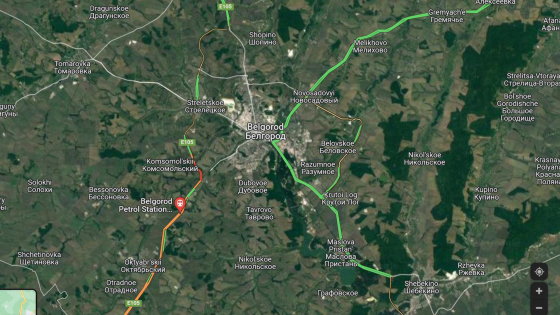
After looking at several points on the Sentinel Hub, Kuo sought out a landscape that resembled Compean's image. Satellite images have different angles from images taken from the human eye, and it is usually difficult to identify any more, but fortunately Sentinel Hub had a 3D visualization tool installed, so you can change the angle of the satellite image to make a detailed contrast. Was possible.
Fortunately, @sentinel_hub recently added 3D visualization tools (you can also download the image to Google Earth as a JPG / KMZ if you wanted, but more steps). If you use those 3D tools and move around ... you get this. 8 /x pic.twitter.com/ogpIcmsQFj
— AI6YR (@ ai6yrham) April 14, 2021
The image that Mr. Kuo finally identified is as follows. The shapes of the cliffs match, and Kuo thinks it's almost certain, but moves to Google Earth with measurement and drawing tools for confirmation.
Hey, you say, I think I found what the lost hiker is looking at! Which leads to ... 9 / pic.twitter.com/3tA43a9Vma
— AI6YR (@ ai6yrham) April 14, 2021
And, as a result of adjusting the image of Google Earth to the time when Mr. Compean seems to have been in distress, he was convinced that the determined point was correct.
Using the time / date feature of Google Earth (desktop) .. bingo. Uncanny match (enough to convince SAR folks that no, I was not a stupid armchair detective with no clue ;-) 12 / x pic.twitter.com/FFG8Vce7lD
— AI6YR (@ ai6yrham) April 14, 2021
In addition, Mr. Kuo said, 'It took 21 minutes to identify.'
(Just for the record, the #geolocation I did the other day on the hiker thing took 21 minutes ... asked a few times lately by reporters how many hours it took me --have been saying 20-30 minutes--and finally looked it up.). Pic.twitter.com/1JkyCjE666
— AI6YR (@ ai6yrham) April 20, 2021
Related Posts:


in Posted by log1p_kr