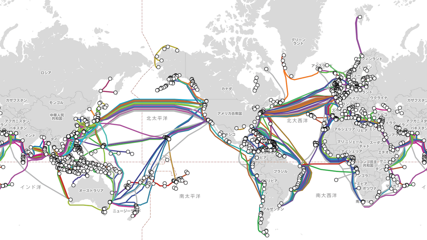
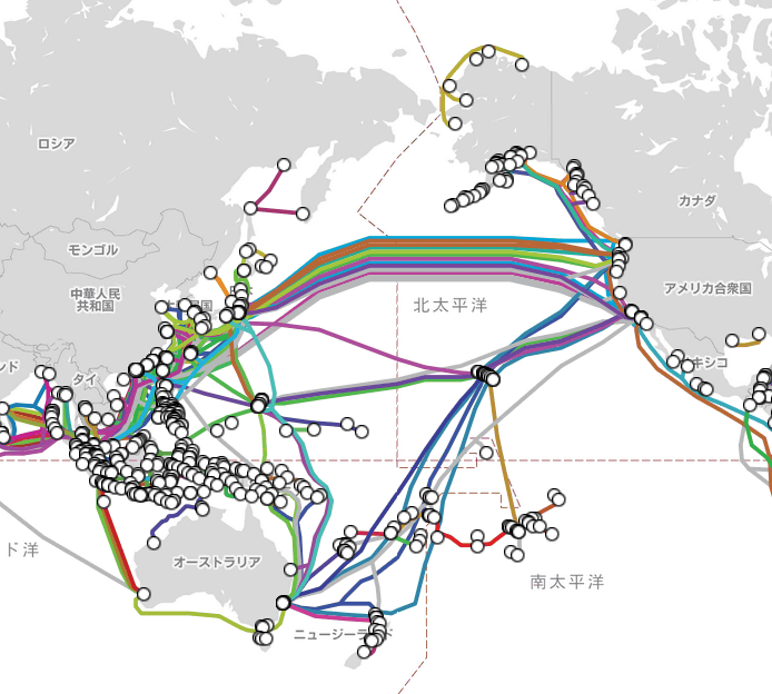
World map 'Submarine Cable Map' that shows the location of submarine cables in the world at a glance
Nowadays, it is easy to obtain information on areas beyond the sea, and '
Submarine Cable Map
https://www.submarinecablemap.com/
When you access the official page , you will see a world map on the left side of the window that visualizes the location of the submarine cables in the world.
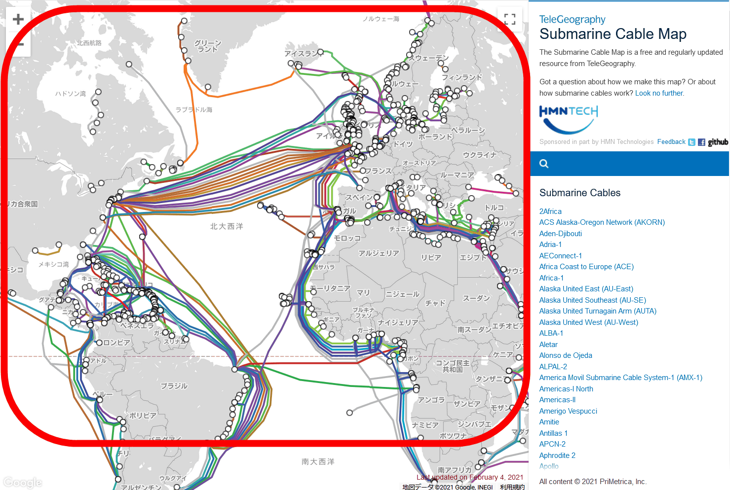
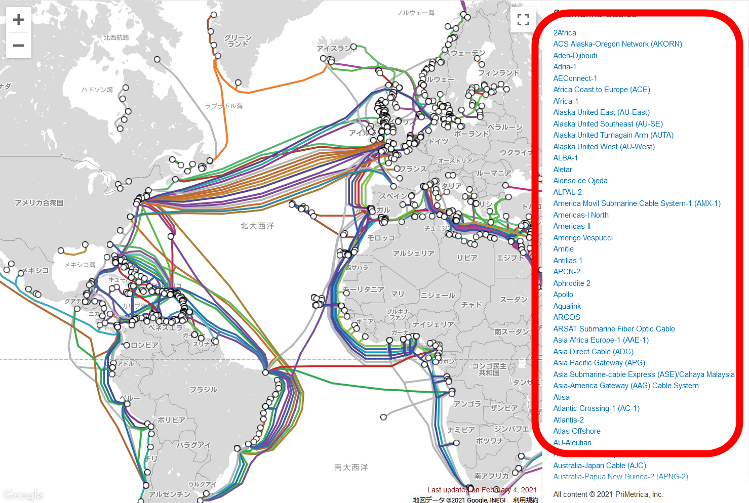
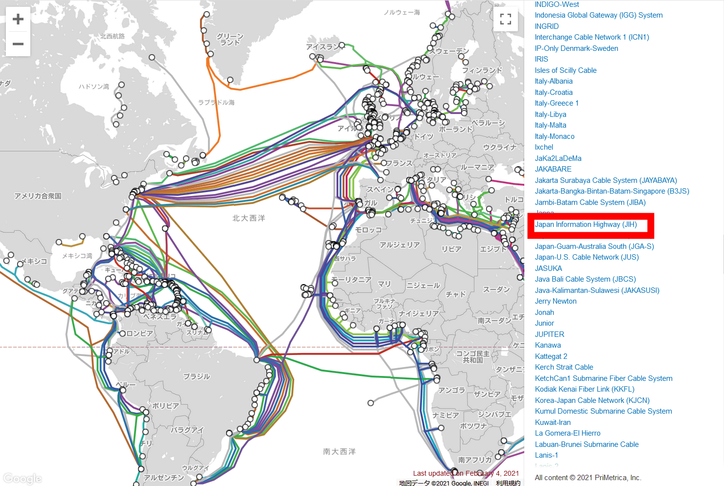
The column on the right is a list of submarine cables covered by this service.
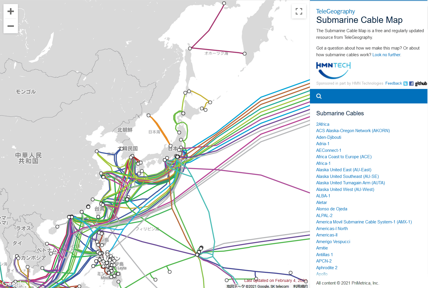
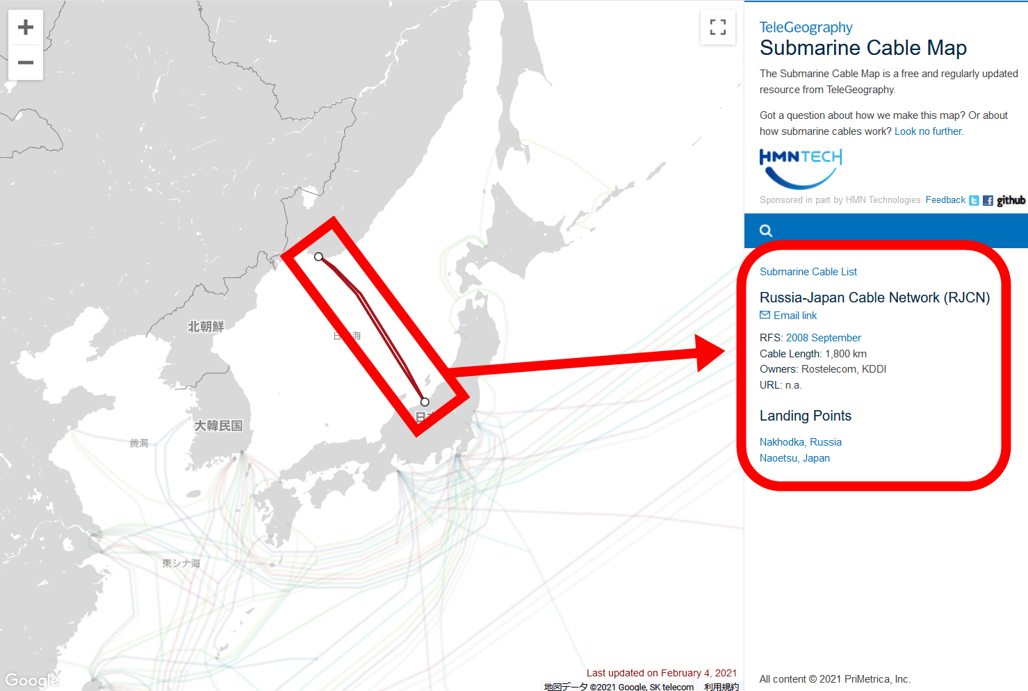
The area around Japan looks like this. While many submarine cables are stretched on the Pacific Ocean side, only a few cables are on the Sea of Japan side.
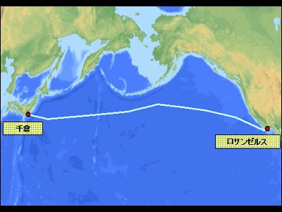
Click on a cable to see details in the right column. The cable connecting the former
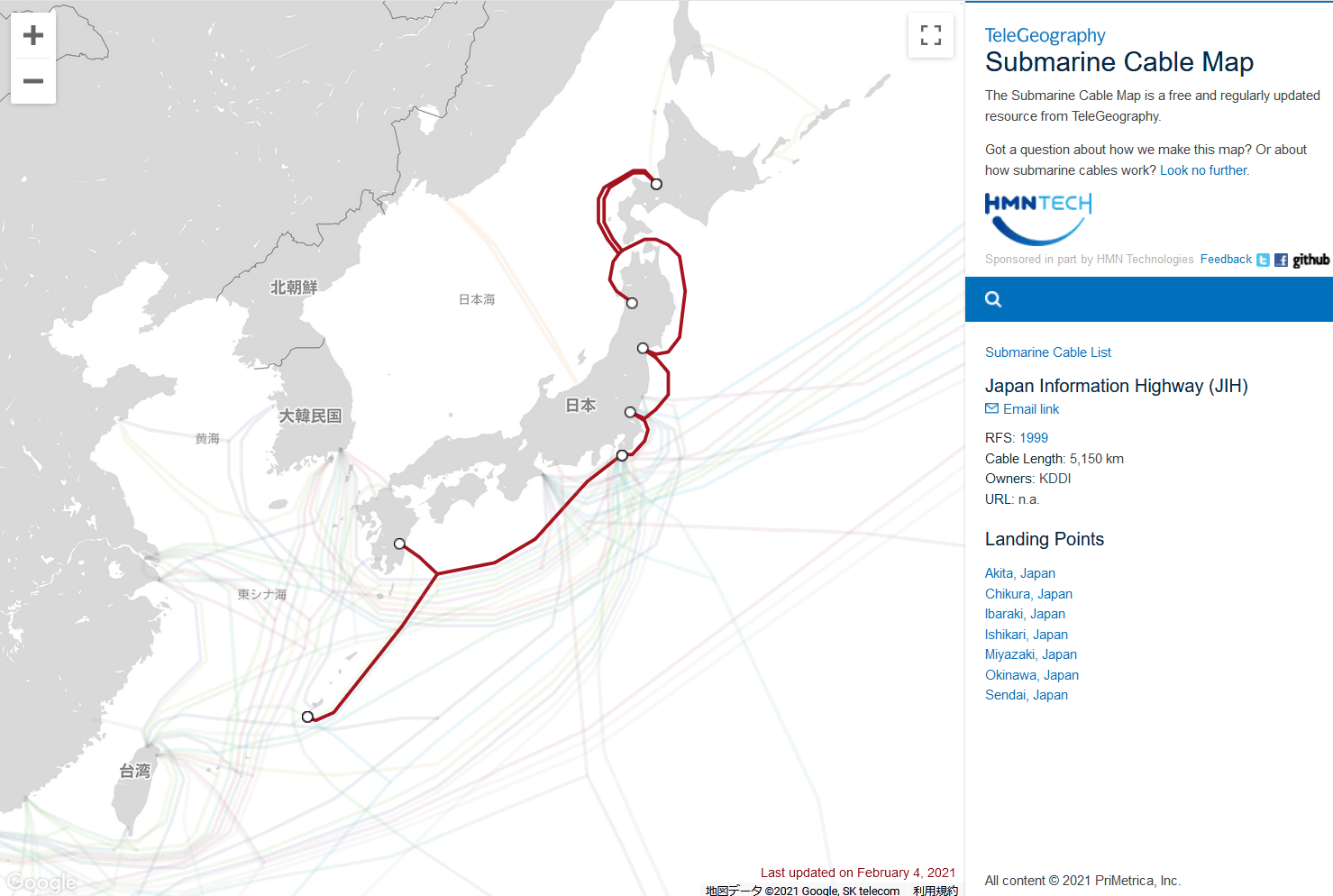
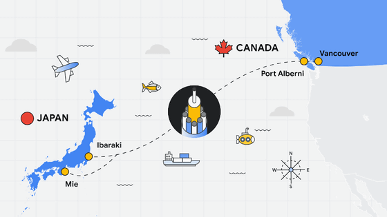
You can also find the location of the cable from the list. For example, if you select the optical submarine cable ' Japan Information Highway (JIH) ' that KDDI stretches around the entire Japanese archipelago ...
The installation location is shown on the map side as shown below, and the information is displayed on the list side.
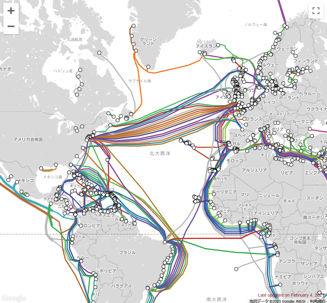
According to the Submarine Cable Map, submarine cables connecting continents were often installed centrally on the same route.
Related Posts:


in Web Service, Posted by darkhorse_log