I looked at the stairs all over Japan with the 'National Stairs Map' which recorded thousands of stairs all over Japan
A ' national stairs map ' that records the positions of stairs throughout Japan using the
National stairs map
https://drive.google.com/drive/folders/0B21bc2CjDckmVTl2VWZxWlZEOEk
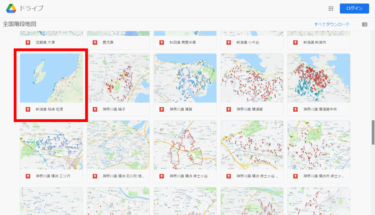
When you access the 'National Stairs Map', links to My Maps that record the location of the stairs will be displayed in a row. First of all, I selected My Map named 'Kashiwazaki Sado, Niigata Prefecture'.
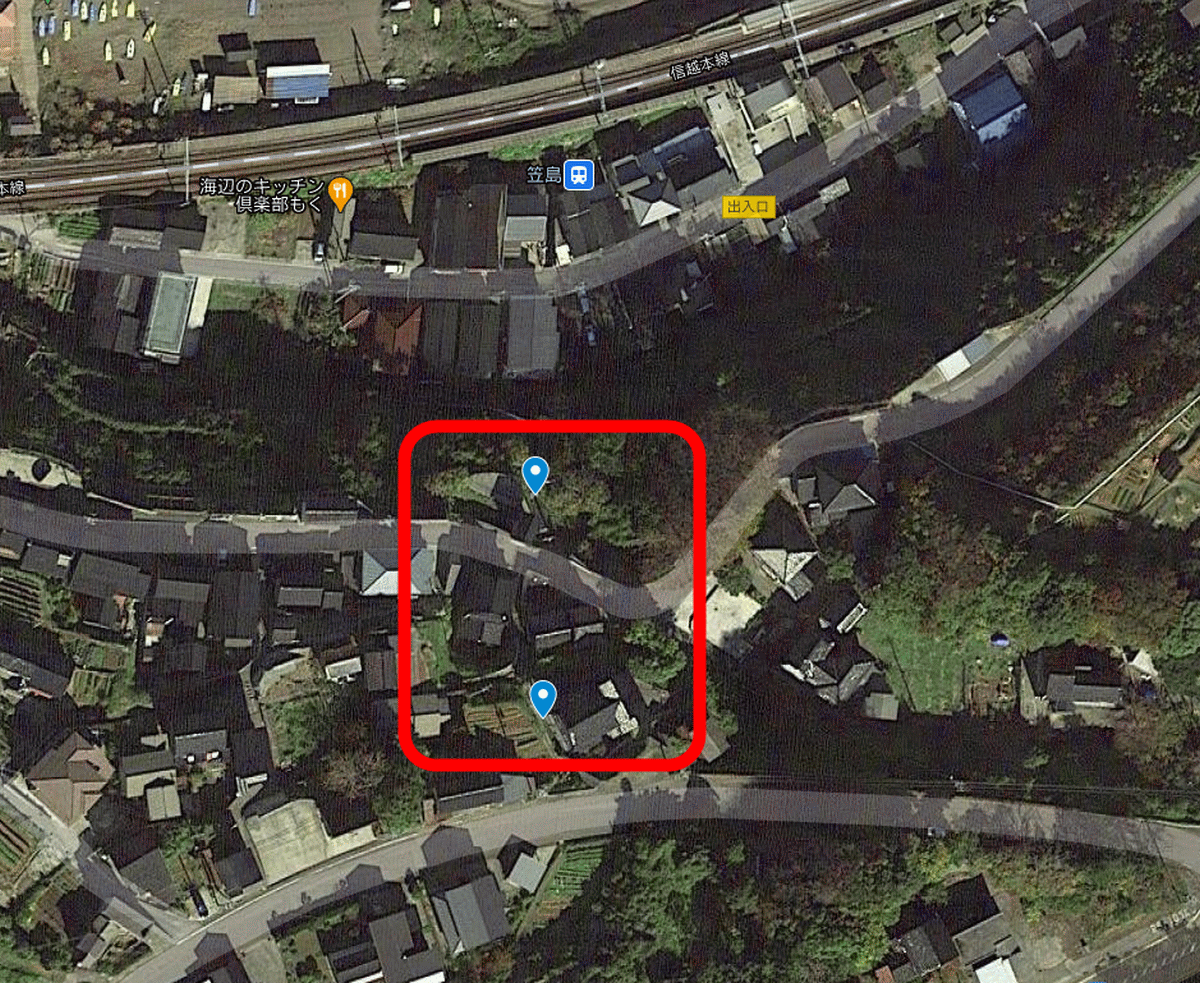
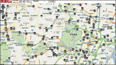
Then, the position of the stairs around
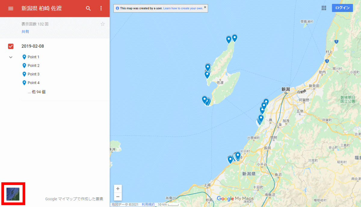
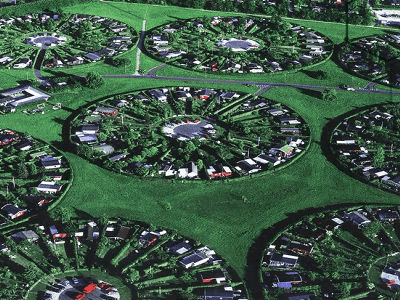
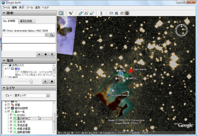
Then, an aerial photograph will be displayed like this, so zoom in on the point you are interested in and observe it.
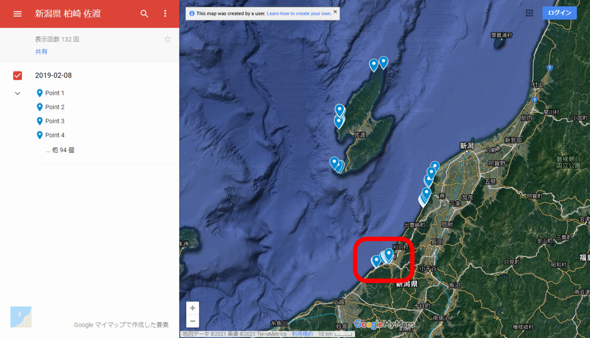
When zoomed to the maximum, it looks like this. You can see two stairs near
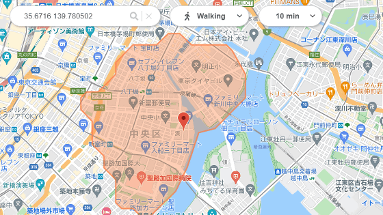
I would like to observe each staircase in more detail, but the browser version of My Maps does not support Street View. Therefore, I decided to display Street View on the Google Maps app on my smartphone. Open the same My Maps in the Google Maps app, press and hold near the stairs where you want to see Street View, drop the pin, and tap the button to start Street View in the lower left.
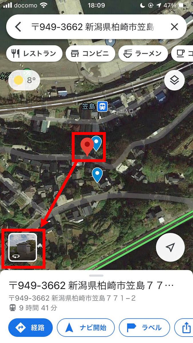
Then, I was able to confirm the stairs that Mr. kaidan meguri visited like this.
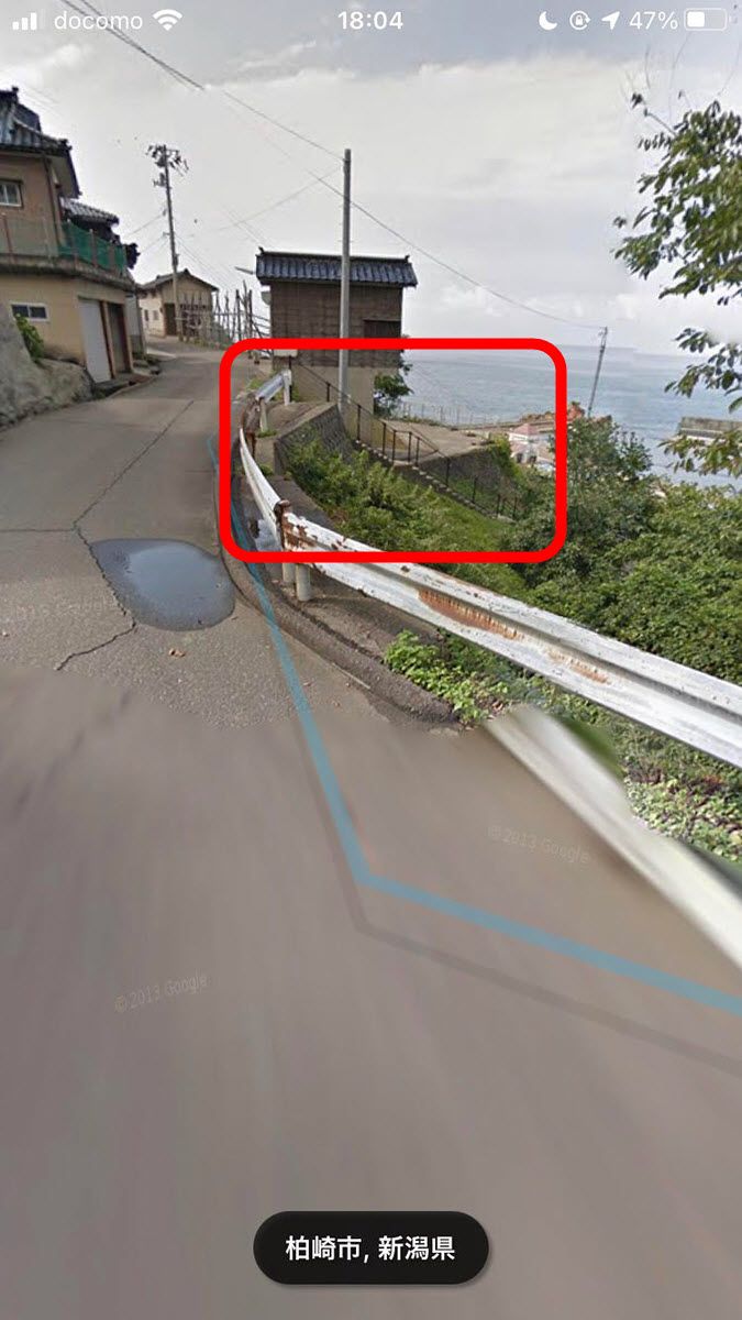
The picture taken by kaidan meguri on the same stairs looks like this.
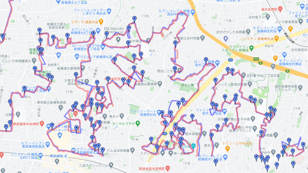
At the time of writing the article, 50 types of My Maps have been released on the 'National Stairs Map'. For example, the map of Kure City , Hiroshima Prefecture looks like this. Kure City has a history of being developed as a military port by the Meiji government due to the terrain surrounded by mountains, but when observed on the 'National Stairs Map', stairs are gathered around the city, and it is on the mountain. You can see that it is an enclosed terrain.
Suga Shrine Otokozaka, which is famous as the sacred place of the movie ' Your Name ', is also registered in one of my maps, ' Yotsuya, Kojimachi, Tokyo '.
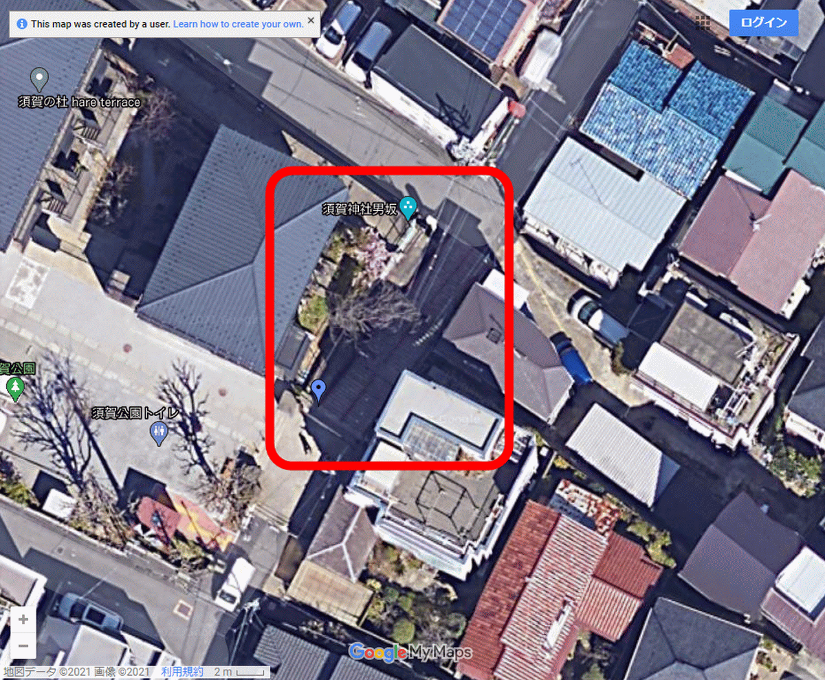
The picture of Otokozaka at Suga Shrine taken by kaidanmeguri looks like this.
Makoto Shinkai's name is Suga Shrine, which is right next to the Y-shaped road, which is introduced as the best three-dimensional Y-shaped road in Mr. Oyama's article. Further to the north, the first-class Arakicho stairs in Tokyo spread out. Tokyo is crazy. pic.twitter.com/5qEbmtYFjc
— Stairs Tour Twitter (@kaidanmeguri) August 26, 2016
In addition, various my maps such as 'Stairs memo that I want to go' that memos the stairs that Mr. kaidan meguri wants to visit were released.
In addition, the 'national stairs map' does not aim to cover all the stairs in Japan, but it is a record of going around 'stairs between old residential areas' within the range that Mr. kaidanmeguri can go. Still, the location of thousands of stairs is recorded, so you can enjoy a variety of ways, such as looking at the areas you have visited or looking for famous stairs.
Well, I'm not aiming for perfect coverage (because it's impossible), but rather going around the 'stairs between private houses in an old residential area'. Therefore, the other stairs are leaking quite a bit. I wish I could go, but it's quite a walk
— Stairs Tour Twitter (@kaidanmeguri) January 25, 2021
Related Posts:


in Web Service, Review, Posted by log1o_hf