How did the map and GPS evolve?
With Google Maps, anyone can view maps around the world for free and use the navigation function to a specific place. Thanks to the fact that the flight of movement has been improved considerably compared to the era when there was no smart phone, the "map" itself was originally not born for the purpose of "making the move convenient" . William Rankin, assistant professor of scientific history at Yale University in his own book " After the Map " describes how the map and related technologies evolved.
The Political Path to GPS - The New Atlantis
https://www.thenewatlantis.com/publications/the-political-path-to-gps
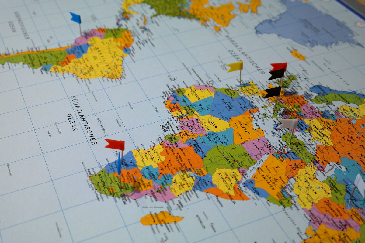
According to Mr. Rankin, "The map originally showed a close connection between the geographical boundary and the political boundary", he says, "It is quite different from the role of the map in the present age". The information on the original map was color-coded showing information on literacy rate, income level and election results and was not intended for heading to the destination. Later maps are now being used for ways such as war to go to their destinations.
After the Map describes various map systems that appeared in the 20th century, many of which are characterized by completely different purpose and subsequent use. Mr. Rankin says, "Looking back on the history of the map, it is divided into three sections," co-creation of maps "," advancement of map production grid ", and" satellite navigation ". By knowing these histories, We will be able to know how the related technologies such as GPS evolved.
The first point, "Co-creating maps" was launched by The International Map of the World (IMW), which was established in 1909 by 12 countries including the UK. Up to now, map production was mainstreamed independently by each country, but in order to realize the purpose "to cooperate with each other and to create a common world map that everyone can use", by the establishment of IMW As each country cooperated, they came to make common maps, and the reference symbols, shapes, colors used for maps were also set by IMW. Many countries are keenly focused on this ideal, and countries participating in the IMW will expand to dozens of countries later. However, as the World War II began, the achievements that IMW had created have been diverted to war, and the goals that IMW initially listed were lost.
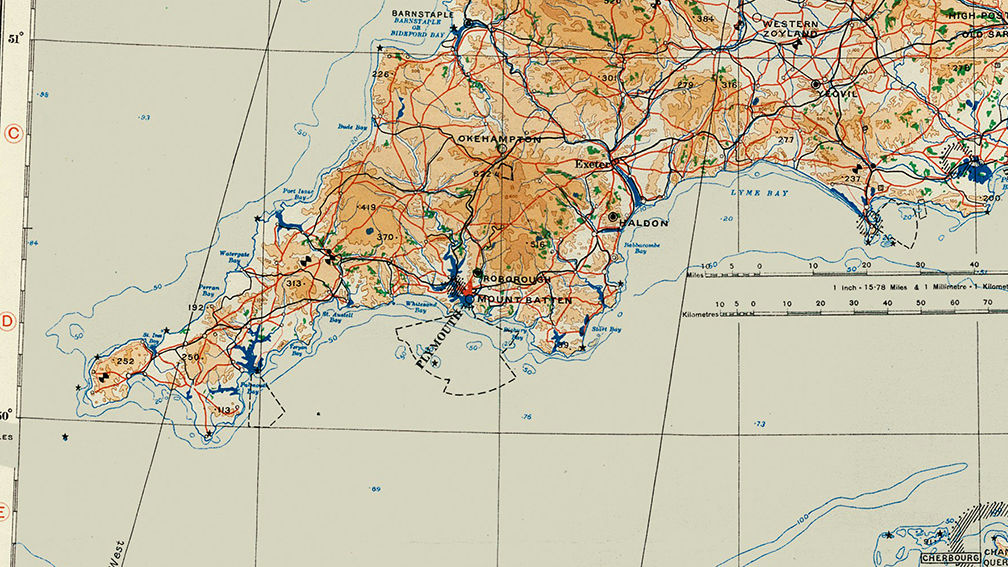
The second point, "Progress of the Map Production Grid" began with a grid line of a map made for the bombing developed during the First World War. By adding a grid line to the map, the land boundary becomes clear. After the war, this technology will be widely used in the private sector because it will not have to do the survey many times at the same point. However, the grid technology at that time had a problem of not being able to deal with the earth of the surface, and after that, a map adopting various grids will come out.
In the US military, the map of the Universal Transverse Mercator Projection (UTM) that can be divided into multiple maps has come to be used. UTM's map is very accurate, but there are disadvantages as well. It is said that the map near the equator is greatly distorted, and it is known that the map of the southern part of Vietnam, which later becomes the stage of the Vietnam War, was very incorrect. Despite this, UTM became popular in the fields of private, commercial and diplomatic, and in 1994 the Israel-Jordan Peace Treaty amended the border line and the setting of the borderline between Eritrea and Ethiopia set in 2006 It is also used.
The beginning of the third point "satellite navigation" begins with a radio navigation system devised for private use from the 1920s. This technology will be greatly polished in the Second World War, and the navy system "Radio Range" of the US Air Force uses a mechanism to skip Morse code of different patterns in different directions. The pilot boarding the fighter plane was able to move to the destination by overlapping each Morse code and continuing to fly the point heard as continuous sound.
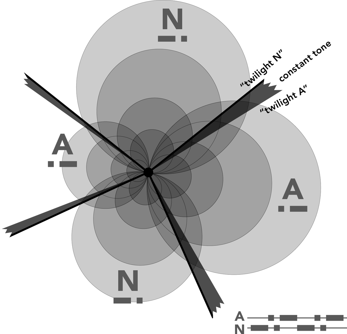
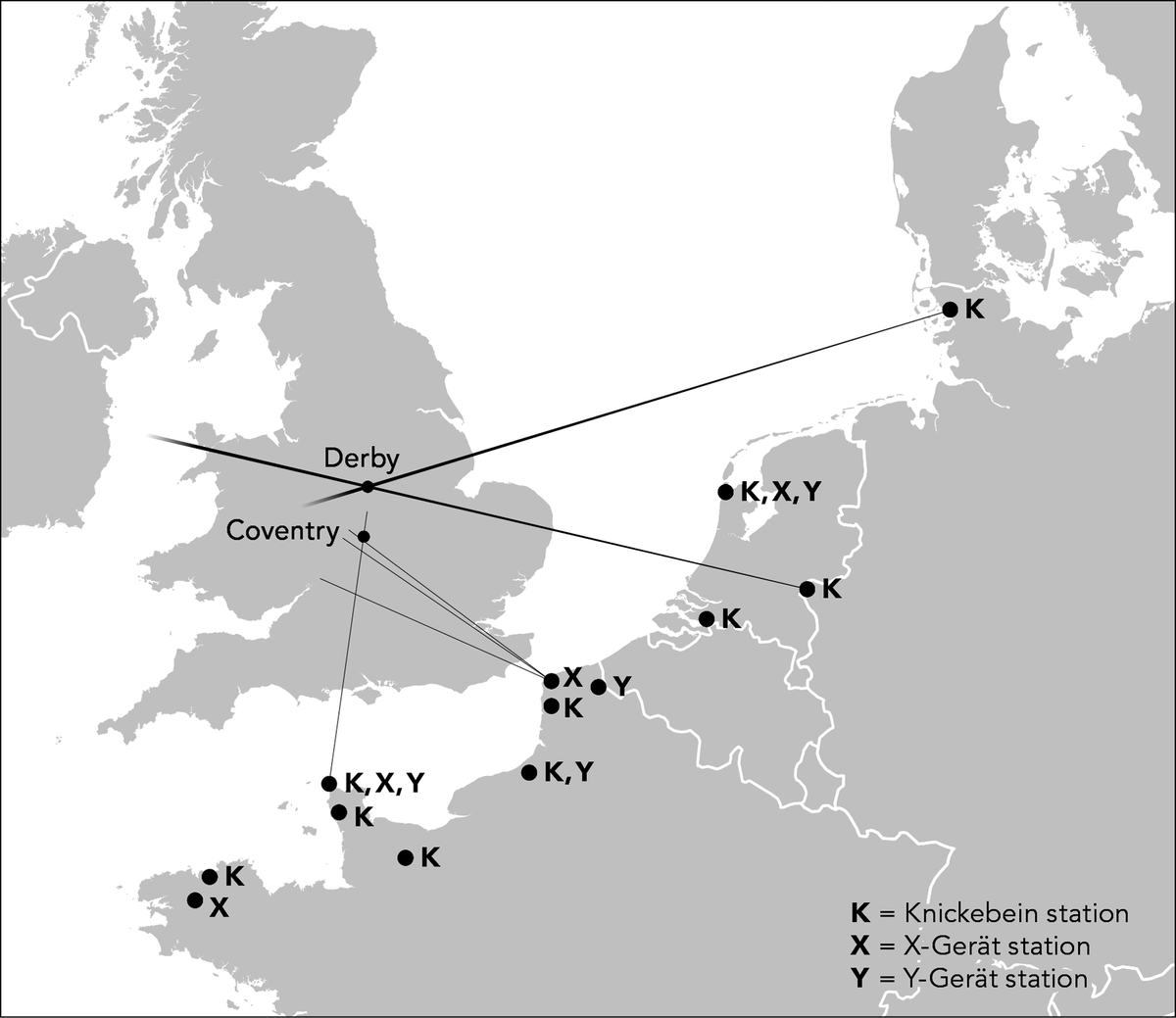
The German Army has also built a similar system, which has succeeded in creating a more accurate system than the Radio Range. The system adopted by the German Army was to irradiate the beam from multiple bases to the target and set the point where the beam intersected as the destination.
And in the 1970s GPS will appear in the USA. The GPS satellite accurately reads the time when the signal was transmitted, and the GPS receiver calculates the time it took to transmit the signal and guesses the distance to the satellite. By using four GPS satellites, we were able to grasp the current location with extremely high accuracy.
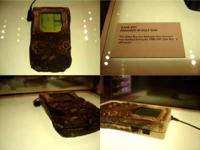
It was the Gulf War that began in 1991 when this GPS became explosive popularization. At that time, the Allied forces were short of military GPS receivers, and 90% of receivers used by the military were collecting from private vendors. Large amounts of money into this GPS market have led to the realization of both the cost reduction and slimming of the later GPS receiver at an astounding rate.
Mr. Rankin gave a title titled "Politics in pocket" to the conclusion of After the Map, and technological innovation in our world, such as a GPS receiver equipped with a smart phone that was reduced in size to fit in a pocket, It emphasizes that it is strongly influenced by political influence.
Related Posts:


in Note, Posted by darkhorse_log