ESA (European Space Agency) exposes the geomagnetic map of "lithosphere" covering the earth with HD animation
It consists of the crust covering the earth and the bedrock layer just below itLithosphereHD animation based on observation data of only the terrestrial magnetism that was carried by ESA (European Space Agency) was released. From the geomagnetic data of only the lithosphere where the observation is extremely difficult obtained in three years using the latest artificial satellite, valuable evidence for knowing the formation of the earth, the history so far, and the plate tectonics where the continent moves It seems that you can see.
Unravelling Earth's magnetic field / Swarm / Observing the Earth / Our Activities / ESA
http://www.esa.int/Our_Activities/Observing_the_Earth/Swarm/Unravelling_Earth_s_magnetic_field
High-res animation reveals Earth's magnetic field | Daily Mail Online
http://www.dailymail.co.uk/sciencetech/article-4339722/Stunning-high-res-animation-reveals-Earth-s-magnetic-field.html
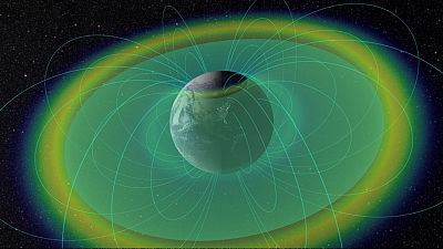
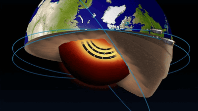
The geomagnetism of the Earth, the majority of the Earth's 3000 km undergroundOuter coreIt is produced by the work of. Eddy currents are flowing in the outer core which is thought to be composed of molten iron and nickel, and the strong geomagnetism created by this causes the whole earth to be a huge magnet. The line of magnetic force reaches the outer space greatlyEarth's magnetosphereAnd it is thought that it prevents the action by the solar wind reached from the sun.

ByAkaase
Apart from this, the "lithosphere" part of the earth's crust and the hard rock at the top of the mantle also has geomagnetism. This geomagnetism was born by earth eruption activity and plate tectonics work, etc. It is valuable data for knowing the history of the earth, but the geomagnetic data of lithosphere having only 6% of the earth's whole geomagnetism It is very difficult to observe, so there was no useful data so far.
Successful observation of such lithospheric geomagnetism was established jointly by European countriesEuropean Space Agency(ESA). ESA is a geomagnetic observation satellite launched in 2013 "SWARM"In collaboration with the United States of Germany in Germany, the Earth Gravity Measurement Satellite"CHAMPWe have succeeded in acquiring detailed data by using.
ESA released the following movie.
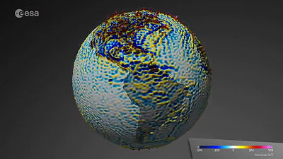
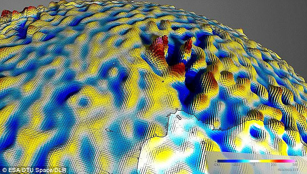
Place the lithosphere geomagnetism around the Atlantic Ocean. The strength of the magnetic force is indicated by color, which indicates that the more blue the color is, the more negative (S pole) and the more red it is plus (N pole).
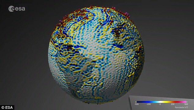
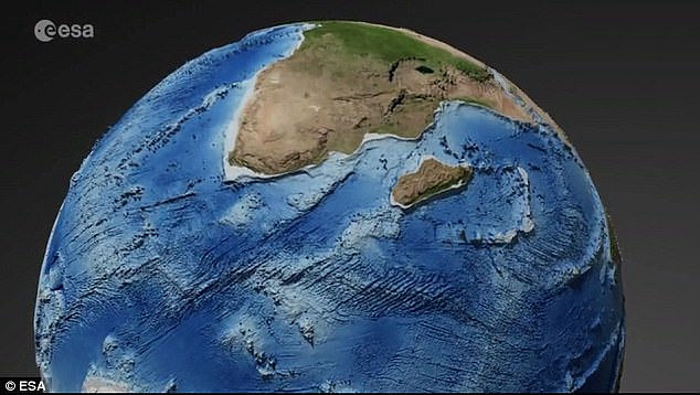
Looking around the southernmost part of the African continent, it seems like this is a normal map ... ...
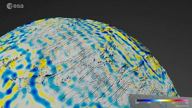
Looking at lithospheric geomagnetism, it looks like this. There is little correlation with the actual terrain, you can take your own stripe pattern. This pattern is thought to be born by "geomagnetic reversal" occurring in hundreds of thousands to millions of years.
Some places have suddenly been confirmed where some of the geomagnetism is strong. Capital of Central African RepublicBanguiThere is a very high magnetic force nearSingular pointThere is that. Its origin is still unknown, but it is also thought that an object with a strong magnetic force scattered around this when a meteorite collided in the past.
SWARM is an artificial satellite that observes three coordinated satellites in cooperation,Supersonic plasma jet surrounding the earthExistence,Strong jet jet on the inside of the earthWe have unraveled the existence of.
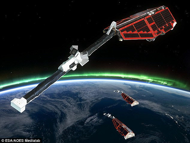
The image observed by SWARM looks like this. One of the three units makes various observations with a highly accurate geomagnetic sensor while circling the earth at an altitude different from the other two.
For HD animation created by ESA, it is possible to download the original version of 1920 x 1080 pixels from the following page.
Space in Videos - 2017 - 03 - Lithospheric magnetic field

Related Posts: